In her own words: Amelia Earhart's record-setting flight—plus a bold prediction
In 1935 Amelia Earhart penned a 'National Geographic' article about her flight from Hawaii to California and forecast that regular transoceanic flight was just on the horizon.

The story of my flight from Honolulu to San Francisco begins several months before the date of the crossing. Paul Mantz, my technical adviser, Ernie Tissot, mechanic, and others had worked for some time getting the plane and motor in readiness.
On December 22, 1934, these two, with Mrs. Mantz, Mr. Putnam and me, set off from Los Angeles for Honolulu. The airplane, intact, rode with us on the Lurline, secured as only sailors could do it, on the aft tennis deck.

During the five days of the voyage we ran the motor up several times, lest it swallow too much corroding salt moisture, and tested the radio. After midnight, as far as 1,000 miles from shore, we picked up the familiar airway station signals. "Sparks," the Lurline's radio operator, was much interested in our set and was extremely helpful.
Two weeks in Honolulu were necessary for final testing and checking. Paul and Ernie, with United States Army helpers, worked day and night. I stayed away except for special tests I had to make. This was partly because I could not help the competent gentlemen in any way and partly because I believe it is better for the flyer's peace of mind to back away from the project in hand, occasionally, and get perspective.
By January 11, Paul had completed to his satisfaction final mechanical details on the plane. I was fit as could be and weather was favorable.
The wind is perverse
I had intended to try taking off about 1:30 or 2 o'clock in the afternoon, but late in the morning light rain began to fall. Before 1 o'clock it had turned into a tropical downpour. The wind, instead of blowing from the northeast as it had been doing, came perversely from the southwest.
Wheeler Field, the Army airport which I planned to use, has no hard-surface runways, and I knew the ground would be fairly soft for a heavily loaded plane. I was carrying more than 500 gallons of gasoline, and this, combined with other extras, weighted my plane more than ever before.
However, the field is 6,000 feet long and slopes into the direction of the prevailing winds. A plane takes off against the wind as does a small boy's kite. Even with unfavorable surface conditions and without the usual help from the wind, I still felt I could lift my plane in a 3,000-foot run, perhaps less. The Army authorities had kindly mowed a pathway for me in the smoothest part of the reservation and had planted small white flags along the edge to guide me.
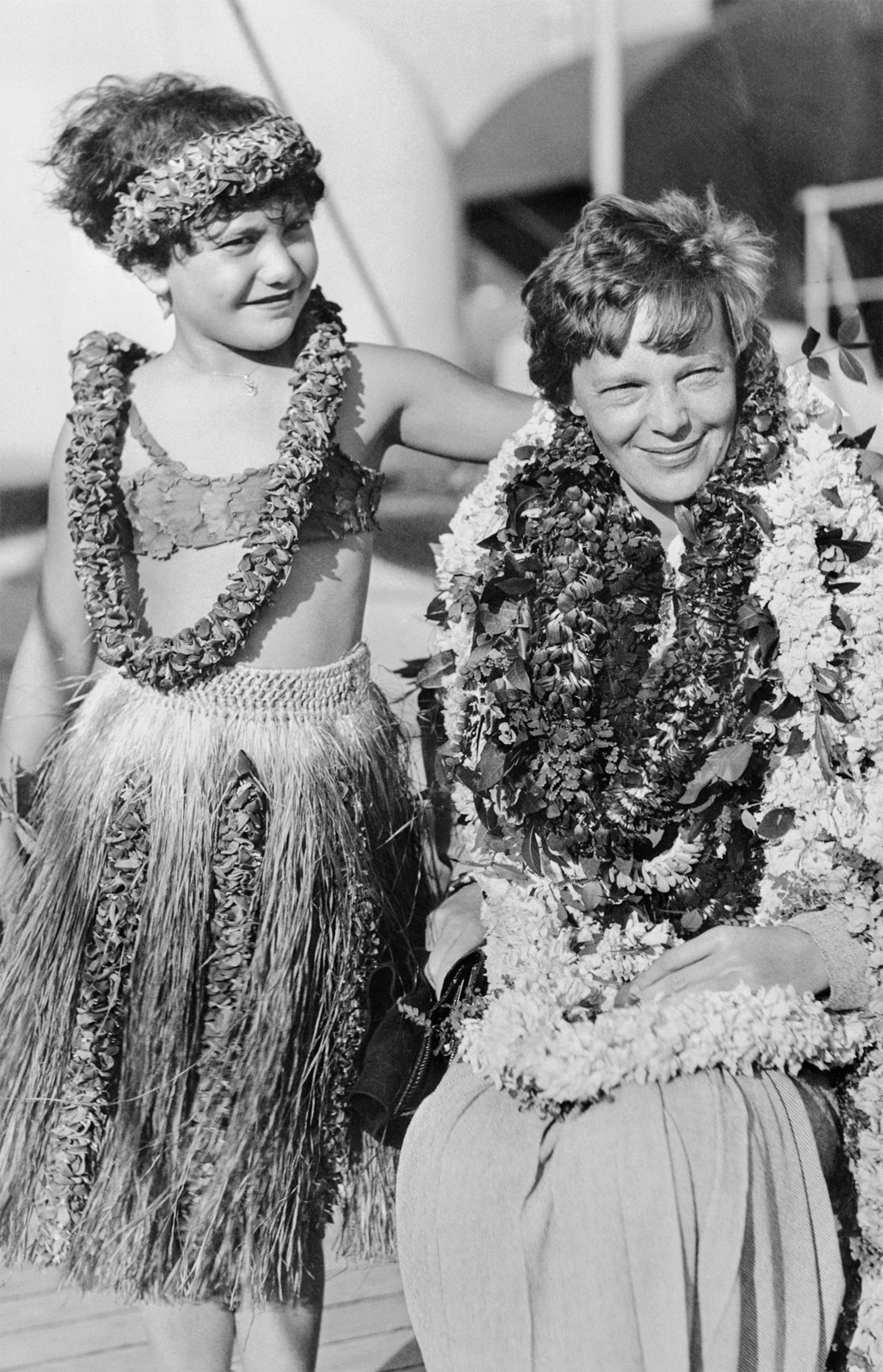
As lunch time approached with no improvement in weather, a small group of those intimately connected with the flight had luncheon at the home of Lieutenant and Mrs. George Sparhawk. The invaluable aid Lieutenant Sparhawk rendered in connection with radio tests was equaled only by his wife's ability and willingness to turn her home into a temporary boarding house for Putnams, Mantzes, and their associates.
Field wet, plane wet, and spirits damp
Intermittently someone at the window reported weather changes. I went to sleep for a while and awoke about 2:30—to the continued patter of rain.
About 3:30 the rain slackened. The wind died down and the clouds gave promise of breaking at last. So I drove to the hangar where my plane was housed. Weather forecasts over the Pacific were satisfactory, but would not remain so the next day. Unless I took off, despite the local meteorological upset, I might be held indefinitely.
I found the field wet, the plane wet, and certainly the spirits of the faithful few who were standing by were damp, indeed. However, I asked that the motor be warmed and my few belongings stowed. At 4:30 I climbed into the cockpit and tested the motor. It sounded crisp and lusty.
At 4:30 I climbed into the cockpit and tested the motor. It sounded crisp and lusty.
There were about two hundred people standing silent on the apron, somber weather having discouraged more of the curious. I saw several women with handkerchiefs obviously ready for any emergency.
Out of the corner of my eye I sighted three fire engines and an ambulance posted down the field where "X" might be expected to mark the spot if an accident occurred. The Army to a man seemed to have portable fire extinguishers in their hands.
Such precautions were wise enough, for the take-off, with excess load, is considered by many flyers the most hazardous moment.
My loaded plane weighed more than 6,000 pounds. Three tons is considerable weight for a comparatively small type like mine to get into the air, even from a smooth, paved runway under favorable conditions. Here I had no runway, and the weather was definitely unhelpful.
Take-off in the mud
At 4:45 I taxied to the end of the marked pathway. Paul Mantz freed a ball of mud and grass my tail skid had rolled up. My last human contact was a fleeting glimpse of Ernie, my mechanic, trotting along beside the plane, mud sloshing over his shoe tops at each step. His cigarette drooped forlornly from the corner of his mouth; his face was as white as paper. I hope he saw me smile.
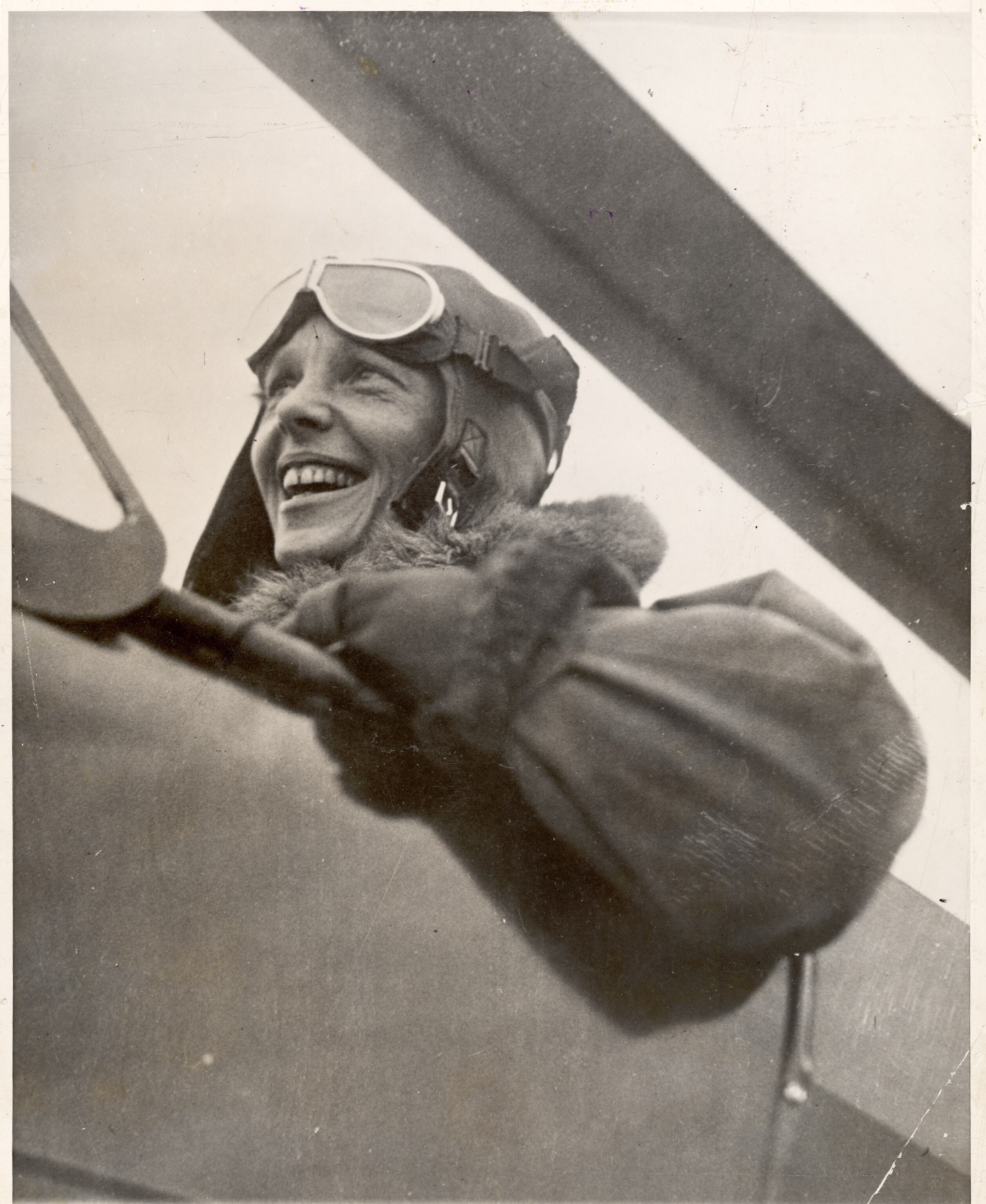
I looked ahead between the marker flags, checked again the spot at which I was to begin to stop in case I was not off the ground by the time I passed it, and pushed the throttle ahead.
The plane did exactly as expected. The tail came up as it gathered speed, throwing up a cataract of red-brown mud. It grew lighter, as the 550 harnessed horses of the Wasp motor gobbled gas. Then a final bounce and it took to the air, holding it easily as I slowly turned to the right toward Honolulu and Diamond Head. The take-off, I am told, was accomplished well within 3,000 feet—less than half the length of the field.
Skirting Honolulu, I could see the human ants, far below, going home after their day's work. I rounded Makapuu Point, the last island outpost on my course. To my right I could see the long sloping side of Molokai, the next island, blue in the hazy distance. Clouds were all about me from the start, and to get on top of them I climbed 6,000 feet, whence I could look down on their fluffy contours moving against the dark sea.
On three over-ocean air voyages, totalling about 6,500 miles, I have seen little more than a thousand miles of water. On these flights I have been above clouds, between two layers, or actually in the formation most of the time. Certainly, in covering similar distances on ships one gets a much better idea of how mighty oceans really appear.
Night of stars
The night I found over the Pacific was a night of stars. They seemed to rise from the sea and hang outside my cockpit window, near enough to touch, until hours later they slipped away into the dawn.
The night I found over the Pacific was a night of stars. They seemed to rise from the sea and hang outside my cockpit window, near enough to touch, until hours later they slipped away into the dawn.
But shortly before midnight I spied a star that differed from the others. It was too pink and it flashed as no star could. I realized I was seeing a ship, with its searchlights turned into the heavens as a lamppost to guide me on my way. I snapped on my landing lights, which are on the leading edge of the wings midway to their tips, and had them bravely blink a greeting to whoever might be watching.
I was wearing my radio earphones, and after a moment the spattering buckshot of code wiped out everything else on the air, as the radio operator on that ship broadcast to shore stations that I had been sighted. Though we could not converse directly, it was comforting to hear the crackle he produced and to realize that at least thus far I was on the course. Later I learned the vessel passed was the Matson ship Maliko, 900 miles from Honolulu.
An interesting data sheet in my "chart room" (a tiny space in the wing beside my shoulder, where reposed maps, tools, etc.) was a blueprint showing the position of every vessel on or near the course, and the exact time I should be over it, reckoned on an average flying speed and a predetermined hour of starting.
But before starting I thought it unlikely that I would sight a ship. The chance of two specks, one on the surface of a very large ocean, the other thousands of feet above it, passing near enough to see each other seemed slim.
About midway the Ramapo, a Navy tanker, reported me, but I missed seeing her.
Two-way radio telephone
Mine was the first civilian long-distance flight made with two-way radio telephone. This equipment, of course, is regularly used on the air-transport lines in the United States, but hitherto has been perhaps too heavy, costly, and complex to find a place in record flying.
My outfit, in addition to the usual set for beam reception, included a 50-watt transmitter with a possible sending range of more than 2,000 miles. My call letters are KHABQ (a mouthful indeed!), assigned by the Federal Communications Commission under a special license for communication at sea, with frequencies of 6,210 and 3,105 kilocycles. On the Pacific voyage I received certain commercial broadcasting stations, tuning the programs low except when the stations "talked" to me.
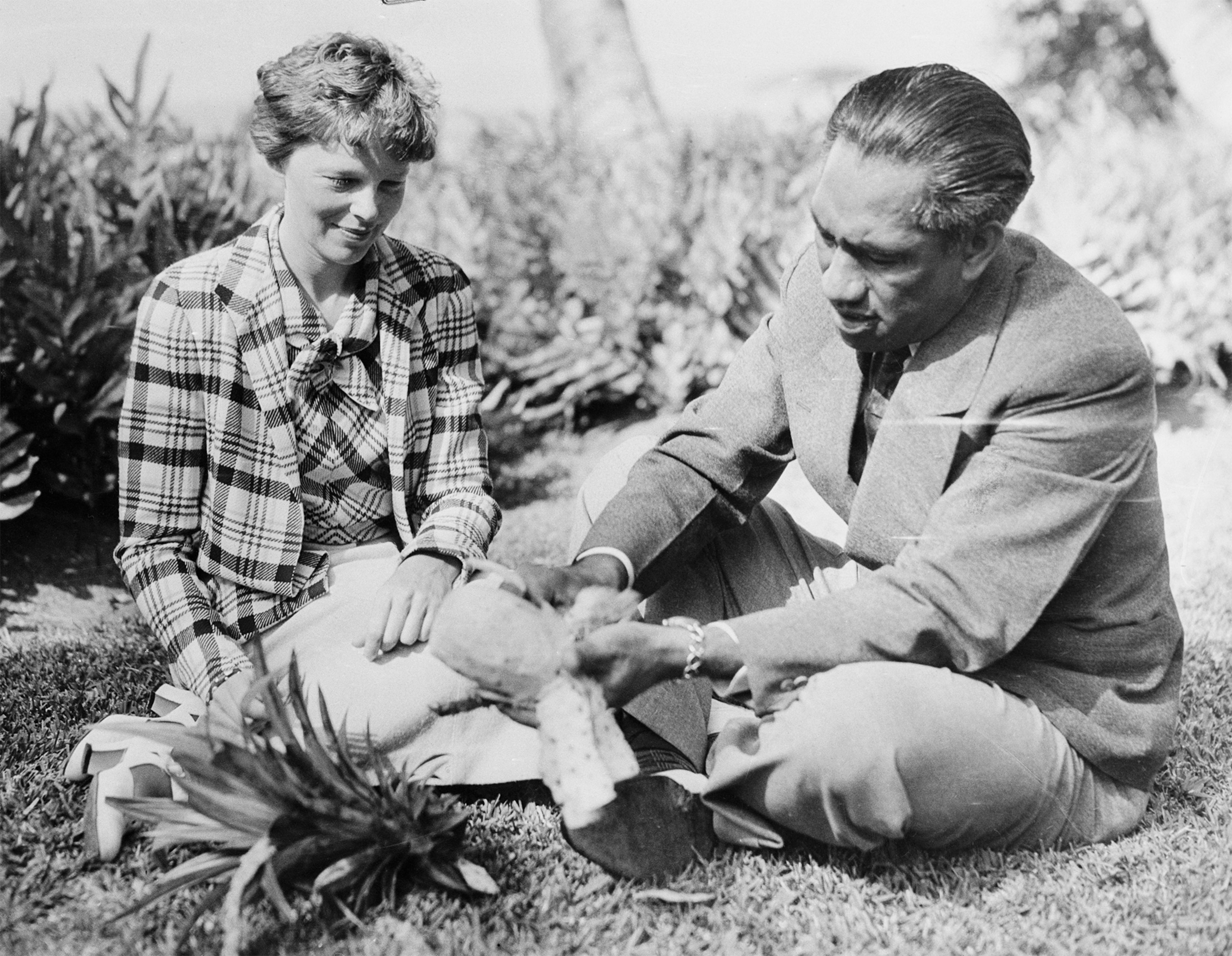
I was scheduled to transmit at a quarter to and a quarter past the hour. The radio itself was operated by remote control and was situated in the rear of the plane, behind the fuselage gas tanks. In the cockpit I had a dial for tone and sensitivity control and volume, a selector switch, and a hand-held microphone.
To broadcast, I rolled out the antenna through a hole in the floor by means of a reel under my seat. The antenna was weighted with a small lead ball, and streamed out in an arc below the plane in flight—adding another thing for a pilot to think about when taking off or landing, for it had to be reeled in then.
Commercial stations which generously cooperated with me before and during the flight were KGU in Honolulu, KPO in San Francisco, and KFI of Los Angeles. The latter put on a special all-night program, relayed information, and otherwise kept in touch with me every half hour. The Department of Commerce short-wave airway stations on the coast and at Kingman, Arizona, also stood by for the duration of the flight. They, and the amateurs who co-operated, can never know how much they helped a lone pilot.
Only a few hours after the start, I happened to hear the KGU announcer say: "We are interrupting our musical program so that Mr. Putnam may try to communicate with his wife."
And then, some hundreds of miles out over the Pacific, I heard my husband's voice as though he were in the next room.
"A. E.," he said, "the noise of your motor interferes with your messages. Please speak a little louder."
A few minutes later I talked back to him, through the little cup microphone—louder, as requested.
Crossing the Atlantic, I saw no actual sunrise, because of clouds. This time, with more than half of the Pacific stretched behind me, the rising sun ushered in a new day in orderly fashion. Since I was coming from "down under," the sun flared over the horizon not straight ahead but somewhat to my right, fortunately for my eyes. Flying full into the glare at high altitudes is very trying, even with dark glasses.
All the way I had flown at 8,000 feet, because best winds had been predicted there. From dawn until 10:30 I was over a solid pack of fog in a world utterly remote and quite my own. Once, on the quarter hour, I confided to my microphone, "I am getting tired of this fog." Subsequently I discovered that all of the message which filtered through the static to mainland listeners were the words, "I am getting tired." So shore radio announcers, bless them, had fresh ammunition for their word pictures of the little girl battling exhaustion as well as the elements.
After I had been flying for about 15 hours, the formation began to break up. Large holes appeared, through which I could see the crinkled blue surface of the sea flecked with morning sunlight.
A larger opening appeared on my left and framed in the middle was another ship. Down through the hole in the clouds I went, happy for the company of that toy steamer and exceedingly pleased because its presence proved I still was on my course.
Only 150 to 200 feet above the sea I circled the steamer, which proved to be the Dollar liner President Pierce. And then I "lined up" on the wake, which from the air I could see stretching astern for perhaps a mile. The line of that wake checked exactly with the compass course I had been following. So I continued on my way. Within a few minutes KPO, in answer to my query, radioed me the position of the President Pierce as 300 miles out from San Francisco. I did not pull up again to 8,000 feet, but flew at about 1,500 the rest of the way to shore.
The last hour or two of any flight is always the hardest. If there are clouds, the pilot, straining his eyes, is likely to see illusions of land. In my opinion California is letting slip many a sightly acre in the Pacific just off her coast. I saw them, islands and distant shores almost indistinguishable from clouds. Were they only clouds, after all? I did not let myself turn from my course to explore.
The last hour or two of any flight is always the hardest. If there are clouds, the pilot, straining his eyes, is likely to see illusions of land.
If there is any time when experience counts it is in putting down the temptation to wander from that course which instruments declare is true to that which the human mind would like to try. A pilot's maxim should be, "Usually the instruments are right and you are wrong."
I was glad to see land—but not in a state to "scream for joy," as reported in one fervid account. My faithful plane, I believe, would fall apart under me if its pilot grew so senselessly emotional.
Contrast to Atlantic flight landing
The first land I sighted was the outjutting of Pillar Point, about 21 miles south of the Golden Gate, and Pigeon Point, some 43 miles. I did not recognize the territory at all. As there was a little rain squall directly in my way, I went around to the right. Thus I appeared five miles or so south of where I otherwise would have been—but anyway on the continent I aimed for!
Pulling up over a notch in the hills, directly on my course, I beheld San Francisco Bay before me. Over San Mateo I sailed and six minutes later NR-965-Y and I sat down on the runway of Oakland Airport, approximately 18 hours from Honolulu.
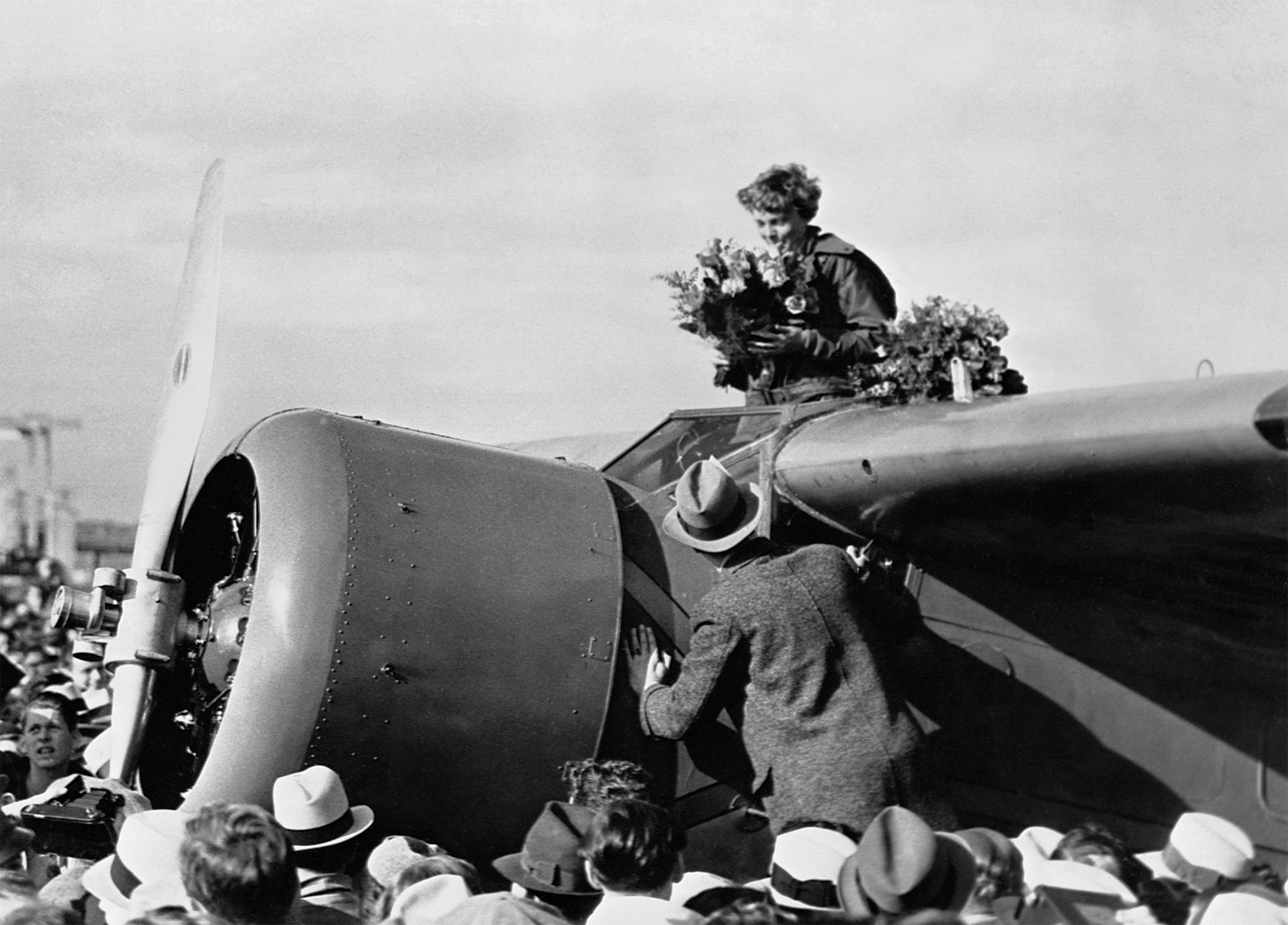
My landing was in marked contrast to that of the solo Atlantic flight. At that time a farmer's best pasture had been my journey's end, and there three Irishmen had come out to see what manner of creature the airplane held. My announcement that I was from America was accepted in dubious silence. At Oakland I did not have to explain whence I came to the thousands of people who waited. Cameras clicked as soon as I opened the cockpit and microphones were raised to catch my important (?) first utterances.
I have said little about the precautions taken in case something went wrong. Mine is a land plane, equipped with wheels. Occasionally such a one has come down safely on water, though the landing is generally dangerous.
There are a number of factors which affect the result. Among them are the roughness of the water, the buoyancy of the craft itself, and its position when it strikes. I had dump valves in the two largest fuselage tanks, which permitted almost instant evacuation of the contents. Empty, these alone had considerable buoyancy—added to that of any wing tanks from which fuel had been used. I felt there was every likelihood the plane would remain afloat for some time.
Paul Mantz, my technical adviser, who in his flying for motion pictures makes airplanes do unbelievable things, helped me plan the best way to bring a high-wing monoplane down on water without somersaulting. The feat has been accomplished and a craft of that type has been known to float for eight days before the crew were rescued. Of course, a steep dive into the sea would so damage any plane that it would tend to sink at once. Similarly, high waves would demolish either unfortunate land or water craft forced down on their merciless surface.
Paul Mantz . . . helped me plan the best way to bring a high-wing monoplane down on water without somersaulting . . . [A] craft of that type has been known to float for eight days before the crew were rescued.
Over my warm flying clothes I wore an inflatable rubber vest, divided into two compartments. Each would blow up instantly when I released the compressed carbon dioxide contained in two little metal capsules at the waist.
A hatchet and knife on the belt
Strung to my belt I had a hatchet and a sheath knife. Once down and out of the plane, I was to crawl back along the fuselage. Because of the weight of the motor, the tail surfaces presumably would be sticking out of the water. Immediately behind the gas tanks was a rubber raft. I was to hack my way through the light fabric-covered wood of the plane to reach it. It, too, was instantly inflatable from a carbon dioxide container. The sealed compartments of the raft held tomato juice, chocolate, malted-milk tablets, and a container of water.
For distress signals I carried a Very pistol which shot regulation red and green rockets. Small flares which burn on contact with water and several small balloons completed my attention-attracting equipment. The balloons were to be let up on stout fishline and bear aloft a very red silk flag.
The raft, once in action, was to be moored beside the plane, as long as the latter kept afloat. Then, as a last resource, I was to abandon ship.
Hot chocolate at 8,000 feet
What did I eat? My standard ration—plain tomato juice, one hard-boiled egg, and the most memorable cup of hot chocolate I have ever had. Drinking hot chocolate alone over the Pacific at 8,000 feet is a unique experience I shall not soon forget. At that, my larder was overstocked. Katherine Sparhawk, at Wheeler Field, put up sandwiches which I did not consume but know were good.
Drinking hot chocolate alone over the Pacific at 8,000 feet is a unique experience I shall not soon forget.
One seems to require very little nourishment on a long pull of this kind. Though I had had the lightest sort of lunch at noon in Honolulu, when I reached Oakland I was in no hurry for food. Actually my first meal was postponed until evening, 24 hours after taking off. But I vanquished a roast chicken then, with ease.
Infinite details of preparation
The plane I used is at least three years old. It is a high-wing monoplane capable, normally, of carrying six passengers and a pilot. It is closed—like a closed car. I like comfort in flying. More important, I believe comfort decreases fatigue on long flights, and fatigue is a factor to be considered.
The passenger seats in the fuselage were removed to make room for four tanks, which with five in the wing were required to carry fuel for at least twenty hours aloft. The cruising speed with moderate load is 150 to 160 miles per hour; with a top speed, at higher altitudes, about 200 miles.

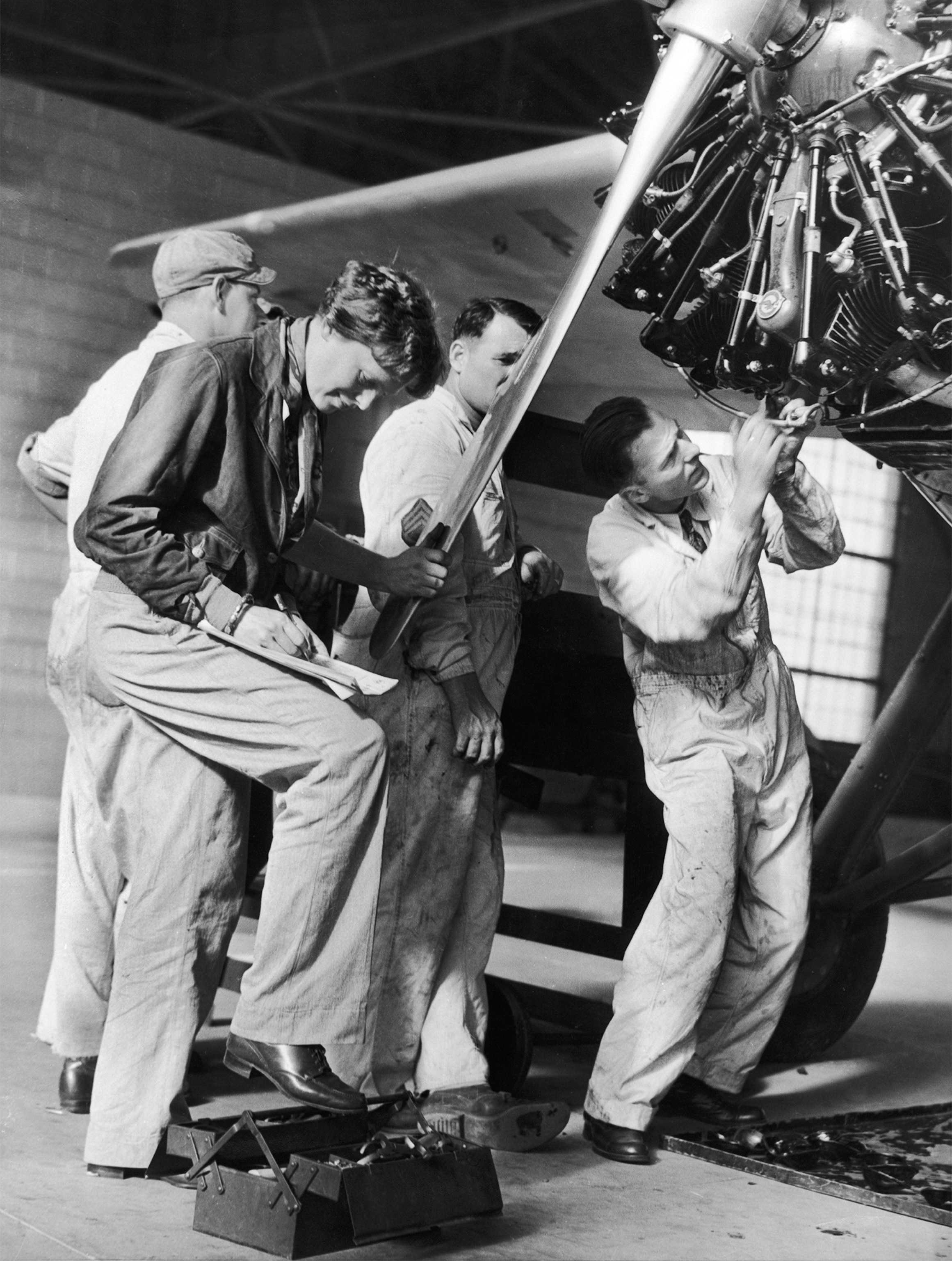
The Wasp motor used is the same one which performed so well on the Atlantic flight three years ago. It is in the prime of life and, after complete rebuilding and mechanical face-lifting, better than new. Pacific Airmotive Corporation, Ltd., at Burbank, did the job and I believe no engine of mine ever sang a sweeter song.
Both motor and plane were checked and double-checked by competent inspectors of the Department of Commerce, and specially licensed for long-distance flying by the Government before I left for Honolulu. My cockpit contains every instrument, I think, the practicality of which has been proved for all-weather flying, except a robot pilot. On my solo Atlantic flight the altimeter failed, the first failure of the kind I had ever encountered. Over the Pacific my instrument board carried two altimeters, as well as three compasses and other duplications. Also, metal gasoline lines were encased throughout their length in rubber tubing—double insurance against fuel leaks. Live and learn.
I have long preached that two-thirds of the success of any expedition is in the preparation. Few know the time and patience expended through weeks or months of testing before even so simple a flight as that between Honolulu and Oakland—and simple it was compared to flights such as Wiley Post's round-the-world.
For example, every one of my nine tanks had to be filled, run dry, and checked at different altitudes for various characteristics. In one, difficulty was experienced with the venting (necessary to allow air to enter the top of a gas tank as the gasoline is consumed from the bottom); so changes in the venting arrangements had to be made.
It took hours of work to determine how many gallons of gasoline the motor consumed. If it used more than estimated, the pilot might face a serious predicament. My calculations were about 24 gallons an hour for 1.50 miles an hour speed. These worked out reasonably well, except that my speed on the actual flight dropped to between 130 and 140 because of head winds.
Oil consumption is as important as that of fuel. I carried 35 gallons of oil, after carefully determining the quantity used each hour. Load and speed tests had to be made with the controllable pitch propeller to find the most efficient setting. Such a propeller works as does the high and low gearshift in an automobile. The pilot takes off in the "low," climbs to the altitude at which he wishes to fly, then shifts into "high," for speed in level flight, or moderate climb. And so it goes through all the intricate phases of getting ready a flight.
Three routes charted
Under preparation, in addition to mechanical detail should be considered personnel. Pilots and mechanics and all others concerned should be experienced and physically and mentally fit. Worry and fatigue are relentless enemies of good judgment.
The subject of navigation looms large on long flights. To keep going is useless unless one knows how to get where he wishes to be. My navigation charts were prepared by Lieut. Comdr. Clarence S. Williams, of the U.S. Naval Reserve, of Los Angeles. On them were worked out alternate courses, one to San Francisco, a second to Los Angeles, and a third providing a shift from the northerly route to the southerly, should Pacific coast weather conditions make a midocean change of destination desirable.
The subject of navigation looms large on long flights. To keep going is useless unless one knows how to get where he wishes to be.
The charts called for fourteen changes in compass course, each to be made at intervals slightly over one hour. To facilitate time calculations, I had three clocks in the cockpit, one set on Honolulu time, another San Francisco time. The third was set at zero when I started and thereafter recorded the exact elapsed time of the trip. All of which is another answer to the question, "What does a transocean flyer think about?"
For the last I have left an aspect of the Pacific flight—or of any aerial expedition-whose conduct can spell the difference between success and failure. That is the forecasting of weather to be encountered, a science which, as regards flying conditions over oceans, is yet in its infancy.
When the Friendship flew from Newfoundland to Wales in 1928, only the sketchiest weather data were available regarding Atlantic upper-air conditions. During a fortnight prior to our flight, reports were obtained at considerable expense by those immediately interested in the project from a dozen ships at sea. These reports supplemented the limited material then available to the Weather Bureau. From all of this Dr. James Kimball, meteorological dean of Atlantic flying, constructed the weather maps used. At best the basic information was incomplete and stale.
Mariners' vs. flyers' weather
The situation was much improved four years later, in 1932, when I flew solo to Ireland. The Weather Bureau was then securing reasonably comprehensive reports from ships every four hours. Dr. Kimball's maps were correspondingly fuller and fresher. However, they still concerned mariners' weather; Nautical observers are not equipped or trained to give information exactly as flyers wish it. What does a sailor care about the height of clouds or how the winds blow at 10,000 feet?
The meteorological assistance rendered me on the Pacific flight indicated the accuracy that can be attained in the science with trained personnel and a new theory of forecasting.
In Honolulu I was fortunate in obtaining the cooperation of Lieutenant E. W. Stephens, U.S. Navy, aerological officer at Pearl Harbor. Lieutenant Stephens, who was responsible for plotting the weather for the Navy's successful flight to Hawaii a year previously, worked with us early and late. Ten days before the take-off he constructed a hypothetical weather map embracing much of the Pacific Ocean and western America. That chart—a thing of highs and lows, swirling isobars, barometer and temperature readings, wind directions and velocities—he made as he felt it should be when I started.
Then we waited for the gods of weather to adjust their caprices throughout this far-flung territory so that their handiwork would at least approximately match our ideal.
Friday the good weather day
After digesting the data that came in by radio from vessels, from tiny islands scattered eastward of Hawaii, from Pacific-coast stations, Lieutenant Stephens on Wednesday remarked: "It looks like Friday. I think things will work out by then."
They did. And because of his satisfaction with the outlook when Friday came, I decided to start, even though that was against advice received from California. The consoling fact is that I found conditions substantially as predicted by Lieutenant Stephens, even on the California coast.
Just now much attention is being directed to the pending possibilities of airlines operating across the Pacific. Momentarily the center of interest has shifted from the Atlantic. But over whatever ocean scheduled air transport may pioneer, a vital factor in its establishment will be the development of meteorological data. With what we now know about weather and with the instant communication of radio, it is not at all impossible, with proper preparation, to command a picture of upper-air conditions prevailing at any given hour over even extended routes. One can also forecast what will "come in" during the time elapsed in the making of a flight.
Flying the Atlantic and the Pacific
The western frontier of the United States lies 2,400 miles from the mainland. Though this stretch of water is several hundred miles greater than the shortest land-to-land distance of the North Atlantic, it probably presents less formidable hazards for the flyer. Of course, no definite statements on this score can be made until after considerable research on weather and more actual flight data are recorded. Further, what is applicable to an individual flight such as mine does not necessarily hold true for transport operation.
For general comparisons North Atlantic and mid-Pacific weather disturbances are similarly severe at times, but probably ice-formation danger is greater over the Atlantic. The shortest course from America to Europe, followed by most flyers so far, has been somewhat north of the normal steamer lanes. From Honolulu to San Francisco or Los Angeles the route lies directly over that traversed by ships—a definite advantage.
To me it seems that regular air transport across both oceans is inevitable, and will probably come about sooner than most people suspect.
To me it seems that regular air transport across both oceans is inevitable, and will probably come about sooner than most people suspect.
Probably used in such long-range service will be the new radio compasses. These are extraordinary "gadgets," which actually lead a pilot to a selected point, guided by radio operating at that destination.
This uncanny "homing" device is gradually emerging from the realm of experimentation into that of proved practicality. One, the Kruesi compass, after Army testing ashore, has recently been tried out over the Pacific in flights instigated by Eugene L. Vidal, Director of Air Commerce.
Another variety of the new instrument, the Lear compass, is being installed in my own plane. With this latest addition to my already generously populated instrument board, I anticipate instructive experience in this most modern means of finding one's way in the air.