By Keene Haywood
Editor's Note: Read this review then find a hike in our Best Trails feature, with 30 weekend, city, park, and backcountry options.
In today’s world, our mobile devices almost always have the ability to provide location, giving us directions as well as many other location-based services on bright, sharp screens with good maps. Whether it is a dedicated GPS device or a mobile phone, location data has become an integral part of the data we now are used to dealing with on an almost daily basis. Like digital photographs and video, location data is becoming ubiquitous. We are starting to accumulate GPS waypoints, tracklogs, and what are commonly called POI’s (Points of Interest) by the handful. Until recently, there really has not been a great way to create, organize, and share one’s GPS data, especially when it comes to trails. You really had to know what you were doing to download this data, make sure it was formatted correctly, integrate it with a map, on and on. It took awhile but could be done by the determined.
This all began to change when a little mapping service opened its doors called EveryTrail. EveryTrail is both a web-based service and an application for your smartphone (iPhone, Android, Windows Mobile, and Blackberry platforms are all supported). It has grown considerably in the past year or so and it keeps piling on the features. So, I wanted to give a review here of this most excellent service.
In Part 1 of this review, I’ll cover the main website http://www.everytrail.com. In Part 2, the iPhone app will be covered in detail. You can explore the website without an account, but in the end, I think you will find you will want to sign up. It is free so you have nothing to lose. On the site menu bar, you will find links to Guides, Find Trips, Destinations, Create Trip, My Trips, Mobile Apps and finally the Forum. I’ll briefly cover these to give you an idea of the features and then you can dive in and explore for yourself.
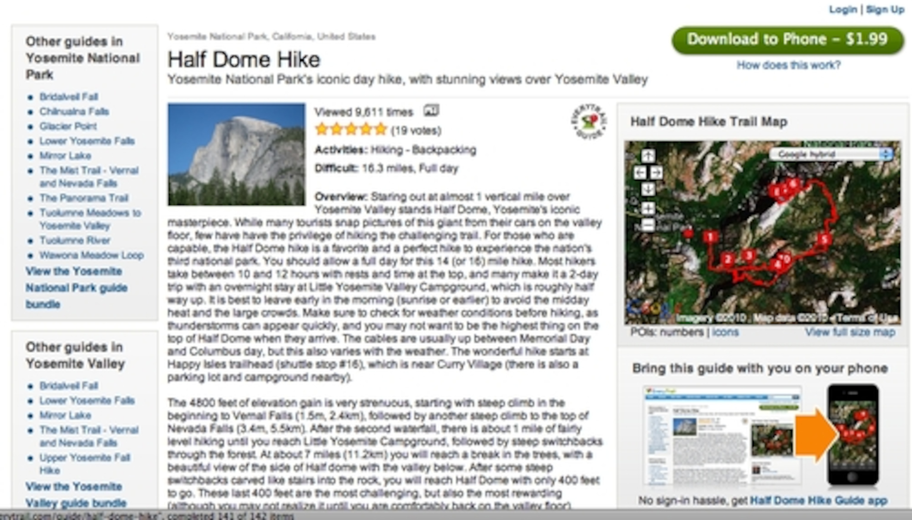
Guides are written by users covering a trail or destination, in detail. They provide detailed trail overviews, tips, and points of interest described by the guide writer. Also provided is information related to weather, directions and of course a map with the trail and POI’s laid for the viewer. Vetted by EveryTrail staff, these guides come from reputable members on the site and users can leave additional comments. This is a nice feature for those looking for a little more information about a destination or if you are curious about visiting an area. If you are interested, you can write and submit a guide. Just get an account, and under this Guides menu you can select to add a guide, manage your guides and redeem points. Yes, you get points for every guide you submit that gets approved. Get at least 1,000 points, and you can redeem them for gear at Moosejaw.com, an online outdoor gear retailer. An approved guide usually bags you about 200 points. Guides can be viewed for free on the website or can be downloaded directly to your iPhone or Android device. Guides cost $1.99 or a bundle of seven guides can be purchased for $7.99. I find this a little steep for user-submitted guides. Maybe a 99-cent model would be better. But the convenience of loading up a Guide and hitting the trail are perhaps worth the cost to some. Guide books can stay home, although its good practice to also have a good old-fashioned paper map with you, too.
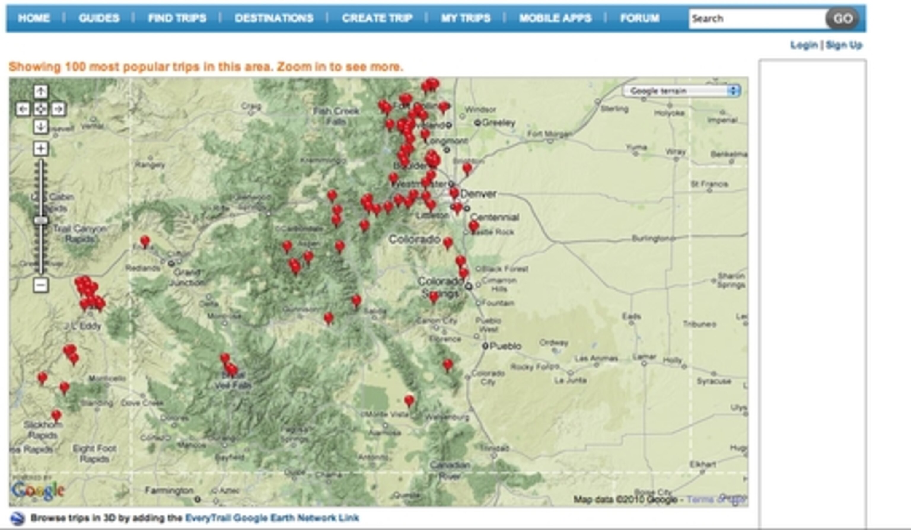
The Find Trips link allows you to find a trip in your area or at a destination where you are going. You can see guides for an area or trips that others have uploaded. An option to view a world map with the top 100 trips can be viewed as well, with the top 100 changing as you zoom into a specific location. These are trips that members have uploaded and shared with the community. Along with the GPS tracks and waypoints, photos, videos, and annotations can be found.
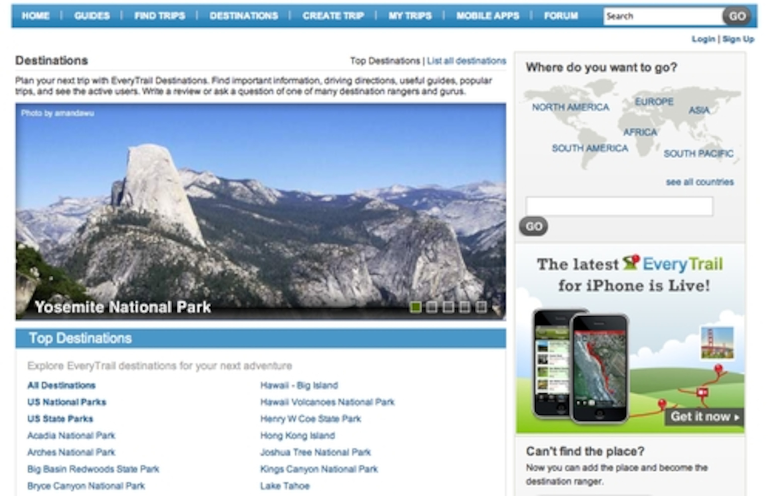
The Destinations link is for trip planning (or arm chair exploring). Pick a destination from the top ones or see a list of all destinations and you will be able to see every destination on the site. Destinations include both guides and trips submitted by users. Or if you don’t seen an area of interest you can add your own destination and allow others to populate this area too with trail data.
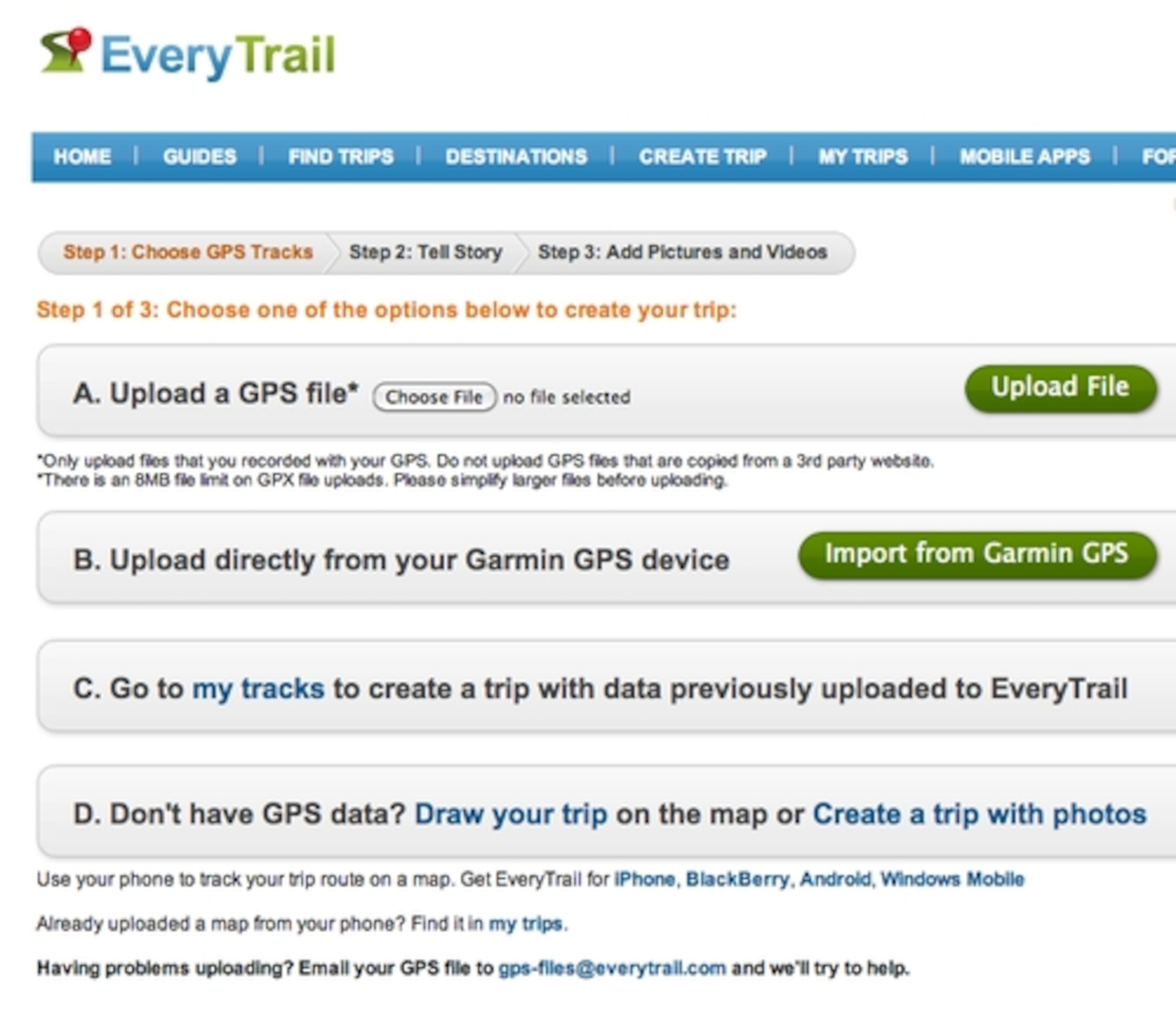
The Create Trip link is really the heart of EveryTrail. This is where the content gets uploaded and is the feature that got EveryTrail started down the, um, right path if you will. Click this link and you will see the three easy steps to loading your GPS data and adding content such as photos and videos and the story behind your trek. GPS data needs to be in GPX format (GPS Exchange). This is a common file format used by almost every recent GPS unit. These are simple text files containing your waypoints and tracklogs. You will have to export this file out of your GPS device using third party software.
If this is too much of a bother, and you use a Garmin GPS, EveryTrail can actually import the GPS data from an attached device using the Garmin Communicator Plugin (free for Win/Mac) that must be installed. Once this is loaded, you can then upload pictures and video. If they are already geotagged, then this all goes smoothly. You can also geotag images and video once you upload them into EveryTrail. You can provide captions, re-order delete this media here, too. Finally you can create your own geostory about this trail and your experience on it. It is really well done and quite easy even for novice GPS users. Users can even upload and geotag content without any GPS info at all, using the maps in EveryTrail to plot out your trek.
The My Trips link helps you manage the trips in your account. It is here you can edit trip information, get messages from other members, set up your profile, and flag you favorite trips (either your trips or EveryTrail member’s trips).
MobileApps is self-explanatory but is also a key area that makes EveryTrail so cool. The EveryTrail apps get you mobile while allowing you to take most of the functionality of the website with you. In this day of iPhone app development, other platform users will be happy to see that Android, Windows Mobile, and RIM’s Blackberry are also supported. I will do an in depth review of the iPhone app in Part 2 of the EveryTrail Review.
The Forum link will take you to the the main discussion area of the site where users can exchange more information in a more informal setting. This is also where EveryTrail can offer help with its mobile apps, website and also take suggestions for future features or changes users would like to see.
Finally, the maps themselves, accessed in the Trips on the site, are presented in a very nice Google Maps interface allowing you to choose between Terrain, Map, Hybrid, or Satellite views. You can also expand this view to full screen for an uncluttered view of the map. Additionally, you can download a Google Earth (KML) file for viewing in Google Earth or download the trail into the GPX format for re-uploading into your own GPS if you want to follow the exact trail. The Map view also lets you expand the map view to full screen. When viewing the map, users can access icons on the lower left and right of the map (roll your mouse over the bottom of the map to see these icons) and play a slideshow of pictures taken on the trail. You can also see elevation data along the trail if the user provided this in the GPS data they uploaded. Additionally, you can click the little gear icon in the lower right of the map to change the map view, units of measurement, and other settings.
On the Trip page you will also find easy to cut and paste code to embed the map in blogs and websites or to share via email and IM. And finally, you can share the trail through Twitter, Facebook, or email. If you don’t want to share your trails with the world, you can also make them private and only share the links to those you know. Related trails are also listed for nearby areas.
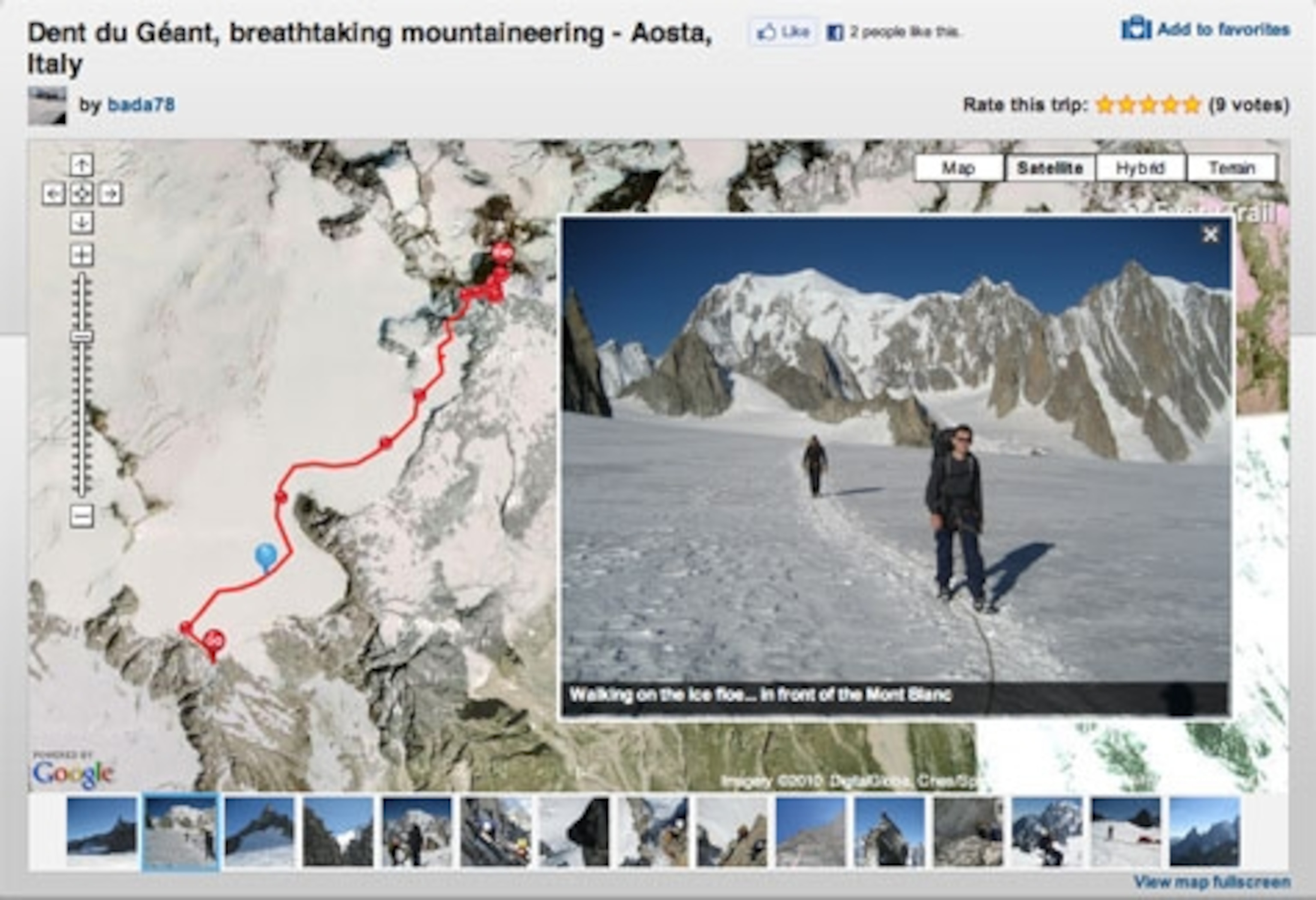
Note: The Guides let you see a map and trail details but you cannot download a Google Earth or GPX file, or share and embed the trail information. To do this you have to purchase the guide through your iPhone.
EveryTrail really has no peer right now. It has done so many things right and has made the experience of adding content and exploring other people’s trail content a delight. The site and service are actively being developed with new features added on a regular basis. For community mapping in the 21st Century, EveryTrail has you covered with just about every feature you could ask for. It is a useful and fun site and one I think you may use often if you collect GPS data and geotagged content on your trail travels. Explore and enjoy!
