By Keene Haywood

For those in the mapping know, the company ESRI is the Mount Everest of the field. It has long been the leading provider of software solutions for those who need to do heavy duty geographic information analysis. Such systems are referred to as GIS or Geographic Information Systems. Recently, ESRI has been getting into more of the consumer area of mapping by offering some easier to use web-enabled options for those who need to do mapping, but don’t necessarily need a geography degree to get it done.
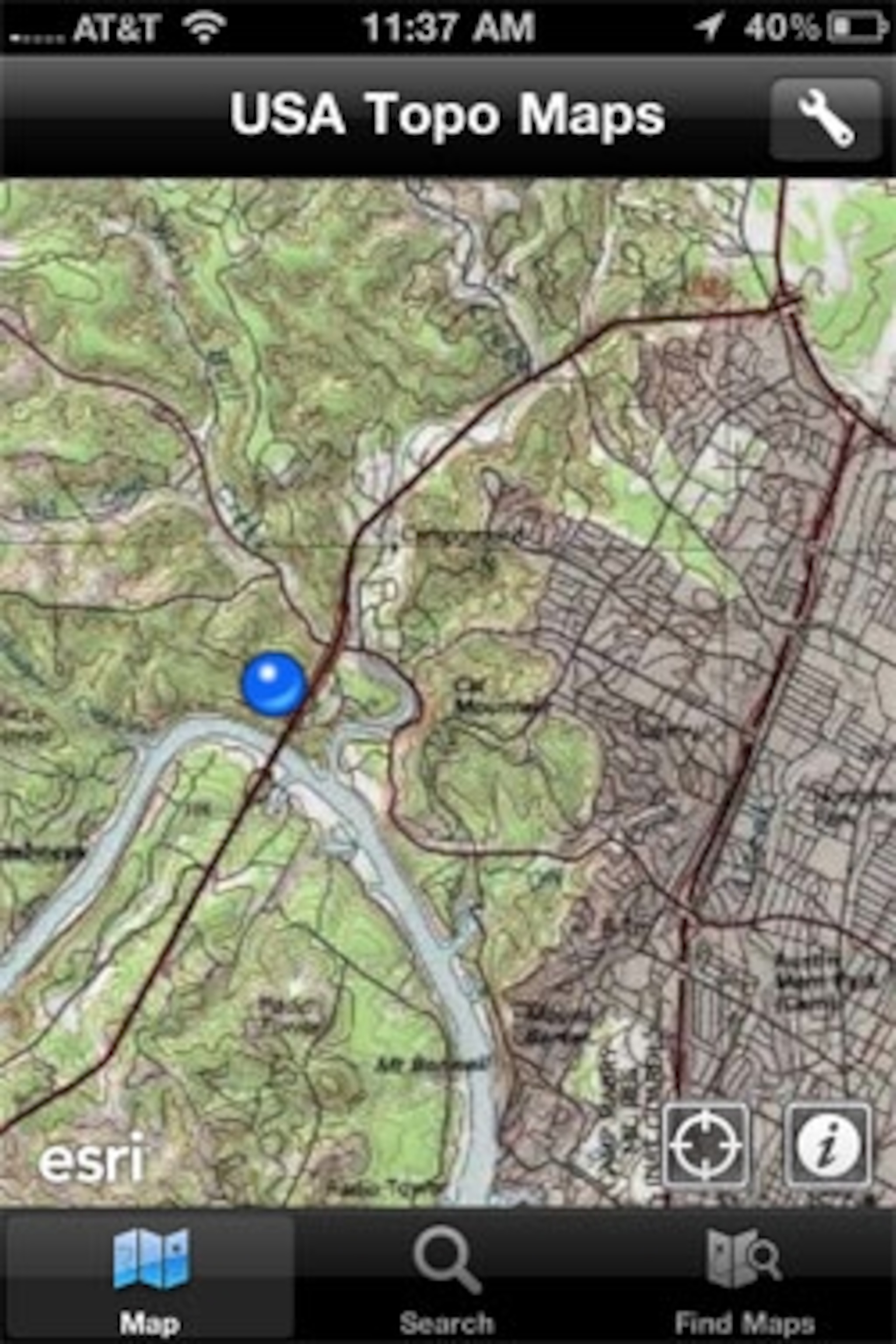
This move took a big jump Wednesday when ESRI released ArcGIS for Apple’s iOS which runs the iPad, iPhone, and iPod Touch. ArcGIS is the flagship GIS software for ESRI. They have done a wonderful job of streamlining the interface while still leaving it elegantly useable and efficient. The best part of the software is its deep catalog of maps that you can pull up and use from within the app. These are all excellent and offer a much wider array of imagery types than, say, Google Maps or Google Earth “out of the box.” For now, the software is basic, but it is a good foundation to build upon and a promising move. ESRI had ArcView GIS for the Mac platform years ago, but left it to focus on the Windows market, so the return is welcome.

The app is very simple to use. Three buttons at the bottom give you access to the online mapping catalog, location search, and the main map view. Toggling the information icon gives you some details about the map layer and there is a location icon you can select that will pin your location on the map via assisted GPS found in the 3G iPad and iPhone 4, 3G or 3GS. At the upper right of the map screen a wrench icon gives you access to simple tools for measuring distances, areas and for identifying features on a map. Selecting this allows you tap a location on the map which will allow you see coordinates for the location or a place name/address if its available.

The Find Maps button gives you access to a number of categories such as My Favorites, Most Popular, Highest Rated, Most Comments, etc. Find a map you like and you can Favorite it for easy reference later. You can even access open source OpenStreetMaps through the app. And, one can also hook into ArcGIS servers to pull down maps stored there using ESRI’s desktop mapping software. This is very handy for those doing work at their desk but then need to access the data in the field. The Find Maps feature is the the best part of the app at the moment giving one nice array of maps to explore. There is even a layer to see the current Gulf of Mexico oil spill disaster impact.
While still very basic, ESRI plans on building out this app further to tap into its growing and sophisticated online maps which are housed on its servers. This app will eventually have more features allowing for analysis and data collection in the field which. This will really add to its usefulness for citizen scientists and mappers in the field. For now its mostly just a map visualization app with a few extras built in. With the large map library and deep technology roots with ArcGIS, ESRI could do some innovative work with this app. The app is closely tied to ESRI maps and data offerings contained within their own mapping systems which is understandable. However, the company has been opening their doors recently and will soon allow outside developers to tap into some of its mapping software features which really will benefit the end user.
- National Geographic Expeditions
For those in the field, this is great news and adds another tool to the mapping toolkit for users of Apple’s mobile devices running iOS. Its nice to pull up a range of different maps for the area where you are (or want to be!) to explore what is there. One caveat. It appears you do have to be online to use the maps. The app does not store them locally…yet. Hopefully this will happen down the road.
If you are a mapping app and want to check out the ArcGIS app for your iPad or iPhone, it can be found for free in the iTunes store. Search for ArcGIS or go straight to this link. The app is optimized for both the iPhone and iPad. The maps look great on the new iPhone 4’s Retina display! Keep your eye on this app. It has lots of promise.
http://itunes.apple.com/us/app/arcgis/id379687930?mt=8
