Secret Images of Pearl Harbor
Confidential photos and maps offer a more complete picture of the surprise attack 75 years later.
On December 1, 1941, in Tokyo, Emperor Hirohito of Japan gave the Imperial General Staff final authorization for war against the United States. Using the code words “Climb Mount Niitaka,” Admiral Isoroku Yamamoto signaled his First Air Fleet—which was already at sea and constituted the most powerful naval force in the Pacific—to proceed with his plan for a surprise attack on Pearl Harbor.
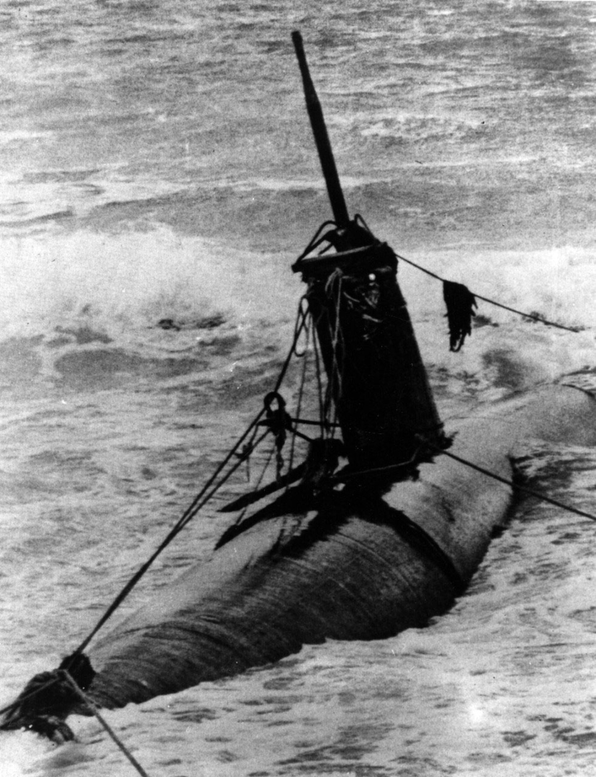
Meticulous preparations had been underway since April, when Yamamoto gave the order to organize the First Air Fleet and his staff began fleshing out details of the operation, which included midget submarines assigned to enter the harbor and launch torpedoes.
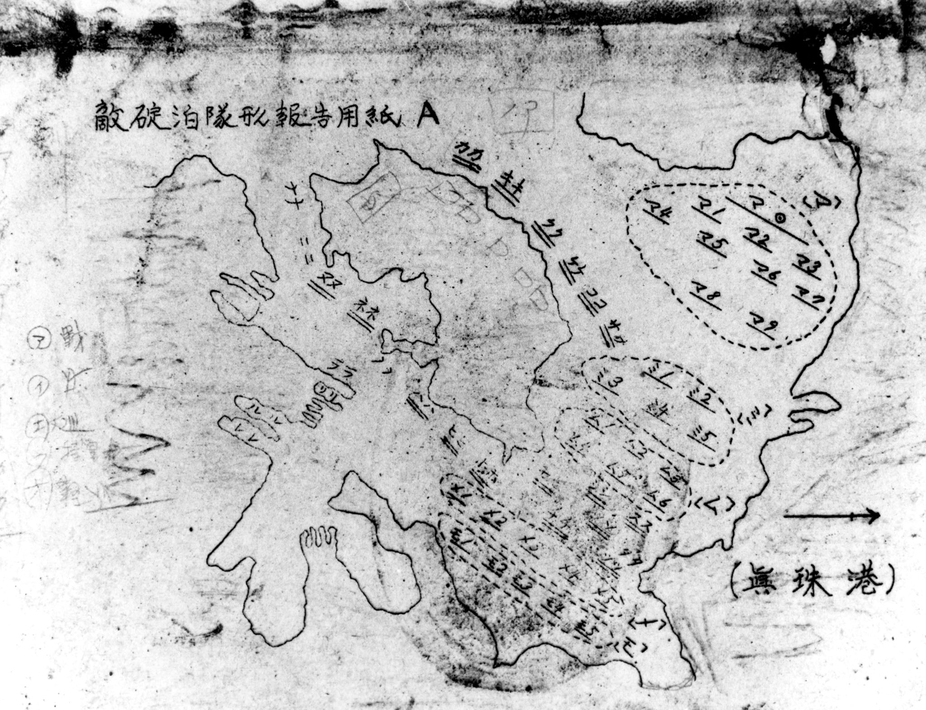
For the audacious plan to succeed, pilots and crewmen needed charts showing the location of warships of the U.S. Pacific Fleet. Such classified information was not indicated on commercial navigation charts like those obtained by Japanese naval attachés in Washington, but officers there helped track the Pacific Fleet by following announcements and press releases by the U.S. Navy and combing newspapers for notices of ships arriving and departing.
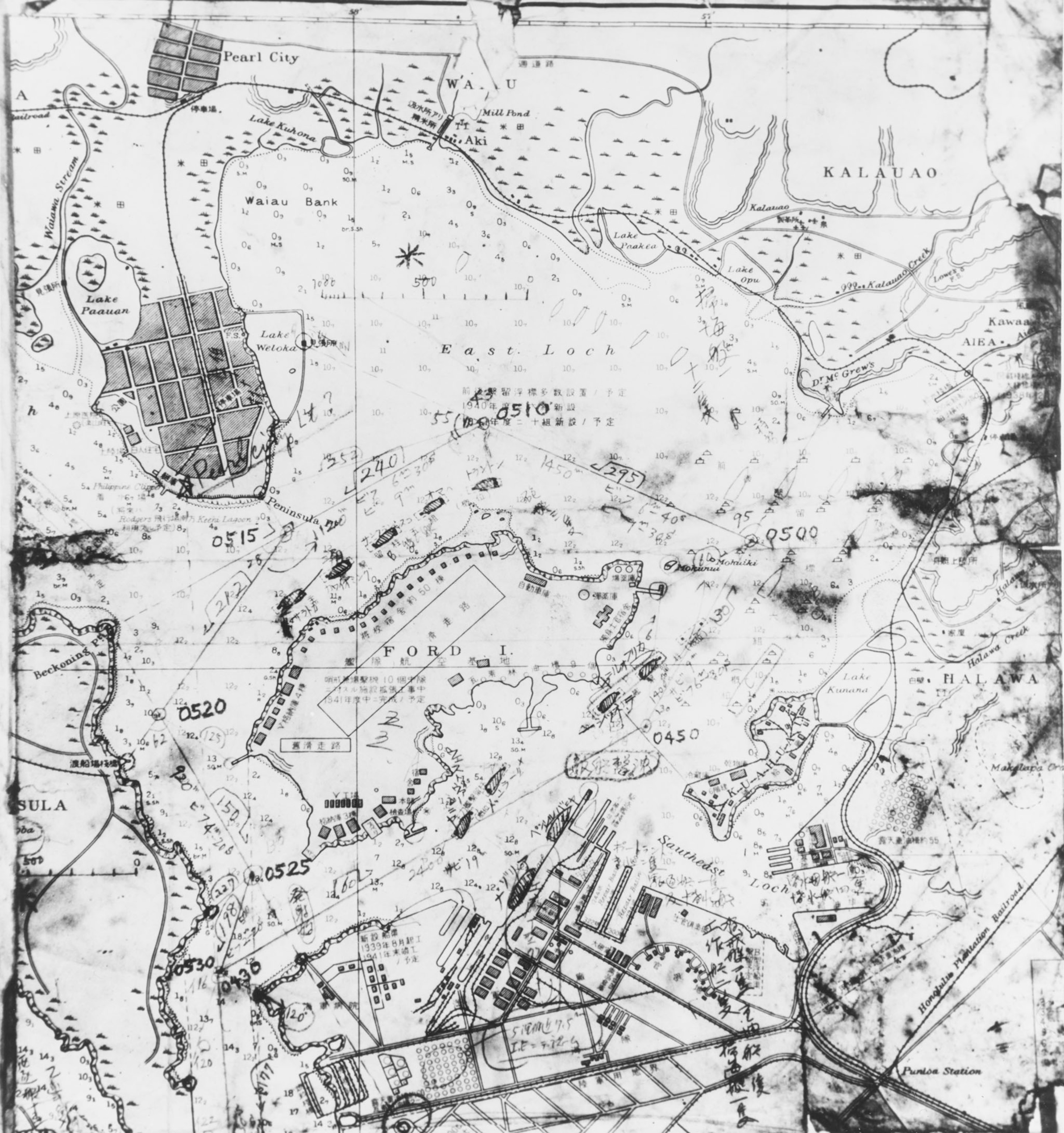
More precise intelligence on the situation at Pearl Harbor came from Japanese spies in Honolulu, notably Takeo Yoshikawa, and from naval listening posts located near Tokyo and on various Japanese-held islands. Those stations picked up radio transmissions from Pear Harbor and used radio direction finding and signal analysis to pinpoint ships that were approaching or leaving the base.
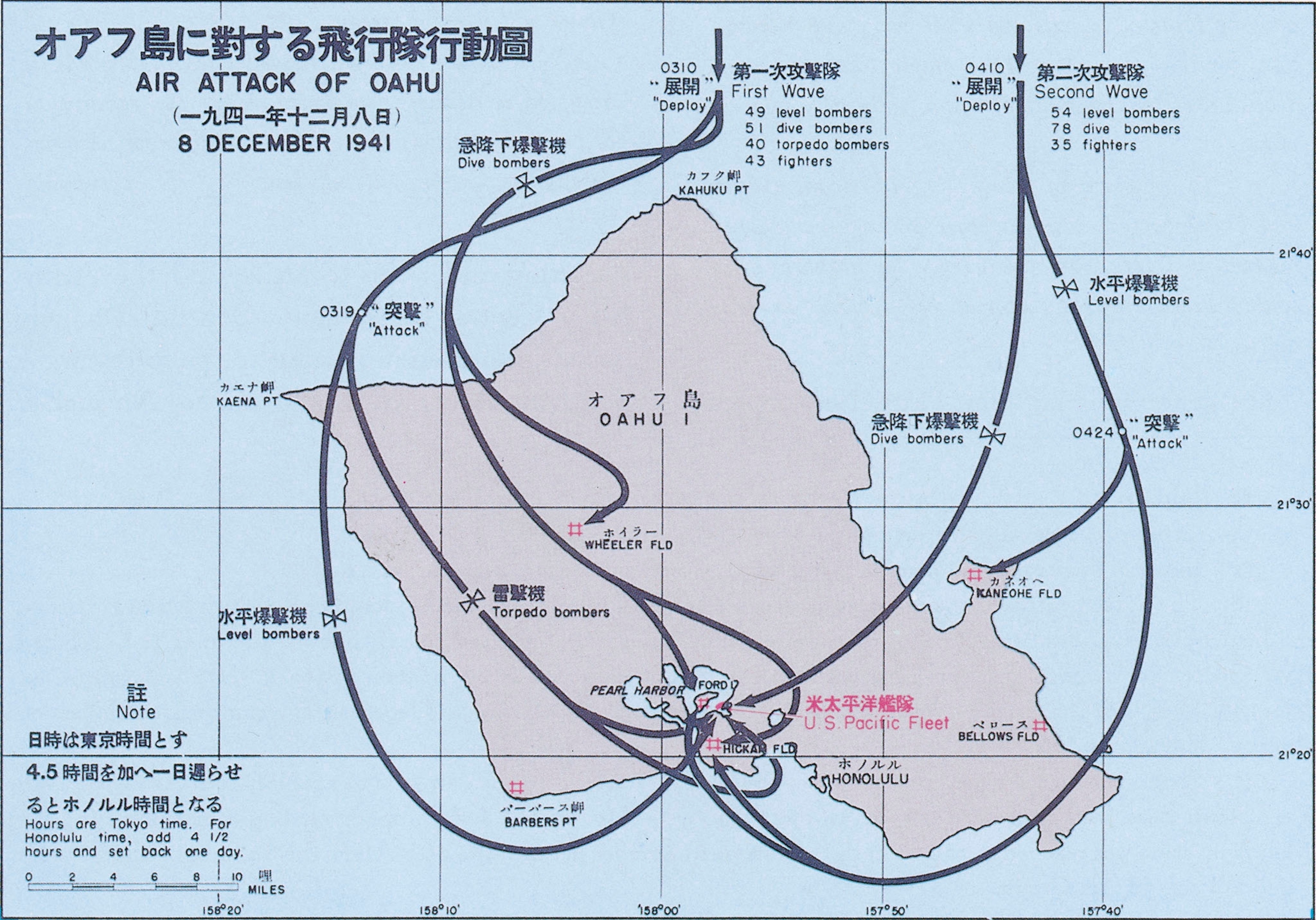
As the First Air Fleet neared its launching point off Hawaii, it maintained strict radio silence but carefully monitored incoming signals. A radio intelligence team on the Akagi—flagship of Vice Admiral Chuichi Nagumo, assigned by Yamamoto to command the strike force—received coded reports from Tokyo on what listening stations had detected and also picked up American naval communications and commercial broadcasts from Honolulu. By the time the six aircraft carriers of Nagumo’s fleet turned into the wind to launch their warplanes on the morning of December 7, the pilots had been thoroughly briefed and provided with charts reflecting the most current Japanese naval intelligence on targets that would soon be within their sights.
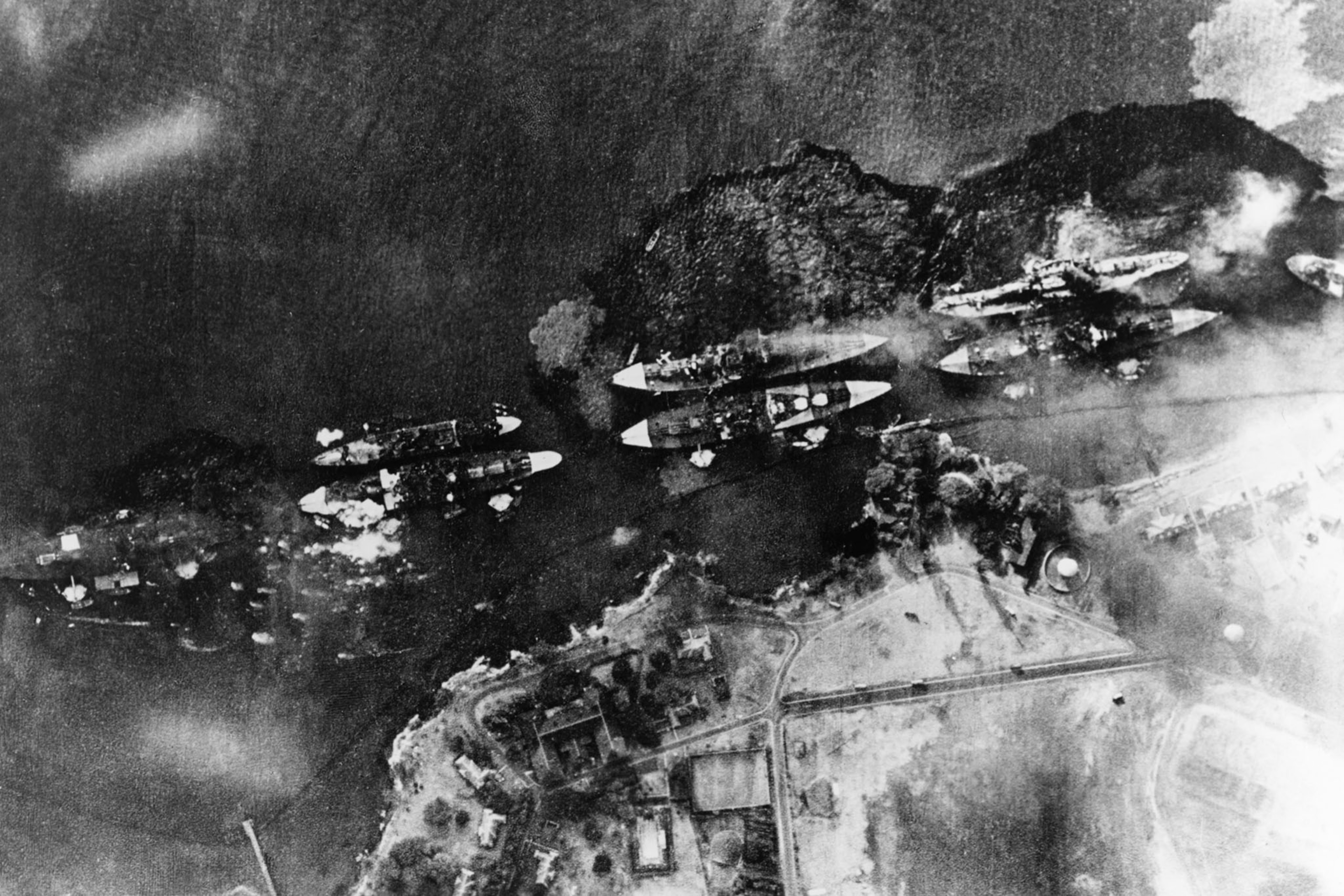
Many photographs of the stunning Japanese assault on Pearl Harbor were not made public until long after 1941. Some shots by press photographers of the mayhem on Battleship Row were withheld from publication because American officials considered them too demoralizing. Other images like the U.S. Navy photo of a stranded Japanese midget submarine assigned to the attack were restricted for security reasons. The Japanese carefully documented their operation on film, not for publicity purposes but for official review and analysis afterward. Several of the photographs in the gallery above were discovered in Japanese military archives as U.S. forces reclaimed ground lost to their foes and went on to occupy their homeland. These confidential views and maps offer a more complete picture of the raid that ignited war in the Pacific than was available to civilians on either side during the conflict.

