3-D Printing Teaches Kids About the Danger of Volcanoes
In a messy experiment, scientists used models to show Mexican students why topography matters.
One of the dangers of volcanoes is that many of them don’t erupt often enough to remind people of the hazards of living nearby. Take Popocatépetl, for example. This active volcano (nicknamed “Popo”) near Mexico City last had a big, explosive eruption about 1,100 years ago. It’s had scores of less violent eruptions since then, and it’s been acting up lately, but that hasn’t been enough to discourage people from living on its slopes. Some even live on top of lava and debris from past big eruptions.
“In many areas, including around Popo, people won’t necessarily believe you when you tell them something is happening,” says Martin Mangler, a geology graduate student at Imperial College London who is studying the volcano. “They’ll say, I’ve lived here all my life, why should I leave?”
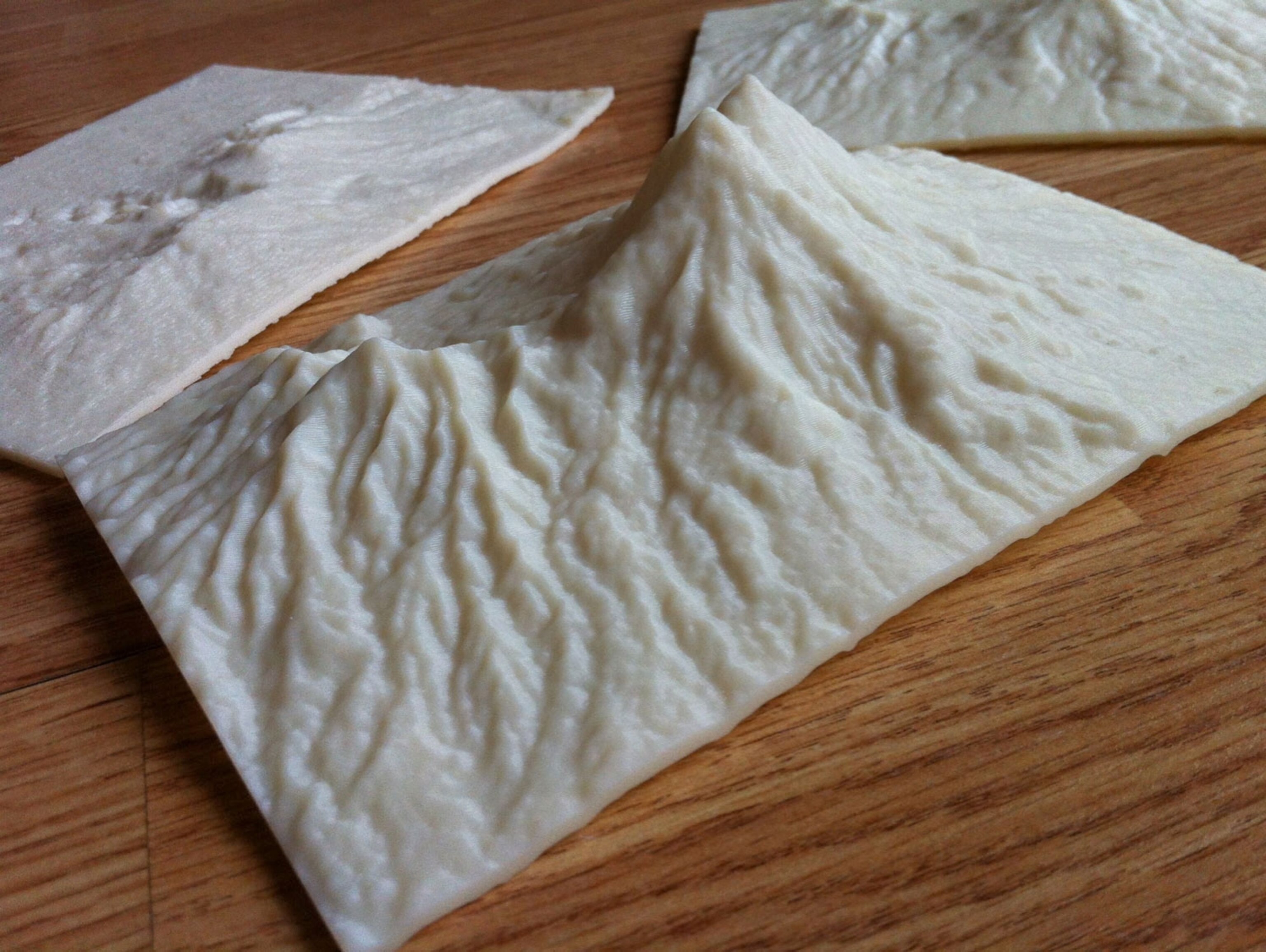
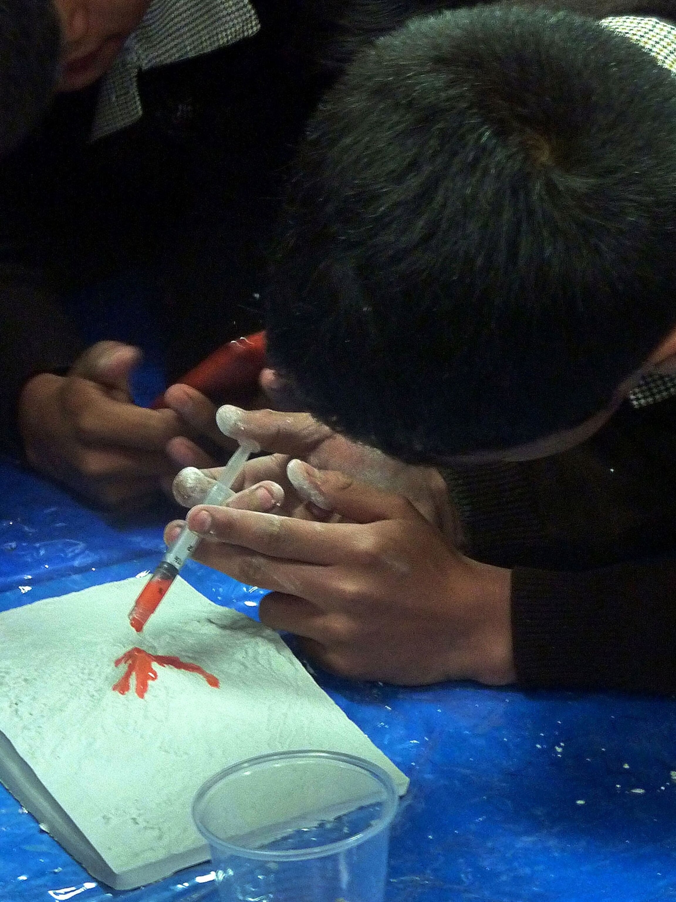
So Mangler and a team of volcanologists from the Natural History Museum in London and Mexico City are trying something new to teach locals about the hazards. They recently took 3-D printed replicas of Popocatépetl to a village school and organized a workshop for about 120 students. They talked about volcano hazards, then brought out the models, which were hollow so that they could be used as casts. “We basically just added duct tape around the edges and poured plaster in it,” Mangler says. “It was a mess, but a constrained mess.”

Then they gave the students syringes loaded with watered down red finger paint to simulate lava. “They could see how it would flow and just miss their village,” Mangler says. A few of the simulations weren’t totally scientific, though. “Some of the models ended up completely red,” Mangler says.
Even so, Mangler thinks it was a useful demonstration. “I had the feeling the children took a lot away from this, to have this small-scale representation that shows how close they really are to the volcano and how important it is to be aware of the topography around you.” Mangler thinks this is just the type of hands-on demonstration that’s needed to prepare people to act when the time comes, and he says the group plans to do it again on their next trip.

The idea for the 3-D-printed volcano maps came from another geologist, Ian Saginor, who thought of it a few years ago when he was a professor at Keystone College in Pennsylvania.
“Volcanic hazards are closely tied to topography,” Saginor says. But standard hazard maps are flat; they use color to indicate where the danger is. Saginor reasoned that 3-D models would be more intuitive and would better help people understand why certain areas were hazardous. On a 3-D model, Saginor says, it’s easy to see steep areas that might be prone to landslides or drainages that might channel lava or debris flows.
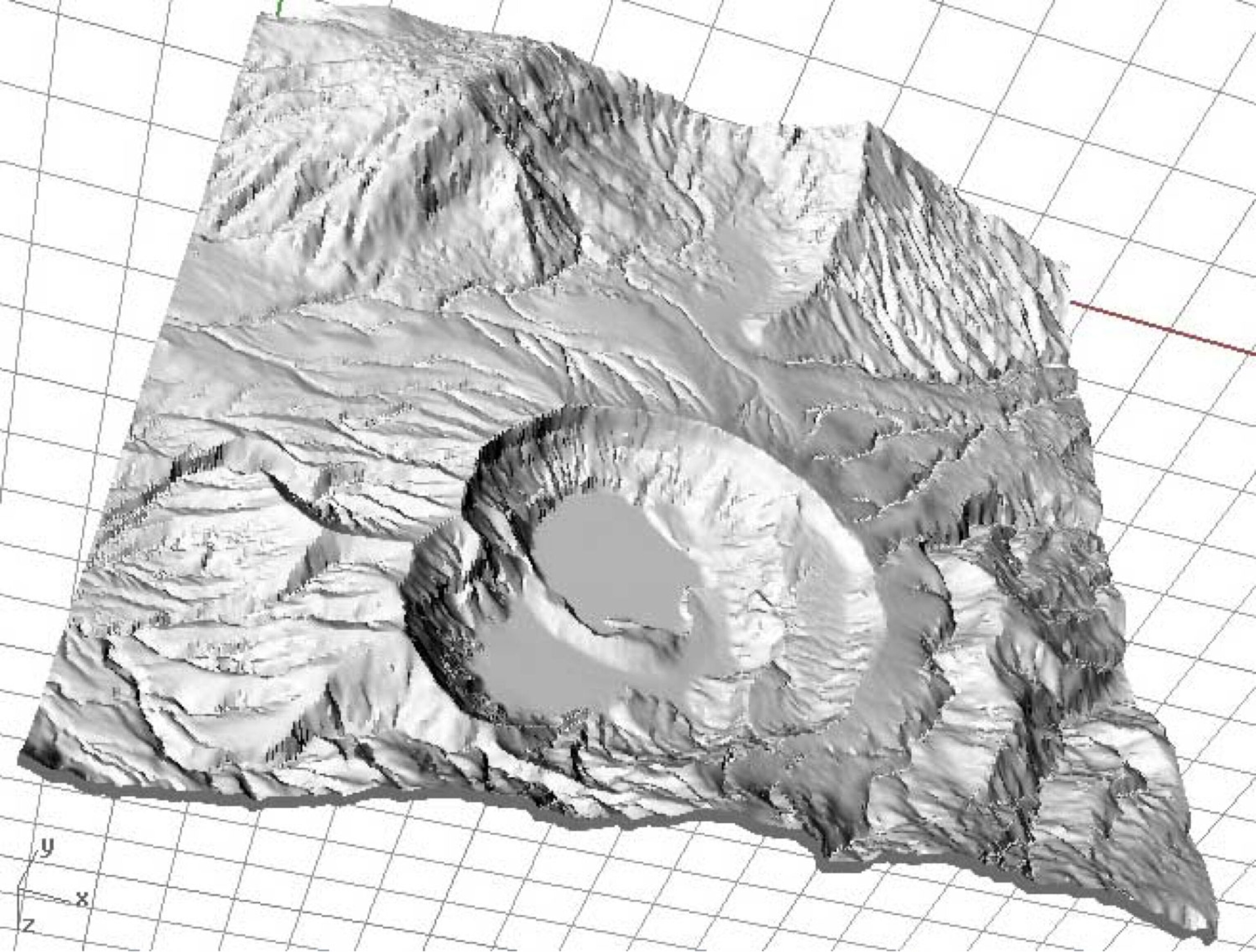
So, Saginor began creating models by feeding digital elevation models—terrain data collected by satellites—into a 3-D printer, and inviting his colleagues to take the models along on their field research trips. “The idea was to get them in as many hands as possible,” he says.
The 3-D printed models cost about $5 to make, but to lower the cost even more, Saginor had another idea: print hollow models that could be used as plaster casts. That way all the kids in a class could potentially get a model to take home and show their parents.

Saginor met Mangler and his Ph.D. advisor, Chiara Petrone, at a geology conference in Dublin in January and gave them some of the models they used around Popocatépetl.
Saginor says he hopes more geologists will give it a try, too. “It’s not particularly hard around a volcano to know where there’s danger; the hard part is getting people to listen to you,” Saginor says. “You get the models into all the houses and one day when there’s a hazard, it’s not new to them.”


