An ‘Atlas for the End of the World’
Dozens of colorful new maps and graphics show where urbanization is most likely to conflict with biodiversity.
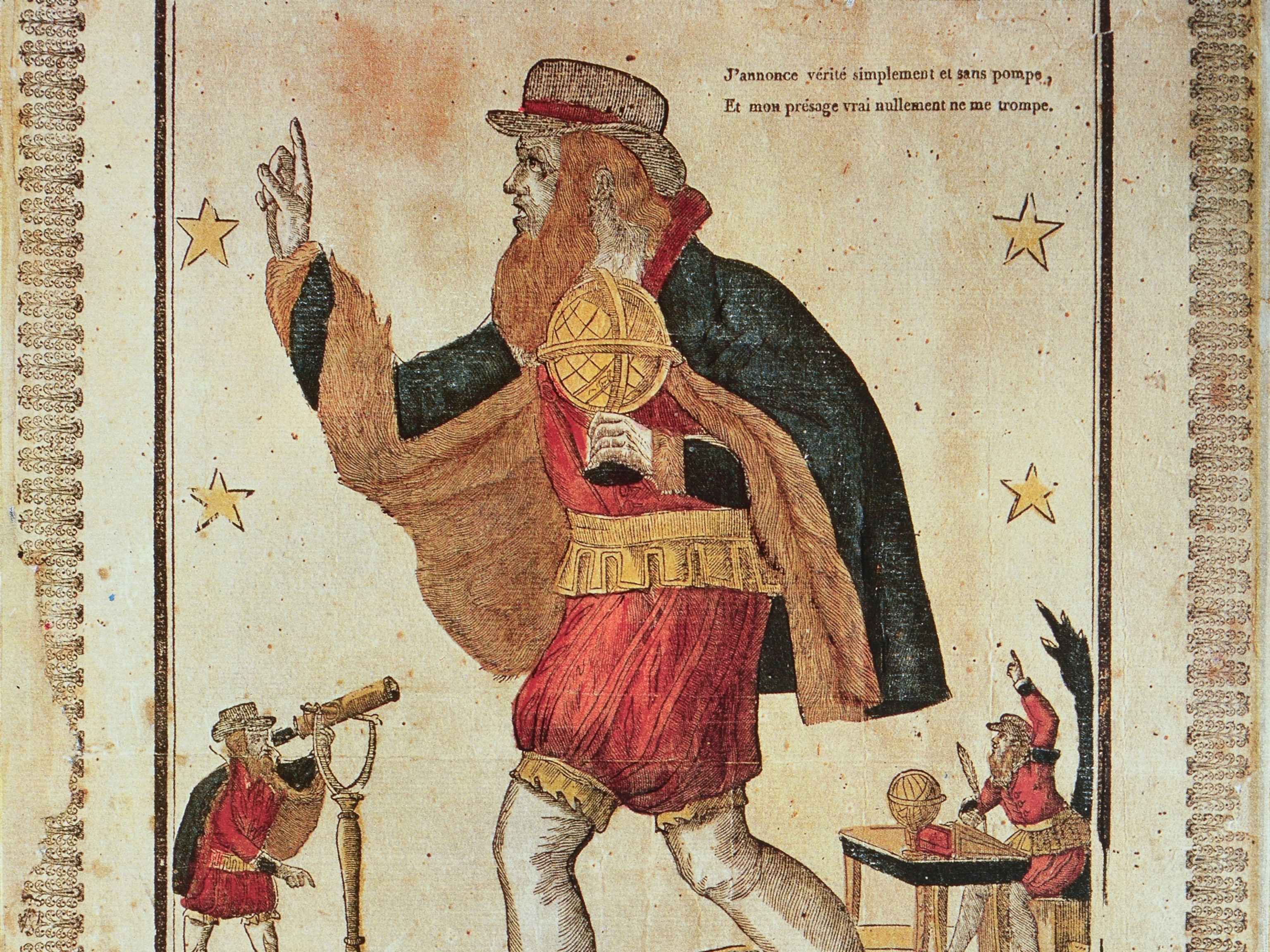
In 1570, the Flemish cartographer Abraham Ortelius published the first modern atlas, Theatrum Orbis Terrarum (Theater of the World). The Age of Discovery was just kicking into high gear, and Ortelius’s artfully drawn maps showed what many Europeans must have seen as a brand-new world, full of recently discovered lands waiting to be colonized and exploited.
That world no longer exists, says Richard Weller, a landscape architect at the University of Pennsylvania and lead author of a recently released online project, “Atlas for the End of the World.” The apocalyptic-sounding title doesn’t refer to the end of the world, Weller says, but to the world as Ortelius knew it. “It's the end of the world where we thought nature was an infinite resource and we could exploit it without consequence,” Weller says.
When Ortelius published his atlas, Weller notes, most of the world’s native ecosystems were still intact. Four and a half centuries later, that’s obviously not the case. The new atlas is for anyone who’s curious about where biodiversity is under threat around the globe, Weller says. But he hopes it will also be a call to action for landscape architects, urban planners, and designers—professionals he believes have valuable expertise to contribute to conservation efforts.
That makes sense in light of one of the new atlas’s major themes: that urbanization and conservation are intertwined. Bad urban planning decisions can increase the pressure on vulnerable ecosystems, Weller says, whereas urban planning done with conservation goals in mind is a largely untapped force for good.
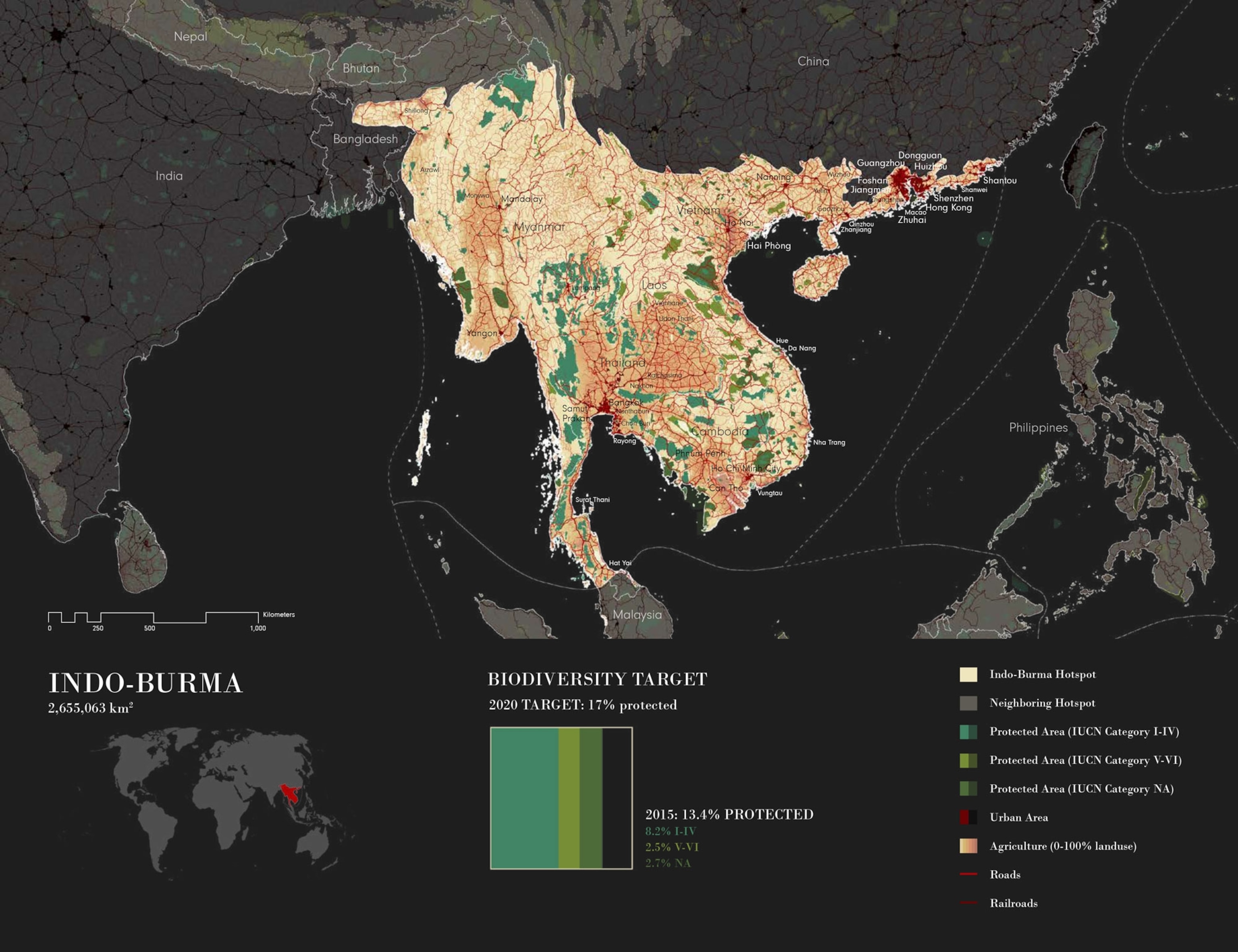
The main focus of the atlas is the 36 biodiversity hotspots targeted for conservation by the United Nations. The hotspots themselves ignore international boundaries; they’re defined by scientific consensus as areas rich in plant and animal species that live nowhere else but face significant threats of extinction.
One of the conservation goals agreed to by 196 countries as part of the UN Convention on Biodiversity is to protect at least 17 percent of the land within these hotspots by 2020. So far that goal has been met for only 14 of 35 hotspots, according to Weller’s analysis. (The 36th hotspot, added in 2015, has yet to be assessed.)
The atlas has detailed maps for each hotspot showing the different ecosystems within them and the threats they face from human activity such as mining, agriculture, and urbanization. Other maps and data visualizations look at regional and global influences that could jeopardize conservation efforts, from energy extraction to government corruption to food production for a human population that’s expected to top 10 billion by the end of the century.
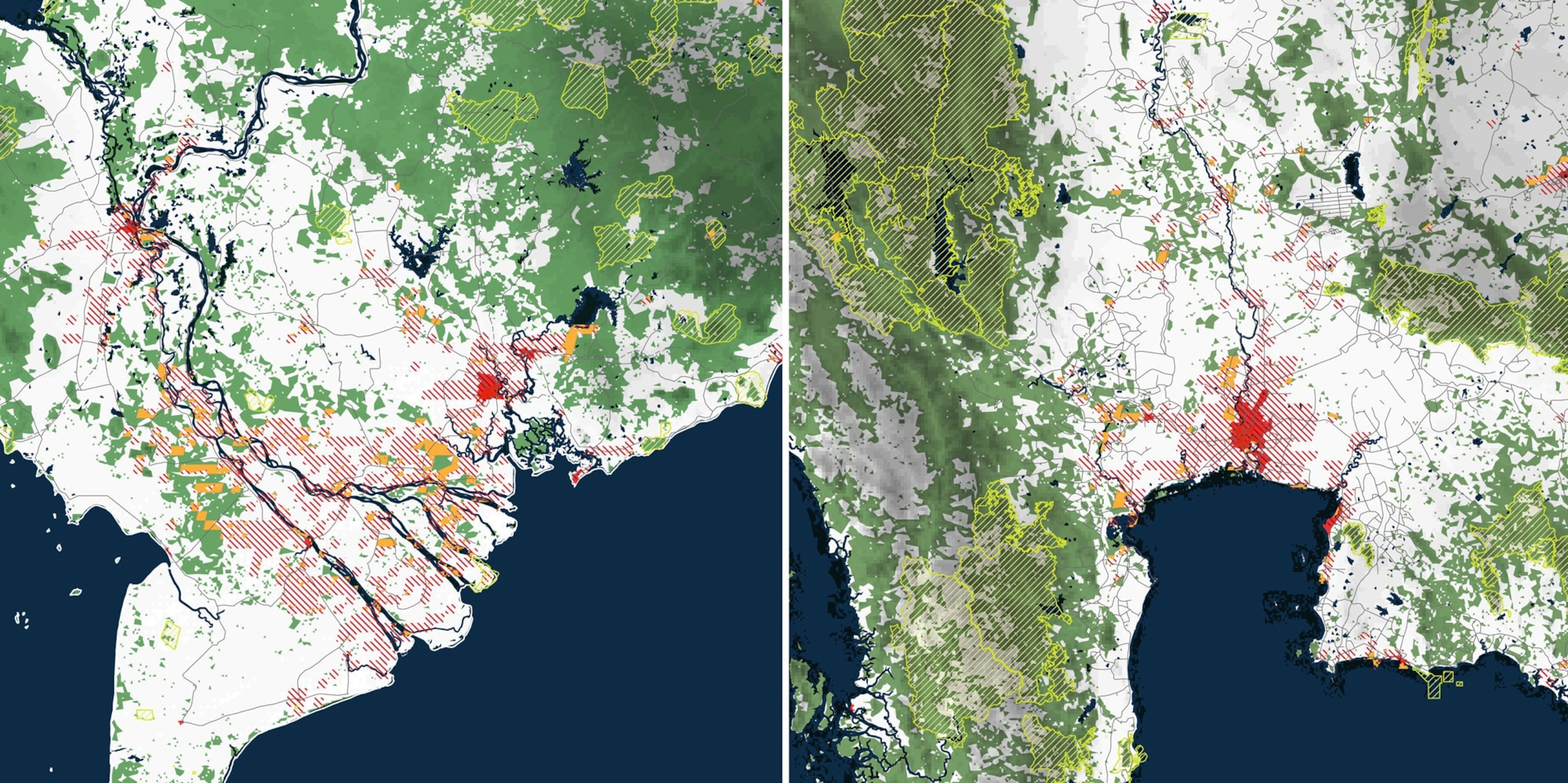
There are 422 cities of at least 300,000 people within the 36 biodiversity hotspots. Many of these are growing, and few have any systematic urban planning, which sets the stage for future conflicts. Weller and his co-authors, Claire Hoch and Chieh Huang, used urban growth predictions from researchers at Yale University to map where these conflicts are likely to occur in the coming years (see above).
This is where Weller thinks his colleagues in landscape architecture and urban planning can play a larger role. “What we do is model different scenarios and look for opportunities to absorb population growth so that it reshapes the city in a certain way,” he says. The challenge is that every city is unique and requires its own plan for balancing growth with the impacts on biodiversity.
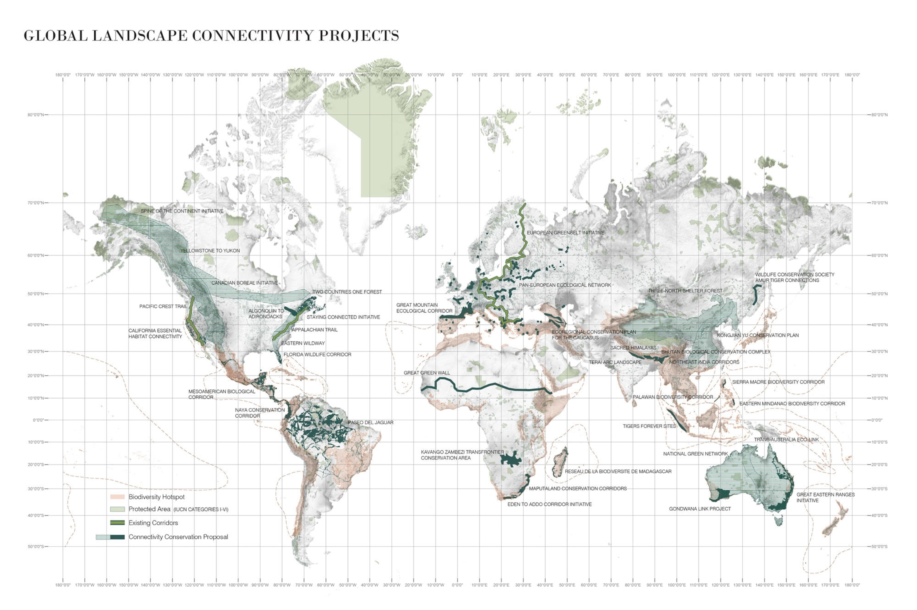
One of the most interesting maps in the atlas highlights another strategy for improving biodiversity: efforts to connect biodiverse regions with one another (see above).
“From a conservation perspective, that stuff that’s locked up in isolated fragments, no matter how well those fragments are protected, isn’t going to last very long,” Weller says.
These connectivity efforts range from the small-but-practical to the big-and-wildly-improbable. But Weller sees them as an encouraging sign that humans have turned a corner and begun to think about how to re-create ecosystems that have been destroyed since Ortelius’s day.
“We need to redesign our systems,” he says, “so that there’s infrastructure for species other than us.”
If you’re interested in conservation, you might enjoy our previous posts on how trade threatens endangered species and how roads threaten biodiversity.
Follow All Over the Map on Twitter and Instagram.

