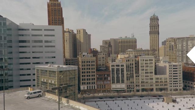
part 1:  Meet Detroit part 2:  Explore Detroit part 3:  See Detroit

Rethinking Detroit

In less than five decades the once vibrant Motor City lost more than half its population and gained a reputation as a failed metropolis of abandoned buildings, widespread poverty, and rampant crime. But photos of derelict homes and empty lots can create a misleading impression. The city ranks 69th in population density—people per square mile—among U.S. cities with more than a hundred thousand people, ahead of Las Vegas, Denver, Phoenix, and Portland, Oregon, to name just a few. Detroit is still losing inhabitants, but neighborhoods such as Woodbridge are rebounding.

Map of Detroit
Residential area
71% Traditional neighborhood
21% Urban prairie/naturescape
8% Spacious residential
Nonresidential area

In less than five decades the once vibrant Motor City lost more than half its population and gained a reputation as a failed metropolis of abandoned buildings, widespread poverty, and rampant crime. But photos of derelict homes and empty lots can create a misleading impression. The city ranks 69th in population density—people per square mile—among U.S. cities with more than a hundred thousand people, ahead of Las Vegas, Denver, Phoenix, and Portland, Oregon, to name just a few. Detroit is still losing inhabitants, but neighborhoods such as Woodbridge are rebounding.


Block by Block

Many neighborhoods along Detroit’s perimeter are as densely populated as the city’s wealthier suburbs. This analysis at the block level shows the range from neighborhoods that are thriving to those that have more vacant lots—and to areas reverting to nature, known as "urban prairie."

City area
(in square
miles)
Percentage of Detroit's residential area
Percentage
of Detroit's
residential
area
71%
Traditional neighborhood

Most densely populated
Fewer vacant lots
Least blight

21%
Urban prairie/
naturescape

Least densely populated
Most vacant lots
Most abandoned buildings

Open space
Mixed-use and nonresidential parcels


Detroit Up Close

Detroit’s population plummeted, in part due to the growth of the suburbs in the 1950s, race riots in 1967, the decline in auto manufacturing, and the 2008 financial crisis. Over the decades each neighborhood has responded differently. Some neighborhoods have remained vibrant, some are being revitalized, and some are approaching the point of no return.


Sherwood Forest

This northern neighborhood has long been stable. It’s near a university and golf course and abuts other strong neighborhoods. The more than 500 brick homes in this predominantly middle-class, black community are in good condition. Eight homes are unoccupied, and 33 lots are vacant. Sherwood Forest has not suffered the exodus other neighborhoods have faced in recent decades.

Map of the Detroit neighborhood Sherwood Forest
Traditional
residential
Urban
prairie


Woodbridge

Many affluent residents left for the suburbs after World War II, but this community of mostly Victorian homes has seen an influx of young professionals since housing incentives began in 2011. City organizations have targeted the neighborhood, within walking distance of downtown and the future M-1 streetcar, for improvement. More than half its 1,200 properties are vacant lots. About 60 houses were unoccupied, but that number continues to decline.

Map of the Detroit neighborhood Woodbridge
Traditional
residential
Urban
prairie


Burbank

Population loss in this part of the city has been staggering. Hit hard by the mortgage crisis, Burbank lost 41 percent of its residents from 2000 to 2010. Of the neighborhood’s 7,300 properties, only 3,000 are occupied and 2,350 are vacant lots. Nearly 200 of its mostly postwar, lower quality homes have been recommended for demolition, and 340 homes have fire damage, most likely related to high rates of arson and vandalism in Detroit.

Map of the Detroit neighborhood Burbank
Traditional
residential
Urban
prairie


Brightmoor

This northwest corner of Detroit has suffered high homicide and crime rates but is also noted for its community groups and urban agriculture. Many of its abandoned homes, mostly wooden bungalows, have been painted with colorful artscapes. About 1,578 of its nearly 5,000 structures are unoccupied, and 321 have fire damage. One-fifth of them still need to be boarded up. Illegal dumping has marred more than 508 lots.

Map of the Detroit neighborhood Brightmoor
Traditional
residential
Urban
prairie


NorHam

The Davison Freeway separates NorHam’s sparsely populated north from its robust, Bangladeshi-populated southeast. The neighborhood, just north of Hamtramck, is almost equally divided between vacant lots and structures. Of its 1,949 buildings—many of which are brick or wooden homes in good condition—1,235 are occupied. Some 130 lots are used for illegal dumping; 415 buildings need to be boarded up.

Map of the Detroit neighborhood NorHam
Traditional
residential
Urban
prairie