Awakening Celtic legends on a road trip along Wales' Coastal Way
Snaking down the western coast of Wales from the windblown Llŷn Peninsula in the north to the city of St Davids in the south, follow a path of Arthurian myth and Bronze Age mystery along Cardigan Bay.
They stand like seals on the beach at Ynyslas, as I pull over, ready to witness a 5,000-year-old standoff.
I see their dark shapes squaring off against the sea, heads curling attentively into the sky, long bodies spilling behind them. There are hundreds lined up along the sand like soldiers. Tensed for action, waiting patiently for the enemy to arrive.
And so, it does. I hear it coming before I see it. It’s the wind that gives it away — pulling on the waves as they bend back and forth, playing with the dark specks like a cat with a mouse. To start with, it’s far off, the noise a gentle swooshing. But as I watch, it gets hungrier, the waves surge a little faster, pound a little heavier on the dark shapes, slurp a little louder as they circle round them. The tide is on its way, and once it comes, these seals, these soldiers, these amorphous dark shapes will be no more.
Five thousand years ago, this wasn’t a beach. In the Bronze Age, the village of Ynyslas was a forest, thick with oak, birch and pine trees. But then something happened. Maybe it was rising sea levels; maybe, legend says, it was the day a local priestess allowed a fairy well to overflow. Either way, the forest was swallowed by the sea. It reappeared in 2014, when winter storms stripped the sands from Cardigan Bay, unearthing phantom trunks that had been slumbering for thousands of years.
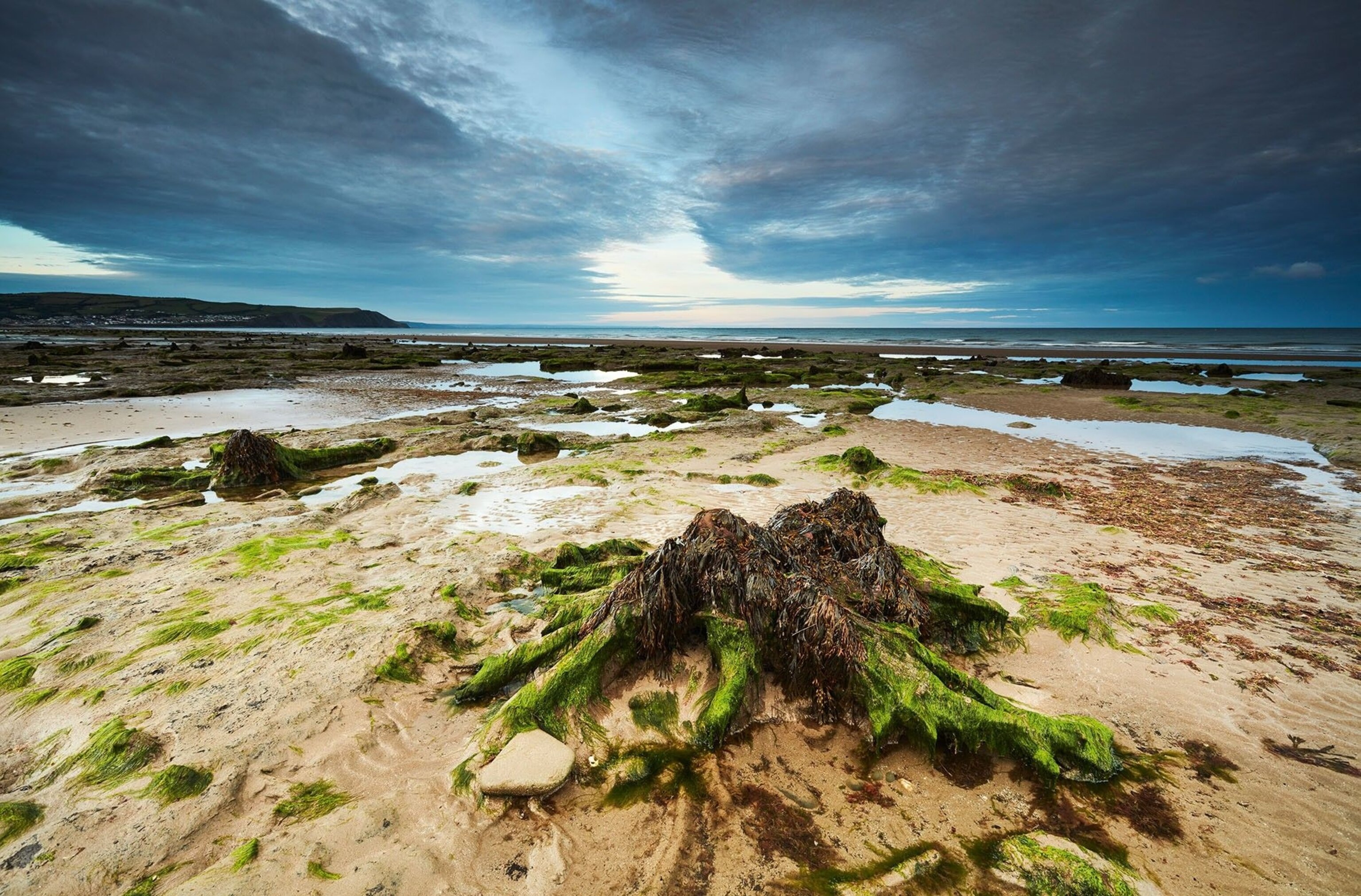
Close up, they swim into focus. No longer sleek seals, these are real trees, their trunks whorled with age (I can even count the rings); their roots like octopus tentacles, finding purchase in the sand. Some are wreathed in seaweed, others have been scoured clean by the sea. All have their trunks lopped off at knee-height, as if a giant had scythed through them before drowning them in the bay.
Is this, as some say, part of Cantre’r Gwaelod, the mythical Welsh Atlantis said to exist somewhere beneath Cardigan Bay? Or a slightly more run-of-the-mill archaeological discovery? Here on Wales’ myth-steeped west coast it’s hard to untangle fact from fancy.
Coastal lore is in my blood. I grew up in Cornwall, amid megalith-wreathed moorland and clifftops thrumming with Arthurian legend. So, it’s no surprise that my five-day Welsh road trip along the Coastal Way — snaking 180 miles along the entire length of Cardigan Bay, from the Llŷn Peninsula in the north to St Davids on the southern tip — still somehow feels familiar.
Actually, I’d come for prettiness: genteel Portmeirion, with its artsy houses stacked down the cliffside; Aberdyfi and Aberaeron, their teeny harbours laced with pastel cottages, a far cry from the rough-and-ready fishing villages I grew up around. But while searching for the twee, it’s the wilderness that’s captivating me: the ragged green coastline abloom with wildflowers, medieval castles crumbling into the landscape, and the tree stumps of Ynyslas, waiting stoically for the tide to bury them each night. With its tales of mythical Welsh fighters and fairy wells, this foreign land, where they speak a language I don’t understand, feels like coming home.
Beauty and the beast
“Oh, poor you!” says the woman on the clifftop at Porth Simdde, outside Aberdaron.
It’s not the usual reaction I get to revealing my roots — normally, any mention of Cornwall provokes melty eyes. But not here on the Llŷn — a very Cornish-looking claw reaching out 30 miles to sea on Wales’s northwest tip.
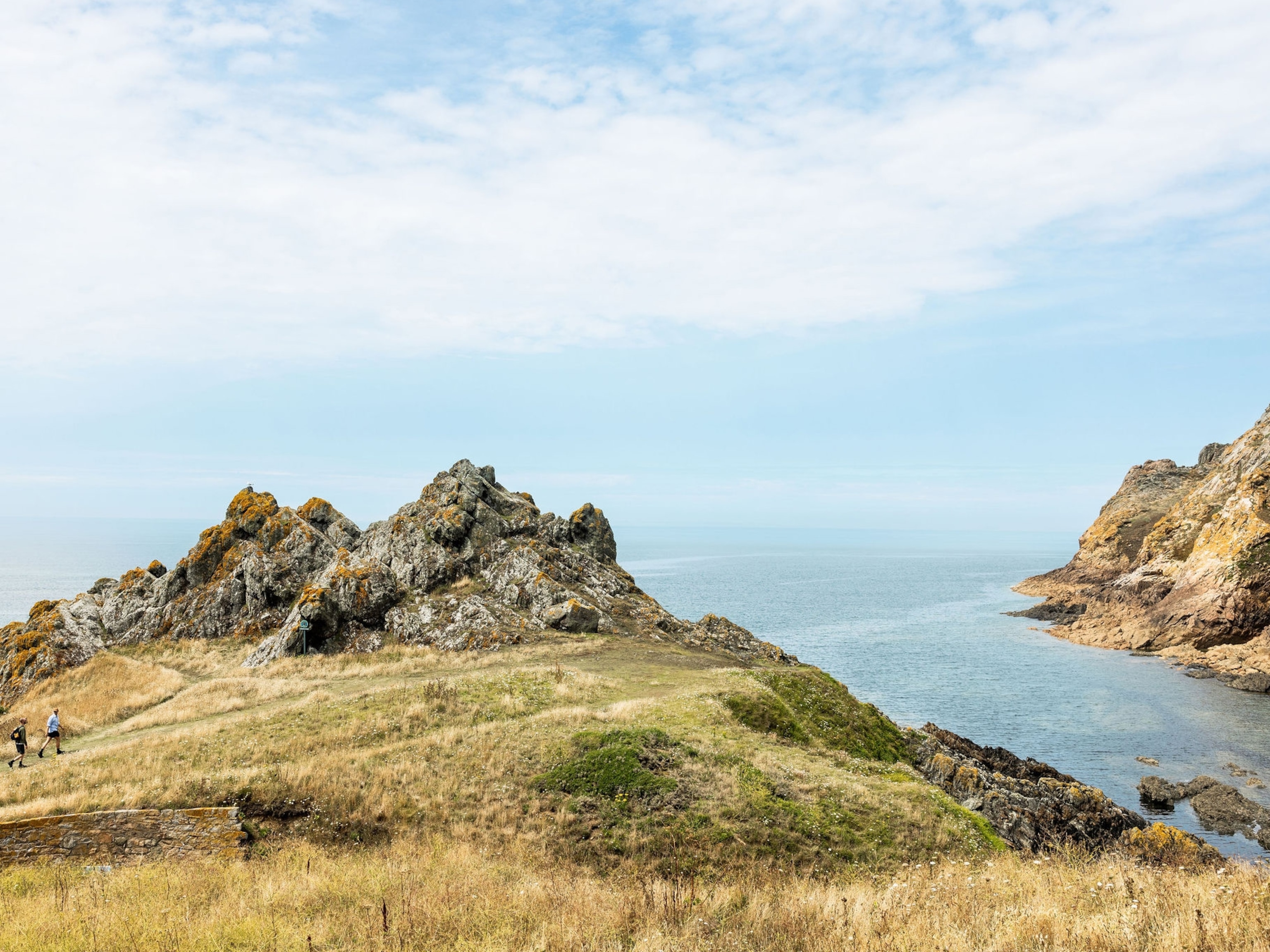
“We have the same coast, but you get all the tourists,” she says, leaving me alone on the headland, drizzled with neon foxgloves and coconut-scented gorse. In the sun, the Irish Sea flashes mackerel-silver, and the coastline stalks into the distance: green-iced rocks with emerald, mustard and mole-brown fields etched on top.
Right now, the weather is deceptively perfect. Across the teal sea is Bardsey Island, where monks lived and the sick sought healing in medieval times.
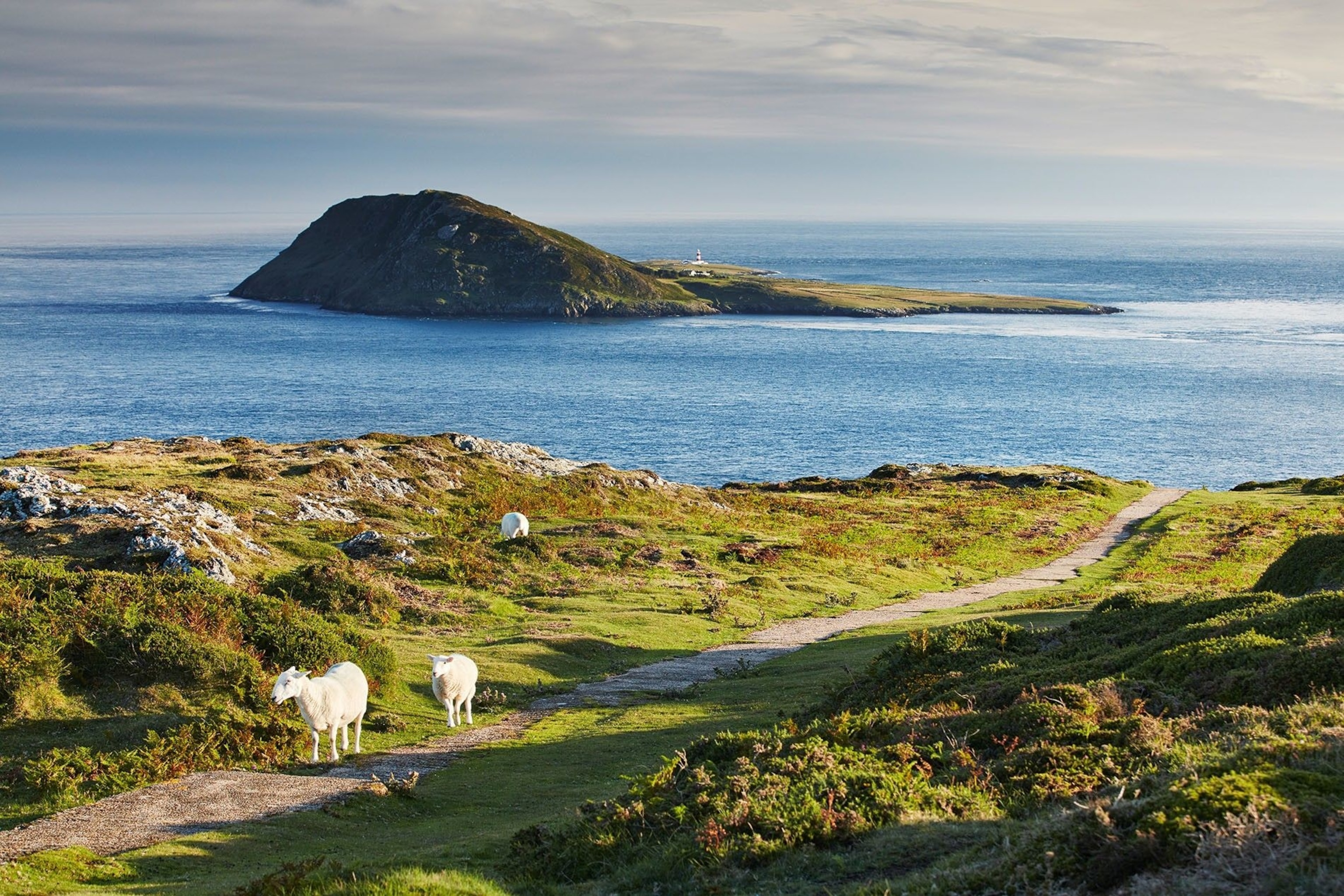
But only a few hours ago, things were different. I’d woken up to find the wind ripping across the bay, and my boat to Bardsey cancelled. I could see why: the night before, I’d arrived in Aberdaron to a squall so bad that the staff at my hotel were shepherding a flock of ducklings blown off the beach. I’d spent the evening warming up with seaweed-flavoured local gin (Dà Mhìle’s organic seaweed gin — it had a tang of the sea); the only English-speaker in the bar. Bardsey was known to medieval pilgrims as ‘the Rome of Britain’, and the journey to get there was just as treacherous as any quest to the Italian capital.
Like Cornwall, the Llŷn is a wild land of billowing jade hills and path-riddled cliffs. At Nefyn, I walk onto a sheer-sided promontory, the track squeezing through waist-height undergrowth. Winding round to the ‘mainland’ — Cardigan Bay’s stretched-croissant of coast unfurling into the Irish Sea — things get more refined. At least, they do on the surface, but the wilderness is never far away. Portmeirion — the art deco, pseudo-Italian fishing village, an hour east from Aberdaron — is tweely gorgeous. But 20 minutes inland, in the mountains of Snowdonia, is Blaenau Ffestiniog, a former slate-mining town where the hillsides bristle with friable stone. At Llechwedd Slate Caverns, 650ft underground, the air hangs heavy with damp as guide Freya shows us how the men worked, feeling their way around the mountain’s bowels in the dark. Up above, Brian — or ‘Rat’, as he calls himself, as a former quarry worker — drives me into the quarry, which closed in 1978. “I spent 10 years under there,” he says, pointing at the rock, voice echoing in the hollows.
Up here, the mountainside looks stripped to the muscle, great chunks gouged from its flesh over the decades. Standing on a 25-ton rock, Brian points out the chambers where they worked — some huge clefts in the rock, others narrow slashes looking barely big enough for a real rat. Viewed from above, the quarry’s peaks make a mini Snowdonia. On a clear day, you can see as far as Harlech’s skeletal medieval castle, but not in today’s mist.

The next day, I’m heading into the real thing — an hour-long drive through Snowdonia National Park on my way to Machynlleth. The road cleaves through moss-coloured foothills, low-hanging slate-grey clouds swallowing the peaks around Tal-y-llyn, a glassy ribbon of glacial lake in the south of Snowdonia. Not that there’s time to stop — I’ve an appointment with Owain Glyndŵr.
The last Welsh Prince of Wales, who rose up against the English in 1400 and disappeared nine years later when his last stronghold, Harlech, was captured, is the stuff of both historical fact and legend. Glyndŵr’s guerrilla-style tactics brought him victories — at one point, he controlled most of Wales. And his disappearance (his wife and children were captured in 1409, but he was never found) only burnished his legend. “We say he’ll come back,” says Rhiain Bebb, on the spot where Glyndŵr held his parliament in Machynlleth. “We’re waiting for him to lead the Welsh into independence.” I can almost feel the expectation humming in the air.
Glyndŵr chose Machynlleth, on the River Dyfi, as the town was traditionally considered the boundary between North and South Wales. It’s here he was crowned Prince of Wales, and the building in which we’re standing is the late 15th-century rebuild of his original. It’s a forbidding, thick-walled barn of a place with low-slung windows and a soaring roof, crisscrossed with hulking beams.
But what’s more fascinating is the exhibition on Glyndŵr — “Wales’s David versus England’s Goliath,” says Rhiain, proudly — and Rhiain herself. A former university Welsh tutor, she plays the Welsh triple harp and runs drop-in language sessions for Machynlleth’s ever-growing population of non-Welsh-speakers, which, for today at least, includes me. Rhiain makes me feel at home by whipping out a vocabulary list to prove that Welsh and Cornish are similar. “Welsh is phonetic, so once you’ve learned how to pronounce the sounds, you can speak it,” she says, encouragingly, and within a few minutes she’s transformed what two nights ago in Aberdaron was an alien language into an approachable one. I learn the subtle difference between ‘ch’ (the sound produced at the back of my throat) and ‘ll’ (pushed out from the side of my mouth), and suddenly I can pronounce ‘Machynlleth’. We count from one to 10. By the time I leave, not only can I say ‘diolch a hwyl fawr’ (‘thank you and goodbye’) but Rhiain’s given me a whole new respect for my roots.

Whether or not Owain is still slumbering, there’s a mystical feel to this part of Wales. Near Owain Glyndŵr’s Parliament House, the deep-fried pizza and window-wide bara brith fruit bread draws me into Blasau Delicatessen, a tea room run by Sabrina, an Italian who swapped Venice for Machynlleth because she’d nurtured “a passion for British myth — King Arthur and the green man — ever since I was little”. Up the road, at the Corris Craft Centre, is Spellbound Herbals, where — between a candle shop and a gin distillery — owner Sarah infuses soaps and creams with medicinal herbs. They smell so richly of the outdoors that back home, hungry for Wales during lockdown, I email her to order more.
West of Machynlleth, towards coastal Aberdyfi, is Llyn Barfog, a moorland-wrapped lake where King Arthur is said to have slain a dreaded monster. And at Aberystwyth’s National Library of Wales, I find the Nanteos Cup, a wooden bowl that’s said, at the very least, to have healing properties, and, at most, to be the Holy Grail itself (science dates it more prosaically to the medieval period). Today, barely half of it remains — the result of generations of sick believers gnawing away at it in search of a miracle. Even so, the deep age rings inside, blackened with centuries of healing potions, are powerful to behold. No wonder I’m away with the fairies by the time I reach Ynyslas, and those prehistoric trees, halfway down the Welsh coast.
Merlin and megaliths
The lower half of Cardigan Bay, south of Aberystwyth, feels more peopled, but even here among the fish and chip shops, there’s an edge. At New Quay, as tourists cram into the sandy harbour to go dolphin-watching (Cardigan Bay is one of the top places in Europe for spotting them), I climb the roller coaster hill to the Black Lion, Dylan Thomas’s favourite boozer. The Welsh poet and writer lived in the town from 1944 to 1945 — the sleepy town of Llareggub (read it backwards) in Thomas’s 1954 radio drama Under Milk Wood is said to be based on New Quay. From the beer garden, I watch paunchy green hills rolling down to the sea, and boats swivelling in the lapis water, circling round flecks that could be either waves or dolphins. Round the back are vintage Dylan Thomas photos; by the bar is a painting of a man grinning furiously as he brandishes a pint. “It’s not him,” says the woman behind the bar, as I flex my camera. “It’s kind of a joke — he’s just a bit of a character.”
At Cardigan, I head to the castle and find something very different to what I was expecting, and a lot more interesting. Only the battlements remain, within which stands a stately Georgian house; now a museum, it tells the story of the Black Death, Owain Glyndŵr’s failed raid and a bloody Civil War siege in 1644. Amid all this human drama, a sign in the car park tells me to beware the tide that could claim my car. However high the battlements, it seems nature is never far away here.

Below Cardigan, down towards St Davids and the Pembrokeshire coast, the myths take over. Nothing I see on my trip is as spectacular as Pentre Ifan, where a gargantuan dolmen — a megalithic tomb built 3,500 years ago — stands in a field, towering over the neighbouring sheep, hills and headland, pointing towards Fishguard. Cardigan Bay sparkles in the gaps between the 8ft-high stone wedges, blanched by centuries of sun; the top slab, curved like a shield, seems to hover in the air like a UFO, barely touching the pillars. There’s an air of Stonehenge about it, I think. No wonder — Stonehenge’s ‘bluestones’, lying nearly 200 miles to the east, hail from right here in the Preseli Hills.
Two miles south east of the dolmen, I drive through a fast-flowing ford, up a steep, road and round a switchback to see the land fall away around Craig Rhos-y-felin, a vast, wild outcrop on which chunks of rock are racked up like matches in a box, megaliths almost peeling themselves off. Three miles further lies Carn Goedog, one of the former Neolithic quarries that supplied Stonehenge’s rocks. I can make out its colossal stones spearing the sky from half a mile away, but there are no footpath signs, and grubby sheep are glaring at me. Not wanting to trespass, I turn around.
There’s more mysticism waiting for me further down the road. At Nevern, a hamlet near Newport, I find an avenue of 600-year-old, Tolkienesque yew trees (one of which oozes blood-red sap from its twisted trunk), leading to a Norman church. It stands on the site of a sixth-century ecclesiastical settlement. Founded by an Irish monk, it was a stopping point for pilgrims en route to St Davids. Inside is an Ogham stone — a rock slab inscribed in a mysterious, early Celtic language; outside, a lanky 10th-century cross is carved with plaits and Celtic knots.

There’s more. On the hill above the village, I march round the ramparts of a motte-and-bailey castle, softened by the centuries into a park framed by trees and filled with wildflowers. Nearby, following a woodland path, is the ‘pilgrim’s cross’ — a crucifix carved into the rock face, said to be part of the pilgrimage route to St Davids. At least, that’s the official version — which ignores the coffin-shaped ‘doorway’ etched into the rock beneath it. The non-official version is that behind the rock is a cave, and in that cave lies either Merlin or the Holy Grail, or King Arthur — dressed in full armour, ready to rise again.
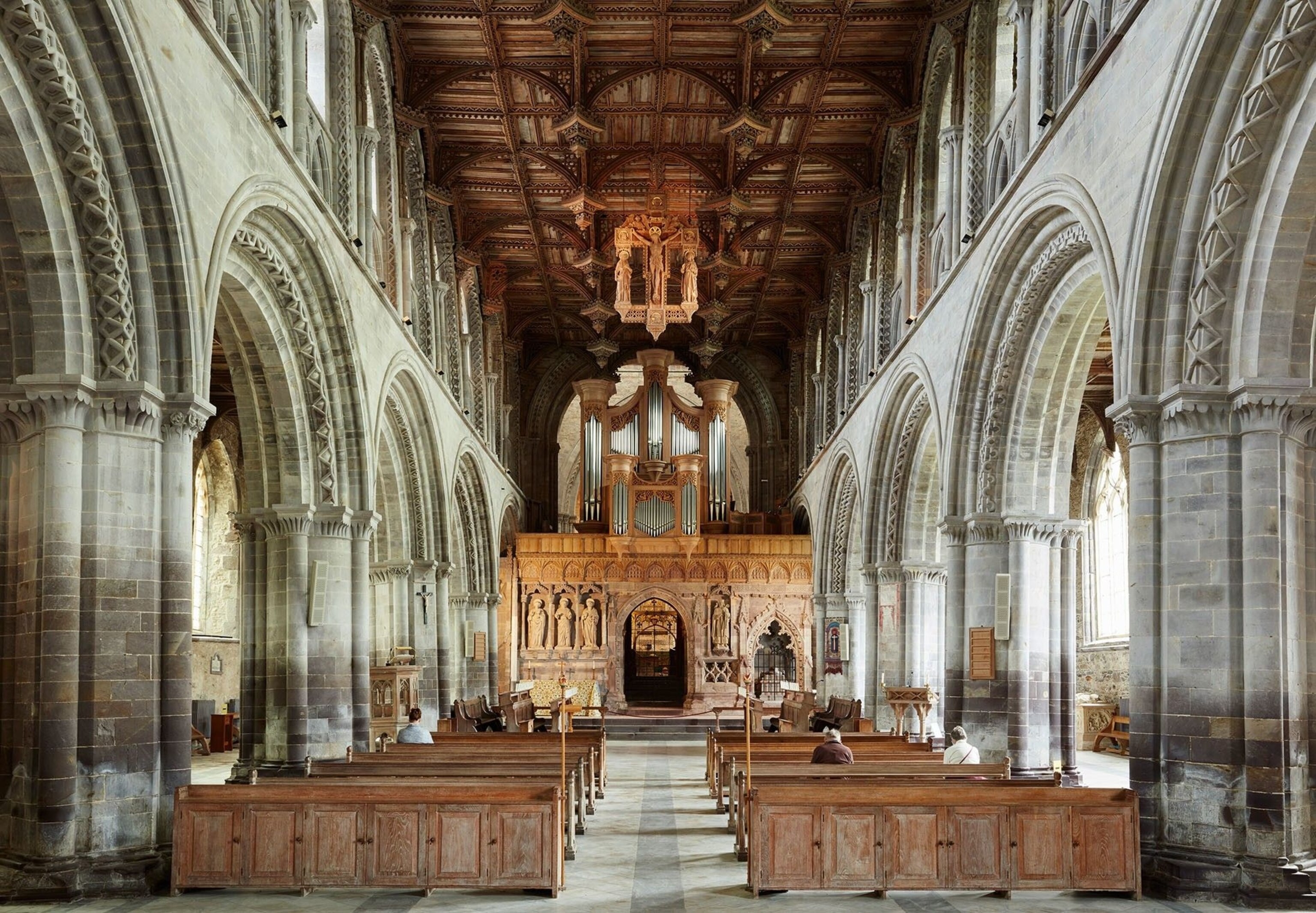
My journey finishes at St Davids, where the land crumbles into the sea at Wales’s westernmost point. This is the UK’s smallest city, population-wise — a town no bigger than any of the others I’ve seen, only with a strapping cathedral in a field at its base, said to hold the bones of the Welsh patron saint.
The next day, I’ll get to see the cathedral, its arches and vaults incised with plaits, twists and chevrons. I’ll wander through the ruined St Davids Bishop’s Palace, where an ecclesiastical hush still hangs over the ruins.
But tonight, I’m here for the sunset. I set out along the cliff and am soon transported back to the scene at Aberaeron — right down to the bright foxgloves squeezing the narrow path. Only, here in Pembrokeshire, the coast fans out in fold after fold, as endless as a hall of mirrors. Beyond is Pen Dal-aderyn, the westernmost nub of mainland Wales, where the land feels saturated with generations past — the peninsula densely mapped with standing stones, ancient settlements and Celtic chapels. But for now, with the sea shimmering under the pinkening sky and wildflowers my nearest neighbours, the only magic I need is right here.
Essentials
Getting there & around
Take the train to Chester and hire a car on a one-way rental — it’s then a pretty two-hour drive to the Llŷn Peninsula. Drop the car at Swansea or Cardiff.
When to go
Year-round. The school holidays bring crowds, and avoid winter if you don’t care for storms while walking coastal paths.
How to do it
Book your trip independently and take a week to do the route, with around five or six overnight stops. At the time of going to press, Wales was out of lockdown. But some sites are reopening gradually. Llechwedd Slate Caverns is doing so in stages: glamping and quarry tours have begun, but there’s still no reopening date for the Llechwedd Deep Mine Tour.
More info: visitwales.com
Published in the Sept/Oct 2020 issue of National Geographic Traveller (UK)
Subscribe to our newsletter and follow us on social media:
Facebook | Instagram | Twitter
