Rapid Rewards: A Canoe Trip Down the Yukon
Paddle into adventure on an unforgettable river.
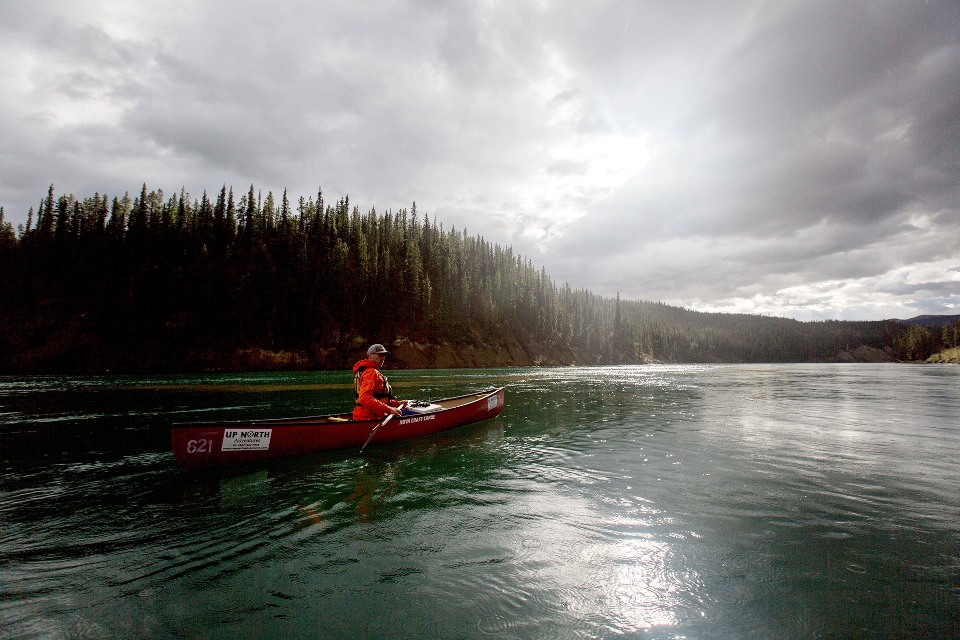
The canoe is facing the wrong way. Only 20 seconds into our Yukon River ride, we’re stuck in an eddy, bobbing uneasily. Spencer Millsap and I—two supposedly seasoned National Geographic guys on assignment in Canada’s westernmost region—aren’t very good at canoeing.
We sit a moment, then paddle fiercely to turn around. It’s not easy.
“This could take a while today,” our Up North Adventures guide, Julien Rouget, says when we finally catch up. “With this wind,” he adds diplomatically. I look ahead. A wind drives sheets of rain at a 35-degree angle into our faces and chops up the waves. Despite going downriver, each paddle forward feels like we’re fighting a tide.
We have seven hours and 55 minutes to go. Still, I can’t wait to get started.
Mercurial yet glorious, the Yukon River offers those who wish to explore its 1,980 miles an experience to remember. Unlike my skills with a canoe, the river is something of an over-achiever. From its headwaters, only 20 miles from the Pacific Ocean in northern British Columbia, the river drains 325,000 square miles of land through the Yukon and Alaska before flowing into the Bering Strait. I first saw the river from the Yukon capital of Whitehorse, where the river makes a six-miles-an-hour breathless pass of the city center. Naively, I figured a ride on the Yukon would be more like a brisk float trip—just keep away from rocks, and let the river do the work. That was a good one.
And so I paddle. Hard.
Growing up in Oklahoma, where riverbeds are dry and all large lakes artificial, I never learned what you’re supposed to think about when you must paddle once every two or three seconds. All day. So I watch the green paddle pierce the clear blue-green water as raindrops create small concentric circles on its surface. I hear more drops patting against the hood of my borrowed raincoat. I taste rain. The river water, splashing onto my hands as I paddle, feels warm in the day’s chill.
Ahead, Julien drives his canoe like an Olympian, thrusting his paddle into the water at a perfectly perpendicular angle—something he picked up boating around Brittany in his native France. It’s intimidating. I try to emulate him but feel a quick pang from a basketball shoulder injury from seven years ago. Past him, the river bank, topped with huddled lodgepole pines, rises and dips. Beyond, the hills disappear into a gray mist.
But this is the Yukon. So, yeah, I’m enjoying myself.
This Canadian territory, just east of Alaska, fills a bit more space than California. But it’s a tough-living space of mountains, marsh, permafrost, and winter temps as low as minus 60º Fahrenheit. Back in the days before Gore-Tex, the river was the key to life. (At least when it wasn’t frozen, when dogsleds took over.) First Nations groups like the Tlingit and Tagish set up fish camps along it. Gold seekers in the 1890s navigated the Yukon to search out fortunes, utilizing over 250 stern-wheeler steamboats to travel between the cities of Whitehorse and Dawson.
The spot we’re paddling today holds the trickiest stretches. In the late 1800s, river pilots congregated at rough spots to lend their services, for a price. It was only in 1942, when the Alaska Highway crossed the Yukon and connected Dawson Creek and Fairbanks, that the river ceased to be central to local commerce. But the lore of this river remains. The Yukon River Quest—an insane 444-mile canoe race between Whitehorse and Dawson City—involves 50 or so hours of nearly constant paddling. (Yukon-based Eva Holland, who’s a pal, wrote this excellent article about her ride on it.)
I can do eight daylight hours, right?
Soon enough the rain begins to let up and the wind to dissipate. Paddling becomes a little easier, and Spencer and I—newly spirited or just lucky—lock into coordinated rhythm. I think about Yoko Ono’s song “We’re All Water” and why it seems any Instagram shot that includes a random body of water always gets more likes. Inspired, I begin to think of myself as one with the river.

“Forty minutes till we find a spot for lunch,” Julien says. We paddle on.
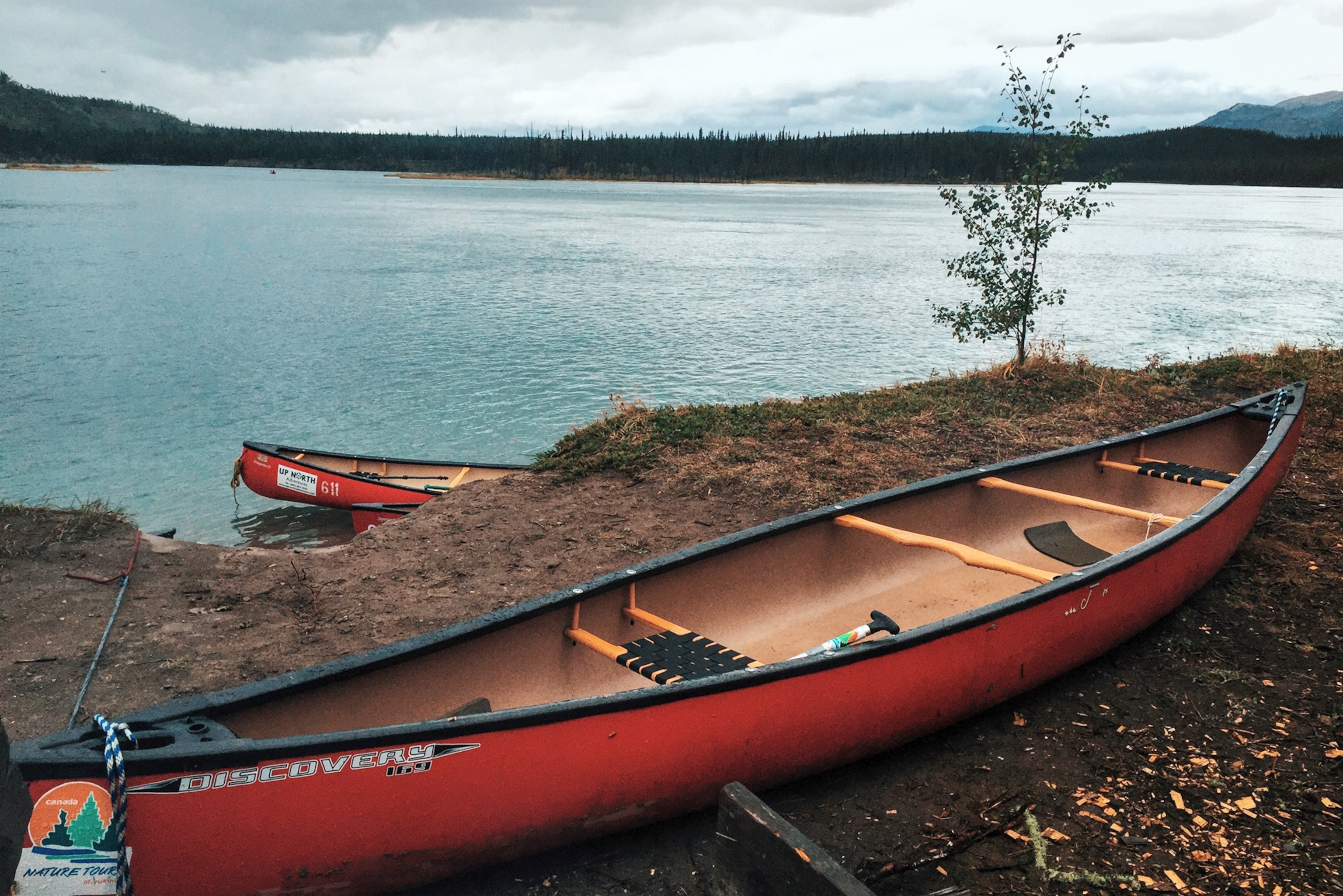
At least 80 minutes later (and about 10 miles into our 18-mile day), the river makes a wide turn to what marks our lunch spot. It’s 2:30 p.m. and I’m ravenous and sore. The wind and rain have returned, so I close my eyes and paddle hard. “Whitecaps!” Julien calls out. I see past the waves to a couple of canoes tied up on the muddy shoreline. We make it, tie up, then scramble up the five-foot bank on all fours.
Julien ties up a yellow tarp between pine trees for cover, as we shed our wet jackets and warm up. A young woman from the other canoe group appears. “Get yourself into some dry clothes and stand by the fire,” she says cheerfully.
For lunch, I have three bratwursts doused in ketchup and mustard, 22 grapes, a slice of lemon poppy seed cake, two cups of coffee, and one cup of tea. I don’t normally eat like this. And I like it.
As the other group sets off to finish their ride, a middle-aged woman, in miraculously spotless purple sneakers, compliments my “singsong accent,” which I didn’t realize I had.
“That only comes out when I’m wet,” I joke.
“We Irish know something about that,” she replies.
We watch them go as we finish our leisurely lunch. By the time we dump out the water from the bottom of the canoes and head out, the rain is gone and the sky’s turned a lighter shade. I see blue peeking out from the clouds.
“So this is what it’s supposed to be like?” asks Spencer.
The colors of the Yukon are rich. Early autumn gold leaves top poplar trees, and varying shades of green cling to slender pine trunks. Soon, an eagle appears. It makes a quick circle not far above us, then soars away. I take it as an endorsement, a welcome to the territory.
The Yukon (a Gwich’in word for “great river”) is a really great name. It joins a relative few that sport that distinguishing article like a triumphant curlicue moustache (another is the Bronx). But, I’m disappointed to learn, the official name for the territory is “Yukon” not “the Yukon.”

Locals rarely follow the paperwork, though. Mark Stenzig, born and bred in Whitehorse (and owner of Up North Adventures, who booked us this trip), tells me: “Yeah, I never got the memo on what we should call it. But we’re so damn good, we should be ‘the.’”
Our paddle’s big payoff lies just ahead, Miles Canyon, a narrow passage ribbed in lava columns that’s named for some American general who never made it here. (Many American-appointed names in fact line the Yukon.)
We briefly stop on shore just above the canyon, where a makeshift town called Canyon City once stood. We see the trace of a former wood-rail tramway used to transport goods around the canyon’s rapids. After the railway reached Whitehorse in 1900, Canyon City was quickly abandoned. The Whitehorse Dam, built in the 1950s, just north of here, turned the canyon’s merciless torrents into a scattered stretch of benign eddies and boils.
Supposedly benign.
Getting back into our canoes, Julien suggests we kneel on the pads on the canoe’s bottom, which help us stabilize it for the canyon ride. “Stick to the center of the river,” he calls out as we push off.
From there, the river takes over our work, tugging us forward in a quickening current. We’re at the start of Miles Canyon, but still can’t really see it yet. I’m a little nervous. We make a sharp right turn and it opens up before us. We glide fast past its ribbed, red walls and under a suspension pedestrian bridge. Only sparse paddling is needed now to keep us centered. I’m finding that kneeling in the canoe makes one feel more connected to the water. It’s so thrilling I find myself thinking of riding more of the Yukon River on one of Up North Adventure’s multiday trips.
Reaching the end of our trip—Lake Schwatka, I calculate that we’ve each made at least 8,600 paddle strokes. The canoeing has been hard, but the challenge of riding this powerful, dazzling river feels like a true introduction to the Yukon.
How To Do This Trip
You can do self-guided paddles from Whitehorse in a day, since it takes just 45 minutes to get out on the river from the city. Pack dry clothes and a hearty lunch. This Miles Canyon ride begins just north of Marsh Lake and ends at Lake Schwatka, taking six to eight hours.
The best two outfitters in town are Up North Adventures and Kanoe People. It’s about $80 per person (including transport) with a minimum of two people going. Guided trips are about $190 per person, including lunch.
The best guidebook is a self-published series of the river by Mike Rourke. His Yukon River: Marsh Lake to Carmacks edition, available at Whitehorse’s Mac’s Fireweed Books for around nine dollars, includes navigation maps and many historical details.
Both Up North Adventures and Kanoe People offer longer camping canoe trips; most last more than a week. You’d need at least a few days to reach historic Fort Selkirk, which was Julien’s favorite spot on the river, reachable only by boat.
If you want to ride all the way to Dawson City, the Yukon River Quest is held in late June.