Eight epic stops in the Four Corners region
Beat the crowds at this American icon and see amazing nature along the way.
Visiting Grand Canyon National Park’s quieter North Rim offers several advantages. With only a fraction of the park’s 6 million annual visitors come thinner crowds, plus temperatures that average 10 degrees cooler due to the North Rim being 1,000-feet higher than the South Rim (because of snowpack, the North Rim is only open from May to October). The journey to the Grand Canyon’s secluded “other side” allows for an epic road trip that is just as rewarding as the destination. Starting 500 miles away in Albuquerque, New Mexico, here are eight stops in the Four Corners region that North Rim travelers shouldn’t miss.

Chaco Culture National Historical Park
A destination in itself, New Mexico’s Chaco Culture National Historical Park is a UNESCO World Heritage property that protects the ruins of enormous “great houses” built around 1100 by the ancestors of today’s Southwest Pueblo tribes. The two-and-a-half-hour drive from Albuquerque to the remote park ends with 16 miles of dirt road driving, but the payoff is one of the darkest night skies in the United States and monumental archaeological sites still revered by Native Americans. Albuquerque’s new Hotel Chaco pays homage to Chaco Canyon and features Native American art throughout the property as well as day trips to the park. (See how Native Americans are recasting views of indigenous life.)
Four Corners Monument
Accessed from the intersection of US 64 and US 160 six miles north of Teec Nos Pos, Arizona, a circular plaque marks the only place in the United States where four states meet: New Mexico, Arizona, Utah, and Colorado. It’s a must-stop photo op operated by the Navajo Nation, and Native American vendors sell art and homemade food like fry bread.
Monument Valley Navajo Tribal Park
The iconic landscape of Monument Valley symbolizes the American West worldwide with its towering buttes and sweeping skies. Located on the Utah-Arizona border, a 17-mile loop drive takes visitors through the park, and guided tours are also available which allow access to more remote parts of the park. The 3.2-mile Wildcat Trail is open for unguided hiking. A $20 cash-only fee is charged to enter the park, and the on-site The View hotel has rooms living up to its name.
Kayenta Burger King and Navajo Code Talker Museum
Even if you’re not hungry for a Whopper, take a few minutes to stop at the Burger King in Kayenta, Arizona, to check out its impressive Navajo Code Talker exhibit. Code Talkers were Navajo who during World War II used their coded Diné Bizaad language to confound the Japanese. Classified until the Reagan Administration, the code was never broken and is credited with saving many allied lives. This Burger King serves as Kayenta’s de facto meeting place, and honors the Code Talkers with displays and artifacts brought back from the war by local residents that detail and honor their service.
Navajo National Monument
Navajo National Monument is often passed by on US 160, but it contains ancestral Puebloan ruins as impressive as anything seen at Mesa Verde National Park. Keet Seel and Betatakin are cliff dwellings that were constructed above the valley floor around 1300. Betatakin may be viewed from the paved, half-mile Sandal Trail that leads to an overlook. Bring binoculars and a telephoto lens. Free ranger-led tours of Betatakin leave from the Visitor Center mid-May through mid-September. Keet Seel may be visited with a free permit that’s granted to 20 people per day, on a first-come-first-served basis. The hike is 17 miles round-trip. The park is free to visit, with free seasonal tent and RV camping year-round. (See pictures of Route 50, the loneliest road in America.)

Upper and Lower Antelope Canyon
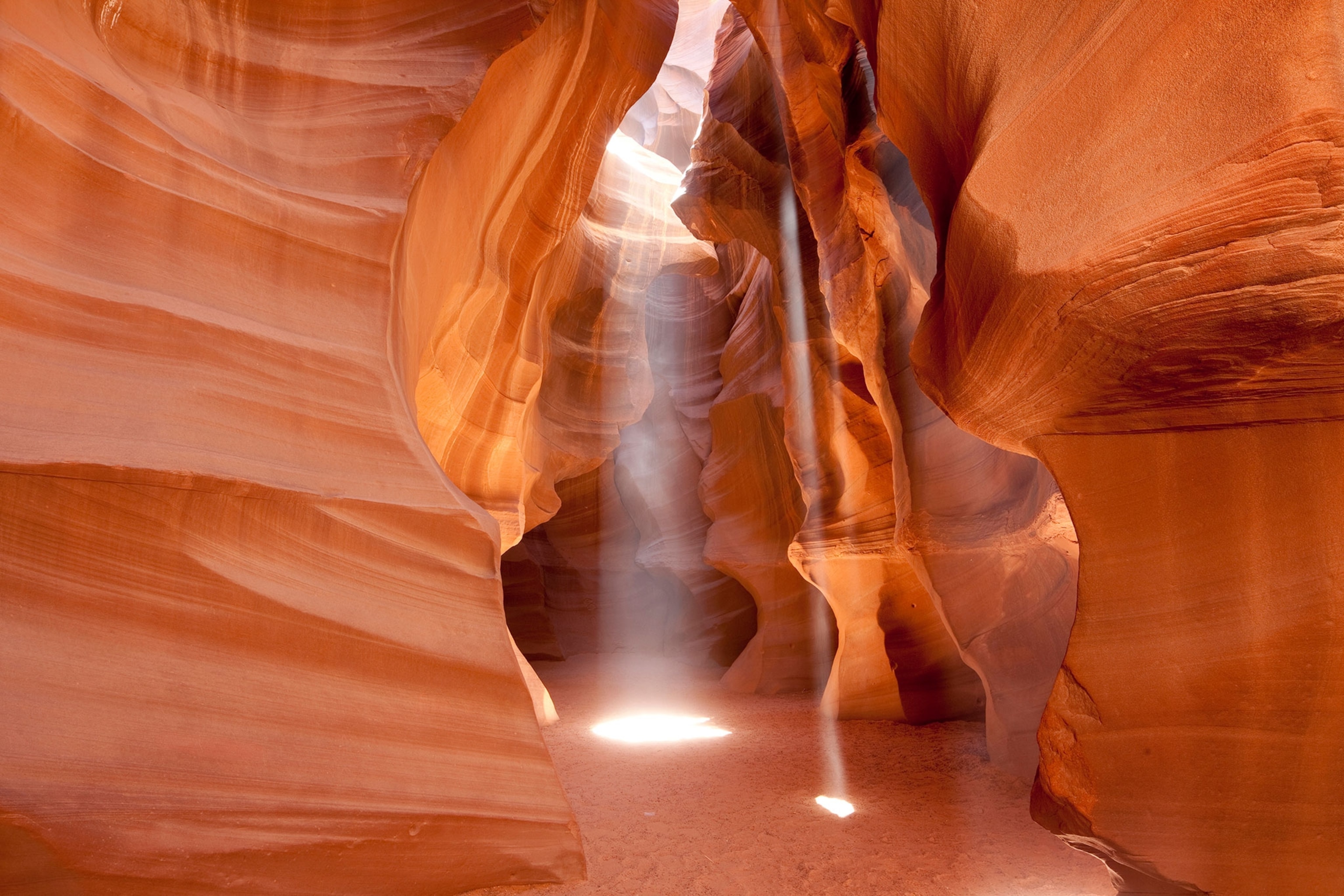
Hike through this sinuous slot canyon just 7.6 miles from Page, Arizona. Formed by eons of erosion, Upper and Lower Antelope canyons require a Navajo guide to visit, which can be booked online. Visitors load up into trucks in Page for the 15-minute drive to the canyon’s entrance. Standard tours typically last an hour and cost less than $40 per person; more expensive photography tours allow more time. Taking a weekday tour may help thin out the crowds, and try to book for the afternoon when the sun is high and shines directly down into the canyon for vivid images.
Horseshoe Bend
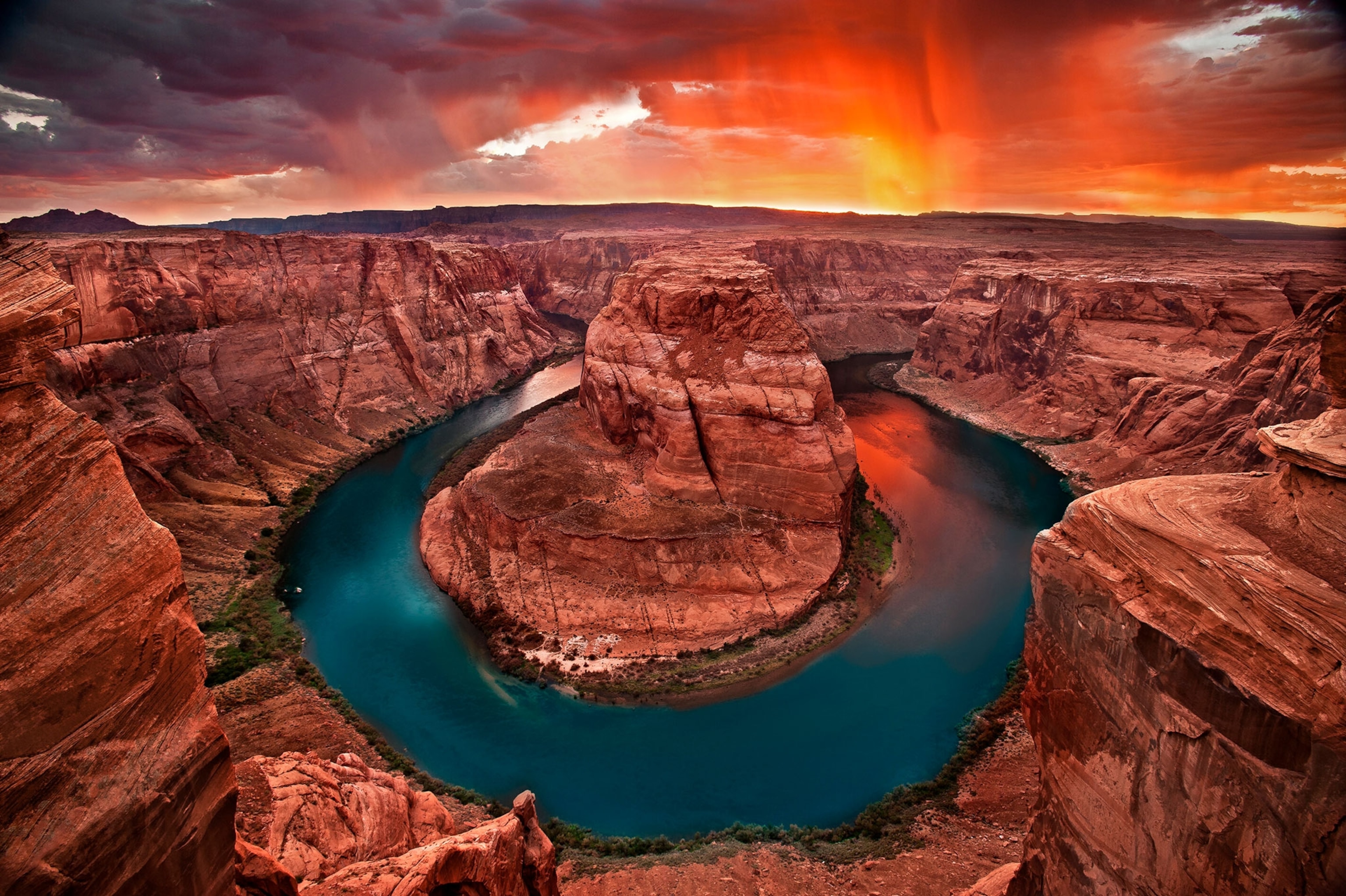
Free-to-visit Horseshoe Bend requires a 1.5-mile round-trip hike from the parking area just south of Page off of US 89. Here, the Colorado River makes a hairpin turn around a mesa in Marble Canyon (considered the beginning of the Grand Canyon) for a dramatic scene viewed from the opposite cliff ledge. Not for those with fear of heights: rafters can often be seen floating the Colorado River 1,000-feet below. Bring a wide-angle lens to capture the view.

Navajo Bridge
Navajo Bridge was the only vehicle structure spanning the Grand Canyon until it was replaced in 1995 by a new bridge immediately next to it. The old bridge was kept as a pedestrian bridge, and today visitors can walk across and take in the beginning of the Grand Canyon at Marble Canyon and the Colorado River 467 feet below. Often seen are Grand Canyon rafters who have started from Lee’s Ferry and endangered California condors with nine-foot-wide wing spans that call the area home. Park at the Navajo Bridge Interpretive Center on the west side of the bridge, open April through October. (Learn more activities to do in the Grand Canyon.)
At the North Rim
First built in 1928 and rebuilt after a fire in 1936, Grand Canyon Lodge offers basic amenities with priceless views. Grand Canyon Lodge was constructed in WPA-style with ponderosa pine logs and stone and situated right on the canyon’s edge at Bright Angel Point with open views. For campers and RVers, the National Park Service maintains a campground near the lodge with almost 90 tent, camper, group, and RV sites. The quiet North Rim has several scenic drives and hikes that accommodate a wide range of ages and abilities. Short hikes lead to big visual payoffs, such as the Bright Angel Point Trail that begins from the lodge and travels half a mile to a spectacular overlook. Along the way, keep an eye out for crinoid and other marine fossils.