Prairies to peaks: hiking gems in southern Alberta
Uncrowded hiking trails and prairie-to-peak scenic vistas await in the lesser known national and provincial parks of southwest Alberta.
Alberta is rightfully famous for its Canadian national park royalty: Banff, Canada’s first national park, and Jasper, the largest national park in the Canadian Rockies. But, for getting back to nature—no matter your age, interests, or abilities—the lesser known national and provincial parks of southwestern Alberta are well worth exploring.
“It’s nice to visit the iconic parks, but it’s cool to think you’re discovering a hidden gem that not as many people have explored yet,” says National Geographic Travel photographer Kahli April. Although she lives just southeast of Banff National Park in the mountain town of Canmore, April says she regularly explore the wilds of southwestern Alberta, the ecologically-diverse region where the prairies roll into the Rockies.
Adds April, “To me, finding something new and experiencing something unexpected is what being in nature all about. There are so many good hikes in southern Alberta that people miss out on because they’re not thinking outside the box.”
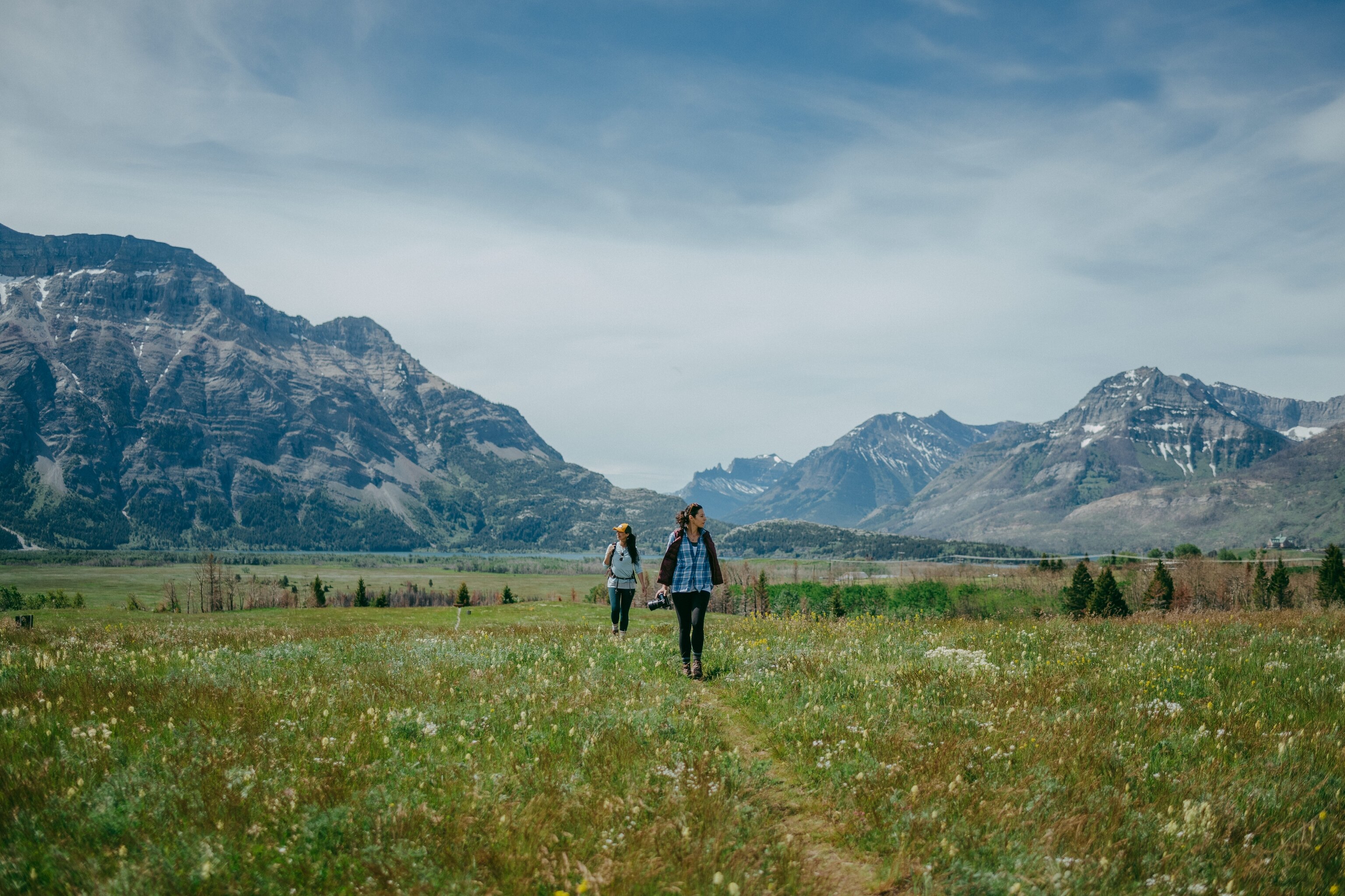
Hikers who seek out trails away from the well-trodden Banff and Jasper tourist paths are treated to serene nature experiences in uncrowded places, such as Beauvais Lake Provincial Park, Waterton Lakes National Park, and Castle Provincial Park. Waterton Lakes is doubly noteworthy because it’s part of Waterton-Glacier International Peace Park, a UNESCO World Heritage Site uniting Waterton with neighboring Glacier National Park in the U.S. state of Montana.
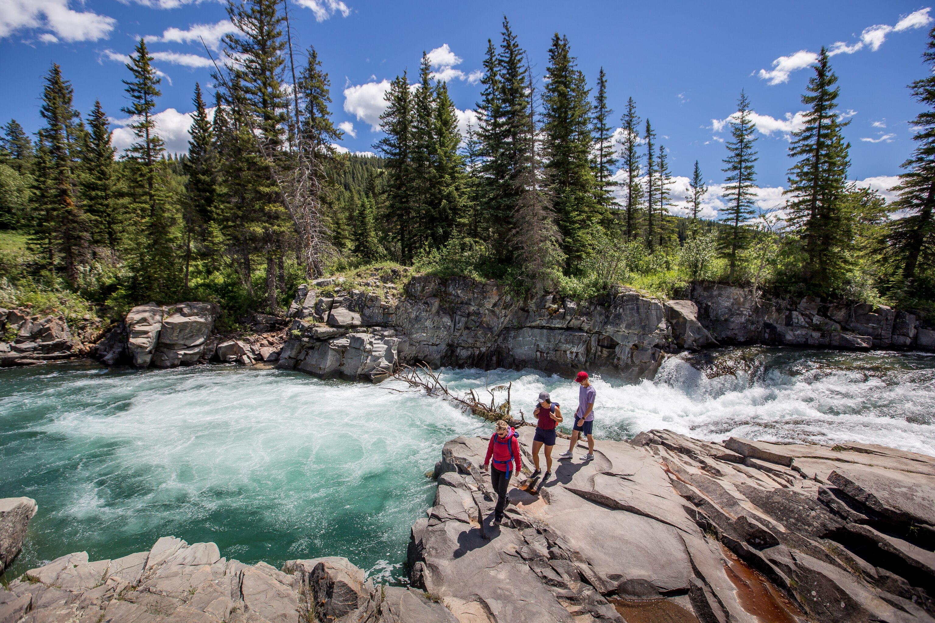
Along with solitude, these parks offer a something-for-everyone selection of hiking trails. At Beauvais Lake Provincial Park, for instance, the South Shore Trail is a level, out-and-back route―3.7 miles (6 km) total―that’s ideal for families and for bird-watchers. The trail offers views of the lake and the surrounding wetlands, breeding habitat for an array of avian life including the common loon, sandhill crane, osprey, and trumpeter swan. Hikers with binoculars can spot some of the more than 180 bird species that have been observed in the park.
Beauvais Lake, located about 12 miles (20 km) southwest of the small town of Pincher Creek, is also home to bigger wild things, such as black and grizzly bear, elk, moose, and mule deer. Look for wildlife (from a safe distance) and see wildflowers, early settlers’ homestead sites, and summit views on the park’s Mount Baldy to Mount Albert Loop trail. The backcountry trek begins on the partially rolling Homestead Loop, and includes two steep climbs to summits: the Mounty Baldy Viewpoint, elevation 1,585 meters (5,200 feet), and the blustery Mount Albert Viewpoint, elevation 1,620 meters (5,315 feet).
To dial up the thrill level even higher, head to Waterton Lakes National Park (a scenic drive less than three hours from Calgary via AB-2 S) and the Crypt Lake Trail. Tackling the 10.5-mile (17-km) Crypt Lake route, considered one of the best trails in Canada, is a six-to-eight-hour (round trip) adventure that begins with a boat ride to the trailhead. From there the trail winds through a succession of natural wonders—including a dense forest, four waterfalls, and a low-ceiling rock tunnel—on its way to the shores of Caribbean-blue Crypt Lake.
For a shorter Waterton Lakes waterfall walk (or snowshoe trip in winter) try the 3-mile (5.2-km) hike to Lower Bertha Falls. Leashed dogs are permitted on the moderately difficult trail, which begins in Waterton Village, the charming in-park town site located on the western shores of Upper Waterton Lake.
With 120 miles (200 km) of hiking trails, Waterton Lakes National Park is one of April’s favorite southwestern Alberta destinations for year-round adventure. But, she says, many of the region’s provincial parks also hold a special place in her heart due to the diversity of landscapes and the breathtaking views.
April recently returned to one of her favorites, Castle Provincial Park near Pincher Creek, to hike Table Mountain’s classic southwestern route.
While a top-of-the-world photo is the big draw for many hikers, the “fun part,” according to April, is the 6 miles (10 km) out-and-back trail. She encourages anyone who does the hike to savor all the scenery―not just the view from the top)―as the route weaves through a variety of different environments on its way up to Table Mountain.
“Even if you don’t want to climb all the way to the summit, there’s still a lot to see on the first half of the hike,” she explains. “You start out in a magical aspen forest where you’re completely surrounded by the canopy. It’s shaded and cool and so lush that you can’t even see the peak. At this stage, you’ve almost forgotten that you’re there to hike to the summit.”
Eventually, the trail leads into an open meadow, and Table Mountain comes into clear view. The meadow viewpoint is a good turnaround point for beginner hikers, says April, since the route quickly gets rockier and steeper from here. The more challenging second half of the trail parallels a rocky creek bed (that turns into a waterfall) before ending with a steep scramble to the 360-degree prairie-meets-mountain vista on the top.
“It gets a little eerie before you pop up on the summit because there are weather-battered dead trees scattered all over the place that almost look like skeletons,” says April, who recommends that hikers wear sturdy hiking shoes with ankle support to safely navigate the uneven, rocky terrain and carry extra layers of clothing due to the temperature drop on the consistently windy summit.
“When you finally make it to the top,” she adds, “you can walk for a few kilometers along this very flat, table-like plateau, look back over the prairie, and get this really amazing view from the true summit (which is beyond a lower cliff that’s featured in most photos). The whole experience is pretty cool.”
The best time to climb Table Mountain is July to mid-September; however, there are off-the-beaten-path trails to explore every month of the year in southwestern Alberta’s national and provincial parks. Discover more hiking hidden gems in the province’s lesser known parks with Travel Alberta.
