Tai Mo Shan: Adventure Sports and Family Friendly Hikes
Chart a course for adrenaline-pumping trail run or a leisurely nature walk on a two-for-one adventure with Hong Kong endurance athlete Wyan Chow Pui-yan.
Wyan Chow Pui-yan was born and raised in Hong Kong, yet she admits she rarely hiked her hometown’s extensive network of trails as a child. “I didn’t really exercise when I was young, and I wasn’t athletic,” says Wyan, who discovered the health benefits of exercise as an adult. “After I started working, I decided to make a change in my lifestyle and chose running.”
What began as a way to improve her health quickly became passion for Wyan, who regularly competed in a variety of endurance events, such as marathons and off-road triathlons both in Hong Kong and around the world. She also motivates others to exercise through community outreach programs and as a personal trainer. One of her greatest joys, she adds, comes from helping low-sighted athletes achieve goals, such as running marathons and climbing to the Mount Everest Base Camp.

Although she is well known throughout Southeast Asia for her athletic accomplishments, it seems fitting that the Hong Kong native achieved one of her most-memorable first-place finishes on iconic Tai Mo Shan, Hong Kong’s highest peak at 3,140 feet. The majestic New Territories’ mountain hosts a portion of the grueling Hong Kong 100 Ultra Trail Race, or HK 100, which Wyan won in 2014 in, what was then, world-record time. Today, she regularly trains on the same steep, rugged Tai Mo Shan section of the HK 100 course. While running up the mountain is an ideal training regimen for a world-class adventure athlete like Wyan, she is quick to point out that what makes the Tai Mo Shan one of her favorites is that it is easily accessible to people of all fitness levels and that it delivers awe-inspiring nature and city vistas.
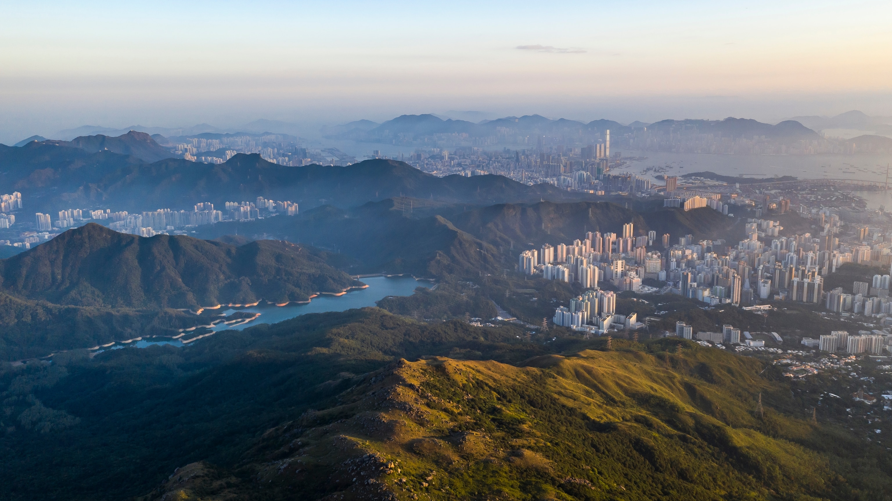
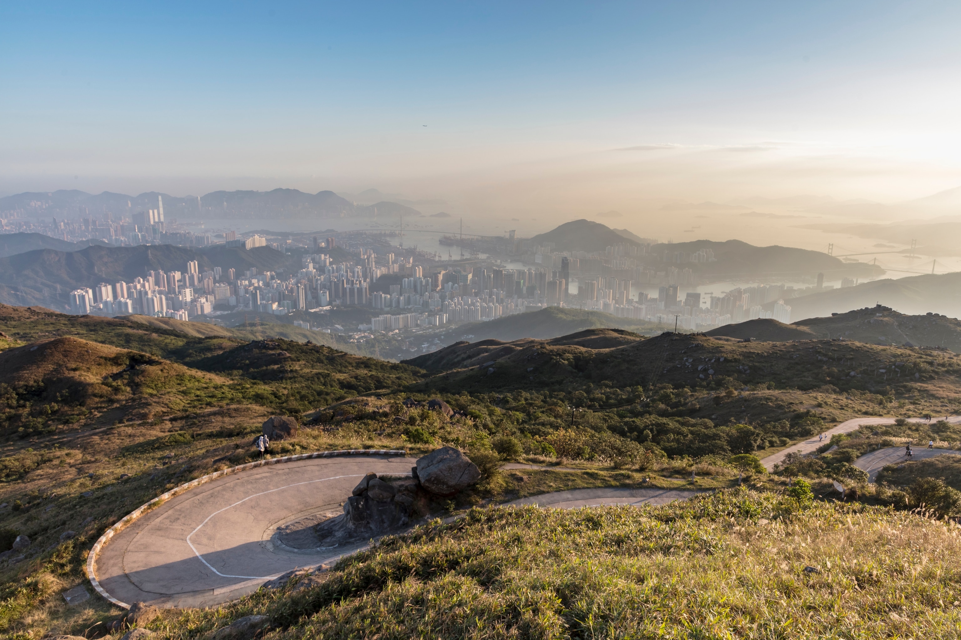
“This high up, you can see Hong Kong in its entirety,” Wyan says. “On a good day, you can get 360-degree views of the surrounding areas: Hong Kong island, Kowloon, the New Territories, and even Shenzhen and mainland China. Tai Mo Shan also is easy to get to, and you can drive up to an elevation of 2,296 feet. Or, if you want to walk, you can start walking from sea level.”

Recently, National Geographic invited Wyan to embark on a two-for-one adventure on Tai Mo Shan. The mountain offers two distinct experiences: challenging trail-running on sections of the HK 100 course and leisurely hikes and nature walks. At the top, visitors also can stand in a single spot and soak up two completely different panoramas: the glittering Hong Kong skyline and resplendent greenscapes. Through her expert insights (and photographs taken by acclaimed Hong Kong fine art photographer Tugo Cheng), Wyan shares what makes Tai Mo Shan a must-visit destination for exploring the wild side of Hong Kong.
Chart Your Own Course
The main hiking trail to the summit of Tai Mo Shan is a level and paved road beginning at the Tai Mo Shan Country Park Visitor Center. Before starting any hike or run, stop at the small kiosk near the visitor center to see (and snap a selfie with) the effervescent “godmother of Tai Mo Shan,” Kong For Lin, known to locals and visitors alike as Sister Lin.

“We always get a photo with Sister Lin,” says Wyan. “She is an icon who has been working at this water and snack kiosk for over 20 years. Every day—rain or shine—she is here. If you train on Tai Mo Shan without Sister Lin and her kiosk, it will be a lot more difficult.”
From Sister Lin’s stand, it’s a little more than three and a half miles to the top. While you could make the climb in about two hours (one way), Wyan recommends custom-tailoring your Tai Mo Shan experience to fit your interests and fitness level. Whether you are an adventure-seeker, a photographer pursuing the perfect Hong Kong sunset shot, or someone searching for a peaceful place to take a nature walk, there are Tai Mo Shan trails waiting for you.

Says Wyan, “Tai Mo Shan is only 3,140-feet-high, so the weather conditions at the top aren’t as extreme as on mountains abroad, which commonly can be 6,500 to 19,500 feet. Even though the mountain isn’t that high, you can find different routes to go up and down, which is great for training. I’ve discovered five other trails for running up the mountain apart from the well-known Maclehose Trail, which was part of the HK 100 course. There’s also a Family Walk route that is family-friendly.”
For mountain bikers, the paved road up to the summit provides a challenging workout, and Tai Mo Shan Shan also offers off-road mountain biking trails. Adds Wyan, “There are also waterfalls and different hiking routes coming up from various districts in the city, which makes it convenient to get there from anywhere. Of course, the view from the top is spectacular; completely different from any other scenic vista in Hong Kong.”
About two-and-a-quarter miles up the paved road is the first scenic overview—Tai Mo Shan Lookout. From this vantage point, hikers and runners are treated to unobstructed views of China in the distance and, closer up, rocky ridges, smaller mountains, and the lush green plains, wetlands, and cityscapes of two western New Territories residential areas: Kam Tin and Yuen Long. The latter is where Wyan lives, and while it’s about nine miles away from Tai Mo Shan, she frequently runs from her home to the mountain.
Reaching the Summit
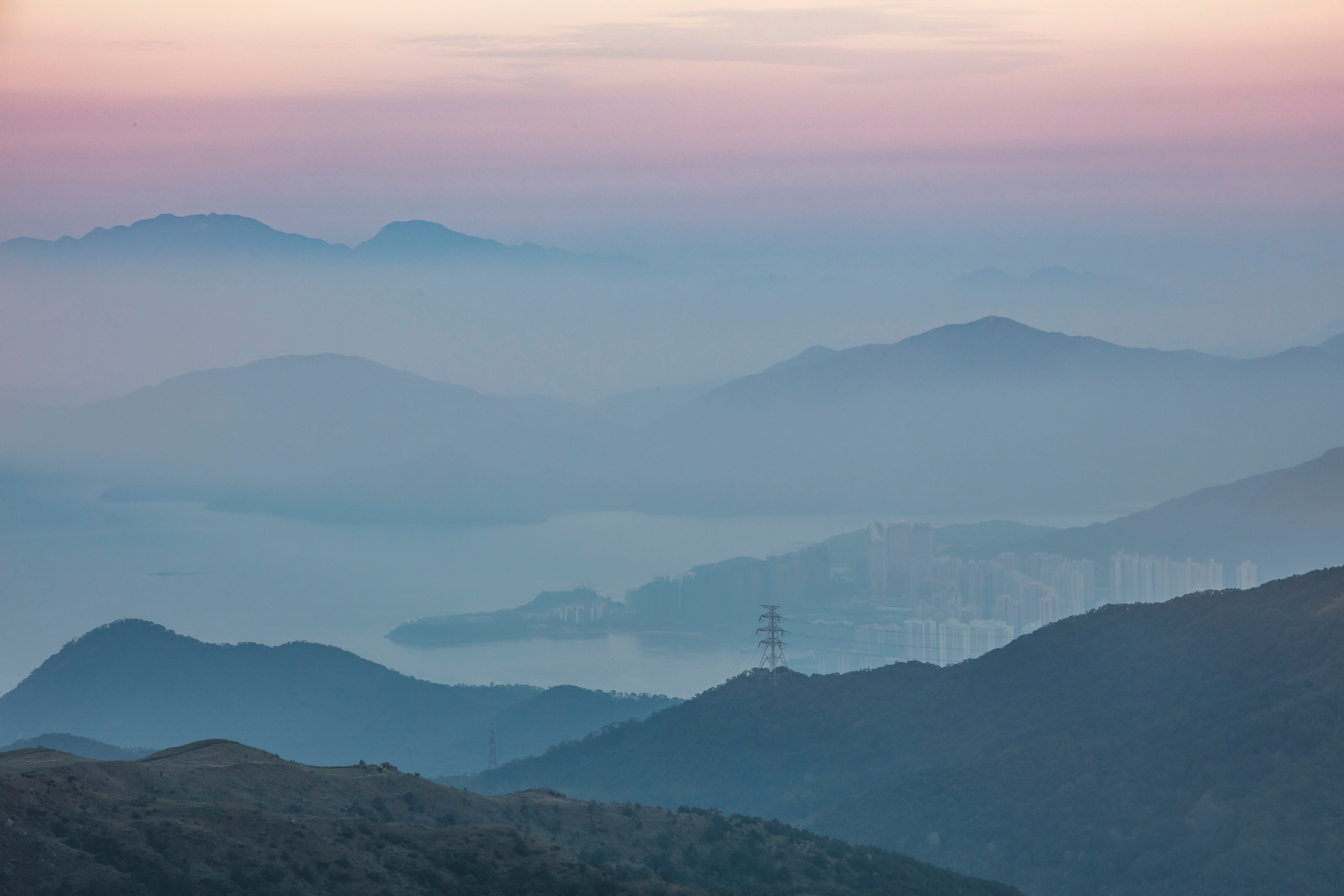
Epic views of the city—commonly shrouded in a magical sea of clouds and fog—aren’t the only reward awaiting those who hike, bike, walk, or run to the top of Tai Mo Shan. Endurance athletes and other visitors who make their way up to close to the summit (the actual highest point houses the Hong Kong Observatory), says Wyan, can snap a selfie in front of the observatory’s Instagram-famous weather radar: a white globe resembling a giant soccer ball on a stick.
“The circular radar is a feature of Tai Mo Shan,” adds Wyan. “Whether we are training or biking, it is a landmark backdrop for photos. We always take a picture to show that we were there.”

Spend time at the top taking in the jaw-dropping panorama: China and Macau in the distance, glistening glass skyscrapers poking up through the clouds, and lush green mountains and valleys, and sparkling water as far as the eye can see. While the views are accessible to people of all fitness levels, Wyan encourages endurance athletes to compete in the race that forever links her to Tai Mo Shan: the HK100.
“The HK 100 feels more like a cross-country party where you can have fun and see friends, and the trail is special,” she says. “The first two parts are in Sai Kung through the Hong Kong UNESCO Global Geopark and beach, up and down the mountain, and then through to Ma On Shan, which from afar looks like an actual saddle. We also run under the iconic Lion’s Rock, and go through Kam Shan Country Park where lots of monkeys live and are known to snatch your food away. Finally, you have to get to Tai Mo Shan. The final stretch up to the weather ball is a very steep road, and the entire route is filled with fun and different paths. You will not get bored, which is what makes Hong Kong so different from other places.”

Know Before You Go
Best For: Trail runners, endurance athletes, mountain bikers, family and leisure hikers, sunset watchers, and photographers
Where to Eat: Have dim sum (try the sesame rolls and locally grown watercress) at Choi Lung, a no-frills, self-serve restaurant in the village of Chuen Lung. Stop at Sister Lin’s kiosk for marinated tea eggs.
Hiking Tips: Follow posted signs. Do not trespass on the summit area near the Hong Kong Observatory Weather Radar Station. For the latest updates on the hiking condition, visit the website of Agriculture, Fisheries and Conservation Department.
Photography Tips: To photograph the city lights from the Tai Mo Shan Lookout, bring a tripod and take a long-exposure shot.
Read more about The Great Outdoors of Hong Kong or for more information visit Your Guide to Hiking & Cycling in Hong Kong.