Hong Kong: Land and Sea
Discover how the forces of nature – volcanic eruptions, water, and wind – shape Hong Kong on a land-and-sea adventure with National Geographic Photographer Matthieu Paley
Hong Kong will always hold a special place in the heart of award-winning National Geographic photographer Matthieu Paley. His oldest son was born on Hong Kong Island, where, from 2002 to 2010, Paley and his family made their home in the beachside village of Shek O. There they regularly hiked nearby Dragon’s Back, an undulating ridge trail overlooking coastal villages and Big Wave Bay.
“I initially went to Hong Kong in 2001 expecting this big city, which it was, but I was amazed that you could live in a small village and still be near the city,” says Paley, a French-born photographer currently based in Turkey. “My wife [Mareile] and I fell in love with Shek O because it offered access to the outdoors. We thought we’d be there for a few months and ended up staying about nine years.”
Recently, National Geographic launched Paley on a Hong Kong adventure showcasing four areas where land meets water: Sai Kung Volcanic Rock Region in the Hong Kong UNESCO Global Geopark, Shing Mun Reservoir, Hong Kong Wetland Park, and Dragon’s Back. Discover why Paley believes all four places are must-visit destinations for people craving a two-perspective adventure on the wild side of Hong Kong.
Hong Kong UNESCO Global Park, Sai Kung Volcanic Rock Region
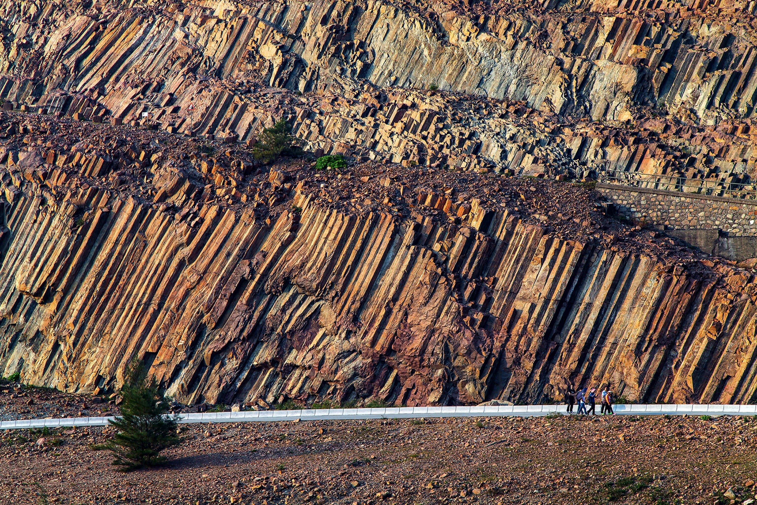
Otherworldly rock formations emerge from aquamarine waters in the Sai Kung Volcanic Rock Region. Formed 140 million years ago by violent supervolcano eruptions, the surreal landscape-seascape and its neighboring Northeast New Territories Sedimentary Rock Region comprise the internationally acclaimed Hong Kong UNESCO Global Geopark.
Since the entire Geopark covers some 19 square miles of land and water, a good first stop is the Volcanic Discovery Center in Sai Kung Waterfront Park. Here you can see an exhibit detailing how Sai Kung’s unique hexagonal volcanic rock columns were shaped and learn about the region’s other amazing geosites (such as sea caves, sea arches, and eerie, twisted formations).
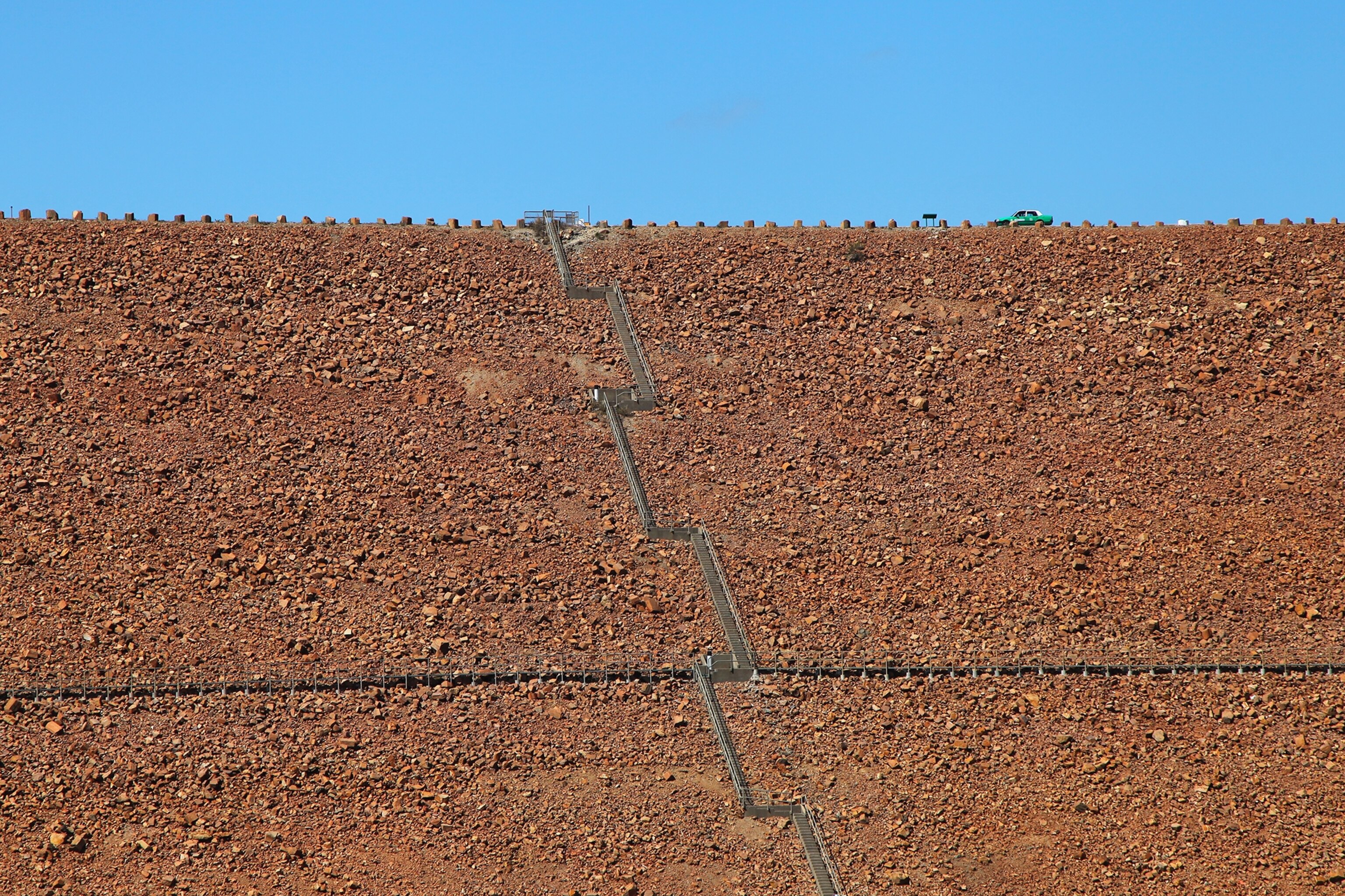
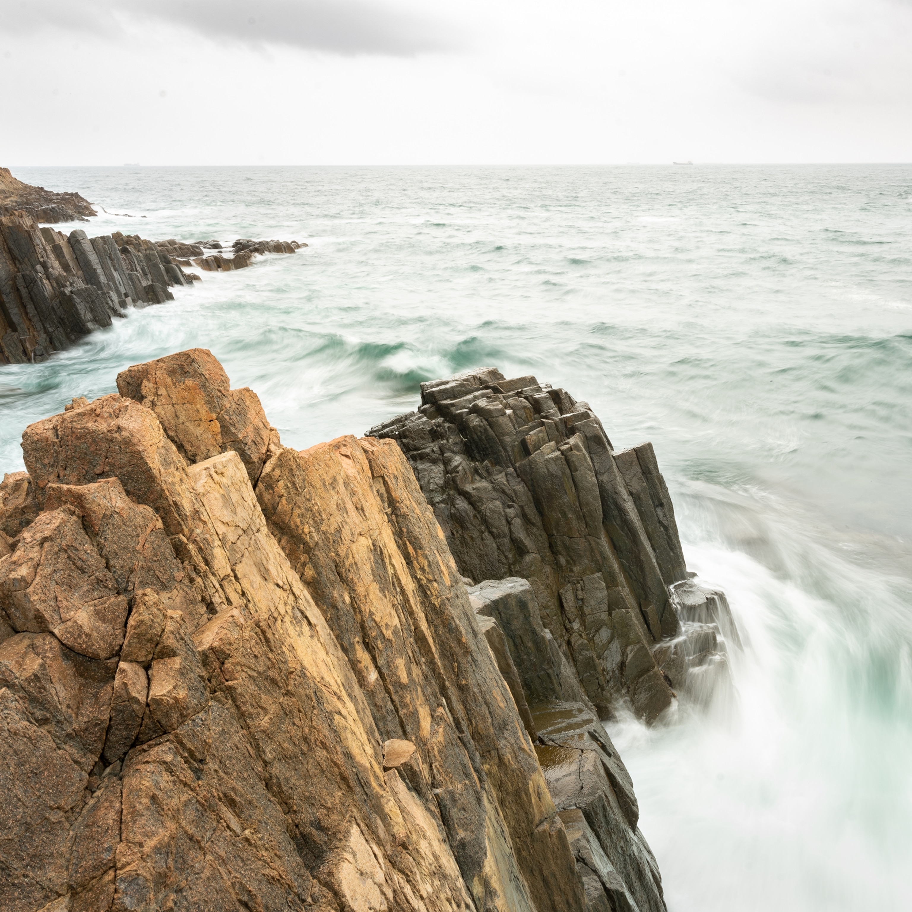
Paley says High Island is an ideal place to observe and photograph nature’s handiwork, particularly the hexagonal columns. Resembling gigantic bamboo canes, the impressive rock formations can tower over 200-feet high. For sweeping views of the columns, cliffs, and offshore rock formations, hike the southeastern end of the island from the High Island Reservoir East Dam to the coastal cliffs at Fa Shan.
“When you trek to the end of the [Fa Shan] headland you can see ‘Broken Island’ [the Po Pin Chau sea stack],” Paley explains. “Looking at the island, all I can think about is how one day in history this humongous slab of land fell in the water, and now, it has been shaped into these crazy rock columns. First it fell, and then, the ocean did its work over time, separating it from the mainland. Seeing that helps you understand how the millennia has worked at shaping Hong Kong.”
Adventure-seekers can scale Po Pin Chau, rappel down the island’s rocky face, and explore nearby sea caves. For photography buffs, Paley suggests bringing a tripod and taking long-exposure shots to capture the continuous movement of the ocean juxtaposed with the immovable rocks.
Shing Mun Reservoir
West of Sai Kung in the Central New Territories, land meets water in Shing Mun Country Park. Follow the paved Shing Mun Reservoir path around the park’s centerpiece, Shing Mun Reservoir, for a leisurely nature walk. The roughly four-mile route is particularly scenic when the water level in the reservoir is high, submerging the roots of the park’s signature paperbark (Melaleuca quinquenervia) trees.
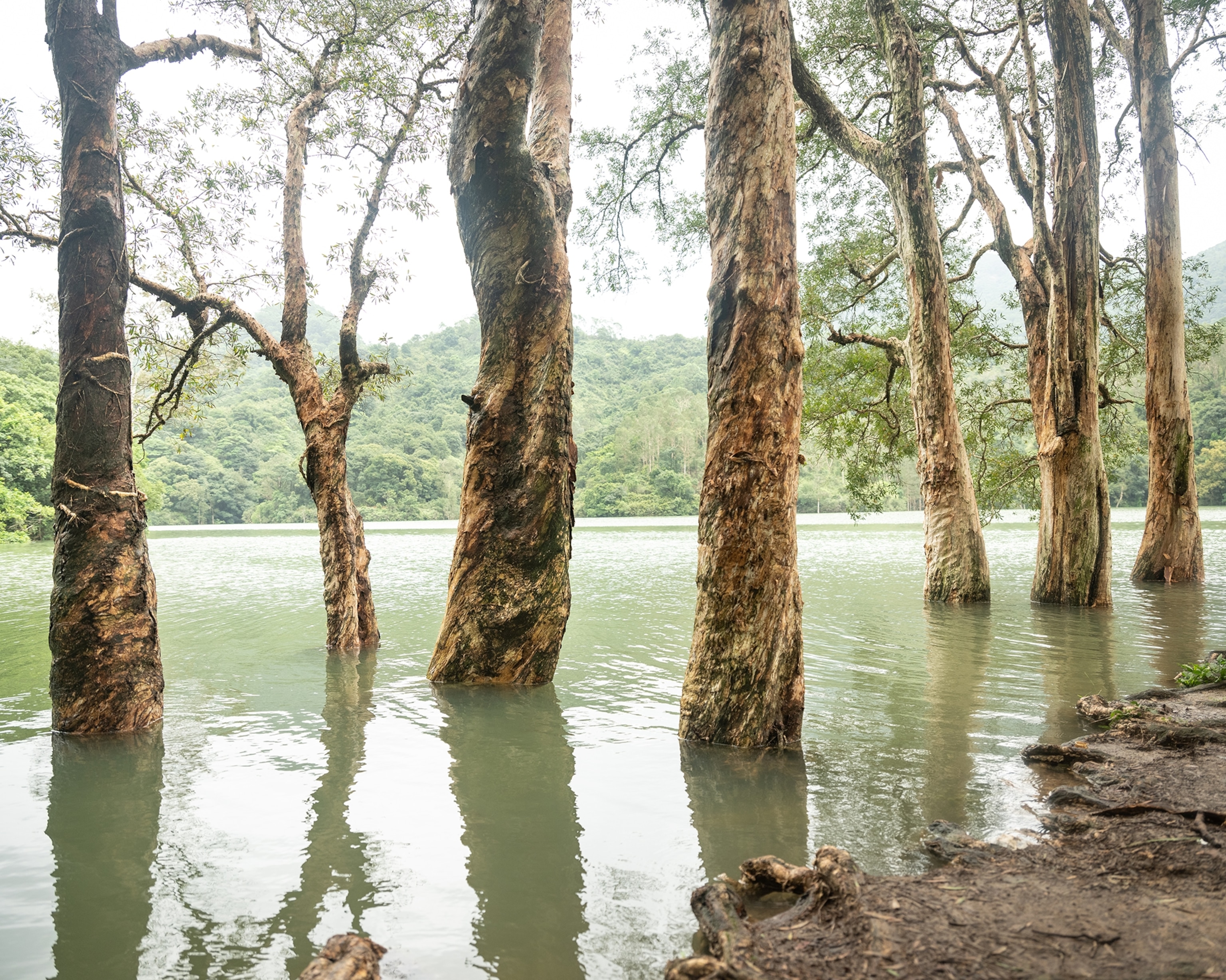
Paley suggests following up a day in the Sai Kung Volcanic Rock Region with a hike around the Shing Mun Reservoir to observe the differences between Hong Kong’s ocean and woodland environments.
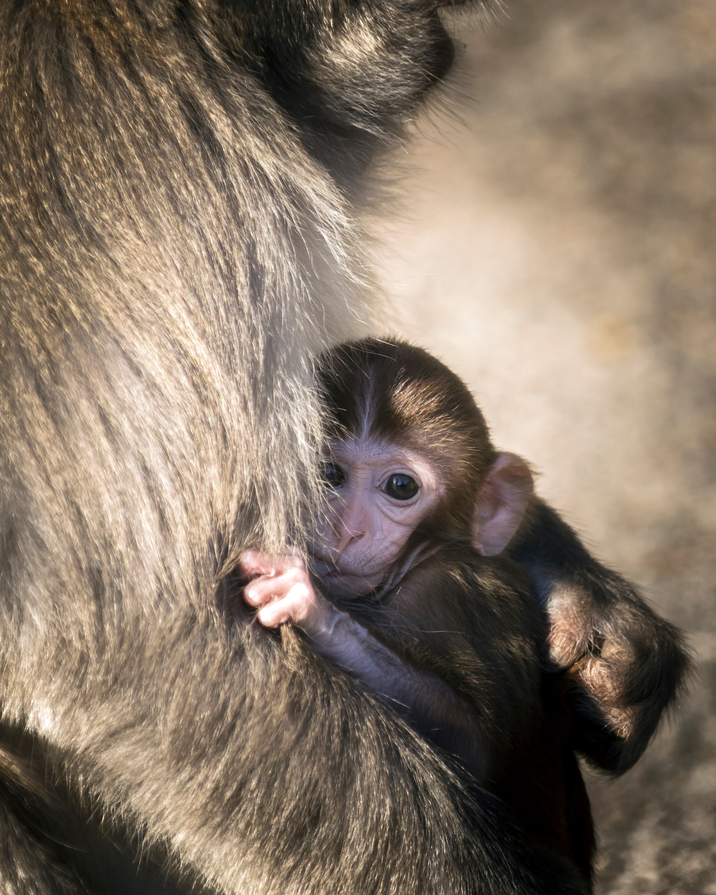
He explains, “The vegetation near the ocean is low bushes, while [at the reservoir] you have more of a high-tree forest environment. There are cool vines and lots of monkeys, which was quite a pleasant surprise to me. The paperbark trees with their big feet in the water creates a surreal scene, which is good for photos. At Sai Kung, you have volcanic rock projecting out of the water and you have the trees. It's a totally different environment, and yet, there are similarities, and, both are right in Hong Kong.”
Hong Kong Wetland Park
A different view of Hong Kong’s wet-and-wild side awaits in Hong Kong Wetland Park, a world-class eco-tourism destination easily accessible via public transportation. Located in Tin Shui Wai in the New Territories, the park showcases Hong Kong’s rich biodiversity. Walk the series of floating and elevated boardwalks and nature trails for up-close views of mangroves, mudflats, gardens, ponds, seasonal pools, and streams teeming with wild things, such migratory and native birds, butterflies, and the amphibious mudskipper—an actual “fish out of water” that can survive and walk on land.
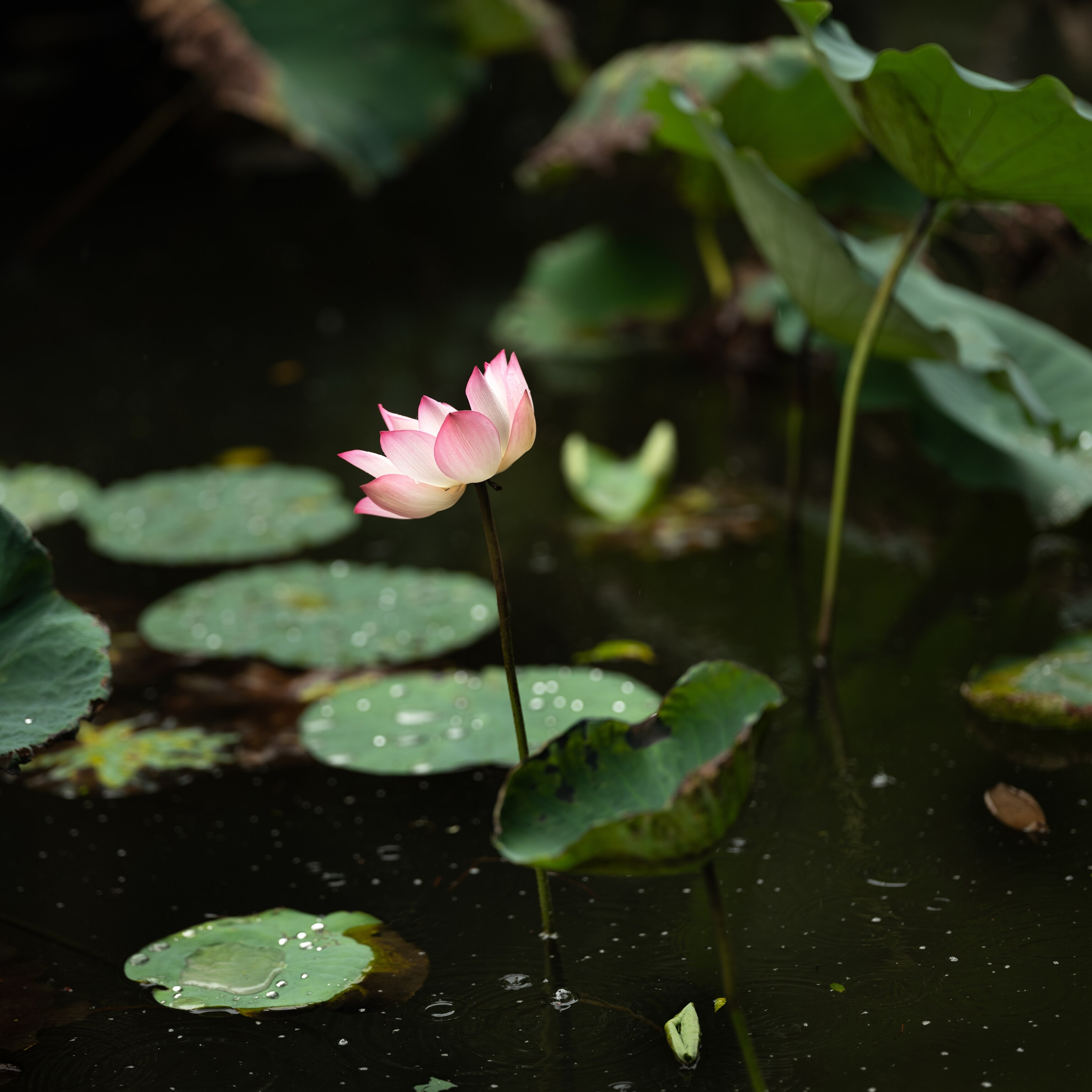
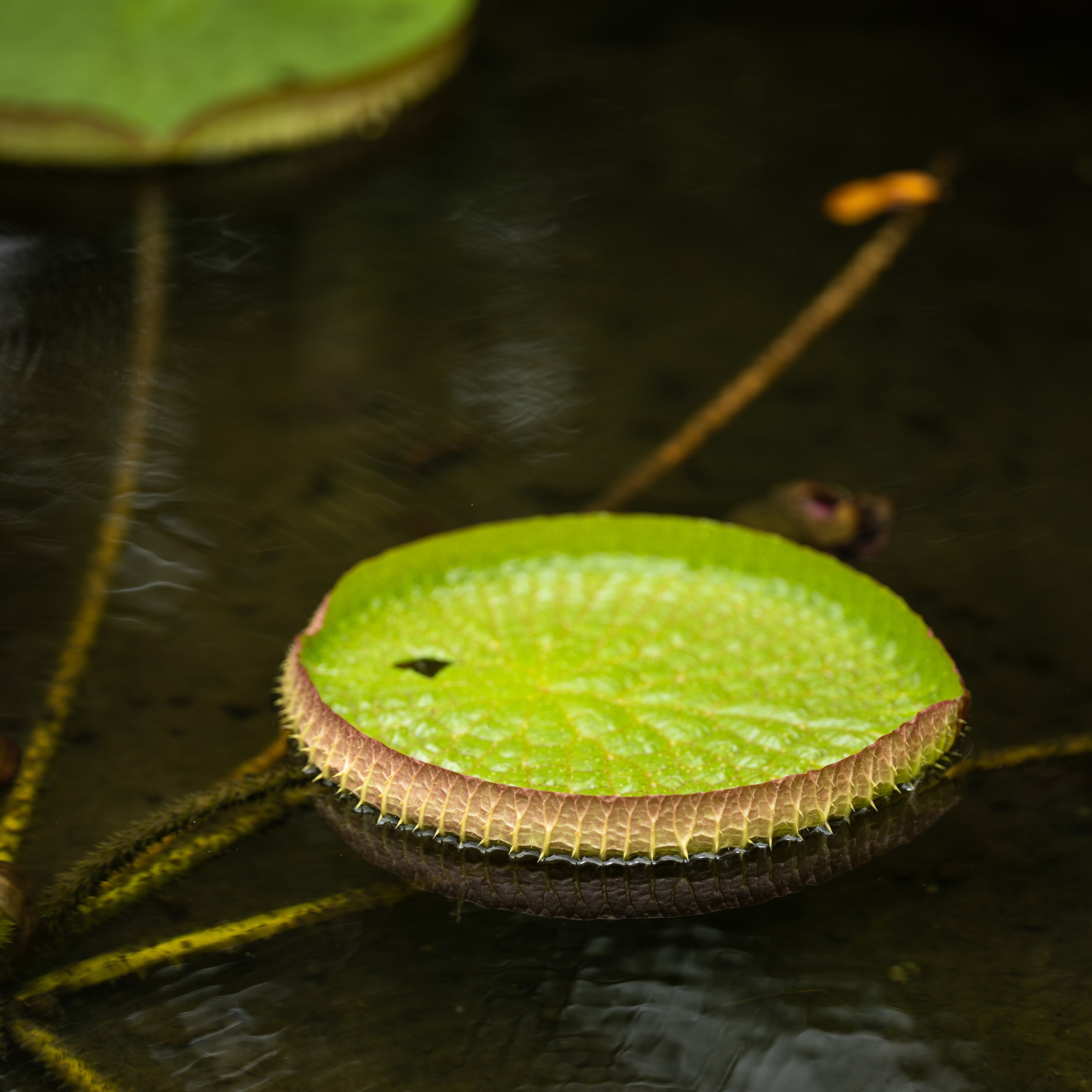
Considered a bit of a best-kept secret, the park protects nearly 150 acres of wetlands within an urban setting. The proximity to the city makes the serene natural area especially appealing, says Paley.
If you’re into wildlife photography, you need a long lens and patience,” he adds. “There are several bird-view observation points. Another image to capture are the ponds filled with pink lotus flowers.”
Dragon’s Back
For Paley, hiking Dragon’s Back—the rocky spine of Hong Kong’s D’Aguilar Peninsula—was a bit of a homecoming.
“We would go hiking there quite a bit when my oldest son was just beginning to walk,” he recalls. “There are incredible views above Shek O village, the south part of Hong Kong Island, and the South China Sea, yet it is still an easy enough trail to carry a child on your back—which we did at the time—or to take a family hike.”
Like most Hong Kong trails, Dragon’s Back is easily accessible via public transportation. Take the No. 9 bus from central downtown and 30-to-40 minutes later, says Paley, you’re in “a full jungle setting.” From the bus stop, start hiking. Follow a mix of stone-step and packed dirt trails all the way (about 5.2 miles) to Big Wave Bay Beach (Tai Long Wan).
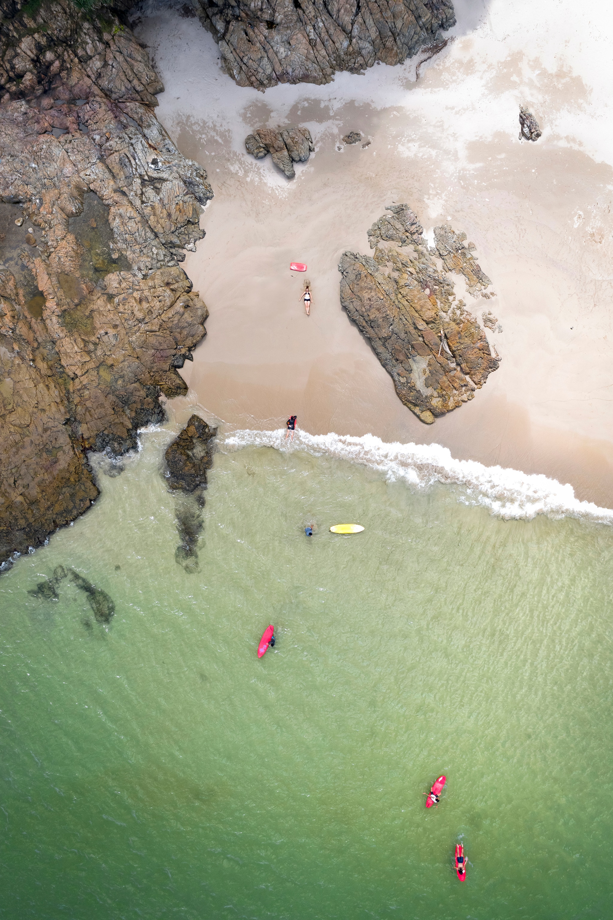
Adds Paley, “When the weather is good you can see people paragliding up from the Dragon’s Back. Most people don’t expect that from Hong Kong. They don’t realize how easy it is to be in the city and a half-hour later be walking on a ridge where you can see carpet of jungle sweeping down to a village on the sea, paragliders floating in the air, and surfers riding the waves below. That’s Hong Kong.”
Best For: Geology buffs, landscape and wildlife photographers, earth and marine science enthusiasts, nature lovers
Where to Eat: Stop at Sai Kung Bakery and Café in Sai Kung for a fresh-baked egg tart or pineapple bun snack to take on your Sai Kung Volcanic Rock Region adventure. At Sai Kung waterfront restaurants, such as Chuen Kee, choose your seafood from the spilling tanks. In the Sai Kung market, buy fresh fish and bring it to Michelin-starred Loaf On for the chef to prepare.
Hiking Tours: The Geopark Hiking Tour takes you through magnificent hexagonal columnar joints, a natural tombolo at Sharp Island, and an inland water dam wall at High Island Reservoir. The Geopark Boat Tour is a guided voyage through the Sai Kung region’s rich geodiversity, such as extraordinary sea stacks, breathtaking tubular rock columns and sea caves, and coastal terrain.
Hiking Tips: Leave no trace by carrying out any trash (such as plastic water bottles) and food waste. On sunny days, wear a wide-brimmed hat, sunglasses, and clothing made from breathable materials. For the latest updates on the hiking condition, visit the website of Agriculture, Fisheries and Conservation Department.
Photography Tips: Invest in a waterproof digital camera or waterproof smart-phone case to guard against the elements (such as ocean spray, rain, and water features) commonly encountered when capturing images at Sai Kung Volcanic Rock Region.
Read more about The Great Outdoors of Hong Kong or for more information visit Your Guide to Hiking & Cycling in Hong Kong.