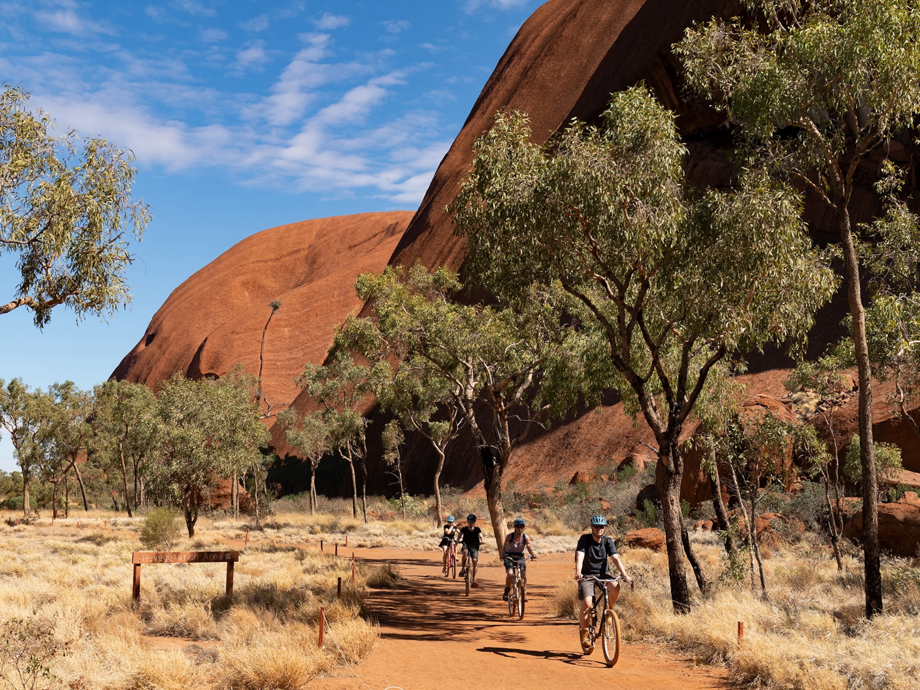
National Parks Road Trip: East Coast
Shenandoah > Great Smoky Mountains > Mammoth Cave
Gateway Airport: Ronald Reagan Washington National Airport, Arlington, Virginia
Any traveler linking fertile river valleys to misty mountains and then plunging into the subterranean depths of the world’s longest known cave system could be forgiven for experiencing a state of culture shock. But these three national parks—Shenandoah, Great Smoky Mountains, and Mammoth Cave—are all within range of a weeklong road trip, so long as you bring a sense of adventure and a picnic basket for enjoying the many scenic overlooks along the way.
Shenandoah National Park
With its plentiful waterfalls, rolling hills, and fertile valleys, the aptly named Skyline Drive traversing Shenandoah National Park offers up more than 70 overlooks facing east over the Piedmont and west over the Shenandoah Valley. Fill up your tank before entering its more than 200,000 acres of protected land; there’s only one gas station in the park, but it’s otherwise full-to-bursting with hikes, wildlife, vistas, and interesting geological formations.
The Route: Washington, D.C. > George Washington Memorial Parkway > I-66W > Rte. 340S > Skyline Drive (179 miles)
On the Way: Getting free of D.C. traffic is a battle in its own right; celebrate victory along I-66 by stopping at Manassas National Battlefield Park, where the Union and Confederate armies fought two major battles during the Civil War. Birds now roost where cannons once flew, and the former battlefield is now listed as a stop on the Virginia Birding and Wildlife Trail.
Stay: There are four campgrounds and free backcountry camping permits are available for those who prefer to rough it, but most overnight visitors to Shenandoah end up at Skyland Resort. With accommodations ranging from rustic cabins to more luxurious en suite rooms, the views out over the Shenandoah River, Shenandoah Valley, and the Piedmont are arguably the best in the park.
Eat: With the fertile plains of the Shenandoah Valley stretching out to the west of the park, both Skyland’s Pollock Dining Room (which opens for the season in March) and Big Meadows Lodge’s Spottswood Dining Room (which opens for the season in May) are well positioned to make the most of farm-fresh regional cuisine.
Don’t Miss: The Birds of Prey program at Big Meadows Amphitheater. Shenandoah rangers have been actively relocating coastal peregrine falcon chicks to the park for years; don’t forget to ask a ranger for tips on spotting them among Shenandoah’s cliffs.
Jaw-Dropping Viewpoints: With more than 70 viewpoints on Skyline Drive, you can’t go wrong. But stop at Crescent Rock overlook (between mile 44 and 45) for a great view of Hawksbill Mountain, which, at over 4,000 feet, is Shenandoah’s highest peak.
Tour: Hike four miles or hop on a bus (ten dollars) for a ranger-led tour of President Herbert Hoover’s Rapidan Camp, where the president and his wife would escape from the reality of Great Depression–era politics.
Walks:
- Easy: It’s only a mile round-trip to Blackrock Summit, but the payoff—a monumental talus slope of fractured quartzite that’s essentially a slow-moving river of rocks—is worth it, particularly for adventurous kids.
- Moderate: The nicest views from Compton Peak are from the western trail, but be sure to follow the blue blazes east to see the columnar jointing, six-sided columns made from cooled and hardened lava.
- Strenuous: You can’t visit Shenandoah without hiking to see a waterfall, and at 93 feet, Overall Run Falls is the park’s highest. Take the Traces Trail from the parking lot at mile 22 to Mathews Arm Trail then Tuscarora-Overall Run Trail for a five-mile hike with a 1,291-foot elevation gain.
Side Drive: Skyline Drive is the only public road through the park, with the exception of short, dead-end fire roads.
Oddity: Wormholes are kind of a big deal at Shenandoah—or, specifically, the worms’ preserved burrows, which are now trace fossils known as skolithos, visible within the white quartzite found at Calvary Rocks at milepost 90.
Before You Come: If you can get your hands on the late Henry Heatwole’s mile-by-mile guide to Shenandoah (it’s now out of print), snatch it up for park descriptions that are anything but boring.
Park Website: nps.gov/shen
Seasonal Notes: Aim for shoulder seasons. “The best seasons are the underappreciated ones—May and September,” says longtime ranger Sally Hurlbert. “The wildflowers are at their best then, partly because the tree canopy hasn’t fully grown in to shade the forest floor yet. Also, you get fewer crowds.”
Great Smoky Mountains National Park
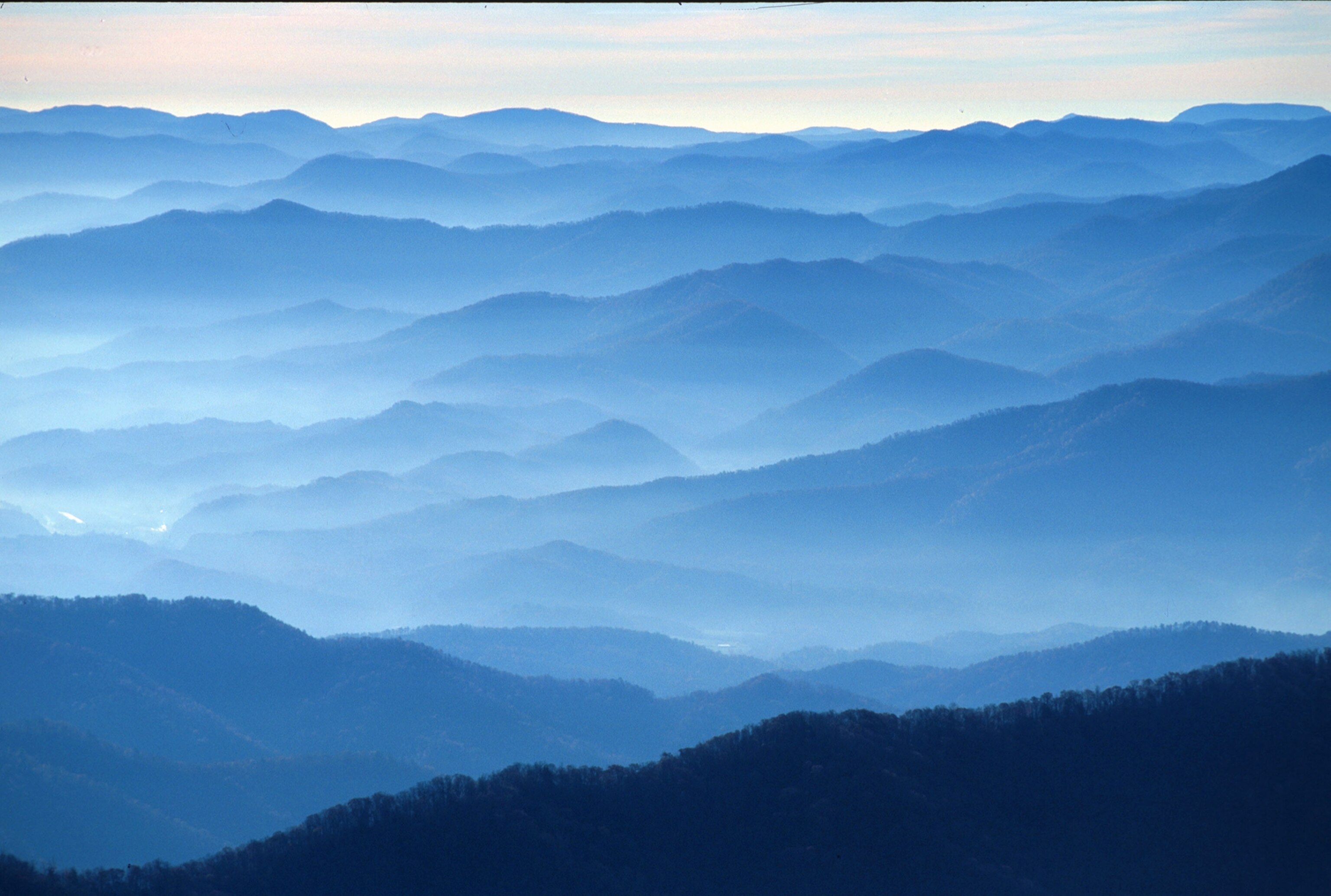
Smokelike shrouds of fog often envelop the high peaks of the Smoky Mountains, giving the park its name and hinting at the plentiful rainfall that makes its high-elevation areas qualify as temperate rain forests. Even though it’s the most visited national park in the U.S., you can often find solitude in the heavily forested mountains, which are among the oldest in the world. Keep one eye on the lookout for bear and elk, and the other eye on the ground for salamanders, which often outnumber human visitors to the park.
The Route: Shenandoah National Park > I-64W > I-81S > I-40E > U.S. 321S (351 miles)
On the Way: For the quickest route from Shenandoah National Park to Great Smoky Mountains National Park, take the highway. For the most scenic route, hop on the meandering Blue Ridge Parkway for a 469-mile stroll across the Appalachian highlands, hiking and camping along the way.
Stay: LeConte Lodge—only accessible via a 5.5-mile hike to its 6,400-foot elevation—is the only lodge actually located inside the park. That means most visitors either camp in one of several front- and backcountry sites, or head out the park’s northern entrance to nearby Gatlinburg. Escape in a private cottage at the Buckhorn Inn, or go cheap and cheerful at the Baymont Inn & Suites.
Eat: You won’t find any trendy restaurants in this park. You can pick up a sandwich or slice of pizza at Cades Cove Campground Store, but packing in a picnic allows you to take advantage of the many scenic overlooks scattered throughout the park. You can also reserve a pavilion in advance.
Don’t Miss: Drive Cades Cove, an 11-mile one-way loop around a historical valley where Cherokee once hunted and 19th-century European settlers farmed. The loop also offers up views over the mountain valleys, and plentiful wildlife-viewing opportunities. Beware that a “bear jam”—a traffic-stopping bear sighting—can slow progress to a crawl or stop it entirely. Enjoy bear sightings—but make sure you do so safely from inside your car.
Jaw-Dropping Viewpoints: April to November, you can drive almost to the top of Clingmans Dome, the highest peak in the park at 6,643 feet—but if you’re up for it, hike the extra half mile up the steep road to the observation tower for 360-degree views and stunning sunsets.
Tour: On a clear summer night, join a ranger for a tour of the night sky at Cades Cove, or rent a bike on Wednesday and Saturday mornings from May to September, when the loop around Cades Cove is closed to cars to let walkers and two-wheelers tour it exhaust free.
Walks:
- Easy: The 2.6-mile Trillium Gap Trail ends with a chance to walk behind the cascading water of Grotto Falls; for a shorter, easier hike with views of the 60-foot Tom Branch Falls and 25-foot Indian Creek Falls, start from Deep Creek Trail. Just be sure to keep an eye out for bears.
- Moderate: Simply driving on Newfound Gap road is an experience, as it passes through a variety of ecosystems and the views are stunning. But if you pick up the Appalachian Trail from the parking lot and head northeast on foot four miles to Charlies Bunion, you can edge out onto a rocky outcropping with spectacular panoramic views of the mountains.
- Strenuous: It’s a strenuous two-mile hike to the knife-edged backbone of Chimney Tops summit, but the final scramble up the chimney typically lends some adrenaline to what is already a stunning view of Mount Le Conte.
Side Drive: When Cades Cove is bumper-to-bumper, escape the crowds by going north to the beautiful Cataloochee Valley, accessed via the winding loops of highway Route 32. It’s a scenic drive with plenty of excellent hiking opportunities, but perhaps Cataloochee’s greatest draw is its herd of elk, which was reintroduced into the valley in 2001.
Oddity: The appearance of fireflies (or lightning bugs) always make a summer evening feel magical, but one species of the bioluminescent beetles that live in Great Smoky Mountains National Park is synchronous—meaning they flash at the same time. The firefly season is fleeting and tickets on the shuttle bus to the best viewing points are limited—book early.
Before You Come: Buy rain gear. Great Smoky Mountains National Park gets more than 85 inches of rain annually. Dispel any dreary moods by tucking A Walk in the Woods, Bill Bryson’s hilarious account of walking (some of) the Appalachian Trail, in your bag for a rainy afternoon.
Park Website: nps.gov/grsm
Seasonal Notes: The diverse ecosystems on view while driving through the park make it stunning year-round. More than 1,600 varieties of wildflowers speckle its slopes in the spring, while the green boughs of evergreens provide a stunning backdrop for snow, fall leaves, or summer’s greenery. Be aware that snow will often close the higher-elevation roads in winter.

Mammoth Cave National Park
For a place once aptly described as “grand, gloomy, and peculiar,” Mammoth Cave National Park commands an impressive number of visitors each year to its eerie underworld. More than 400 miles of the vast cave system—the longest known in the world—have been mapped to date, and nearly ten miles are open to visitors who dare to explore its subterranean secrets.
The Route: Great Smoky Mountains National Park > U.S. 321 > I-140W > I-40W > TN 84N > TN 52W > State Hwy 163 > KY 90W > Cumberland Pkwy > I-65N (205 miles)
- National Geographic Expeditions
On the Way: If you didn’t get your fill of wildlife in Great Smoky Mountains National Park, pull off I-40 for a quick visit to the Catoosa Wildlife Management Area, where you’re likely to see deer, wild turkey, plenty of birds, and possibly even a wild boar.
Stay: There are numerous opportunities for camping out under a tree or by the river at Mammoth Cave. If that’s not your preference, the Mammoth Cave Hotel offers convenient (and recently renovated and reopening in May 2016) hotel rooms right in the park, while nearby cottages offer more budget-, pet-, and family-friendly options.
Eat: Like sailors on the high seas, most visitors to Mammoth Cave return to dry land craving a good meal and hot coffee. If the Crystal Lake Café in the hotel is still closed for renovations, try the Watermill Restaurant in nearby Cave City for Southern-style cooking with a locals-only atmosphere.
Don’t Miss: The 52,000 acres aboveground. The park is roughly divided in half by the meandering Green River. Horse trails and mountain bike trails wander among the hills and hollows of the north section; to the south, trails are shorter, carving through beautiful sandstone bluffs and other interesting geological features. Don’t miss Cedar Sink, a natural depression or sinkhole caused by the gradual erosion and dissolution of the surface rock all the way down to the level of the underground river below.
Jaw-Dropping Viewpoints: People have been coming and going via Mammoth Cave’s historic entrance for more than 4,000 years. An appropriately gloomy-looking door to the underworld, the historic entrance is covered over with ferns, mosses, and a weeping waterfall. Keep an eye out for the many species of bats that make Mammoth Cave their home, but don’t worry—there’s no mass exodus come sundown.
Tour: Rangers lead all belowground tours at Mammoth Cave, as park officials found that visitors left to wander quickly became lost. Tour prices vary.
Walks:
- Easy: The Frozen Niagara Tour may be short, but like all of the trails underground, this one is memorable, thanks to the dramatic rock formations that look like massive waterfalls frozen in time.
- Moderate: The Domes and Dripstones Tour is less than a mile long, but it swoops up in elevation to explore a series of 14 connected domes and caverns, then down through several small corridors to traverse pits separated by massive boulders. Descend another staircase (there are more than 500 steps on this tour) to view the dripstones, or stalagmites and stalactites formed by drops of water.
- Strenuous: Not for the claustrophobic or those afraid of the dark, the Wild Cave Tour entails four hours of crawling and climbing through small passageways past gypsum variations into the massive Cathedral Domes, which are 200-foot-high connected canyons. For less crawling and more walking, try the four-mile Grand Avenue Tour, which traverses expansive, cathedral-like halls and caverns, and passes by beautiful gypsum formations and waterfalls, eventually exiting through the Frozen Niagara.
Side Drive: There are less than five miles between the Frozen Niagara entrance and Mammoth Cave Adventures, but after the eerie quiet of the caves, an adrenaline-filled zip-line ride through the tree canopies seems an excellent antidote to subterranean adventures.
Oddity: Although it feels as though you’re exploring far under the ground, the deepest point in the cave is actually about 360 feet above sea level.
Before You Come: Practice your deep-breathing techniques if you’re afraid of the dark or claustrophobic. Also, take the stairs for a few weeks in advance; several cave tours require a surprising amount of stair climbing.
Park Website: nps.gov/maca
Seasonal Notes: The temperature in the cave hovers at about 54°F year-round, so while the greatest variety of tours are offered during peak summertime months, winter offers similar cave temps, but greatly reduced crowds.
