Everything you should know about Yosemite National Park
Our expert guide will help you make the most of your visit to this epic California park, home to El Capitan and Half Dome.
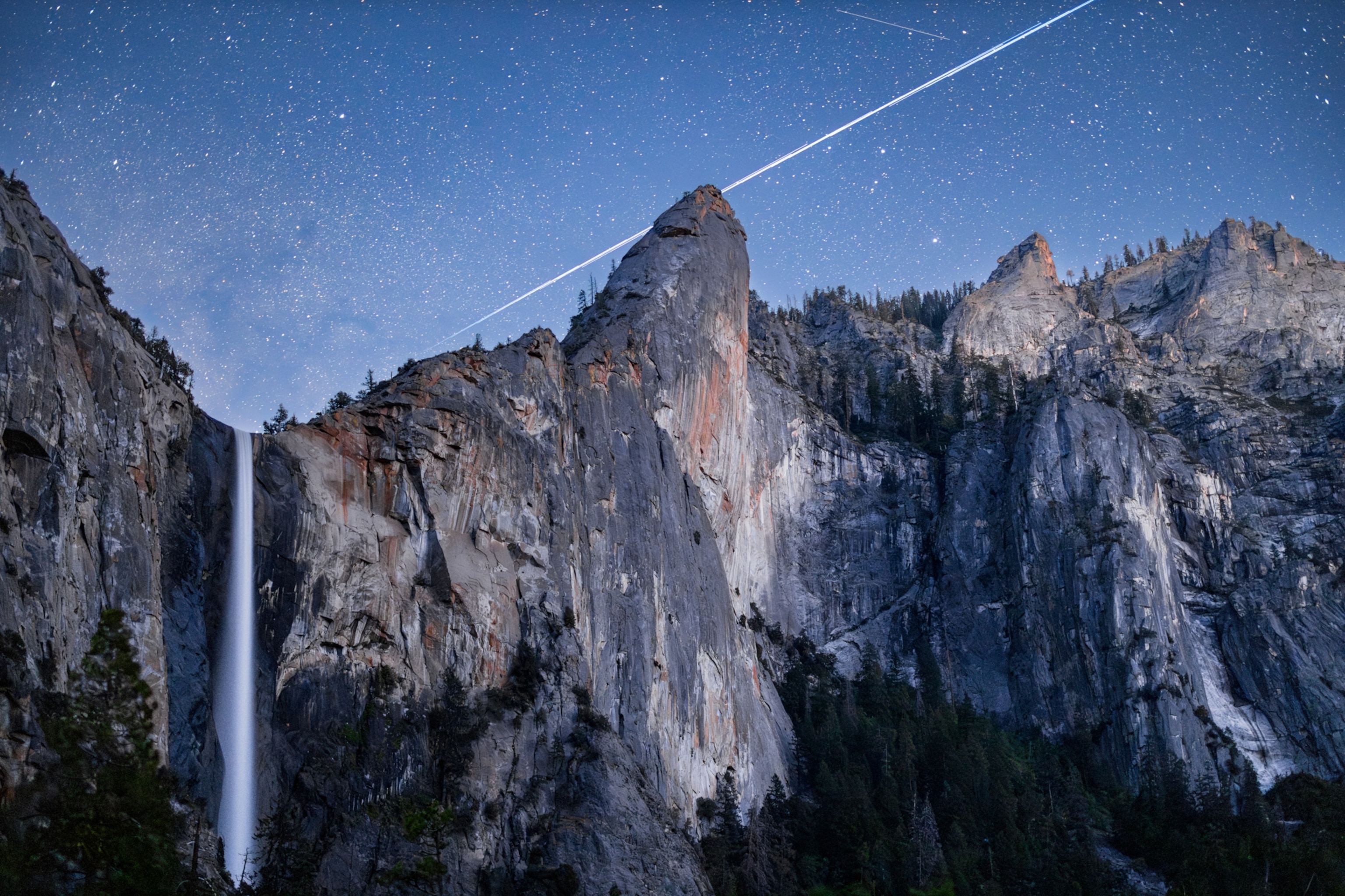
It wasn’t the first national park. But Yosemite’s granite walls and giant sequoias were so extraordinary that Abraham Lincoln took time out from his presidential duties during the Civil War to sign an 1864 bill authorizing their preservation and public use, eight years before Yellowstone became the first official national park.
Yosemite made a lasting impression on Teddy Roosevelt too. During his 1903 camping expedition there, he hatched ideas that would lead to the creation of the National Park and National Forest systems.
In a speech after, Roosevelt told the crowd that he wanted the giant sequoias preserved “because they are the only things of their kind in the world.” The same could be said for all of this iconic national park. Here’s everything you need to know to make the most of your visit.
Best times to visit Yosemite National Park
The Park Service reports that around 75 percent of Yosemite’s four million annual visitors enter the park between May and October. Within that timeframe, June-August is the peak time.
It almost goes without saying that if you don’t want to fight the crowds in Yosemite Valley and other popular parts of the park, you should plan to visit in early spring, late fall, or even winter.
It may be chilly, but winter is a magical season in the park. Snow blankets the meadows and mountaintops, while waterfalls freeze solid. With very few people, visitors who brave the temps find plenty of room for snowshoeing and skiing at Badger Pass, ice skating at Curry Village, and the possibility of walking through a snowy redwood grove.
(How do you avoid the crowds in national parks? Visit during winter.)
Where to find the best views in the park
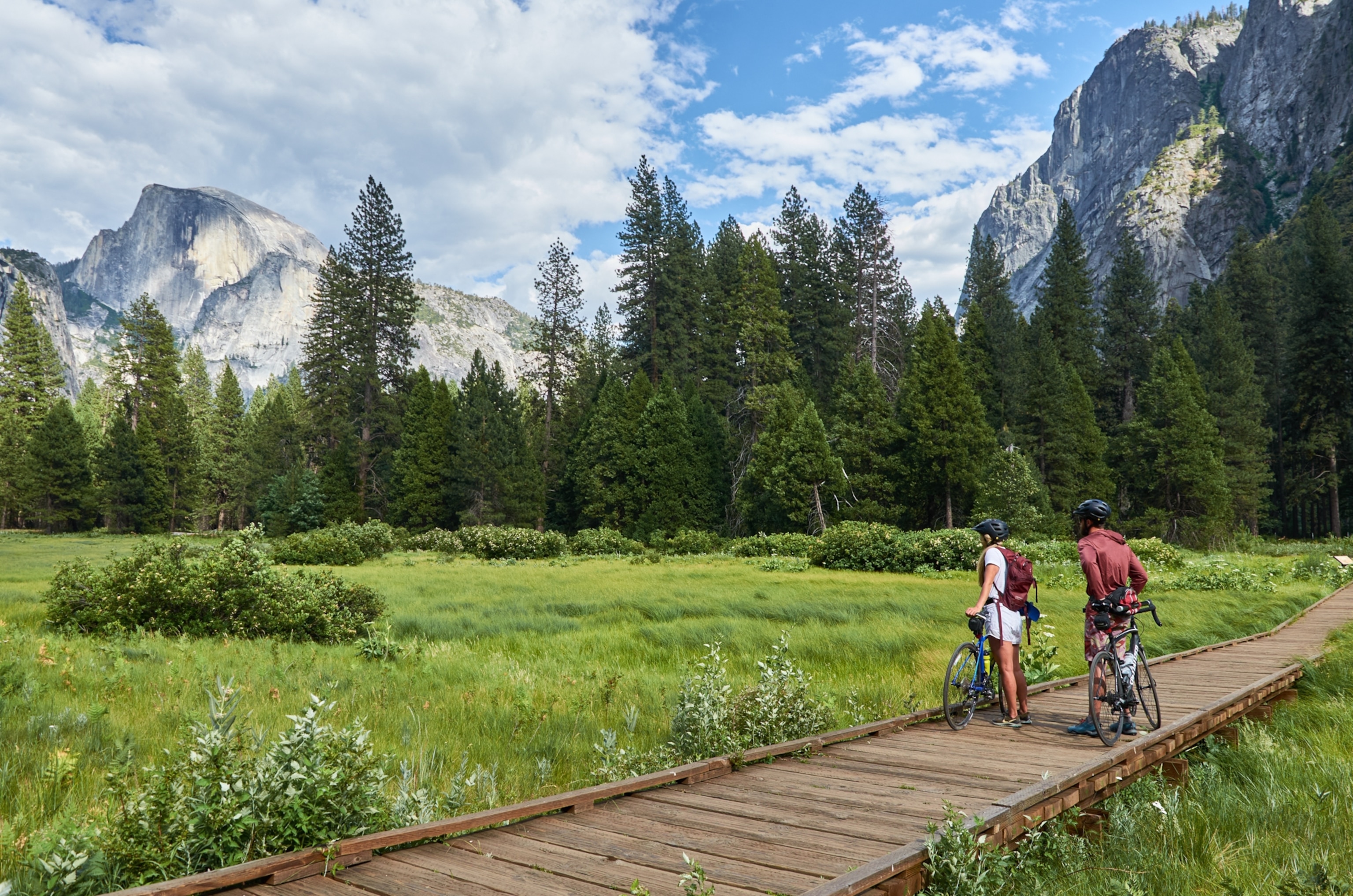
Is there a bad view anywhere in the park? Visitors would be hard-pressed to find one. However, a few views are legendary, including Glacier Point (accessible by car) and the summit of Half Dome (a 16-mile return hike from the valley)—both offer panoramic views of Yosemite Valley below and the Sierra crest on the eastern horizon.
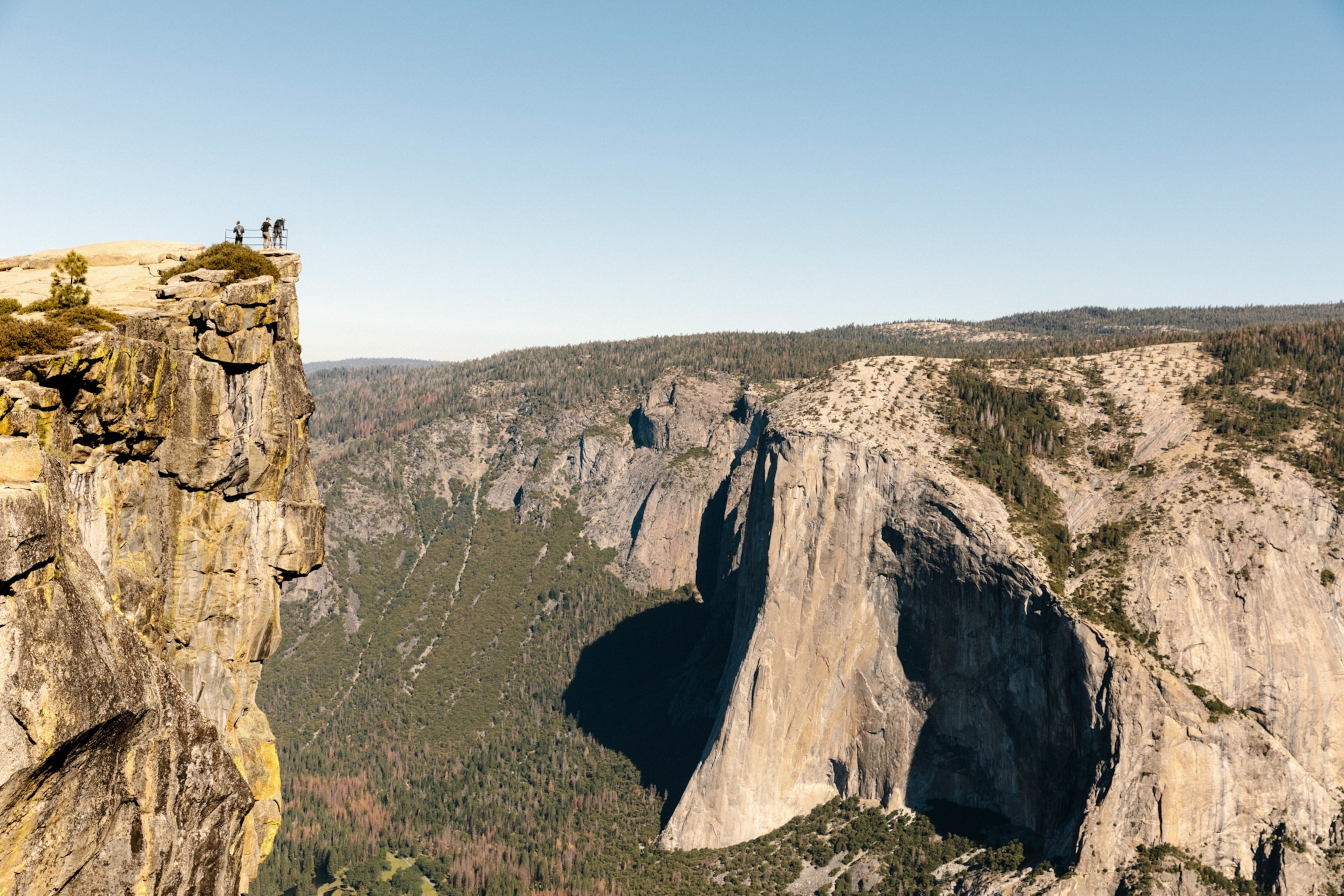
From the valley’s south rim, Sentinel Dome and Taft Point are two of the park’s more vertiginous views. Two-mile-long trails connect these viewpoints from a small parking lot along Glacier Point Road, directly opposite El Capitan.
Taft Point is a great place to watch climbers scaling the famed vertical face. Just as incredible are the views from the north rim, like the top of El Capitan, North Dome, and the top of Yosemite Falls. But reaching these requires a steep uphill hike or long overland hike from Tioga Road.
No view is quite as striking as seeing Yosemite Valley for the first time while exiting the Wawona Tunnel. Stretching all the way to Half Dome, this sight impressed even the great Ansel Adams. For an even better view (and far fewer people to share it with), hike the short trail to Inspiration Point from the tunnel’s upper parking lot.
Along Tioga Road, Olmsted Point renders a glimpse down Tenaya Canyon to the backside of Half Dome, as well as a chance to watch the yellow-bellied marmots hanging out on the granite around the viewpoint.
Where to find the best hiking trails
In the same vein as viewpoints, Yosemite offers an awful lot of cool trails.
Among the easier walks are the Lower Yosemite Fall Trail (1 mile/1.6 km), the recently upgraded Bridalveil Fall Trail (0.5 miles/0.8 km), and the route to Mirror Lake (2 miles/3.2 km).
Visitors fiind plenty of easy walks beyond the valley, on routes like the Parsons Lodge & Soda Springs Trail (1.4 miles/2.3 km) across Tuolumne Meadow and the Grizzly Giant Loop (2 miles/3.2 km) in the Mariposa Grove of giant sequoias.
The park’s most iconic day hike rises from the valley floor to the summit of Half Dome, a strenuous trek of around 16 miles (25 km) that involves scaling steel cables on the mountain’s backside. Because only 300 hikers per day are allowed on that final ascent, all hikers must obtain a permit via lottery on the website Recreation.gov.
Another tough but spectacular day hike is the Yosemite Falls Trail (7.2 miles/11.6 km) to the top of the towering cascade. Best of all, no permit is required to tackle this route.
The Pohono Trail (13.8 miles/22 km), across the south rim between Glacier Point and Wawona Tunnel, offers more acrophobia-inducing views as it makes its way along the edge of Sentinel Dome, Taft Point, and Dewey Point.
Serious backpackers make for the legendary John Muir Trail (JMT), a 211-mile (340-km) journey through the High Sierra from Yosemite Valley to Kings Canyon and Sequoia national parks that terminates at the top of Mount Whitney. For much of its length, the JMT shares the path with the Pacific Crest Trail.
(Before you go hiking, read these life-saving tips from first responders)
The best spots to see wildlife
Like anywhere in the great outdoors, spotting wildlife in Yosemite is largely a matter of luck, location, and timing.
To increase your chances, hang out at dawn and dusk around the edge of the 3,000-plus meadows scattered across the park. There are seven big meadows in Yosemite Valley. Tuolumne Meadows in the backcountry is another great spot for glimpsing animals at sunrise and sundown.
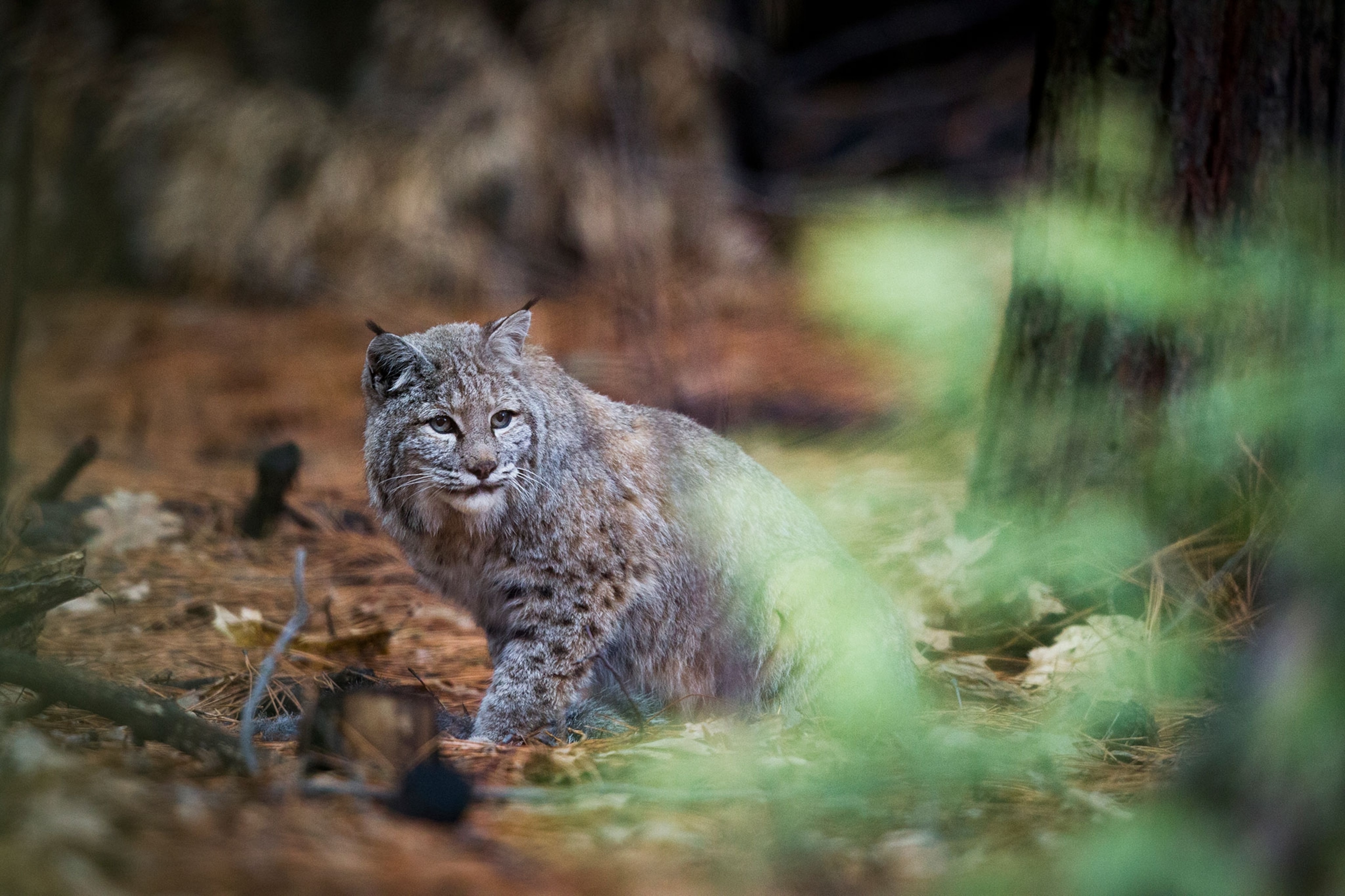
Mule deer, squirrels, and chipmunks are the most common mammals, but you may be lucky enough to see a black bear or coyote lumbering across the meadow. Be sure to look upwards for some of the 262 bird species that have been recorded in the park.
(Birds, bison, and bears—here’s how to see wildlife from your car)
Some animals are best spotted in specific places. Yellow-bellied marmots tend to hang out at Olmstead Point while Sierra Nevada bighorn sheep roam the rocky heights around Tioga Pass.
Visitors should always be careful around bears. Do not approach them or try to snap selfies. Don’t leave food in your vehicles. Follow park instructions for storing food overnight at campgrounds. Learn more here.
Expert recommendations and tips
Cory Goehring, the outdoor programs manager and senior naturalist at Yosemite Conservancy emphasizes the importance of getting into the park before 8 a.m. “That sort of ensures that you’ll get in before the line builds up at the entrance gates and you’ll also be able to find parking.
He adds that it pays to linger in the park. “Bring a picnic for dinner or pick up something from one of the grocery stores or food vendors here and have a picnic at sunset,” he suggests. “Even in July and August, right around six, seven o’clock when it starts to get towards sunset, you almost feel like you have the park to yourself.”
Goehring recommends less busy areas. “Yosemite Valley gets over 90 percent of the visitation to the park, but the valley is only a very small percentage of Yosemite. It’s a huge park, the size of the state of Rhode Island—1,200 square miles. If you get outside of Yosemite Valley, you can find areas like Hetch Hetchy, or up at Crane Flat, or Tuolumne Meadows that not as many people are going to visit.”
“My favorite hike is taking the Four Mile Trail up to Glacier Point and then hiking down the Panorama Trail. That’s like a 14-mile [22.5-km] day with a lot of elevation gains. So it’s not for the faint of heart.” He also recommends the short trek to May Lake (2.4 miles/3.9 km) off Tioga Road in the high country, a hike that can be extended by summiting nearby Mount Hoffmann.
Things to do in Yosemite
Stretching nearly eight miles (12.8 km) from east to west and with granite walls more than twice the height of the Empire State Building, Yosemite Valley is one of the wonders of the natural world. Carved by glacial dynamics, weather, and erosion spanning 30 million years, few other places reflect so remarkably the geological forces that have shaped our planet.
A circular one-way road system cruises past all the valley’s major landmarks. The first of the many astonishing sights is the aptly named Bridalveil Fall, which tumbles down a granite face beneath the Cathedral Rocks.
The road eventually leads into Yosemite Village, the valley’s human hub and home to the new Yosemite Valley Welcome Center. In addition to a grocery store, gas station, post office, medical clinic, and other facilities, the village offers the Yosemite Museum, the Ansel Adams Gallery of photographic art, and the Yosemite Wilderness Center, where backpackers can obtain wilderness permits, bear canisters, and other backcountry essentials. The village’s latest addition are the interactive exhibits of the Yosemite Exploration Center & Theater.
(These are the best stargazing sites in North America)
Many of the landmarks scattered around the valley’s eastern end are best reached on foot or via shuttle from Yosemite Village. Tumbling down an enormous rock face just west of the village, Yosemite Falls is impressive not so much in water volume but the sheer height from which it falls. Split into three sections, the cascade plunges 2,425 feet (739 meters), the highest waterfall in North America and fifth tallest on the planet.
Perched along the south side of the Merced River are the Sierra Club’s Yosemite Conservation Heritage Center (interpretive programs, natural history exhibits, library) and Curry Village with its myriad food, beverage, recreation, and accommodation options. During the winter, the village ice rink hosts skating under the stars.
The bulk of Yosemite National Park lies above the valley, a vast expanse of high-country meadows, mountains, and forest that includes the headwaters of several mighty rivers and more than 1,100 square miles of designated wilderness. Most of this region is accessible only by foot or horse. But two long, winding roads open up much of the backcountry to motorists and casual hikers too.
Tioga Road, one of the nation’s most scenic highways, literally splits the park in half, between Crane Flat near the park’s western border to Tioga Pass at the crest of the High Sierra. Often closed until early or even midsummer due to snowpack, the road is the only drivable route between Yosemite Valley and the eastern side of the Sierra.
Flanking Crane Flat are two of the park’s lesser known wonders: Tuolumne Grove and Merced Grove. These are the only spots in Yosemite where you can occasionally have the redwoods to yourself, especially during the snowy winter months.
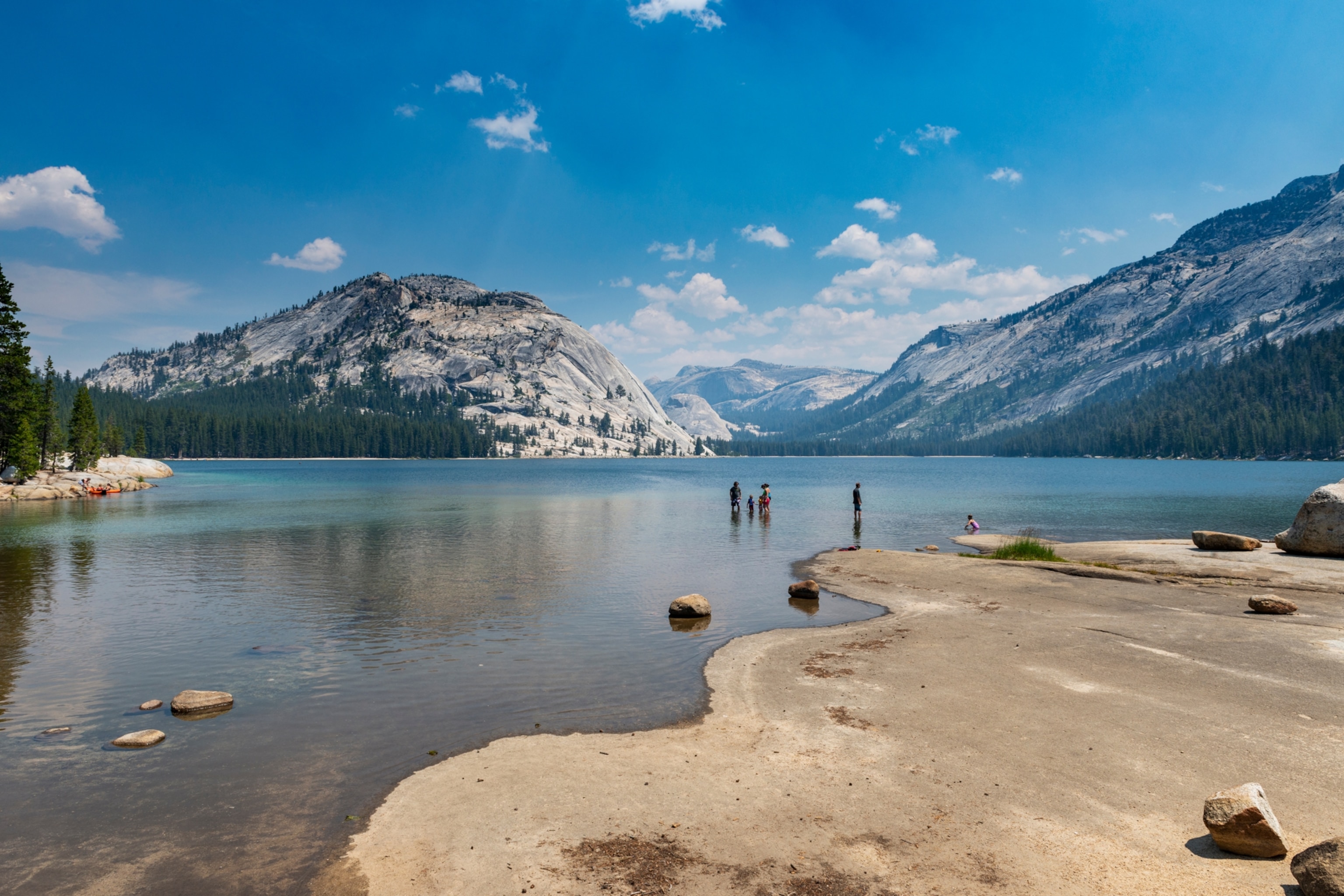
The largest of the park’s water bodies, Tenaya Lake is ideal for a picnic or paddle—and perhaps swim, if you can stand water that’s chilly even at the height of summer. A 2.5-mile (4 km) trail leads around the lake.
With its visitor center, campground, tented lodge, and other services, Tuolumne Meadows is the “Times Square” of the high country. Trails meander across the giant meadow to Sunset Lakes, Soda Springs, Lembert Dome, and other natural landmarks. Both the Pacific Crest Trail and John Muir Trail transit the meadow.
(Here are some expert tips for navigating the wilderness alone)
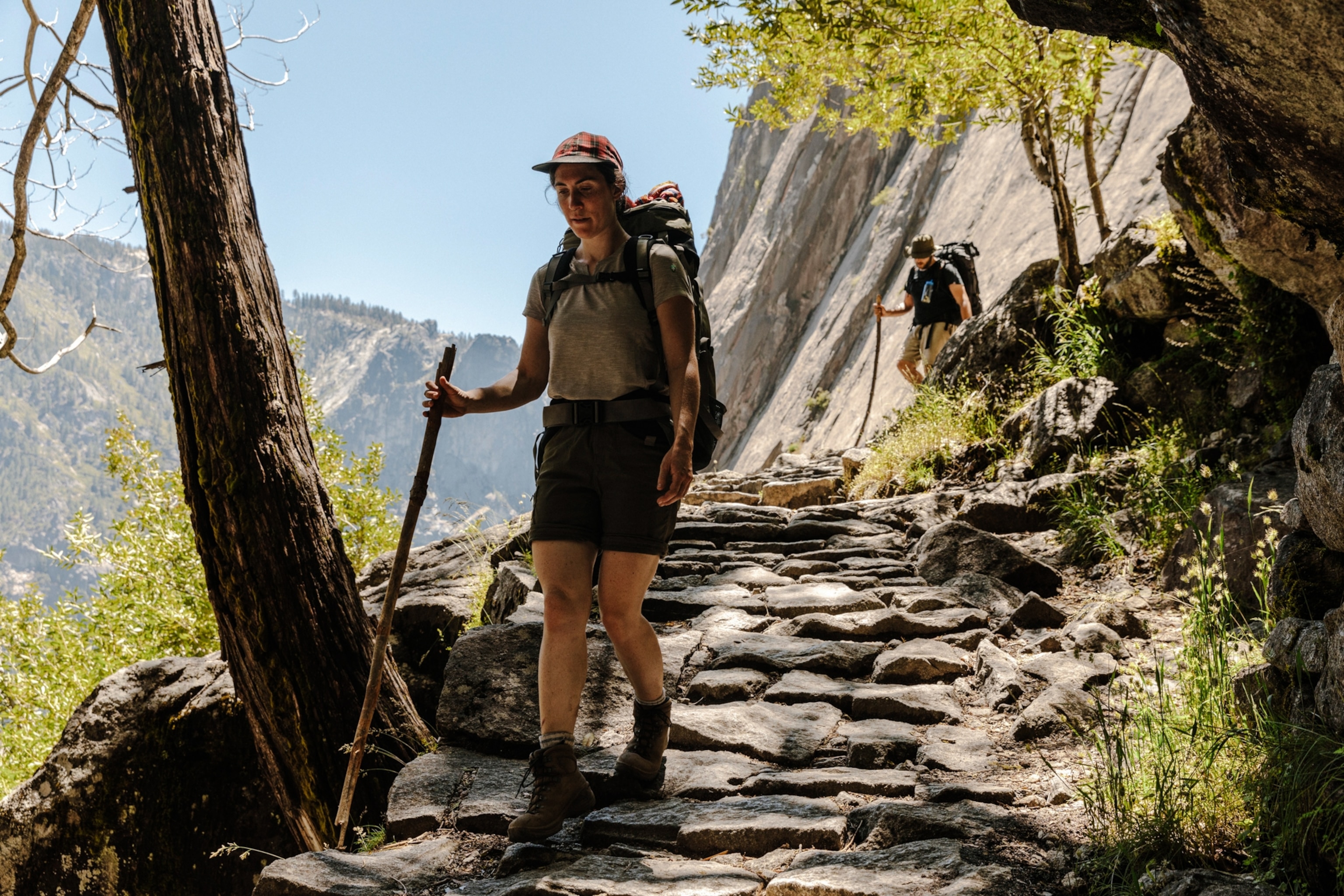
The wild and scenic Tuolumne River runs slow and gentle close to its source in the High Sierra. The river eventually tumbles through the remote Grand Canyon of the Tuolumne (accessible only by hiking) down into deep Hetch Hetchy Canyon, an almost identical twin of Yosemite Valley until it was dammed and transformed into a lake in 1923 to provide water for San Francisco.
Wawona Road climbs the valley wall into the park’s low-key southwest corner. Roughly 7.6 miles beyond the tunnel lies the turnoff to Glacier Point Road, which follows the southern edge of Yosemite Valley to the awe-inspiring Glacier Point.
About halfway along Glacier Point Road, visitors find the Badger Pass, a winter sports area originally developed for Yosemite’s failed bid to host the 1932 Winter Olympics. In addition to family-oriented skiing and snowboarding, Badger Pass also facilitates ranger-led snowshoe tours and cross-country skiing along the road (closed to vehicles in winter) to Glacier Point.
Yosemite’s frontier side is on display in Wawona Village, where the Yosemite History Center offers horse-drawn carriage rides, a working blacksmith shop, covered wooden bridge, and other relics of the era before National Park status. Wawona’s nine-hole golf course (created in 1918) is one of the few found in the National Park System.
Among other Wawona activities are horseback and mule rides through the surrounding woods and wandering the Mariposa Grove, the park’s largest stand of giant sequoias (more than 500 trees). The grove’s most celebrated tree is the Grizzly Giant, estimated to be around 3,000 years old (plus or minus a few centuries). A free shuttle runs between the grove and the new welcome plaza.
The nonprofit Yosemite Conservancy—the largest “friends” group of any national park—offers hundreds of programs each year. They range from short naturalist walks and multiday backpacking and field school scientific adventures to astronomy sessions, art classes, and children’s activities at the Happy Isles Art & Nature Center.
Best things to do for families
Just being in Yosemite is enough to blow the minds of most kids. But there are ways that families can enhance their stay in the park, starting with three ways to move around.
During the warmer months, rental bikes, attachable trailers, and strollers are available at Curry Village, Yosemite Village, and Yosemite Valley Lodge for cruising the 12 miles of flat bike trails that loop around the valley.
The slow-flowing Merced River provides plenty of scope for swimming, tubing, rafting, and fishing during the valley’s hot summer months. Would-be river rats can hire four-person rafts at Curry Village in June and July (but usually not August because the water level is too low).
(How to plan an epic summer trip to a national park)
Numerous kid-friendly trails include Lower Yosemite Fall (1 mile/1.6 km) through towering trees to the mist zone at the base of the falls; Mirror Lake (2 miles/3.2 km) along the base of Half Dome; the Big Trees Loop (0.3 miles/0.5 km) and Grizzly Giant Loop (2 miles/3.2 km) in the Mariposa Grove of giant sequoias; and the Parsons Lodge & Soda Springs route (1.4 miles/2.3 km) across Tuolumne Meadows in the high country.
In the winter, Curry Village opens its outdoor ice skating rink. Considered one of the best places in California for beginner skiers and snowboarders, Badger Pass offers lessons for children aged 7-12, and adult lessons for teens.
Opened in 2024, the year-round Yosemite Exploration Center & Theater was designed with interactive exhibits on park history and nature.
Cory Goehring of the Yosemite Conservancy often takes his son to Happy Isles Art & Nature Center at the eastern end of the valley. “We have all sorts of awesome free art programs along with hands-on activities that are great for kids. You can hang out there for two to three hours just doing art activities and exploring the nature center.”
Where to stay
Hotels: For reservations, call 888-413-8869 or book online here. Travelers have many options within the park, including The Ahwahnee, the historic 1920s lodge in Yosemite Valley, with a pool, restaurant, and bar. Curry Village has cabins, tent cabins, and Stoneman House rooms, along with a pool and a restaurant. Wawona Hotel is a vintage 1876 wilderness retreat with a pool, golf, and a restaurant.
Yosemite Valley Lodge is a motel-style accommodation in the village with a pool and restaurant. High Sierra Camps consist of five remote tent-cabin camps along the John Muir Trail in eastern Yosemite accessible only by hiking. The lodging price includes three daily meals.
Camping: Thirteen campgrounds are spread across the park, including Yosemite Valley, Tuolumne Meadows, and Wawona. To reserve, call 877-444-6777 or book online here.
(Iffy about camping? Here’s how to dip your toes in.)
Outside the park: Evergreen Lodge is a historic 1920s family-friendly resort near Hetch Hetchy and Big Oak Flats. AutoCamp Yosemite offers kid- and dog-friendly glamping in comfy Airstream trailers, plus yoga classes, a swimming pool, and nightly live music around a campfire.
Under Canvas Yosemite has safari-style tents with full bathrooms and king beds, plus an onsite bar and restaurant. Tenaya Lodge is a modern luxury retreat seven miles south of Wawona.
What else you need to know
Entrances: The park has five entrance gates: Hetch Hetchy and Big Oak Flat in the northwest, Arch Rock/El Portal in the west, the South Entrance near Fish Camp, and Tioga Pass in the east.
Visitor centers: Yosemite Valley Welcome Center (year-round), Wawona Visitor Center at Hill’s Studio and Big Oak Flat Information Station (May–October), Tuolumne Meadows (June or July–late September).
Entrance fees: $35 per vehicle, $30 per motorcycle, $20 per person for those without their own vehicle. In addition to those fees, non-U.S. residents must now pay $100 per person. All visitors are now required to present an ID at entrance gates. Reservations are no longer required to enter the park during peak hours in peak season.
Are pets allowed: Dogs are allowed only on paved roads, sidewalks, and bicycle paths and in campgrounds.
How accessible is the park?
Yosemite offers a wide range of accessibility options including wheelchair accessible YARTS public transit buses and Yosemite Valley Tram Tour.
Accessible trails include the paths to Lower Yosemite Falls, Glacier Point, Mirror Lake, Bridalveil Fall, and various meadows in Yosemite Valley. There are also accessible lodging and campgrounds, food and grocery outlets, restrooms and picnic areas.
Online resources include a comprehensive, downloadable Accessibility Guide (also in Braille), a deaf services program, a visual guide to Yosemite Valley for visitors with aphasia, and a version of the Junior Ranger Handbook with activities for kids with communication, learning, motor and/or sensory needs. The park map and brochure is also available in Braille.