Eye on the Tiger: Satellite Images a New Tool for Conservation
Conservationists get a bird's-eye view of what's happening on the ground.
If a picture is worth a thousand words, satellite images may tell a crucial story for conservationists and anyone else looking to protect tigers or other endangered species.
"Maps are a common language, and satellite images are an unfiltered channel of information," said Dmitry Aksenov, general director of Russia-based nonprofit Transparent World. "With satellite monitoring, it's not possible to hide what you're doing on the ground—your dirty secrets of mining, logging, and pollution."
The former biologist presented the Open Landscape Partnership Platform at an international conference in Moscow in October 2013. The platform is led by Transparent World, ScanEx Research and Development Center, the World Resources Institute, the World Bank, the Global Tiger Initiative, and Global Forest Watch.
The Global Tiger Initiative then put the Open Landscape Partnership Platform to use, analyzing super-high-resolution images from countries with tiger habitats—parts of Russia, India, China, Myanmar (Burma), Laos, and Thailand. Over the past few months, the images have expanded beyond tiger habitat to a wide swath of ecologically important areas, ranging from the Amazon Basin in South America to parts of Indonesia, covering more than 380,000 square miles (1 million square kilometers) of lush land.
The platform goes beyond Google Maps and Google Earth, in which images from remote and forested areas tend to be blurry. Each pixel on the Open Landscape platform represents nearly 20 inches (50 centimeters) on the ground—enough to identify individual people or specific types of trees.
"We devoted 23 years of our lives to making images from space affordable in terms of price, speed, and technical simplification—and it was at a time when Google Earth did not exist," said Olga Gershenzon, vice president of ScanEx Research and Development Center, which is footing the bill for the initial 2.25 million square kilometers (0.87 million square miles) of satellite images. (Other projects by the remote-sensing company include providing images to help search-and-rescue missions after an earthquake in Haiti and after Japan's Fukushima nuclear disaster in 2011, as well as to monitor construction, forests, ice, and impending floods.)
Saving Tigers With Mapping
For conservationists focused on habitat loss—one of the biggest threats to tigers, snow leopards, and other big cat species—detailed satellite images may be pixelated gold. That's because, with the blink of a satellite lens as it passes over the Earth, conservationists can closely see what's happening on the ground.
In four years, land occupied by tigers shrank 4,600 square miles (12,000 square kilometers)—three times the area of Rhode Island—according to a report released by the National Tiger Conservation Authority and the Wildlife Institute of India and cited recently in the Times of India. Tigers are now restricted to seven percent of their historical range of the past 200 years, claims scientist Uma Ramakrishnan of India's National Centre for Biological Sciences.

Smaller, more fragmented habitat areas mean more territory conflicts among the big cats, and more clashes with humans along habitat edges as tigers pursue their prey, scientists warn. And with fewer than 3,500 tigers left in the wild, connectivity between populations is essential to their genetic viability.
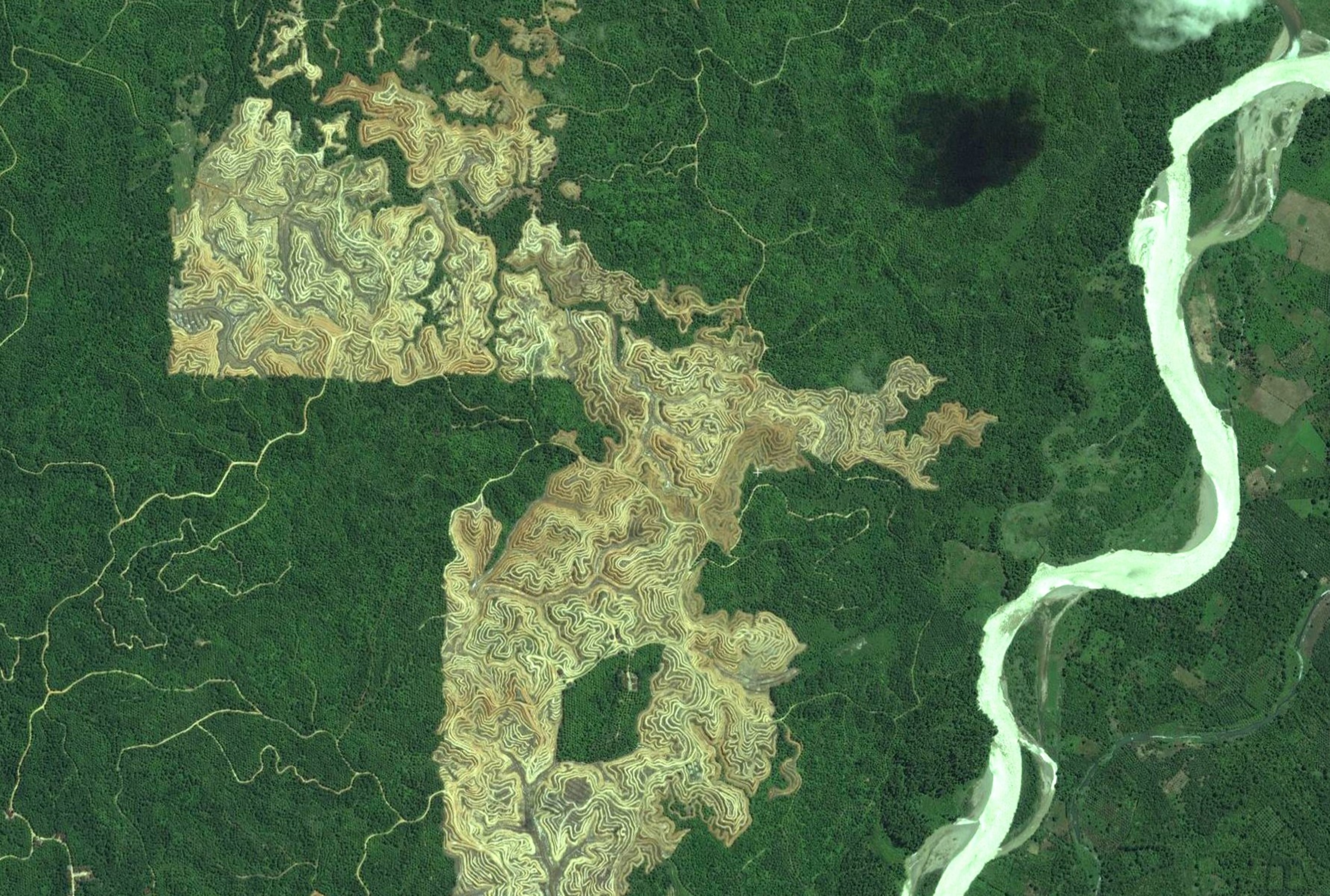
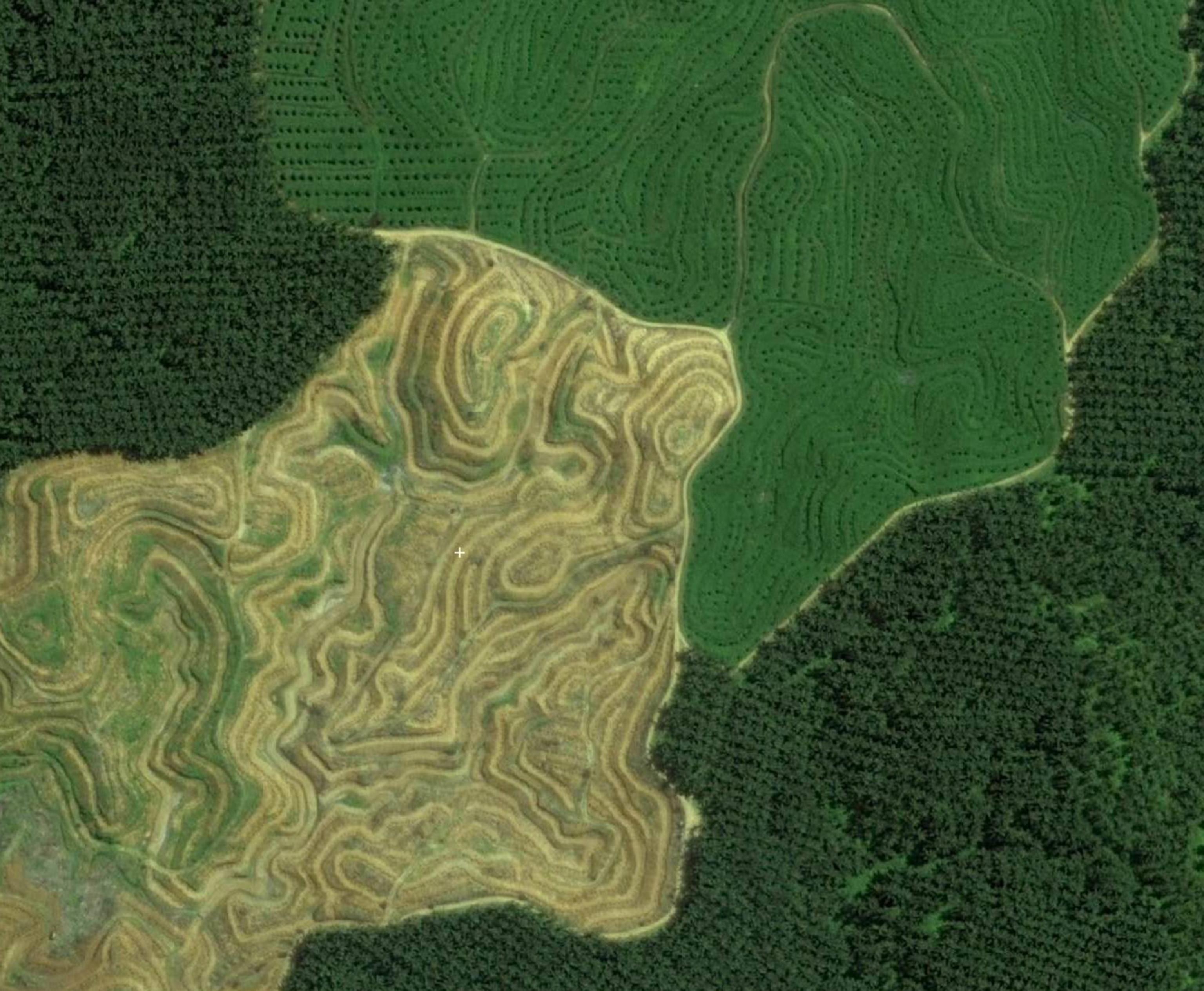
In addition to the human footprint of housing and road construction, other factors jeopardize the habitats of tigers and other wildlife. Palm oil, used in cosmetics, foods, and household products, is produced on plantations that have cleared extensive tiger and orangutan landscapes. So have plantations that produce pulpwood for paper. From 2009 to 2011, forest clearing for both types of plantations destroyed two-thirds of all tiger habitat in Sumatra's deep peatland forests.
But changes in vegetation often leave a trace. With satellite images, the plantations "look very different from the natural structure, where you could see a mosaic of different tree sizes, different species, and different colors of leaves," said Aksenov.
High-resolution images can also uncover ecological disasters that may otherwise remain concealed, like fires and oil spills. In 2010, the East Siberia-Pacific Ocean oil pipeline, which was constructed to export crude oil to Asian nations, posed a potential threat to Siberian tigers when it leaked more than 10,000 cubic feet (280 cubic meters) of oil in eastern Siberia.
Though that accident was reported, "many times we caught oil spills in Russia that were never presented to the public," said Aksenov. Greenpeace also claims that the Russian oil industry spills more than 30 million barrels on land each year, often without reporting it.
From high above, oil spills can resemble black pools, which could be confused with water. But thermal satellite images distinguish oil from water, since water is cold and oil emits heat.
Saving Other Species, Too
Nikolay Vorobiev, a geographic information systems specialist with Sakhalin Environment Watch, which strives to protect the natural ecosystems of Russia's largest island, plans to use images from the Open Landscape platform to protect salmon spawning grounds from gold miners and to check for oil spills from a skeleton of pipelines stretching across Sakhalin.
The organization began satellite monitoring with ScanEx and Transparent World three years ago. Before that, "we spent a lot of time and effort identifying violations for fish traps using boats and GPS," he said. "I was amazed when I realized that the satellite sees all violations," he said about the more efficient technology.
Within three years, the group reported thousands of violations with fish traps. As a result, the number of violations decreased by 68 percent in 2013.
The imagery need not be solely for scientists. Anyone with an Internet connection can access the Open Landscape website. They can draw lines and points on the images, and share coordinates. Applicants willing to wait three months can request specific imagery, buy it, or obtain original data directly from Digital Globe, the satellite provider. (One limitation is that the images provided by the satellites are, at least for now, on a six-month delay. This means that by the time someone receives a specific image they requested, it would have been taken nine months earlier.)
So far, the platform has received 20 applications, mainly from scientists, universities, and nonprofit organizations. But it may be just the beginning—and a way to diversify the satellite image industry, which relies heavily on U.S. government support.
Follow Sasha Ingber on Twitter.