Explore Historic Mount Everest Expeditions Through National Geographic Maps
Sixty-five years after the first climbers summited Mount Everest, we look back on our most stunning maps of the mountain.
On this day, 65 years ago, Sir Edmund Hillary and Tenzing Norgay became the first people to reach the summit of Mount Everest. Hillary described the moment to National Geographic the following year in the July 1954 issue: “We are there. Nothing above us, a world below.”
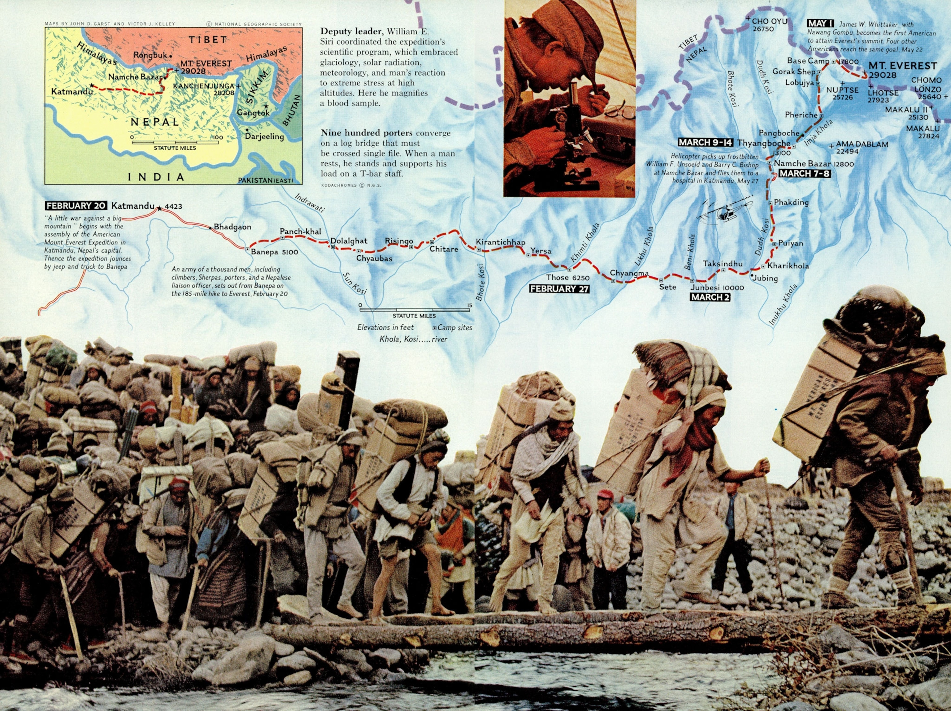
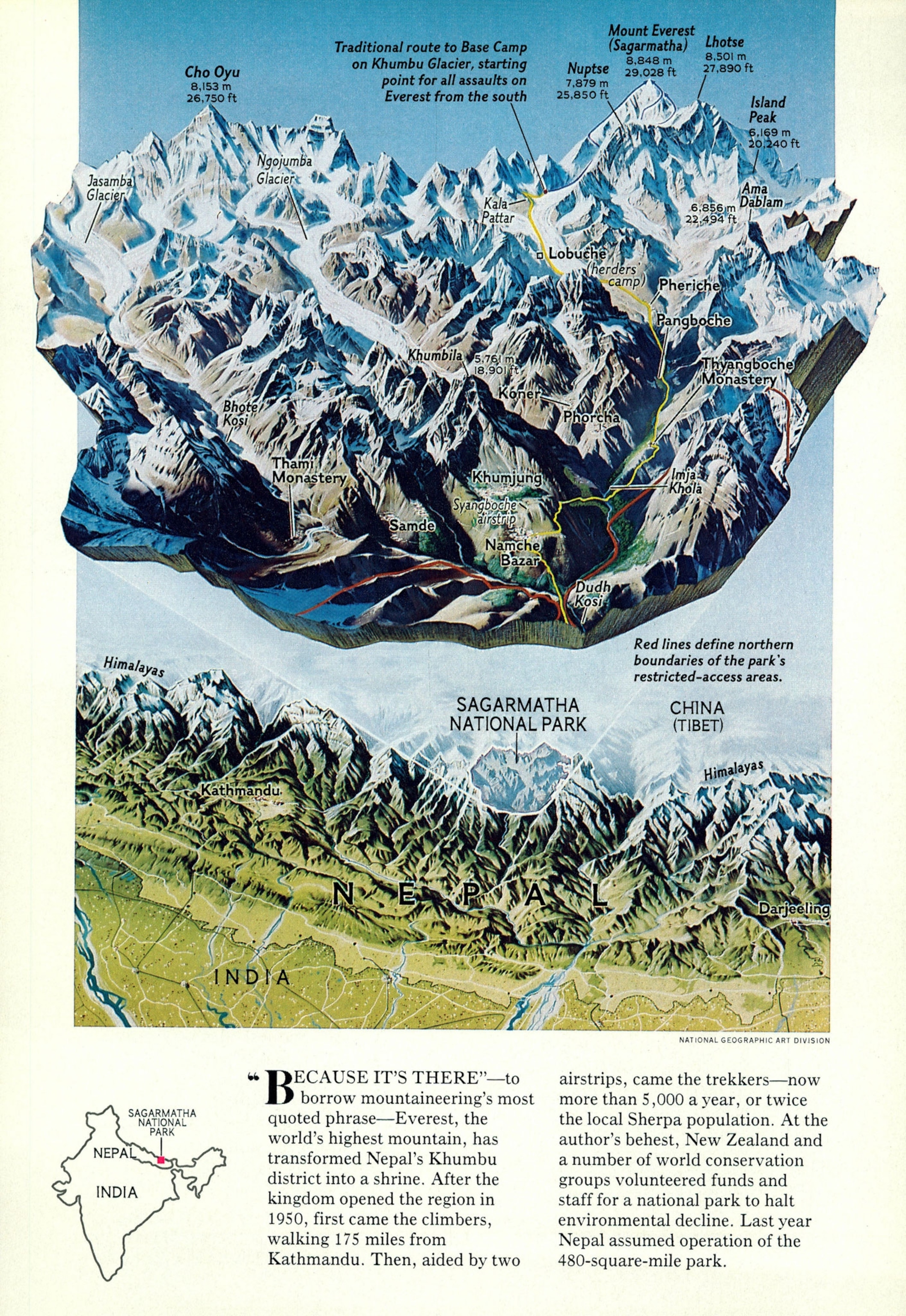
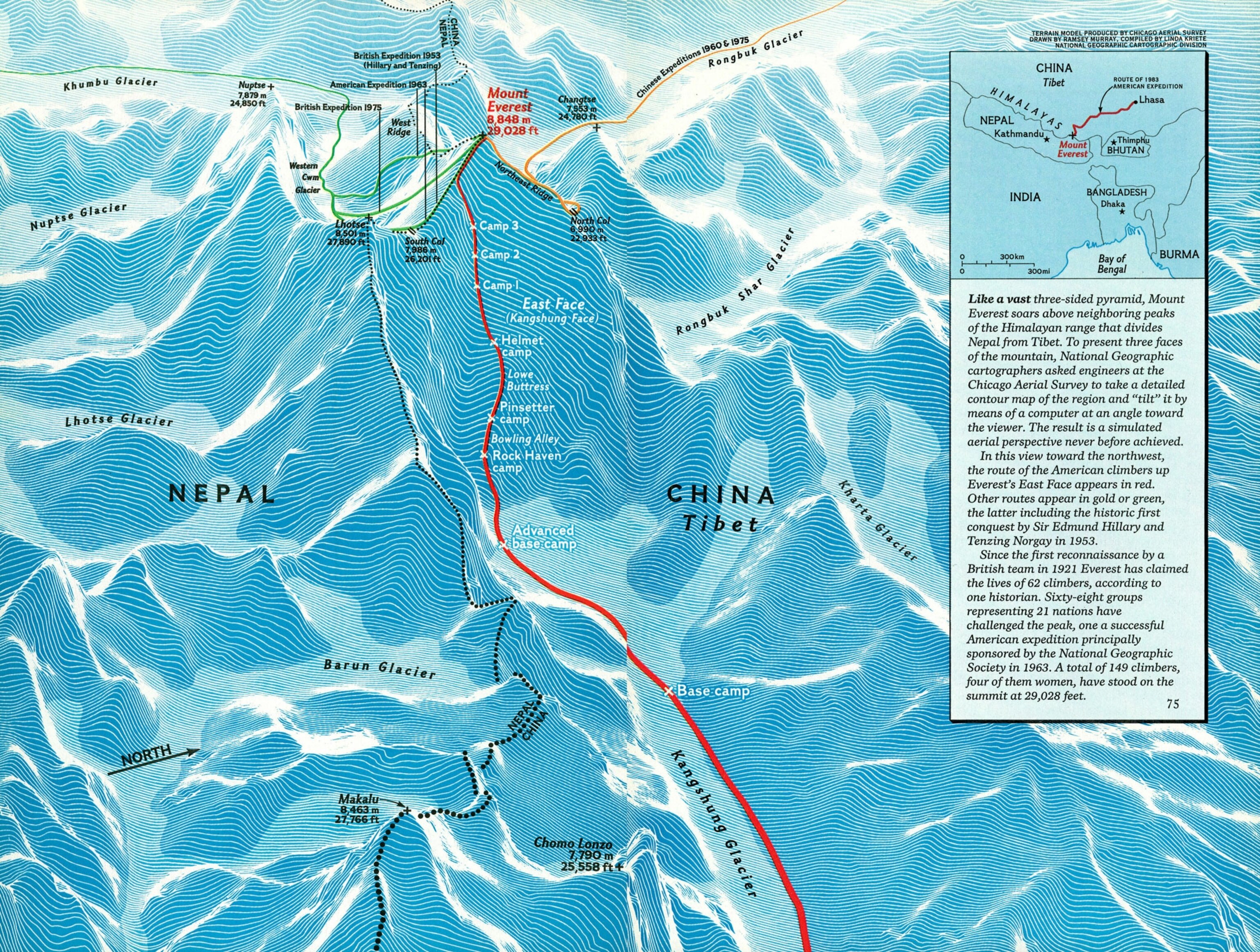
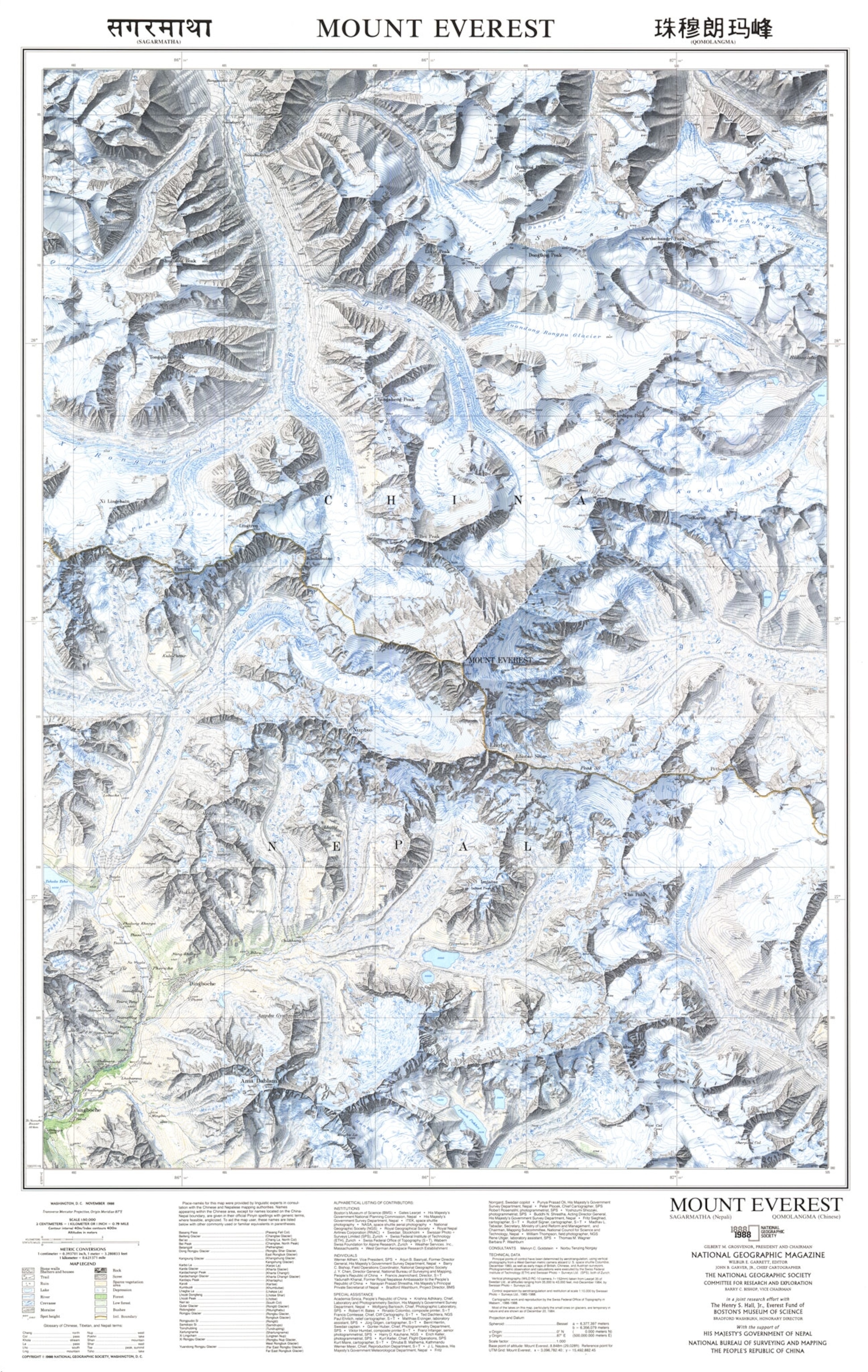
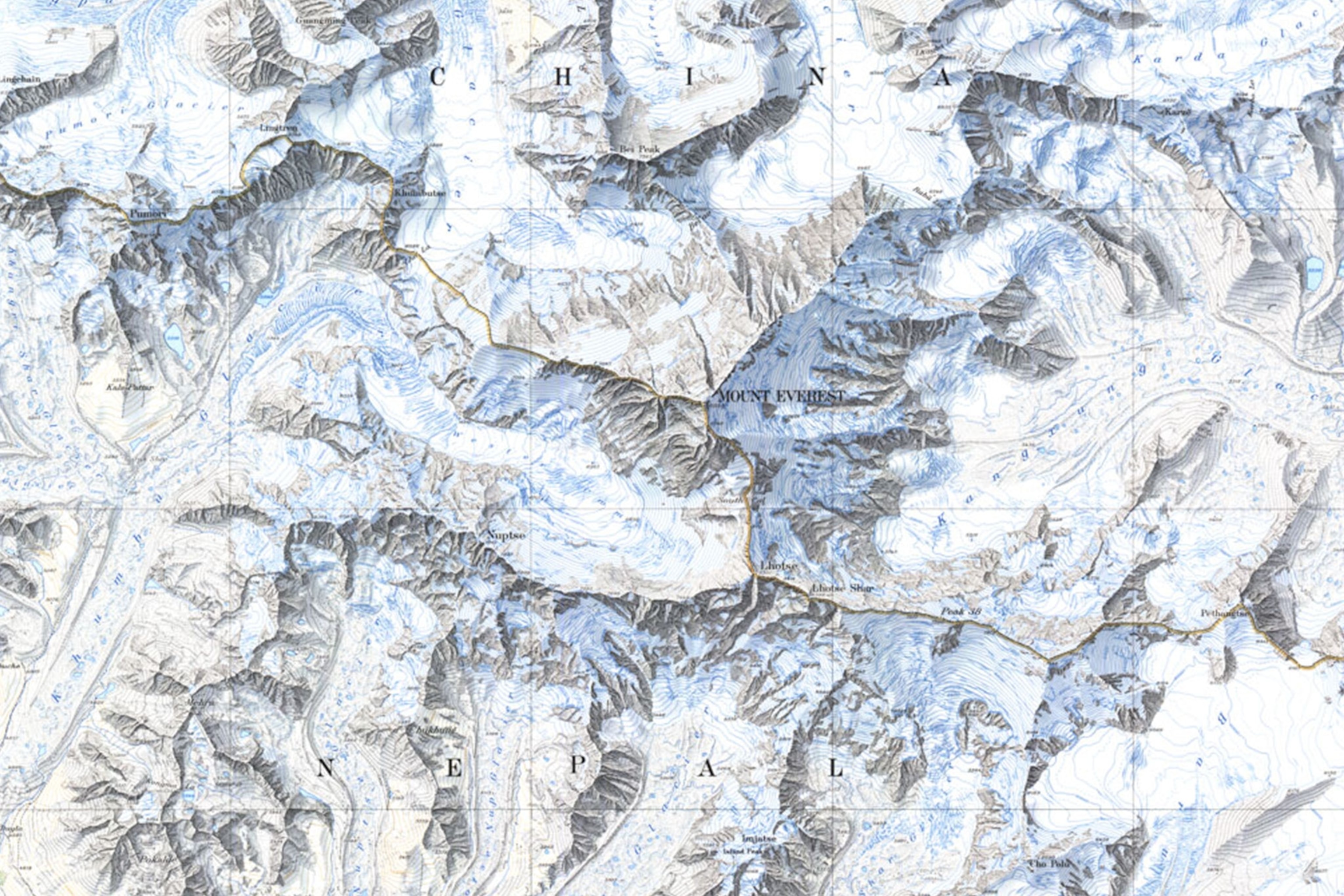
Hillary’s account was accompanied by a map of the historic climbing route, part of a long and prolific history of mapping Everest at National Geographic. In celebration of that first ascent, we’re mining the magazine’s archive of more than 6,000 maps to highlight some of the wonderful cartography inspired by Earth’s tallest peak.
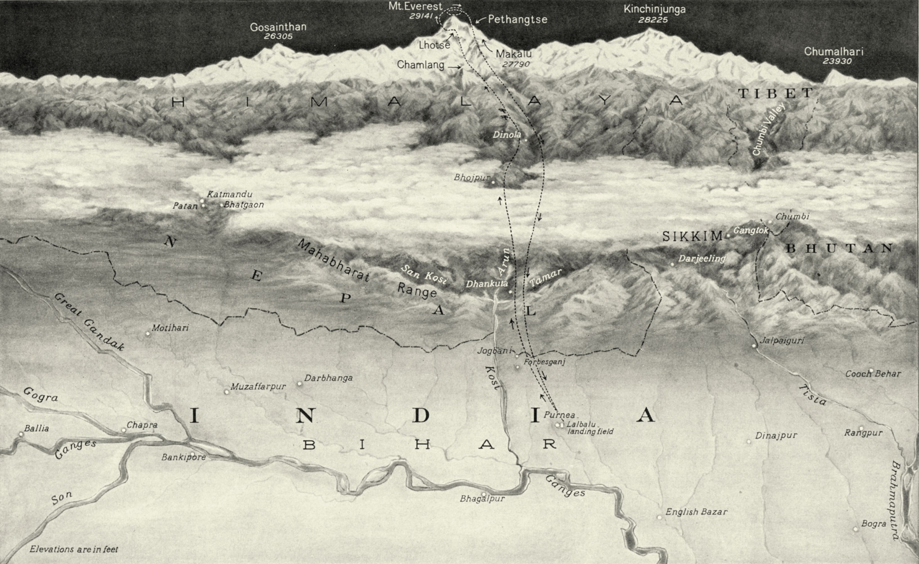
The first map of Everest to appear in the magazine, featured in August 1933, accompanied an account of the first flight over the mountain. “Ever since it was discovered, in 1852, to be the highest mountain in the world, Mount Everest has exercised a hypnotic fascination for explorers,” it begins. That fascination has made the mountain a perennial subject for National Geographic magazine.

In 1963, National Geographic sponsored the first successful American expedition to climb Everest. The magazine turned to Heinrich Berann, one of its most capable artists, to create a beautiful panorama of the mountain—mapping the two routes that six expedition members took to the top, including one along the West Ridge that hadn’t yet been completed. In order to get the detail he needed for the project, Berann chartered an airplane to fly him around the peak. His iconic illustration brings out both the beauty and fierceness of the terrain.
Three years later, Berann made an even more ambitious painting of the Himalaya, one he considered the “crowning achievement of my 25 years of panoramic activity.” The gorgeous painting is based on more than 100 mapping photographs taken by a climber, as well as Berann’s own observations. It took 600 hours to create the “Sky World of the Himalayas” panorama.
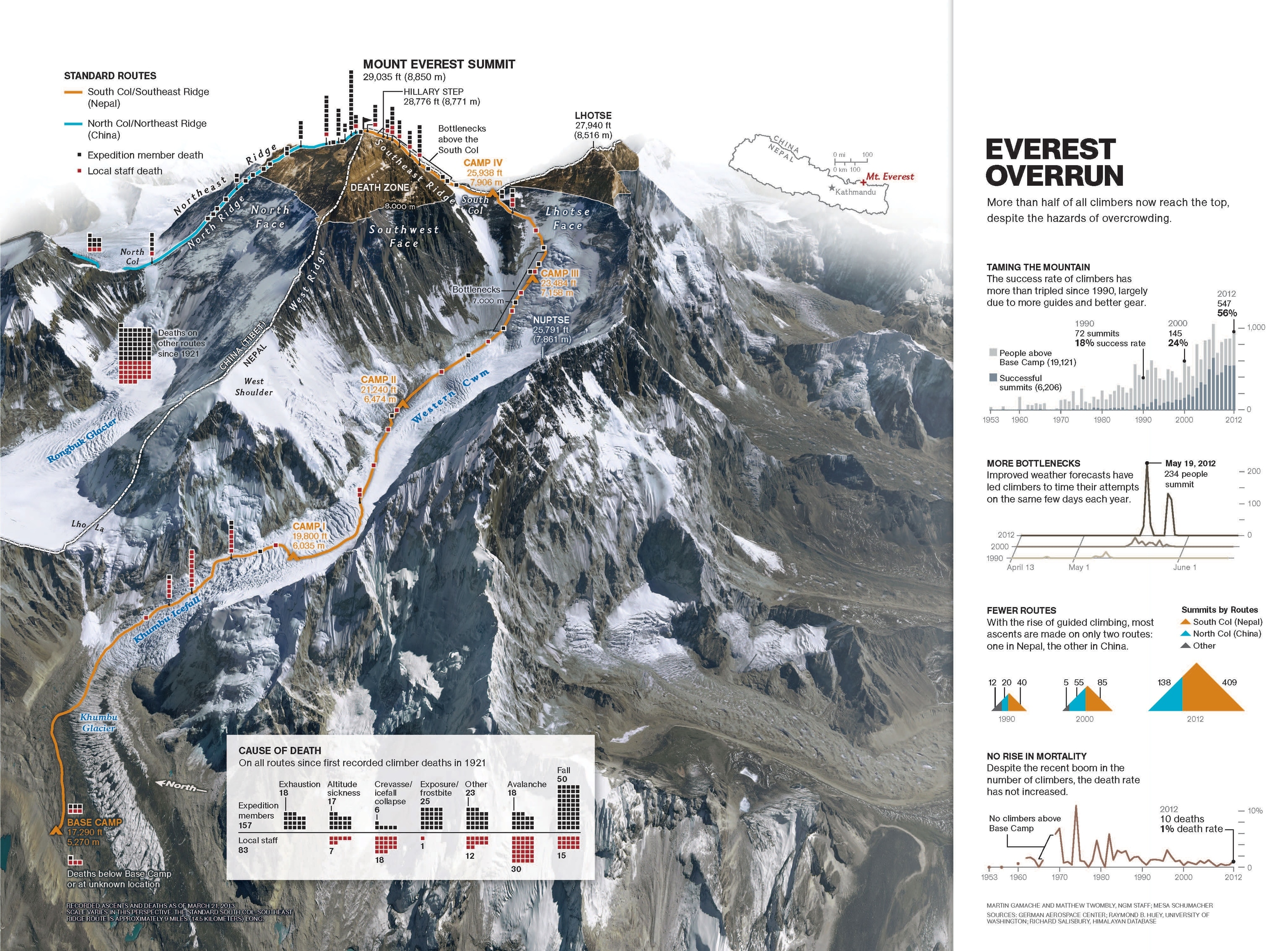
One of National Geographic’s most recent maps of Everest, published in June 2013, explores how the mountain’s rising popularity with climbers has yielded record numbers of successful summit attempts, but also resulted in overcrowding and bottlenecks on the most popular routes. The map notes that despite the increase in traffic, the death rate remained unchanged. Unfortunately that would soon change with the mountain’s deadliest years ever in 2014 and 2015.
Even with the danger, Everest continues to inspire explorers and capture our imaginations—and National Geographic will continue to map the world’s loftiest peak and the expeditions that seek to reach its summit.
Stay tuned for more stories about National Geographic’s editorial map archive here on All Over the Map. And to discover a new map every day from the National Geographic archive, follow @NatGeoMaps on Instagram, Twitter, and Facebook.
