Have we been measuring mountains all wrong?
A new method for quantifying grandeur is reshuffling the pecking order of the planet’s most impressive peaks. Turns out Everest has steep competition.
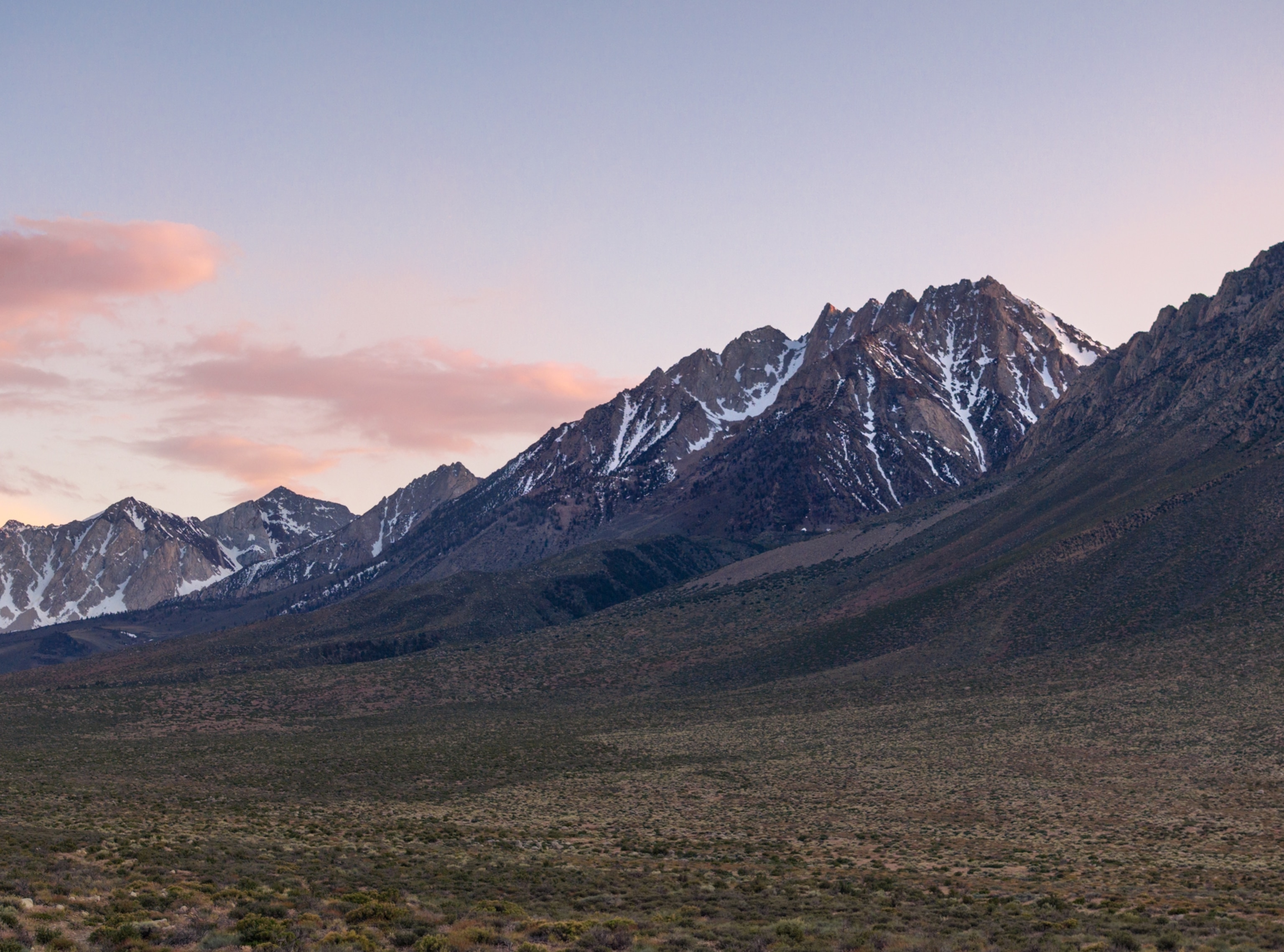
When Kai Xu was 19 years old, the summer before starting his sophomore year at Yale University, he found himself staring up in wonder from the base of Mount Tom, a 13,652-foot peak in California’s Eastern Sierra Nevada range. Ever since childhood, he had been fascinated by mountains: They influence the weather. They birth rivers. In elementary school, he would spend hours scrolling through Google Earth, zooming in on well-known peaks, poring over their contours and elevations.
He had read all about the Eastern Sierra escarpment, how its length and steepness made for one of America’s most stunning views. But even though he lived just a few hours away, in the Bay Area, this was the first time he had gone to see it.
He found the view more extraordinary than any description could impart.
“I was just captivated by what I was seeing,” says Xu, who’s now 23. In front of him, the granite faces heaved up from the Owens Valley floor like a colossal barricade. He had never laid eyes on the Himalaya or the Andes or any of the world’s largest mountains, but he couldn’t have been more impressed if he had.
At the time, Xu was a double major in applied mathematics and computer science; these days he’s a comp-sci doctoral student at New York University. And as he stood there in the Sierras, he couldn’t help seeking an algorithmic explanation for his awe. “Is there a way to measure this?” he wondered. “How do you do justice to the dramatic allure of these really impressive peaks?”
What he came up with—after a year of researching, programming, and calculating—is nothing less than a whole new way of measuring mountains. His system takes into account both a mountain’s height above its surroundings and the steepness of its rise, then spits out a single objective calculation that Xu has named jut—as in, how abruptly does a rock face jut into the sky? How magnificent is that relief to gaze up at?
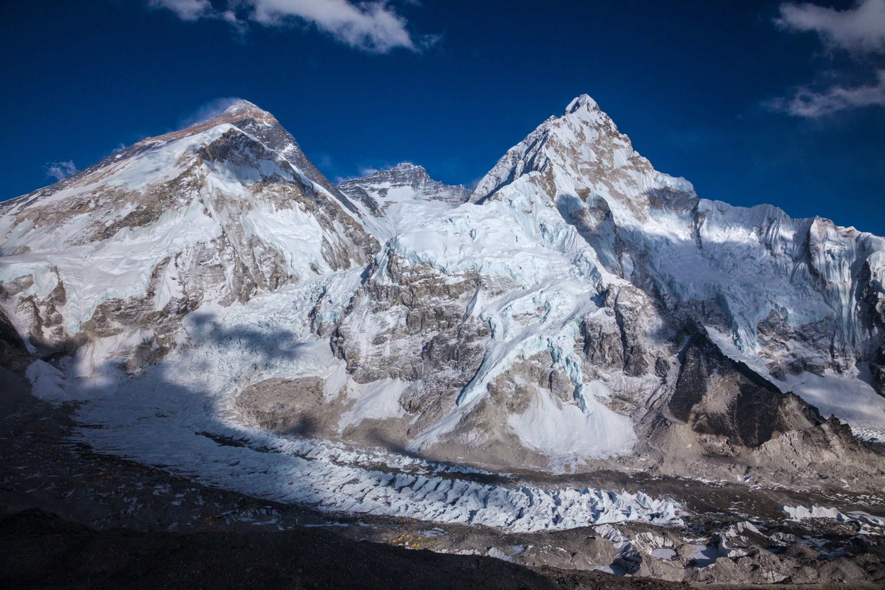
It is essentially a method of quantifying grandeur, one that looks at 29,032-foot Mount Everest, does some arithmetic, and ranks the world’s ostensibly loftiest peak a paltry 46th. And since Xu began fervently hyping it online three years ago, the new metric has reignited old debates among mountaineers, hikers, and geographers over exactly what it is that makes a mountain great. To its fans, jut is a provocative reassessment of cherished summits—a reallocator of bragging rights and a novel way to discover little-known peaks worth adventuring to.
Where jut may rankle some traditionalists is in its dismissal of the one attribute that generations of peak baggers have tended to value above all others: a summit’s height above sea level. When Xu got home from the Sierras, he started thinking about Half Dome, in Yosemite National Park, one of the Yosemite Valley’s more diminutive peaks at just 8,842 feet above sea level. But Half Dome is capped with a roughly 2,000-foot sheer granite face that stands out starkly against the Sierra Nevada skyline, making it one of the most picturesque mountains in North America. Some four million people line up in front of it each year to stare and take pictures.
By contrast, Xu considered Dome Argus, the highest point in East Antarctica. It tops out at 13,428 feet but rises extremely gently over hundreds of miles. You could stand on top of it and not necessarily recognize it as a mountain. Clearly, Xu thought, a peak’s elevation does not explain its wow factor.
So that fall, when he got back to Yale, he set out to devise an equation that would—and in the process, he rearranged the hierarchy of the planet’s mightiest mountains and introduced a smart new tool for seeking them out.
Xu is only the latest in a long line of scientists and adventurers to challenge conventional wisdom about orometry, the science of mountain measurement. In the fourth century B.C., the Greek thinker Dicaearchus is said to have used a crude surveying instrument called a dioptra to prove to his peers that the Hellenic peaks weren’t large enough to affect the planet’s overall roundness. The 11th-century Persian scholar Al-Biruni used trigonometry to measure mountains more accurately, and his method was still in vogue a few hundred years later, when Europeans started poking around the Andes, declaring a succession of mountains to be Earth’s highest.
But the most ambitious effort to measure mountains began in 1802, when the British launched the 70-year Great Trigonometrical Survey of India, which eventually revealed that the Himalaya loomed larger than any other range. Crews hacked through jungles toting massive angle-measuring instruments called theodolites—some weighing more than 1,000 pounds—and established a network of survey stations that stretched 1,600 miles. George Everest, who led the effort for 20 years, probably never saw the peak later named for him. But his labors—and those of his peers—laid the groundwork for modern methods of measuring the planet’s surface.
Then came the golden age of alpinism, in the mid-19th century. And in the 20th, as mountaineering grew more popular and competitive, debates flared up among alpinists over the relative stature of the great peaks. In the 1960s, a well-known mountaineer named Terris Moore made a case that because of the planet’s equatorial bulge, a mountain might be better measured from the Earth’s center than from sea level. Beginning in the 1980s, some climbers took to privileging the concept of prominence, a measure that ignores sea level and assesses a peak’s height relative to its surrounding terrain.

Xu, looking for his own alternative benchmark to sea level, took inspiration from both prominence and a more recent metric known as ORS: omnidirectional relief and steepness. Devised in 2002 by David Metzler and Edward Earl, a mathematician-and-climber duo, it’s a complex formula most easily understood as gauging how dramatically land falls away around you when you’re standing on a summit—the expansiveness of that 360-degree view.
But none of these gave Xu quite what he wanted: a measure of the impression of tallness, of how majestically a peak seems to loom when admired from its most impressive vantage point.
Xu started by borrowing an idea from Metzler and Earl, that a mountain’s impressiveness is a function of both its height above its surroundings and its steepness. Then he developed an equation that, roughly speaking, takes the vertical distance between a summit and any given point, then reduces that number based on the angle of view. Xu calls the resulting value “angle-reduced height”—or sometimes simply “viewpoint impressiveness.”
The math is intricate, but the concept is straightforward: Imagine standing right beneath a perfectly vertical 1,000-foot cliff, craning your neck straight up at the summit. From that spot, the viewpoint-impressiveness value would be a straightforward 1,000 feet. But looking at that same summit from farther away, at a 45-degree angle, it would seem less impressive, and the number would shrink accordingly. Meanwhile, a view of the summit from someplace on the mountain might have a steeper angle but so little height as to make the number lower still. The trick is in finding the sweet spot.
So next, Xu turned to the Google Earth Engine, with its vast catalog of geospatial data, to calculate the one spot for any given mountain where his new formula would churn out the highest possible value for viewpoint impressiveness. Xu calls that spot a mountain’s base—and in theory, it’s the optimal vantage point for looking up at a peak, the source of the most breathtaking view. The maximized value is what Xu calls a mountain’s jut. And it took Google’s platform less than a week to compute it for some 200,000 mountains around the world.
About a year after his visit to the Sierras, Xu published a paper detailing his new metric on arXiv.org, a respected, Cornell University-maintained platform for scholarly math and science papers. The next spring, he launched peakjut.com, where users can surf customizable lists of mountains ranked by jut, search by location for high-jut peaks, and find coordinates for a mountain’s most impressive viewpoint.
To get the word out, Xu took to promoting jut on mountaineering and geography boards on the online forum Reddit. Posting with the handle Gigitoe (a gibberish word his mom made up), he set out to explain how his new system worked. He ranked well-known mountains by their jut, shared maps of the highest-jut peaks by country and state, and posted lists with titles like “Incredibly Impressive Mountains with an Unremarkable Elevation.” His posts, over time, garnered thousands of comments. He compared photos to show how a peak like Wyoming’s Grand Teton—13,770 feet above sea level, with 3,462 feet of jut—is clearly a more stirring sight than some taller peaks, such as Colorado’s Mount Elbert, that state’s high point at 14,433 feet but with only 1,412 feet of jut.
And of course, Xu crowned a new most magnificent mountain. When he crunched the numbers, it turned out none of the planet’s five highest peaks above sea level cracked the top five for jut. The world’s actual most impressive summit? Annapurna Fang, a 25,089-foot Himalayan peak with 11,1194 feet of jut—towering over Everest, figuratively speaking, with its measly 7,293 feet.
Xu posted so often and so enthusiastically that visitors to some forums took to calling him “the jut guy” and cracked wise about his proselytizing. (“Have you heard about our lord and savior Jut?” joked one Redditor.) And the new metric wasn’t without its detractors. Some argued height should play a bigger role in calculating impressiveness. Others simply took umbrage with their favorite peaks’ rankings. (“I’m not sure I can agree with any indicator that puts Fitz Roy below Denali.” “Celo Knob more impressive than Pilot Mountain? Pfft.”)
But for the most part, online alpine buffs have been enthusiastic. Many seemed to recognize in jut an elegant way of capturing a quality they’d lacked a way to express. “When I first started reading this, I thought ‘aw just some wack job on Reddit making stuff up again,’” begins a characteristic response to one of Xu’s posts. “But as I kept reading, I realized you’ve basically solved classifying mountains. Like there’s all these measures: elevation, prominence, etc. etc., but none of them tell you how … for lack of a better word, badass a mountain is. And that’s what people wanna know!”
And before long, Xu was hearing from hikers and climbers using jut to seek out places where that kind of rugged splendor had gone overlooked.
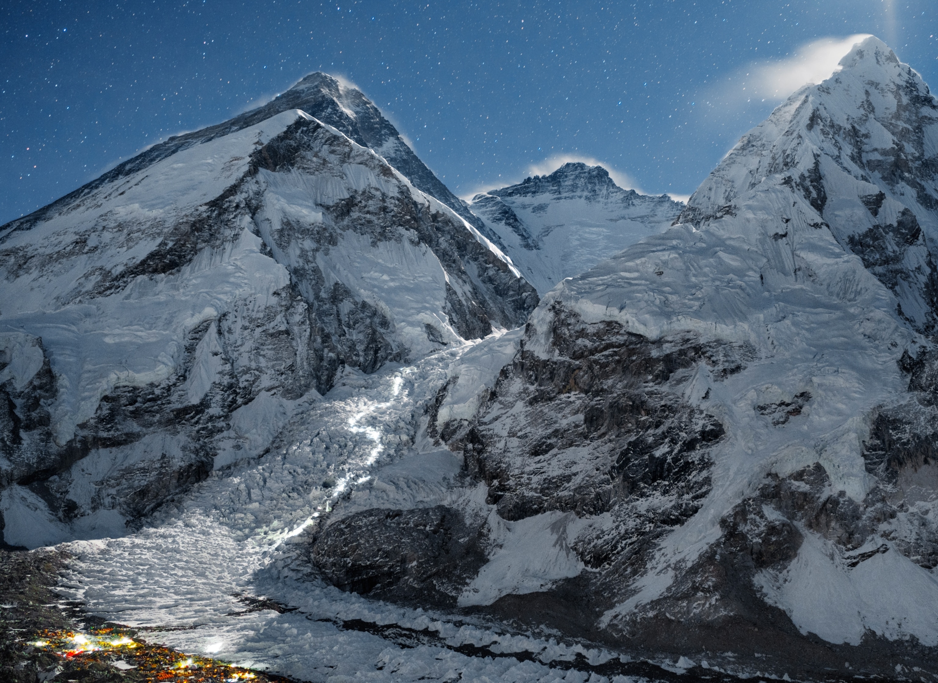
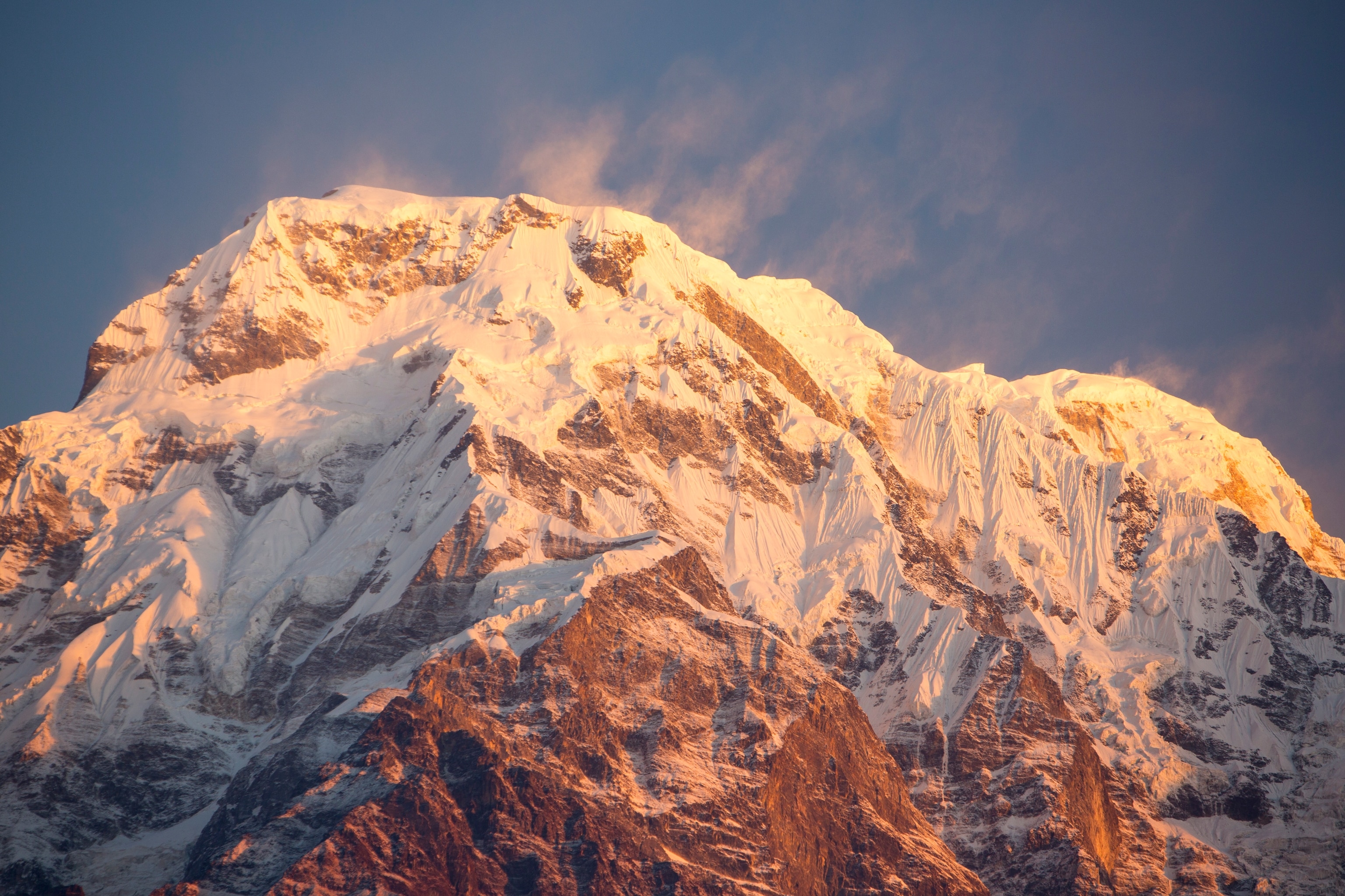
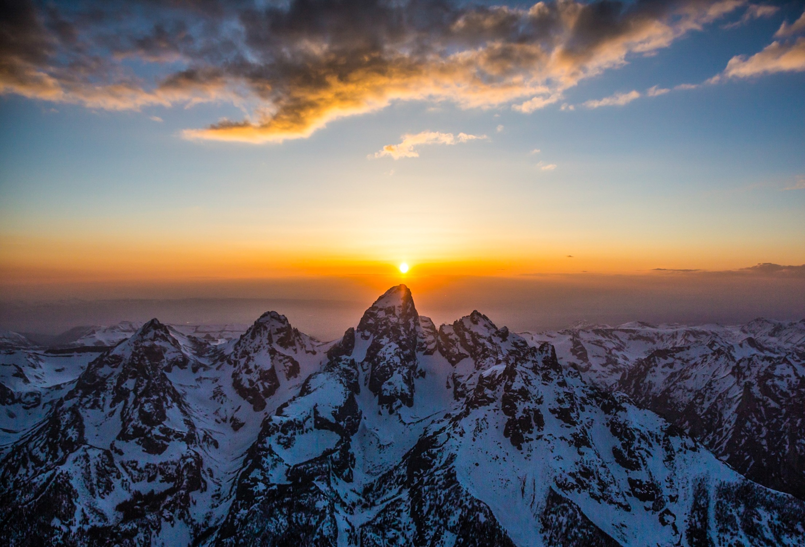
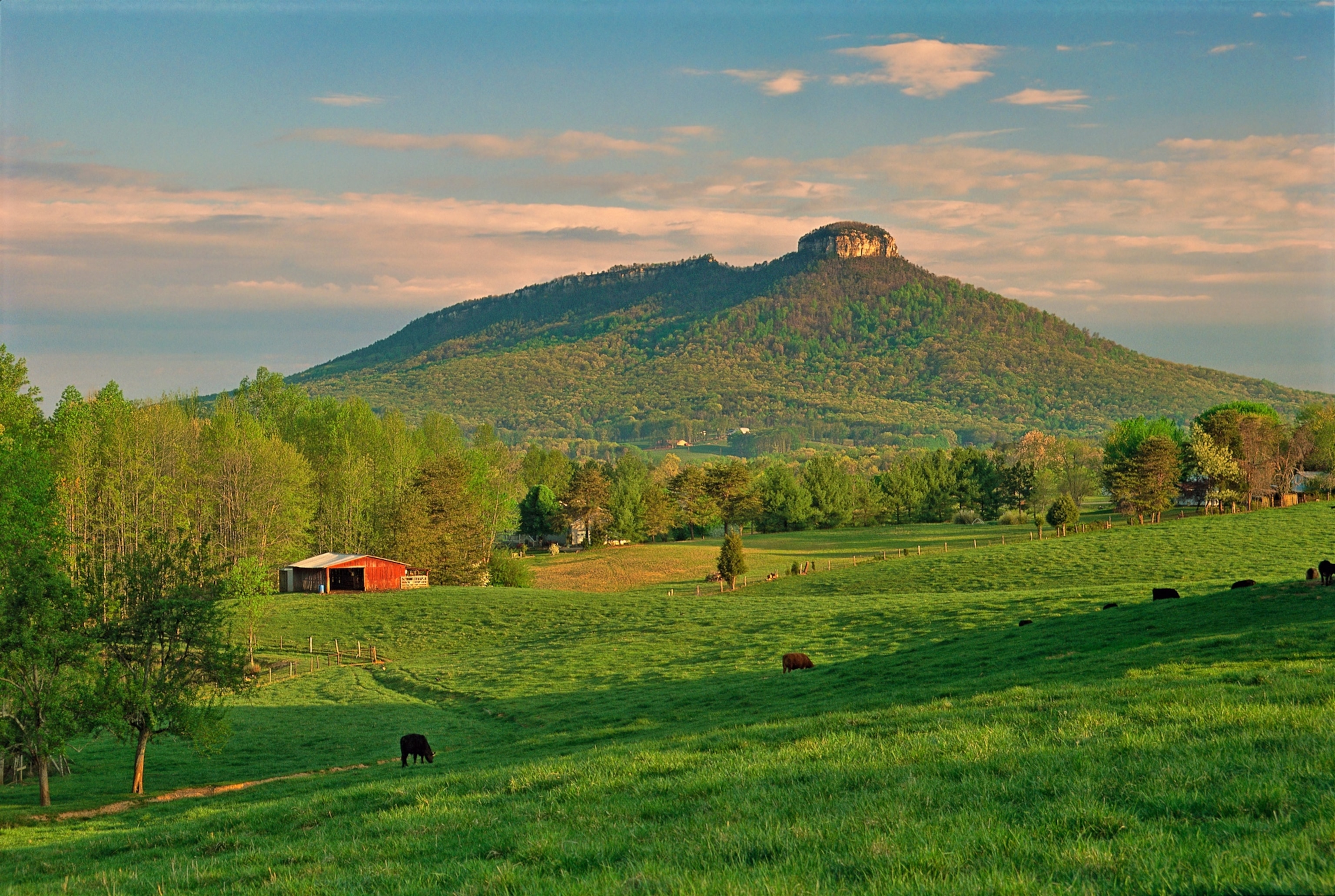
Xu didn’t set out to create a travel-planning tool. When he first published his academic paper outlining jut’s mechanics, he thought the measure’s most practical application might be extraterrestrial. “Celestial bodies lack a sea level,” he points out. “How do we define what is zero elevation?” Jut, he thinks, can provide scientists with an objective framework to describe mountains on other planets.
As it happens, NASA already employs a method similar to jut for exactly this purpose, says Kevin Hand, an astrobiologist at NASA’s Jet Propulsion Lab and director of its Ocean Worlds Lab. The math used to analyze terrain while steering a Mars rover, Hand says, is more complicated than Xu’s formula. But he gives jut high marks all the same, for a different reason.
“Kai’s metric helps determine the most jaw-dropping viewpoint from which to gaze at a mountaintop,” he says. “And that’s part of why we head out into the mountains in the first place—we’re seeking out awe and wonder in nature, and we’re inspired to explore and discover those new vistas.”
Jut, it turns out, is indeed already inspiring exploration. “People have written to me and told me they changed their travel plans based on jut,” Xu says. “They wanted to visit some of these very impressive mountains.” And jut’s designation of most impressive viewpoints gives it a use for non-alpinists that other mountain measures, like prominence or ORS, don’t have. You may never lay eyes on Annapurna or many of the world’s juttiest peaks, but Xu’s website can steer you to some of the best mountain views in your own backyard—even give you coordinates for where you might take that Instagram photo.
“It’s a good number for showing how big the mountain looks in your camera,” says Andrew Kirmse, a former engineering director of Google Earth. In 2017, Kirmse calculated the prominence of every mountain in the world and published an academic paper about it. He learned about jut when Xu, not long after publishing his paper, asked to pick his brain over coffee. “People are always interested in which mountains to climb,” Kirmse says. “The very uninteresting answer is to climb all the highest ones.”
A trip to the mountains inspired Xu to share his ideas about jut; now a community of its fans share ideas with Xu about how to make jut even more useful and engaging. Around a year ago, Xu got an email from a software developer and backpacker named Noah Lomas, a 22-year-old living in Boise, Idaho. Xu’s work, Lomas said, had prompted him to learn to code in Google Earth Engine, and he’d started creating a worldwide “heat map” of jut. Xu added it to his site earlier this year: an interactive Google Maps layer that shows high points lit up in green, yellow, orange, or red as their jut climbs. Click a peak on the map and the site spits out coordinates for its allegedly most impressive viewpoint.
One day, while Lomas was idly scrolling through Mexico, he noticed a spot where the map lit up bright orange. The mountain he was looking at was in the Sierra Mazateca region, near the border of Puebla and Oaxaca—and for all his Googling, he could find precious few details about it. Had its dramatic face ever been climbed? The moment opened his eyes to the obscure spots that jut can help would-be adventurers discover. “The only reason we know about this spectacular piece of geography,” Lomas says, “is because of the jut map.”
Xu is just happy to see jut making inroads, whether it’s leading people to new peaks or new appreciations of old ones. “Ultimately,” he says, “I’d like people to look at the world from a different perspective.” Lately, he’s been head down on his Ph.D., studying artificial intelligence. But even in the lab, Xu finds his thoughts drifting back to geography, to how AI could scan maps, photos, and online mentions to reveal the kinds of peaks that only locals know about—remote subranges and unnamed summits. As AI applications go, that may seem like a small thing. But to Xu, it would be huge.
