Testing Panama's Waters by Foldable Kayak
On their circumnavigation of a Caribbean island, Young Explorers Becca Skinner and Clare Fieseler wrestle with overloaded kayaks and accidentally forget the GPS.
“I can’t even remember the last time I kayaked,” I thought to myself as I pulled my boat into the turquoise water. It probably wasn’t the best thing to realize before a four-day trip to attempt to circumnavigate an island off the coast of Panama.
When my friend Clare Fieseler, a marine ecologist and National Geographic explorer living in Panama, came up with the idea to kayak around Bastimentos, there were a lot of unknowns. This trip, the “test expedition,” was born out of the idea of completing a challenging goal with smaller consequences to prepare for a circumnavigation of a larger Caribbean island next year.
Clare and I were starting from square one on many levels. For starters, to our knowledge, no one had done a trip to this scale around the island. For good reason, too. If the weather didn’t cooperate, we could be pulled into the open Caribbean and its brutal waves, making that side of Bastimentos virtually impassable. We checked the weather meticulously.
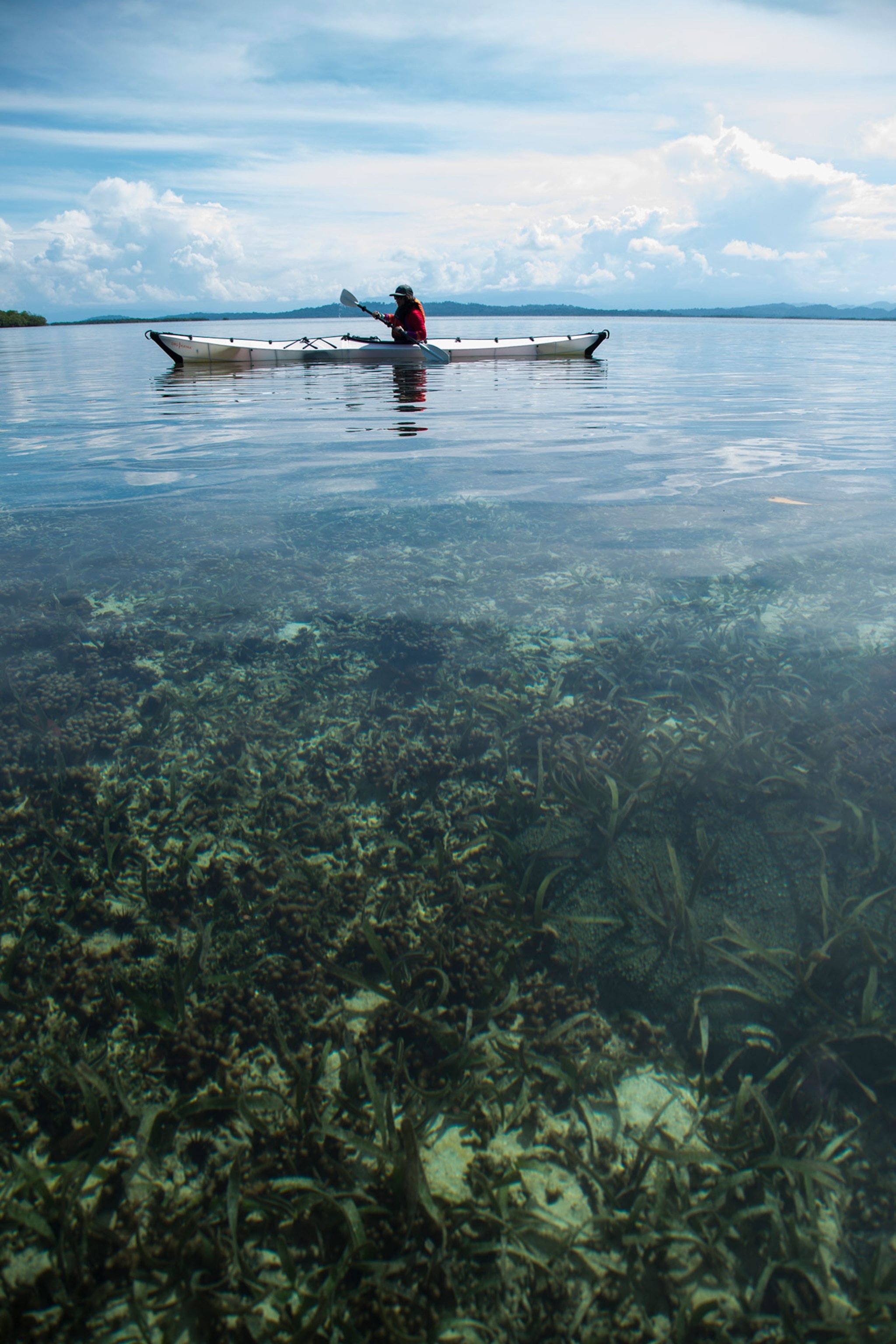
Secondly, our kayaks hadn’t been on the market for long. Despite their incredible ability to collapse into a four-by-three box and unfurl into 16-foot boats, we only had a rough idea of what their carrying capacity was. Neither one of us had ever used one or had even opened up the boxes until we reached our starting point.
The biggest unknown was how we would work together. We had only been friends for three months after meeting at a National Geographic event. I’ve been on enough trips to know your friends don’t always make the best expedition partners, so jumping right into a serious mission would be telling of how we would move forward.
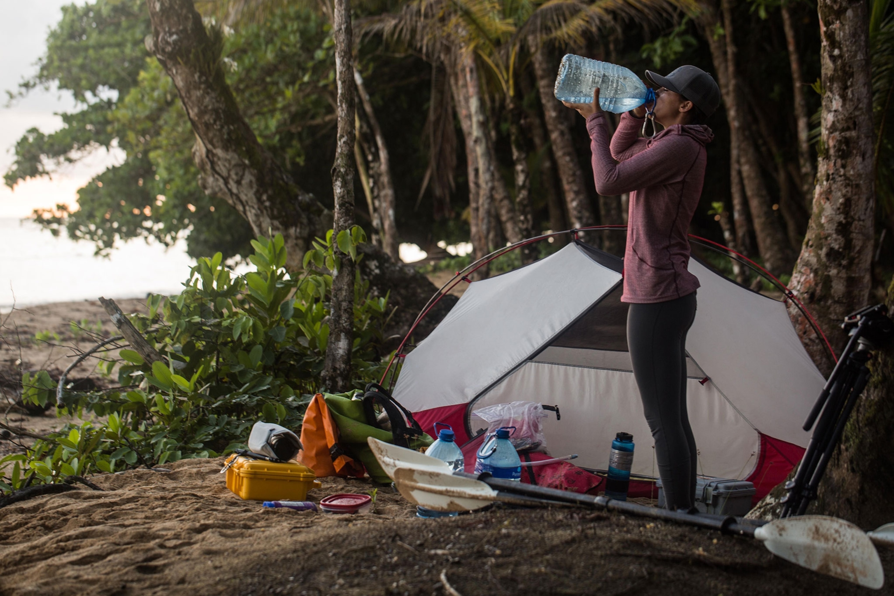
Lastly, these Oru Kayaks hadn’t been tested in tropical waters on a multiday trip. Though our test expedition wouldn’t be entirely self-supported, we would need to haul our water with us. In the heat of the Panamanian sun, with high humidity, that meant 20 liters of water for the both of us per day. We would also be bringing a full set of camera equipment, plus food and camping gear. The weight visibly started to add up.
We had to narrow the gear list down. But what do you cut when you’re already traveling with minimal gear? Definitely not the camera kit. Or the dry bags, or sunscreen or water. It came down to our food. We whittled it down to the necessities: cheese, peanut butter, apples, bread, and a small bottle of rum.

This culmination of unknowns on our circumnavigation would give us a baseline for what was working (and what wasn’t) in an effort to prepare for the true expedition the following year. We wanted to leave room for mistakes, surprises, and failures. We hoped it would answer a series of questions.
Clare and I stayed up too late the night before we launched, trying to get everything ready on a nearby island, Bocas Del Toro. Between our swatting at mosquitos and foregoing the instruction video, it took us a few hours to put the kayaks together. Finally, we fell asleep in the early hours of the morning, dreading the effects of lack of sleep before our sunrise departure.
The next morning, saltwater sprayed onto my arms as we got jetboated to our starting point on Bastimentos. We had made the collective call to sleep for an additional hour. Both of us had been deprived of sleep for the past month, as I was on an expedition in Canada and Clare had been working on her research.
This was one of the best parts of a test expedition: There are no rules. You adapt, you put out small fires along the way and figure out alternatives. Our test expedition began with one extra hour of sleep for health benefits.
As we waved goodbye to the jet boat, we sat alone on the dock, looking at our stuff and looking at the boats, fingers crossed they would actually float.

And they did! But a few hours into paddling I was so tired, I silently wished my arms would fall off. The current was pushing me harder on my left side and I could feel my kayak going with the pull, away from the island. I fought hard to keep the tip of the boat in the right direction.
Clare had downloaded the topographic map onto the GPS to make route finding easier. Although we could see Bastimentos the whole time, the mangroves are thick on the coastline and can make finding an entrance into a camping location difficult.
- National Geographic Expeditions
“Hey, can you look at the GPS to see how much farther we have to go?” I asked Clare. I was anxious to get to our first landing spot: a fishing lodge called Tranquilo Bay on the southern tip of the island.
“I thought you had it,” she responded. Confused, we both looked at each other.
In the midst of packing, finishing emails, and setting up the boats, we had forgotten the GPS on the table at home.
Now, miles away from the coast, we decided to push on without it.
Read part two tomorrow.


