Top 10 Trail Runs in the U.S. Parks
Whether the jogging path is in the heart of a high desert or a refreshing run on a New England trail shaded by sycamores and elms, there are thousands of terrific trails. Due to the nature of the activity, runners love getting out to enjoy the great outdoors—which makes their sport and America’s national parks a perfect match.
- Lake Mead National Recreation Area, ArizonaLakeshore Drive and Northshore RoadAt Arizona’s Lake Mead, hard-core runners looking for places to test their endurance will find plenty of trails leading into fantastic canyons. Most casual runners, however, are attracted to the popular area surrounding the southwest shores of sinuous Lake Mead. As a natural energizer, 11-mile Lakeshore Drive and the southern portion of Northshore Road offer pavement for firm footing as well as a perpetually scenic panorama of the lake’s clear blue waters framed against colorful distant hills and mountains. There’s no separate jogging lane, so stretch out and keep one eye on traffic from Boulder Beach along long, loping blacktop that continues into the hills or down to the shore. Considering the heat of the Mojave Desert can bake this national recreation area (desert temperatures can reach 120°F in the shade), this may be a run better saved for fall or spring when the mercury drops into the comfortable 50s and 60s.
- Rock Creek Park, Washington D.C.Western Ridge Trail and Valley TrailWashington, D.C., isn’t just for politicians. Runners, too, can find much to enjoy, including several choice trails in Rock Creek Park, one of the oldest federal parks (established 1890). At just over 1,700 acres (twice that of Central Park), Rock Creek Park packs in an impressive 20 miles of dirt trails that usher runners into an assortment of tree-lined paths along wooded hillsides, ridges, and valleys that are perfect for easy hiking or a gentle jog. The blaze-marked single-track Western Ridge Trail and Valley Trail are both well suited for runners ready for a moderate workout, not a marathon. For a little more elbow room, trot onto one of the wider trails that double as equestrian trails (so watch your step), or drop down to the paved multipurpose path that parallels the park’s eponymous stream. By using connector trails and roads, it is possible to make short and large loop runs. In addition, many trails branch out of the park into nearby D.C. neighborhoods, such as Dumbarton Oaks and Palisades Park, as well as into the Maryland suburbs.
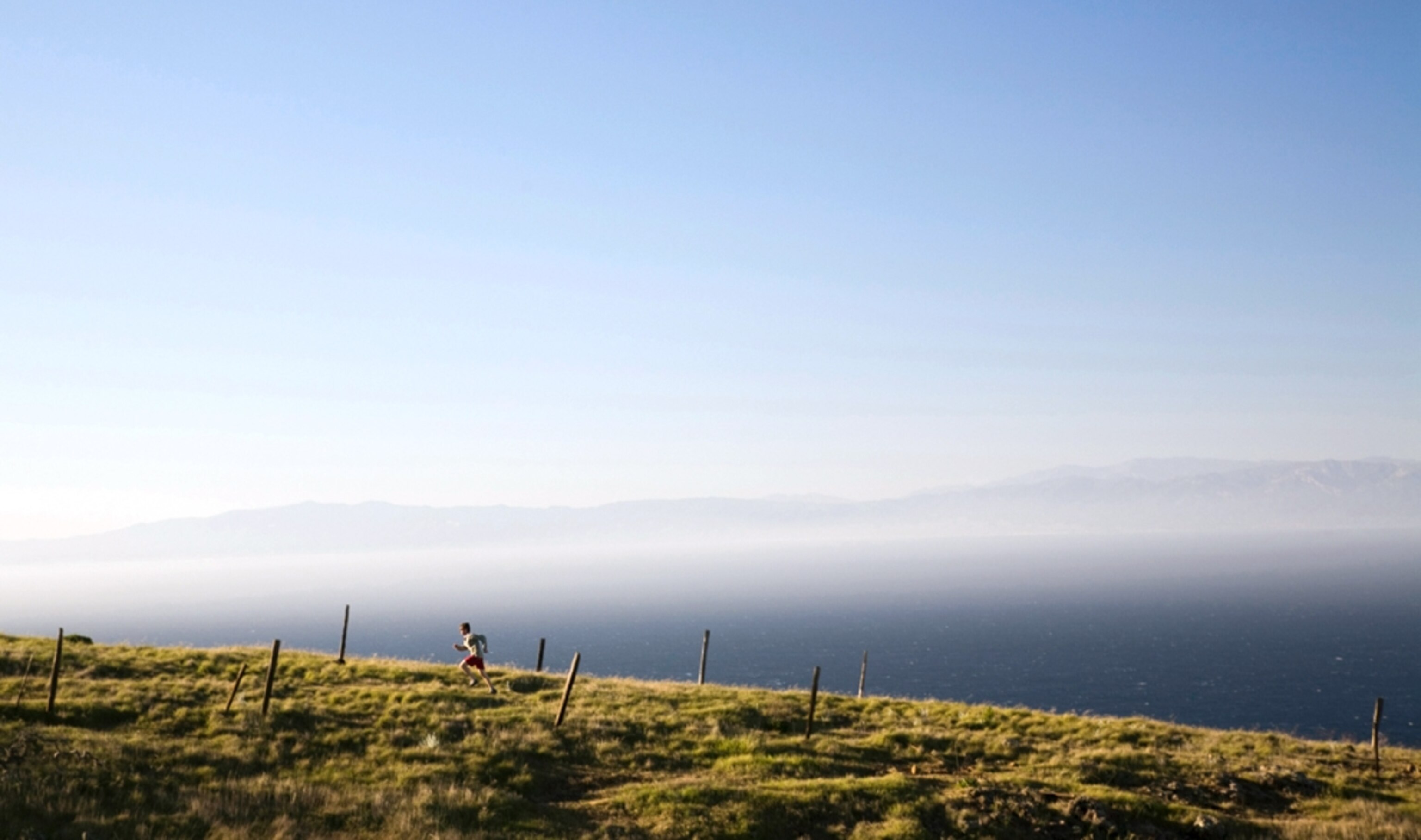
- Golden Gate National Recreation Area, CaliforniaMarin HeadlandsWith the twin icons of San Francisco and the Golden Gate Bridge providing inspiration (and a water bottle providing hydration), the maze of trails in the Marin Headlands is a trail runner’s delight, offering myriad runs. One option is to scale a solid section of the Coastal Trail from Rodeo Beach, climbing into the headlands and cresting out along Wolf Ridge, then descend on the Miwok Trail to find a way through the Tennessee Valley. Another option from Rodeo Beach is to head south around Rodeo Lagoon and capture sections of the coast en route to water’s edge at the Point Bonita Lighthouse. Both runs are out-and-back routes, but with a map it is possible to create any number of loops, and of any distance one could possibly desire. If the body’s running on autopilot, try to take in the setting’s spectacular remoteness, the hills and fields that accent windswept cliffs overlooking the grand Pacific Ocean. It’s worth the time spent training.
- Channel Islands National Park, CaliforniaIsland TrailsA quintet of islands (Anacapa, Santa Cruz, Santa Rosa, San Miguel, and Santa Barbara) makes up Channel Islands National Park, and each is proud to promote hiking trails that alternate between smooth and steady and rough and rugged. For runners, this means the trails are more suited to experienced cross-country runners, surefooted and well-balanced runners who can negotiate the trails at a steady clip. Most of the islands have trails that range from easy to strenuous, with the easy ones sticking to coastal areas and the strenuous ones often venturing into the mountainous interiors. As an added bonus, coastal trails offer the opportunity to see marine wildlife. Trails range between 2 and 20 miles, and on the largest of the five islands, 62,000-acre Santa Cruz, several trails on the northern coast provide views of beaches, ocean, mountains, and cliffs that create a classic California backdrop. It is only possible to reach the islands via boat or plane; the trip can take one to three hours.
- Valley Forge National Historical Park, PennsylvaniaOuter Line Drive Multipurpose PathThere’s not only history at Pennsylvania’s Valley Forge, but an opportunity for a pleasing run along a wonderful loop road. The scenery protected within the boundaries of Valley Forge—from the cannon and monuments to the restored headquarters of George Washington—is so impressive and this land so bucolic that it’s a challenge to picture the grounds as they were in the winter of 1777-8, when George Washington and his Continental Army toughed it out for several harsh winter months. Starting near the visitor center, the 6.6-mile Joseph P. Martin Trail, a wide, paved multipurpose path, parallels the scenic North and South Outer Line Drives, providing a perfect avenue for bicyclists and joggers. Sweeping across rolling hills and past re-creations of cabins troops constructed to shelter themselves from the snow and sleet, the path stretches from the visitor center past the magnificent National Memorial Arch and on to Knox’s Quarters. The trail connects with other trails to make a loop of the park’s windswept fields, filled with deer and birdsong.
- Muir Woods National Monument, CaliforniaDipsea TrailWhen even motorcyclists find this coast region’s paved roads challenging, imagine what joggers feel when they take on the jittery single-track trails of Muir Woods. Snaking in and out of the national monument, the Dipsea Trail is one of the most challenging trails in the nation. Each year the single-track terror attracts hundreds of contestants to a century-old race famed for its utter punishment of runners. With a vertical ascent of more than 2,200 feet over its 7.1-mile length from the town of Mill Valley to Stinson Beach, prepare for demanding climbs—including three sets of stairs, together numbering more than 600 steps—and the obstacles of rocks and roots and branches and slopes that are alternately grueling and, when conquered, rewarding. Runners should pace themselves and enjoy the scenery (walk if need be; many runners do in places); focus on the cooling pleasures of the old-growth coastal redwood forest—the only one in the San Francisco Bay area—and soak in the awe-inspiring Pacific Ocean views at Stinson Beach.
- Cape Hatteras National Seashore, North CarolinaLighthouse BeachThe coastline of North Carolina’s Outer Banks is a natural jogging trail for runners. Finding the optimal stretch of strand to sample would be difficult were it not for the Cape Hatteras Lighthouse. At 198 feet this beacon, one of three within the park boundaries, is the tallest lighthouse in the United States. It's an iconic image, aand the chance to run in its shadow is the “OBX” (Outer Banks) equivalent of a Paris jog around the Eiffel Tower. Although eroding sands necessitated its move a quarter-mile inland in 2000, the shoreline is still close enough to start the day with a sunrise beach run here, or perhaps return at dusk for a brisk shoreline jog in the pulsing glow of its powerful light.
- Rocky Mountain National Park, ColoradoLoch ValeThe thrill of running in the Colorado Rockies is not only in the sights, but in the challenge. The six-mile round-trip run around Loch Vale begins at the already thin-air altitude of 9,240 feet before scampering as high as 10,210 feet. The reward, of course, is the pure joy of being here, where the waters of Andrews Creek and Icy Brook flow from Andrews Glacier and Taylor Glacier into the Loch, a subalpine lake as picturesque as one can imagine, with emerald green aspens and evergreens framing the sapphire blue lake. From the Glacier Gorge Trailhead the moderately difficult trail climbs past Alberta Falls through a gorge to Glacier Junction where, incredibly, two glacial valleys have converged. The trail then clears Icy Brook and springs ahead through a series of switchbacks that climb up through Loch Vale toward the waters of the lake. The ultimate reward: even more spectacular views of an unspoiled American wilderness.
- Lewis and Clark National Historic Park, OregonFort to Sea Trail: In the Footsteps of the Corps of Discovery:It was quite a challenge for 28-year-old Meriwether Lewis and 32-year-old William Clark to cross the country and reach the Pacific in December 1805, but a run in this historic park that honors their achievement is nowhere near as exhausting. This national park shares the accomplishments of the explorers with nearby state parks and preserves in both Oregon and Washington, so options are not limited to these trails alone. In Oregon, the Fort to Sea Trail runs between Fort Clatsop, the winter encampment for the Corps of Discovery, and Sunset Beach on the Pacific coast. On the gentle 6.5-mile trail, one appreciates the beauty of the Pacific Northwest, particularly in trees that seem heroically large and landscapes and woods and water that are each consistently impressive. The misty forests, coastal streams, dunes, and the endless sea are very much as they were in the time of Lewis and Clark. The Lewis and Clark River Trail connects to the Fort to Sea Trail at Fort Clatsop. It runs 1.5 miles to Netul Landing, the expedition’s canoe landing on today’s Lewis and Clark River, up which the Corps paddled to reach their winter campsite.
- Acadia National Park, MaineCarriage Roads 45-Miles Encircling IslandIn 1919, a group of “Rusticators”—extremely wealthy families who summered in fabulous mansions on Mount Desert Island—donated a substantial 30,000-plus acres of mountains, lakes, and seashore to the federal government to help create Acadia in Maine, the first national park east of the Mississippi. In addition to this generous gesture, John D. Rockefeller, Jr., advanced the design of 45 miles of carriage roads that encircle the isle. These roads now serve in part as excellent running trails. One pleasing stretch of about three miles wraps around Witch Hole Pond and offers a splendid path through eastern deciduous trees, including oak, maple, beech, and other hardwoods. Try to come during the fall, because in a region known for its fiery burst of changing leaves, autumn trail running in Acadia can seem, in the words of one runner, “As if you’re running through a painting.”
From the National Geographic book The 10 Best of Everything—National Parks
- Nat Geo Expeditions
Book your next trip with Peace of Mind
Search Trips