Charming Illustrated Maps Illuminate the Character of New York City
A new exhibit highlights beautiful, funny, and intriguing illustrated maps of the Big Apple from New York Public Library’s huge collection.
New York City has always attracted mapmakers. Its instantly recognizable street grid, intensely diverse populace, and iconic, ever-changing skyline have provided endless inspiration for cartographers throughout history. Perhaps nowhere is that more evident than in pictorial maps, filled with illustrations that reflect New York’s culture at the time they were created.
(New Online Archive Shows Colonial New York Was Rowdy, Filthy, Smelly)
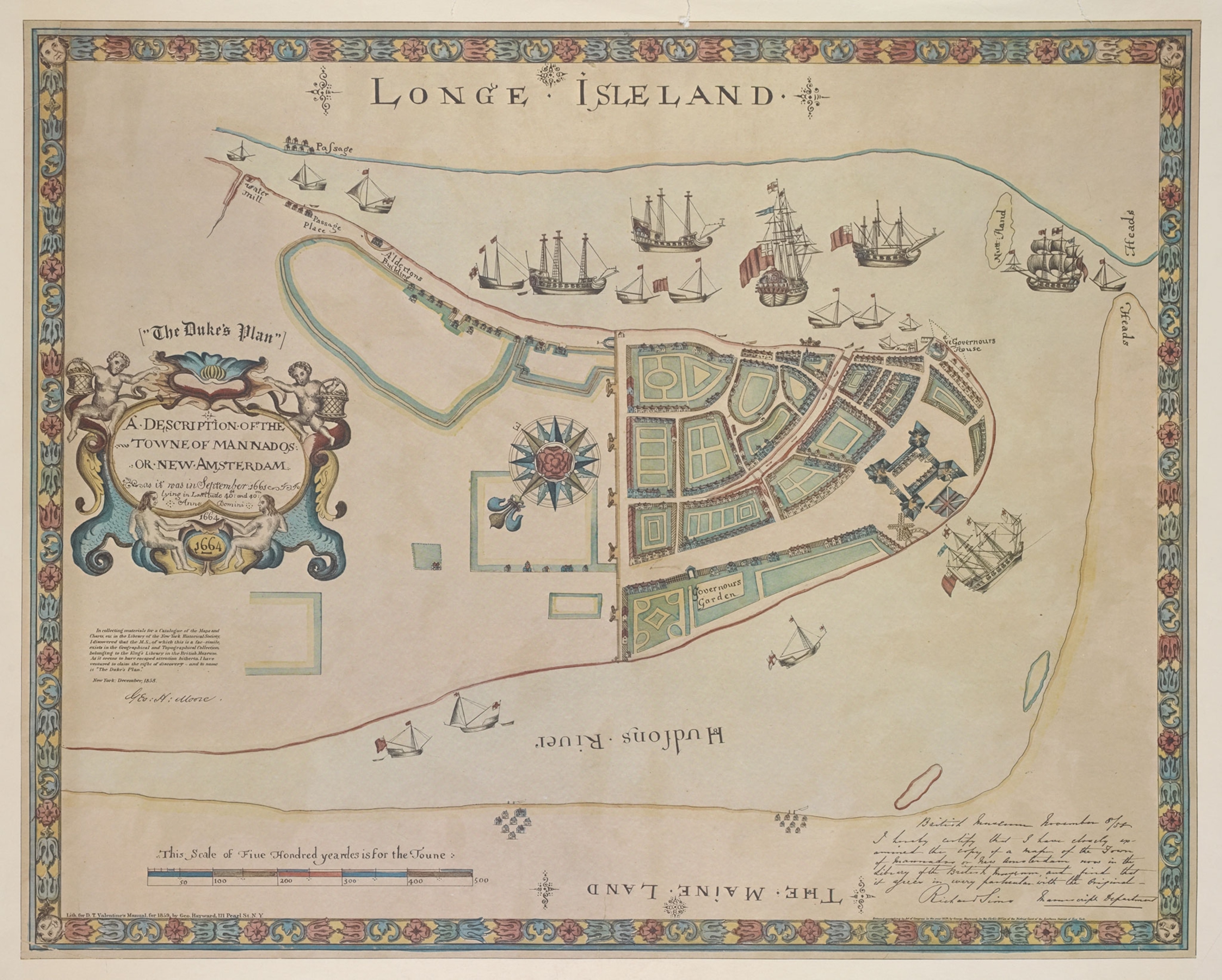
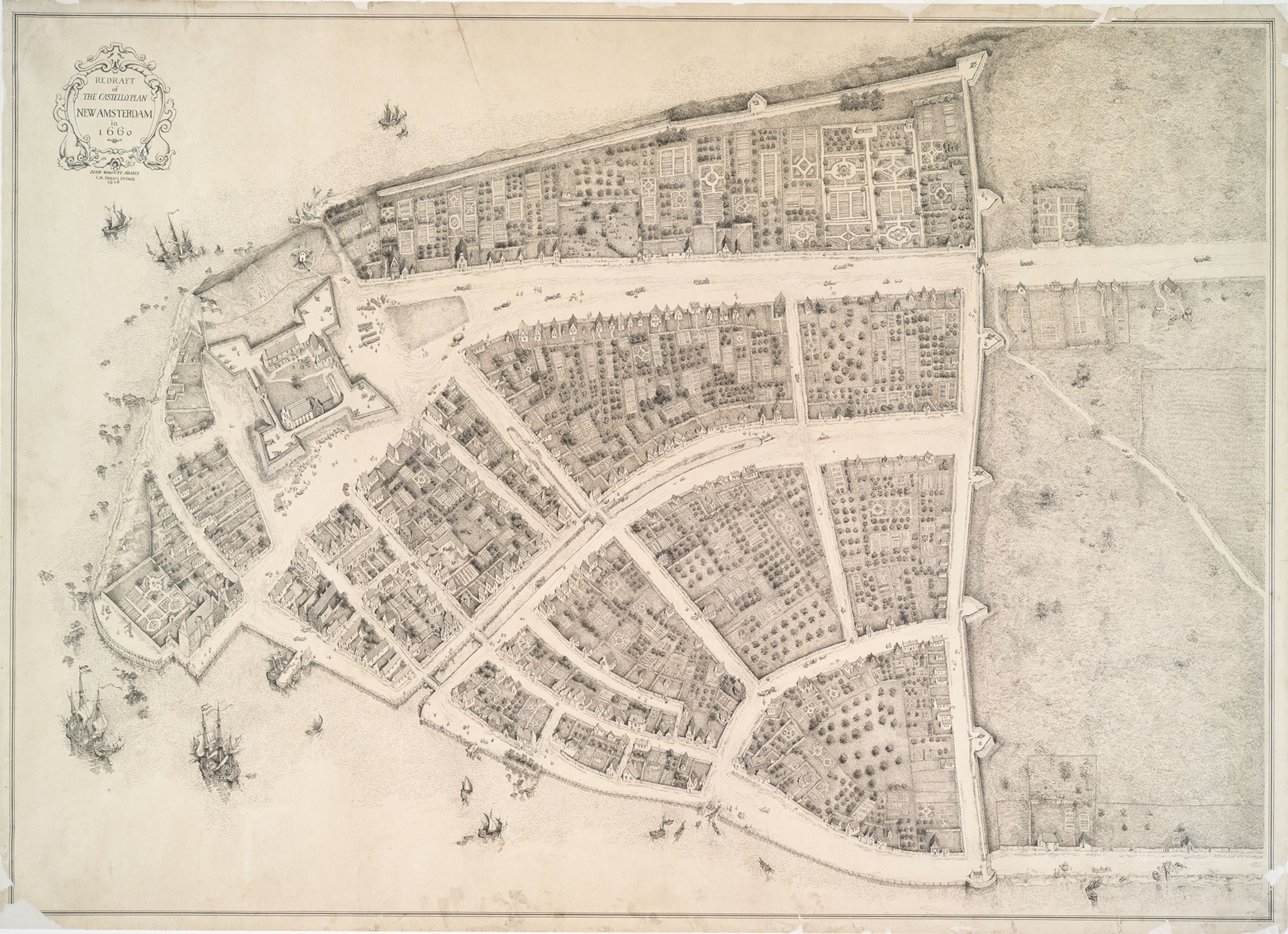
One of the earliest pictorial maps of the city (above) depicts New Amsterdam as it stood when the British took the city and renamed it New York in 1664. The map shows the tip of Manhattan Island covered in gardens ringed with buildings, and British Man-of-war ships occupy the surrounding waterways.
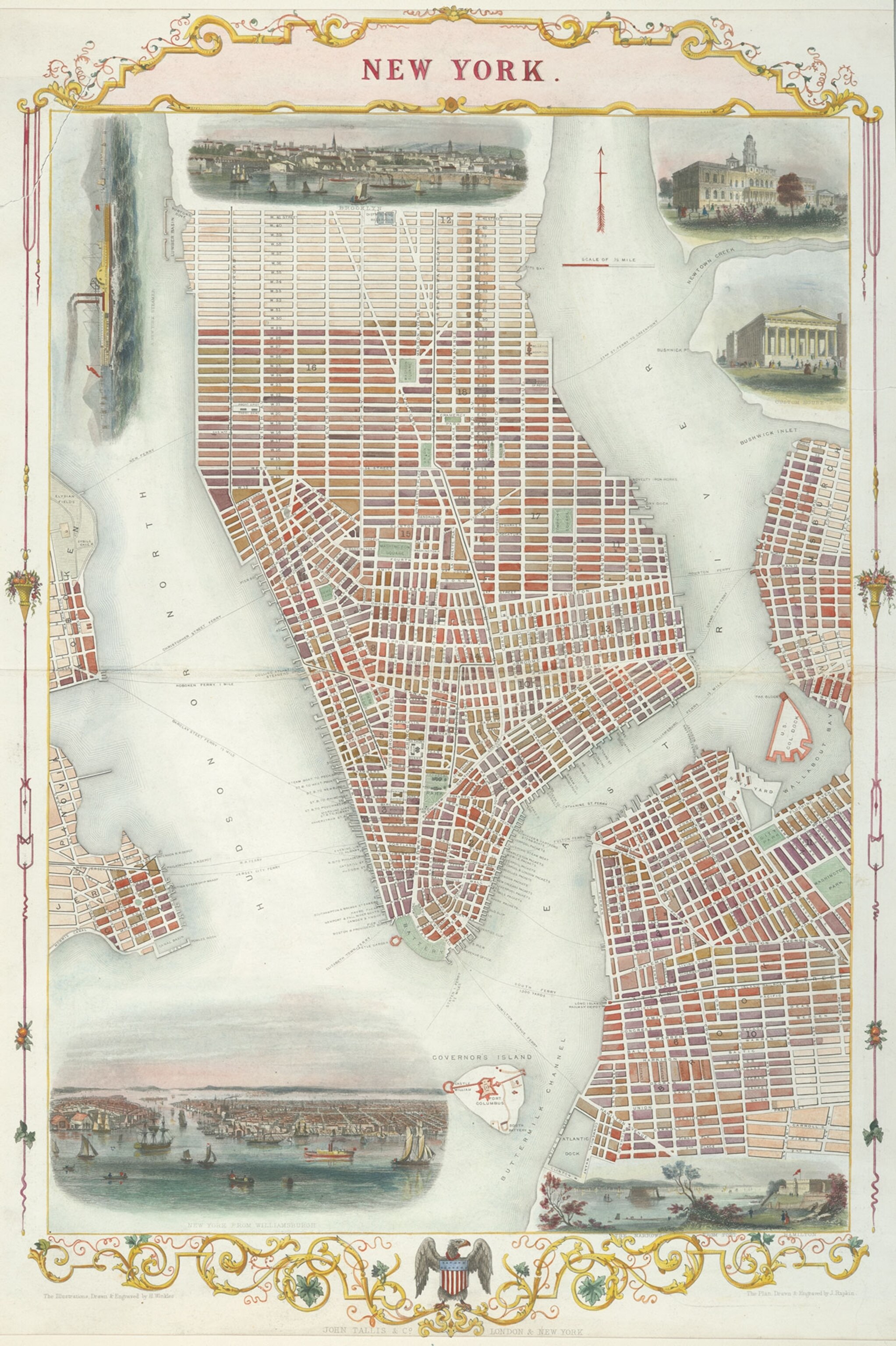
This rare map is among those carefully selected from the New York Public Library’s massive cartography collection for an exhibition of pictorial maps.
The library has a collection of around a half a million maps—one of the largest in the world. It is home to the best collection of New York City maps that exists. Guest curator Katharine Harmon, author of You Are Here: NYC, chose some of the best pictorial maps of the city, spanning four centuries.
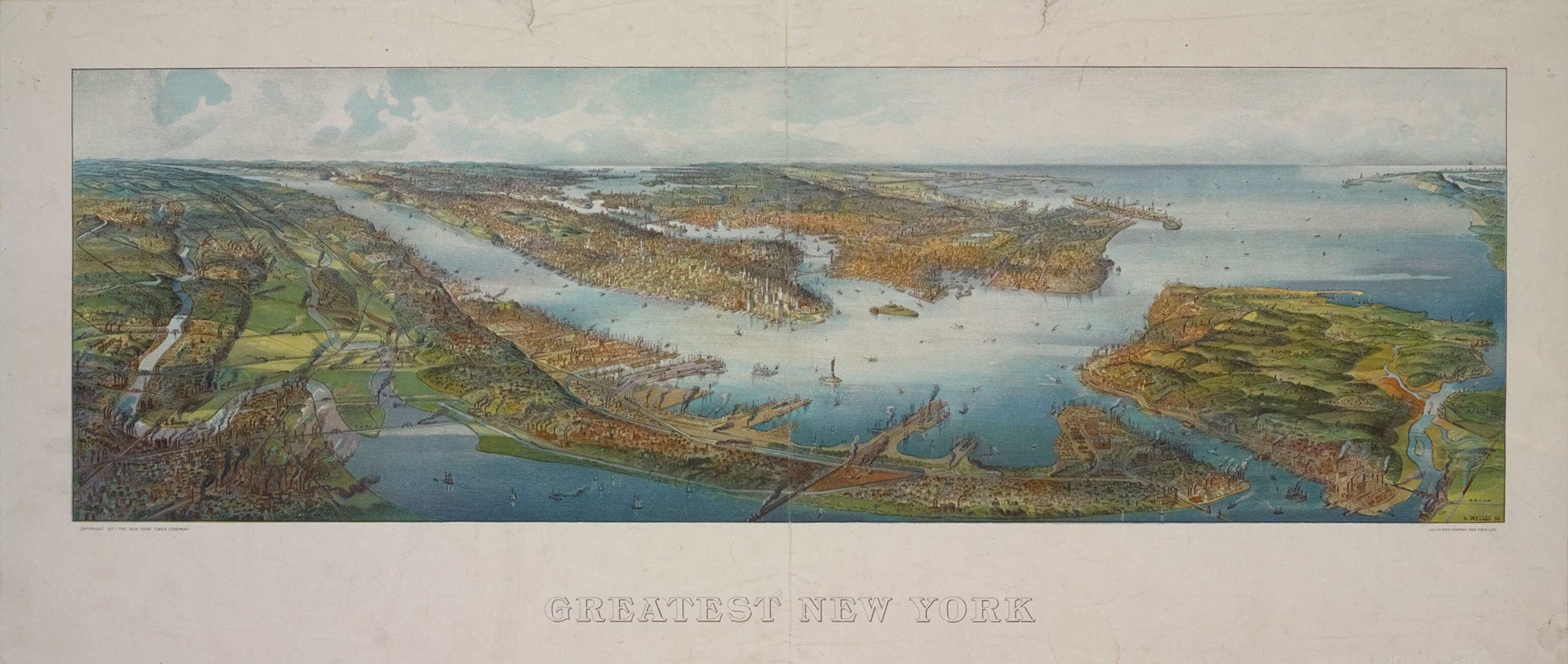
Pictorial maps are particularly intriguing for those interested in the social and cultural history of a place. Because these maps are often meant for entertainment or commentary and don’t necessarily adhere to rules of cartography or geography, they can offer a revealing view of a place at a particular point in its cultural history.
“I think with traditional cartography you're kind of stuck in the constraints of scale and perspective and what people normally think of coming from a more cartographic or scientific basemap,” says Ian Fowler, Map Curator and Geospatial Librarian at The New York Public Library. “With pictorial maps, it's not only a representation of the culture and artistry of the times, but it also provides more leeway and more freedom to express how [the mapmaker] sees the city.”
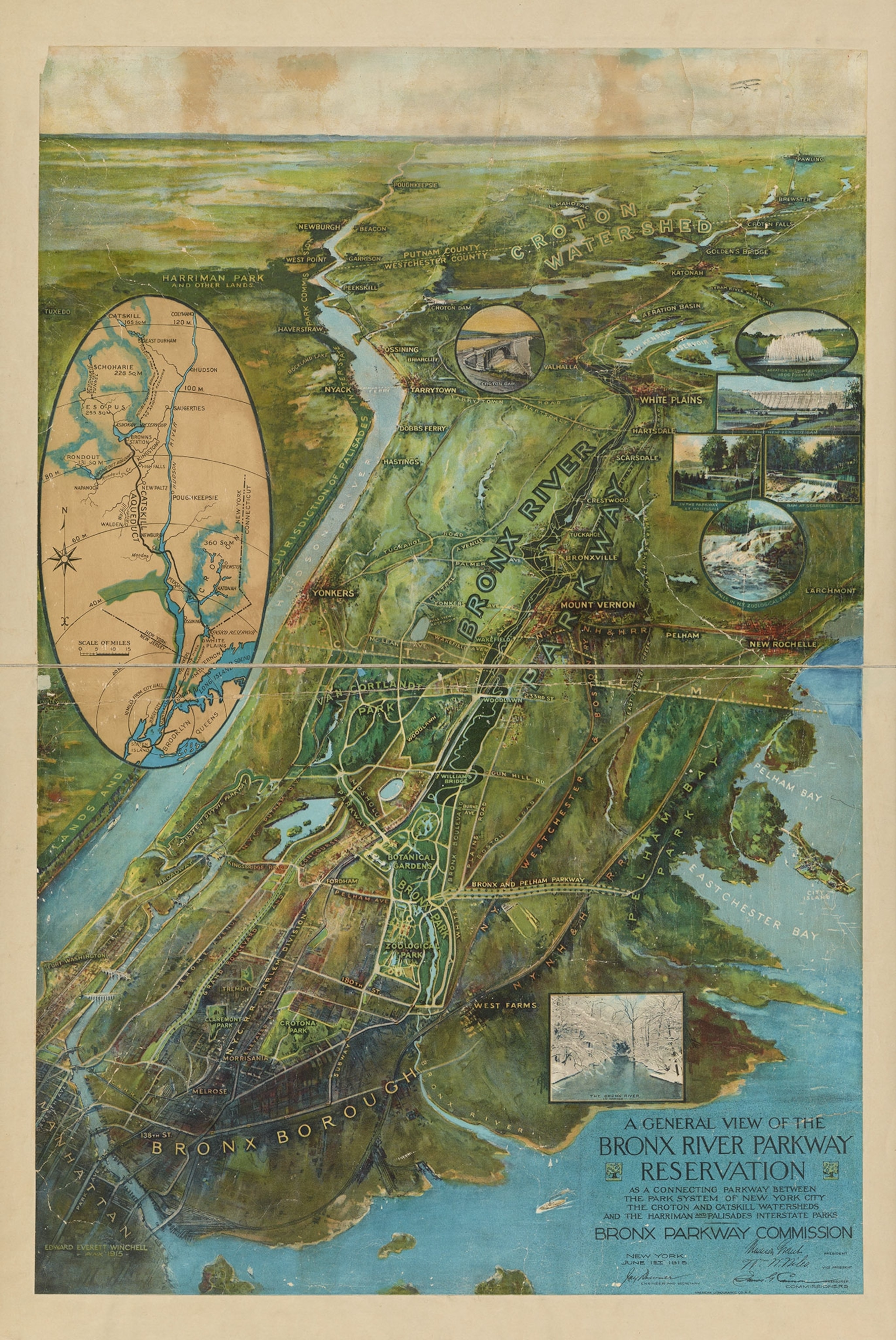
For artistically inclined cartographers, New York offers so many facets to map, from physical and permanent to social and ephemeral. Mapmakers continue to find new things to explore.
Other maps in the library’s exhibit include “In the Heart of Harlem, USA,” made by Bernie Robynson and Langston Hughes in 1953; “The Queens Jazz Trail,” created by Tony Millionaire in 1998; and Arthur Zaidenberg’s 1938 Downtown District of Manhattan.
In the introduction to her book, Harmon muses about why New York City has inspired so many maps of such variety. “New York has no shortage of inventive thinkers who make excellent cartographers. Each act of creative cartography reflects both the state of mind of the mapper and the state of the city,” she writes. “Perhaps, in the end, what makes the city the most mapped metropolis in the world is that it offers complete cartographic liberty.”
Betsy Mason and Greg Miller are authors of the forthcoming illustrated book from National Geographic, All Over the Map. Follow the blog on Twitter and Instagram.