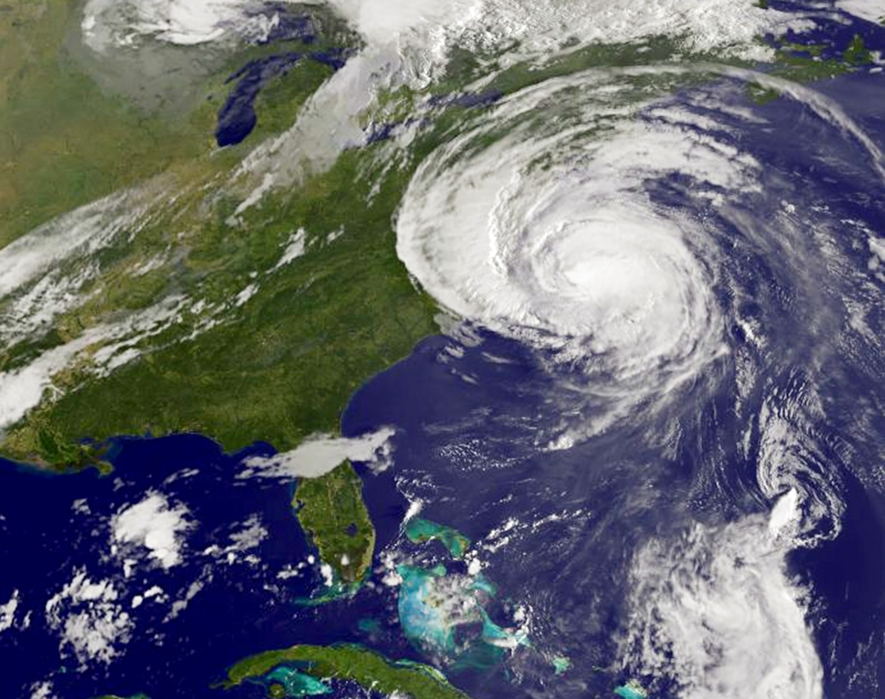
Why Hurricane Earl Weakened on Path to Cape Cod
Changes in the wall of clouds around Hurricane Earl's eye helped it diminish to a Category 1 storm as it moved toward Cape Cod, experts say.
Changes in the towering wall of vertical clouds surrounding the storm's eye helped diminish Hurricane Earl's intensity as it roared toward North Carolina's Outer Banks (map) Thursday morning, meteorologists say.
Earl was a very intense storm with winds exceeding 140 miles (225 kilometers) an hour as it moved northward along the U.S. East Coast.
But as of Friday morning, Earl had diminished to a Category 1 hurricane with peak winds of about 85 miles (137 kilometers) an hour.
Although some damage was reported in the Outer Banks due to high winds and flooding, the area did not experience hurricane-force winds, said Wallace Hogsett, a meteorologist at the National Hurricane Center in Miami.
Forecasters think a weakened, but potentially still dangerous, Earl will pass over or very near Cape Cod, Massachusetts (map), Friday night.
(Related: "Hurricane Earl a Harbinger of Worse to Come?")
Second Eye Wall Put Brakes on Earl
Hurricane Earl weakened in part because of a phenomenon called an eye-wall replacement cycle, said Keith Blackwell, a meteorologist at the University of South Alabama's Coastal Weather Research Center.
Extremely powerful hurricanes often experience this cycle, in which a second eye wall—the wall of vertical clouds around the eye—forms around the original. As the new eye wall closes in around the eye, it acts like a braking system, slowing the hurricane's momentum and causing its winds to temporarily diminish.
The new eye wall eventually replaces the old one, and the hurricane can then regain power, often becoming stronger than it was before.
"A pretty potent outer eye wall formed around Hurricane Earl," Blackwell said. "By late yesterday afternoon, the inner eye wall had all but collapsed. That led to sustained weakening [of the storm]."
By the time the cycle was complete, the storm was encountering disruptive upper level winds known as wind shear, Blackwell said. Earl "could have reintensified after the destruction of the inner eyewall, if it had not experienced the strong wind shear."
(Related: "Hurricanes to Be Sapped, Not Strengthened, by Warming?")
In addition, an approaching low-pressure system from Canada helped nudge Earl a little farther to the east, so that its eye, which is surrounded by the storm's strongest winds, stayed about 80 miles (129 kilometers) offshore from Cape Hatteras, Blackwell said.
Earl is now expected to weaken to a tropical storm with peak winds of no more than 73 miles (117 kilometers) an hour en route to an eventual landfall Saturday in Canada's Maritime Provinces (see map).