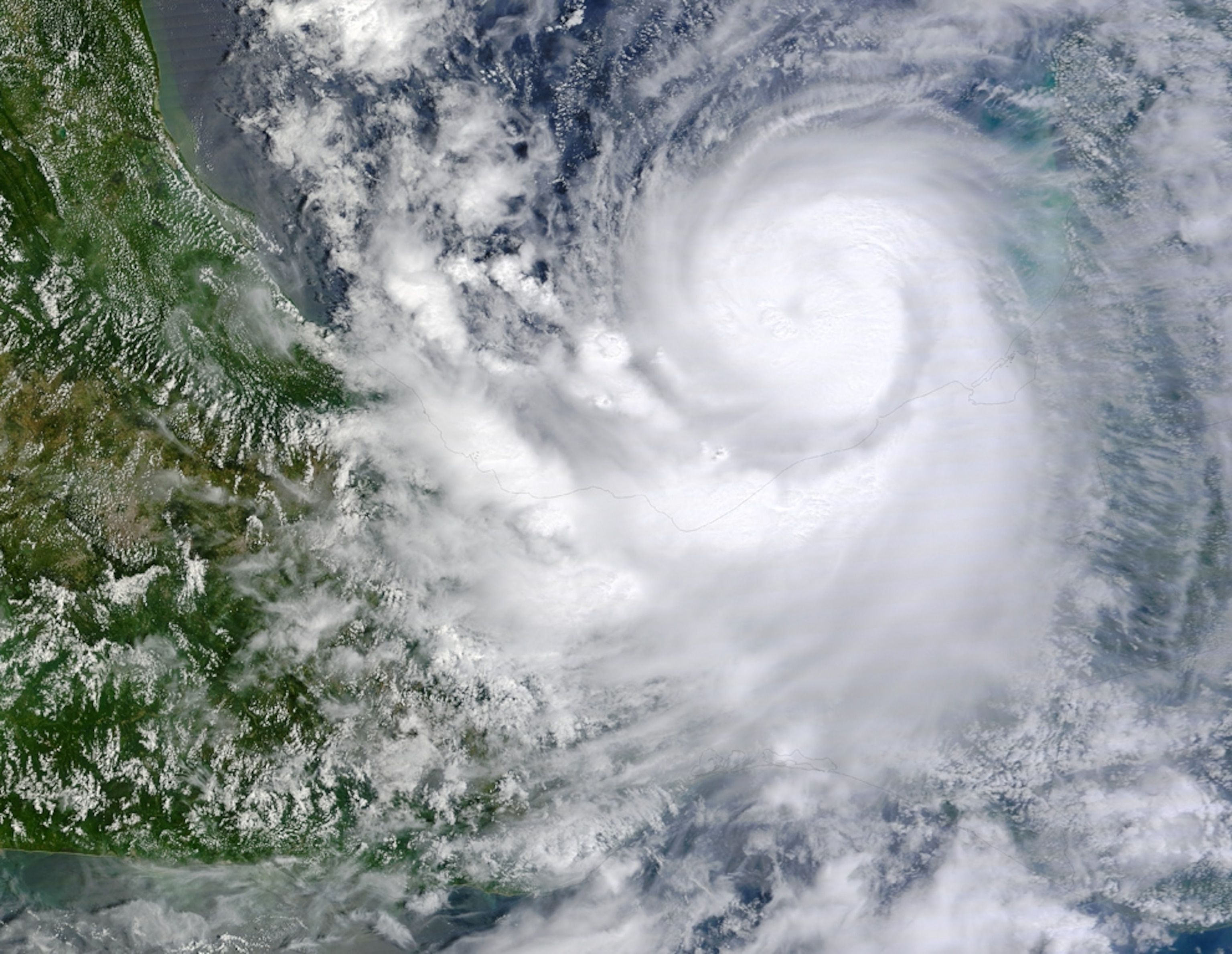
Hurricane Karl Slams Into Mexico; Flash Floods Predicted
Storm will dump "humongous" amount of rain on Mexican mountains.
Hurricane Karl is expected to bring severe flooding to the mountains surrounding Veracruz, Mexico (see map), after making landfall today near the port city with winds of 115 miles (185 kilometers) an hour.
Karl's eye came ashore just north of Veracruz at 11:30 a.m. CT, according to meteorologist Todd Kimberlain of the National Hurricane Center in Miami.
Veracruz was spared from Hurricane Karl's strongest winds, but the storm will dump a "humongous" amount of rain as it moves over the mountains of southern Mexico, said meteorologist Keith Blackwell of the University of South Alabama's Coastal Weather Research Center.
"There will be tremendous rain, with a lot of flash flooding," Blackwell said. "I wouldn't be surprised if some places get 20 or 30 inches [51 or 76 centimeters] of rain."
(See flash flood pictures).
"The runoff will be very quick because of the steep terrain, and there will be very severe flash floods in the valleys."
Hurricane Karl "Exploded"
The storm formed Tuesday from a tropical depression in the northwestern Caribbean Sea, but it struggled to gain strength because upper-level winds known as wind shear disrupted it.
But as Karl moved across the Yucatán Peninsula Wednesday, the wind shear diminished.
Hurricanes get their power from warm ocean waters, and the reduced wind shear and very warm waters of the Bay of Campeche (see map) allowed the storm to quickly regain intensity yesterday as it approached the Mexican mainland. (See hurricane pictures).
"Karl exploded overnight. It absolutely exploded," Blackwell said.
But Karl will quickly diminish as it moves westward across the mountains, Blackwell said.
2010 Hurricane Season: "We're Not Done Yet"
Meanwhile, large and powerful Hurricane Igor is creating wind shear that is disrupting nearby Hurricane Julia and causing that storm to rapidly weaken, Blackwell said.
Earlier this week, Hurricane Julia reached Category 4 status with winds of about 135 miles (217 kilometers) an hour. But as Julia moved closer to Hurricane Igor, Julia began to lose strength.
Hurricane Igor became the most powerful storm of the 2010 season when its peak winds reached 150 miles (241 kilometers) an hour earlier this week.
Igor is expected to remain a Category 3 storm with winds exceeding 110 miles (177 kilometers) an hour through Sunday, but both Igor and Julia are expected to remain far offshore and not be a threat to the U.S. mainland.
A series of low-pressure systems moving from west to east has pushed Igor, Julia, and other hurricanes away from the U.S. so far this summer.
It's too early to predict whether the low-pressure systems will dissipate, Blackwell said. Even so, he expects the 2010 Atlantic hurricane season to stay active for at least several more weeks.
(Related: "Hurricane Earl a Harbinger of Worse to Come?")
"We're not done yet."