Expedition Braves Arctic Perils for Climate Science
After being foiled for years by the harsh conditions, researchers were finally able to collect key core samples from a remote lake in Svalbard—which may provide valuable insight into how our climate will change over the coming decades.
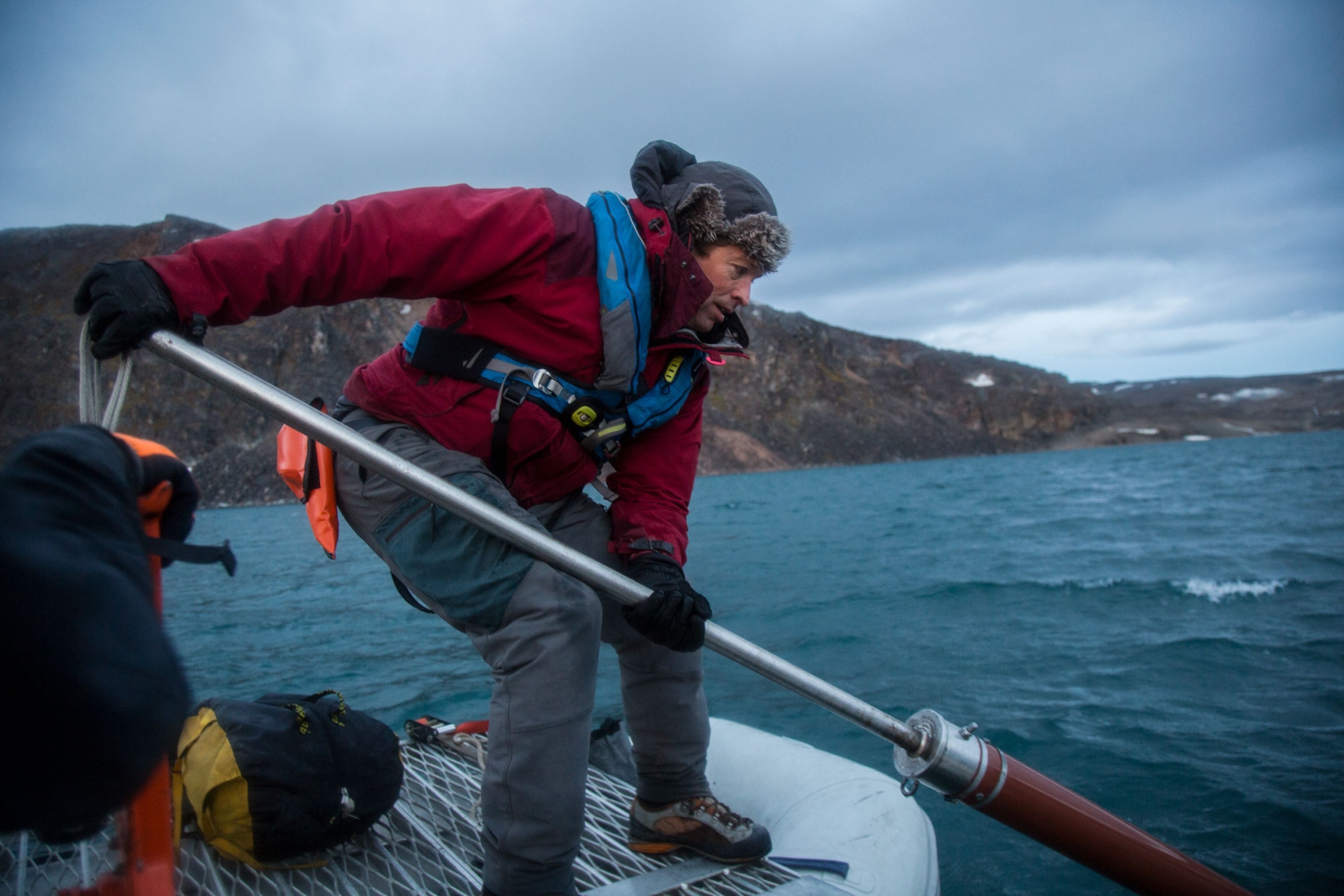
Nordaustlandet, Svalbard — The boat shot up the deep blue face of the wave, broke through its lip, hung silently in space for a moment, and then slammed back into the sea. The shock reverberated through the aluminum hull, amplifying the vibrating hum of the mast straining in a force eight gale. As the vessel plunged down nose first, the frothing cobalt waters of the Arctic Ocean rose and blocked the view of the snow-covered spikes of Nordaustlandet, in Norway’s Svalbard archipelago. Powered by 45-mile-per hour winds of heavy, cold air, another 20-foot wave caught the sailboat on its side, sending the crew of paleoclimatologists reeling.
After giving a six-hour beating, the unexpected storm showed no signs of weakening. Skipper Mario Acquarone made a hazardous, high speed turn through close packed waves and retreated. Just the day before, on this inaccessible coast at 80 degrees north, the crew of scientists had cored sediment samples of a little explored lake and glacier system. They hoped their research would yield several millennia of climate change data so detailed it would provide records on a decade level—documentation of climate change relevant to a human lifetime—and help them more clearly predict the effects of a warmer future.
For five years they had been trying to reach Lake Ringgåsvatnet and Ahlmannfonna glacier, but every time they had been routed by epic storms or blocked by pack ice. Now they were eager to get back and analyze their bounty of mud—but first they had to survive the gale.
“This is hardcore science,” said Ray Bradley, the oldest and most experienced Arctic researcher on the trip, as the boat anchored in the safer but still treacherous confines of Innvika cove later in the day. After fifteen hours of heaving seas, the director of the Climate System Research Center at the University of Massachusetts at Amherst was finally able to make a bowl of oatmeal. “People always forget when they see a graph on a piece of paper […] all the hard effort that went into getting that,” he said. “In many places you're putting your life on the line to get these records.”
Indeed, the expedition faced numerous dangers to collect data from this remote location high in the Norwegian Arctic—not only four storms in nine days, but also the constant threat of polar bear attack, the risk of striking a rock and sinking in uncharted fjords, and low-lying icebergs. Most ominously, starvation was possible if the fickle winds shifted, pushing the polar ice south in a matter of hours and locking the boat and its crew in a fjord too distant for helicopter rescue. All of this for some mud.
But this is not just any mud. “What we’re hoping is that the sediment found at the bottom of the lake will give us essentially a history of how the icecap has survived—or grown or shrunk—over time. So we’re trying to put the present condition of the environment here in a long-term context,” said Bradley, whose English accent has been almost entirely lost to Boston. “We wanted to come here because it is essentially the canary in the coal mine for giving us some indication of how the climate will change in the future and how it has changed in the past.”
The sediment cores are “natural archives of past environmental change,” he says. “What we want to do is basically open that library and read the story of the sediments.”
Lake of Secrets
Lake Ringgåsvatnet is important because it is an unfrozen body of fresh water in the extreme north of the planet, warmed by the tail end of the Gulf Stream. Also, it is fed by only one ice cap and its bottom sediments have not been scoured clean by a glacier, so it has a clear historical signal. Ahlmannfonna glacier is important because it is a small ice cap and stands alone, so it is especially prey to changes in climate. Studying the layers of glacial sediments washed into the lake will reveal how the glacier has changed and thus show how the climate has changed.
To reach such an illuminating spot is dangerous, but Bradley is no stranger to risk. In 2005 he was embroiled in what became known as the Hockey Stick Controversy after Congressional Republicans attacked him, and his colleagues, for an historic climate graph published in an Intergovernmental Panel on Climate Change (IPCC) report. The table showed a dramatic spike in global mean temperatures that coincided with the Industrial Revolution—strong evidence humans were causing global warming.
“They decided the best way to put down the credibility of the IPCC report was to attack the scientists, rather than the science,” said Bradley. During the “political shenanigans,” as Bradley describes it, the chairman leading the attack, Joe Barton of Texas, addressed an open letter to his constituents, dismissively writing that the science was, “all indoor work and no heavy lifting.”
Svalbard’s Dangerous West Coast

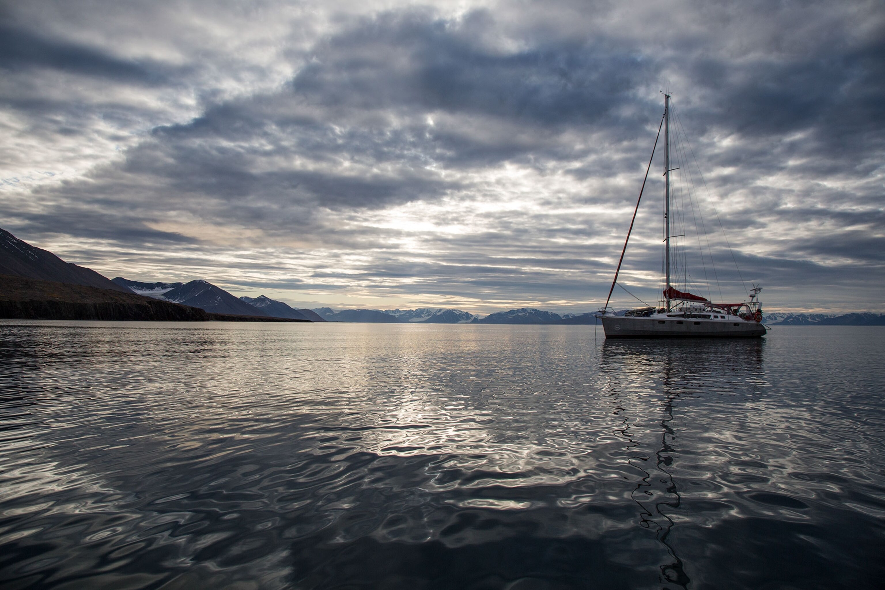
In the days before the storm, we spot a polar bear and her cubs on a hillside and see blue whales and humpbacks blowing spouts against a backdrop of glaciers flowing down into the sea. Finally, after 48 hours on the ocean, we approach our Rubicon: the narrow gap between the north-pointing Platen Peninsula and the Arctic ice pack just 20 nautical miles away.
“We have been trying to do this trip for five years and we have had a lot of issues with ice,” says expedition leader Jostein Bakke, head of the Quaternary Earth Systems group at the Bjerknes Centre for Climate Research at the University of Bergen, in Norway. “It's not the safest type of expedition,” he says. If the winds turned and pushed the ice south, it would be just hours before the boat was trapped. “We are pushing the limits of what you can do.”
This day, there is no ice. As we sail past the aptly named Goodenough Mountain on the tip of the peninsula, Acquarone, a marine mammal researcher and president of the European Cetacean Society who has been sailing the archipelago for two decades, says the lack of ice is good and bad. “On the one side it's exciting because we have the possibility of visiting new areas that were previously ice locked. But, on the other hand, it's kind of scary because it's a sign that things are changing very, very fast.”
Now past the point of no return, the boat rounds south and into the uncharted Innvika cove. Examining spotty weather forecasts, the climatologists see they have just an eight-hour window to unload hundreds of pounds of equipment and get it ashore before another gale strikes. As we get ready to land the gear, Bradley says, “We're about to see that it’s not all indoor work and it’s definitely a lot of heavy lifting.”
Threshold of No Return
Even though it is difficult, and sometimes impossible to get here, this lake and glacier system will help paleoclimatologists tell a bigger story about the climate. “Svalbard is a very sensitive place,” says Bakke. Because of this, it uniquely can help them put climatic changes into a longer term perspective.
Maybe more importantly, they want to understand why there seem to be “steps” in the ancient climate record—times when the system seemed to suddenly shift. “For future climate that's very important because you have these thresholds, and once we cross them there's no way back,” Bakke says. “Hopefully our research can help to get better predictions for the future. Then we can be prepared for what's going to happen in the next hundred years.”
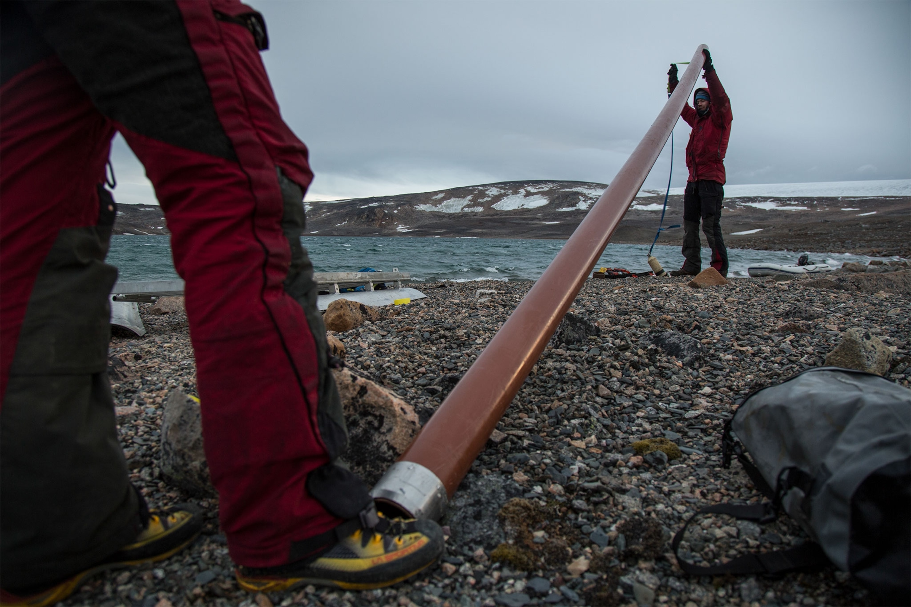
To do this, the researchers will gather the cores and other data about the area. Back at the lab, they will carefully cut the plastic coring tubes open, run a piano wire down the length, and split the soggy mud open like the two halves of a book.
Carbon dating pegs the ages of the layers of sediments. Mineral-rich layers point to glaciers growing in cold periods, as they grind up stone and it is washed into a lake. Layers of organic sediment mean a glacier retreated from a lake during warm periods, thus producing less ground-up stone. “We can look through time and see when the glaciers have been big and when they've been small, how abruptly they've changed, and how dynamic they’ve been throughout the last 10,000 years,” says William D’Andrea, a climatologist at Columbia University’s Lamont-Doherty Earth Observatory.
D’Andrea studies plant waxes and fat molecules and dead algae that are preserved in the cores. The kind and amount of these substances can tell him the temperature of an ancient lake and how much precipitation there was at different times.
“The main thing we're after is temperature and precipitation,” he says. “Those are the two things that matter to you on any given day—is it going to rain and should I be wearing a T-shirt or a sweater?”
Around 9,500 years ago, the climate in Svalbard was T-shirt weather, much warmer than it is today. And the paleoclimatologists think that climate could be where the Arctic is headed again. Better understanding exactly what happened in the past can thus help us better predict the near future.
Yet, while many people now understand that the climate is changing, the process is relatively slow compared to our day-to-day lives. Because of this, it is often hard to focus the public’s attention. This team hopes to pull finely layered cores that will allow them to show ancient climate changes on the scale of decades, instead of millennia.
“Just 30 years from now, when your kids are older, when your grandchildren are around, the climate will be very different,” says Bradley. “We’re trying to get a history at a very fine resolution, on a timescale that is relevant for people.”
Coring Work (Is Anything But Boring)
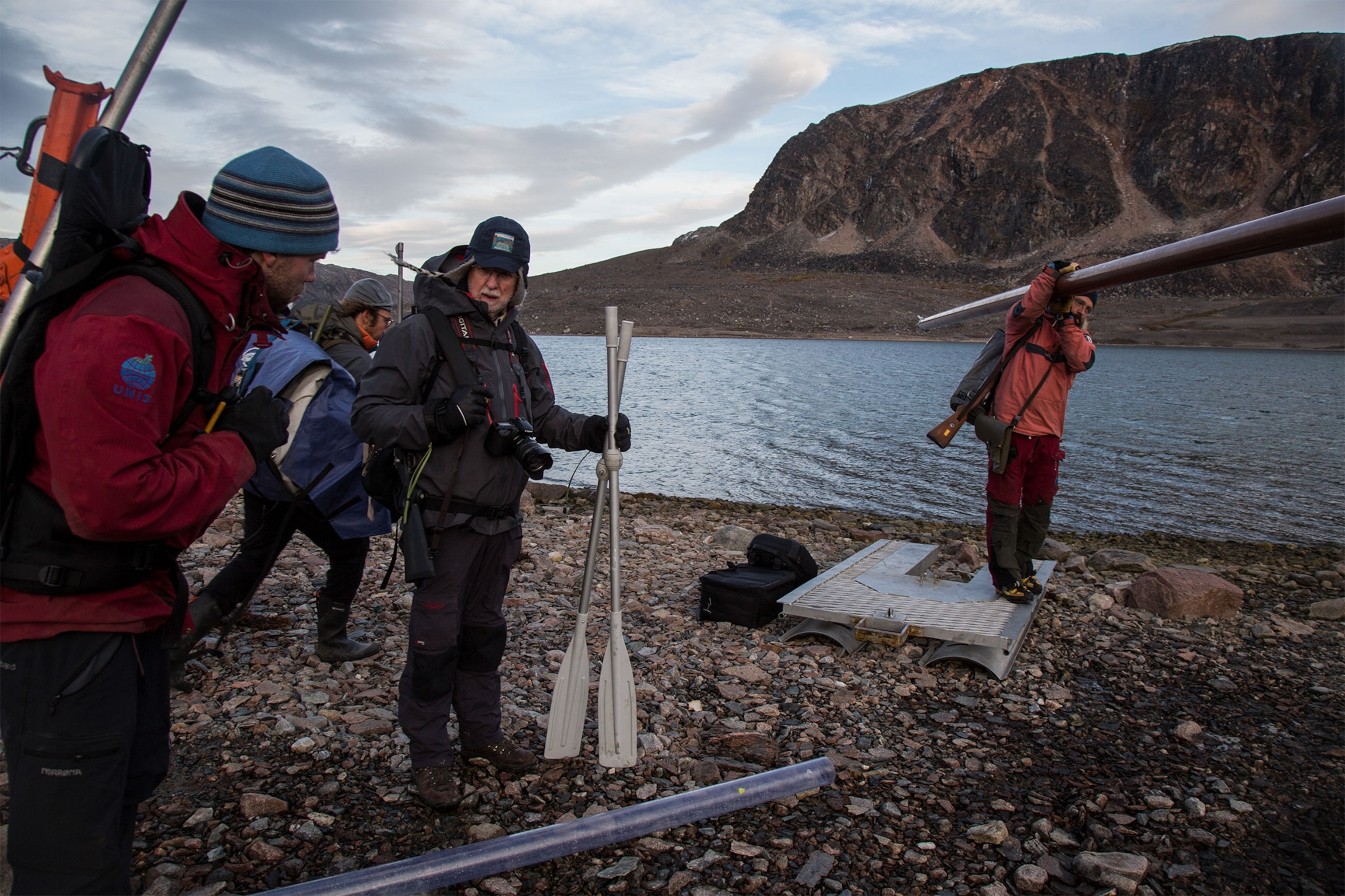
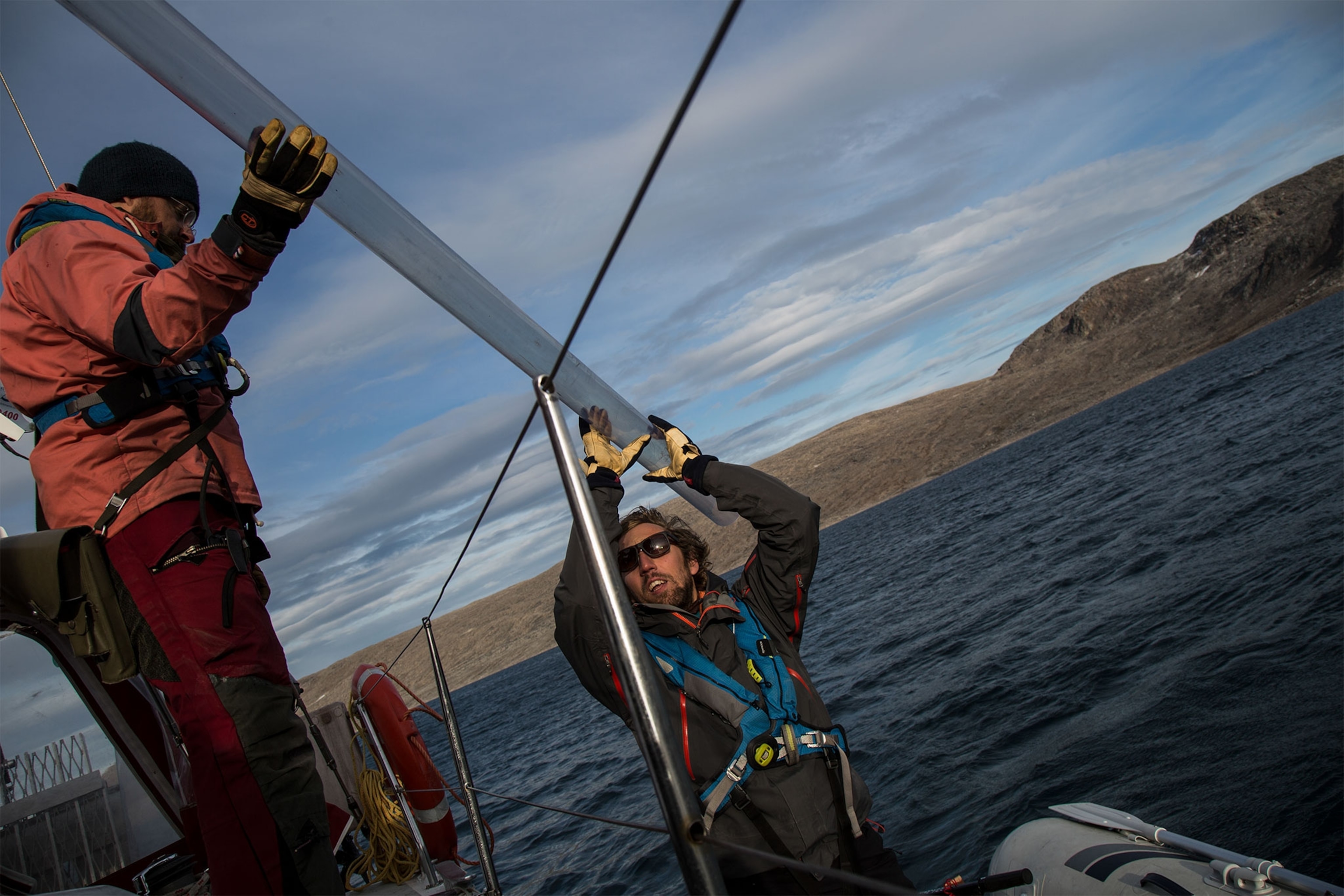
On the deck of the boat, the scientists get ready to go ashore and start the heavy lifting. They load three old Mauser carbines with soft-nosed bullets, inspect five flare guns, and have a serious talk about polar bear safety. A single curious seal follows the zodiac raft in as they look for a staging spot. Returning, they unstrap brown plastic tubes you could buy at any plumbing store. The coring tools would not have been out of place on an 1850s oil rig. Dozens of trips transport two inflatable boats, 400 pounds of drilling platforms, coring weights, a solid metal jack, a piston for driving the tubes into the mud, two boat engines, at least fifty meters of pipe, and an assortment of other equipment. Then the work starts.
Between the shore and the lake is a mile of boggy, broken ground. Carrying 90-pound sections of platform, our heavy steps are swallowed by spongy layers of ancient mosses. Other times we sink to the top of our boots in sucking mud. Ankle-breaking boulders lie everywhere. Running from a bear seems impossible. At last, the goal of the expedition comes into view: the 100-foot-deep, mile long Lake Ringgåsvatnet.
The wind is picking up and the team hurriedly assembles the equipment. I’m given a rifle and am told to watch out for polar bears. We get to the sailboat just before the storm. For the next 24 hours, it shrieks at 70 miles per hour, churning the shallow cove. Again and again the anchor slips and the aluminum-skinned yacht is driven perilously close to the rocks. “It’s a real Arctic experience,” says Acquarone.
At last, the gusts die down. Under a midnight sun shrouded in heavy gray clouds, the researchers dress for a full shift of hard labor and motor into shore. Out on the lake, crowded onto the small platform of the coring raft, Bakke and his Norwegian team sinks one of the long brown tubes through the drilling gap and into around 85 feet of water, lowering it until it touches the bottom. For the next four hours, they do hundreds of squats, hauling up and then dropping down a heavy piston, driving the pipe vertically into the mud, grit, sand, and gravel of the lake bed. A five-foot sample usually takes a couple of hours of this ab-crunching workout. The pipe can provide a core of up to 20 feet. “It’s not very sophisticated, but it works,” says Bradley.
The scientists, after coming all this way and going through so many hazards, are determined to pull as long—and ancient—a core as possible from the lake. They work for six hours. On shore, D’Andrea and another researcher have been cataloging the jumbled landscape of bowling ball-size rocks between the 1,600-foot glacier two miles away and the shore of the lake. They collect baggies of sediment and take water samples and GPS elevation readings.
After working from midnight to noon, the rig team has pulled a long core and a short core, and the land team has completed its exploration and measurements. Meeting back at the gravel beach, the fatigued expedition members begin the exhausting job of undoing all their work and heading back to the boat.
Finished after three more hours, the scientists know they have two and a half more days at sea, four lakes, and many more repetitions of the coring process ahead of them. Although they cannot foresee the the big storm waiting for them, what they all know is that the danger and exhaustion is worth every moment of exploration and discovery. The data’s value makes the hazards worthwhile.
“There are certain aspects of science where people have to risk themselves to do it,” says Bradley. “In the end you have to take those risks if you're going to get the information.”
See more of John Wendle’s work at johnwendle.com, instagram.com/johnwendle and vimeo.com/johnwendle.

