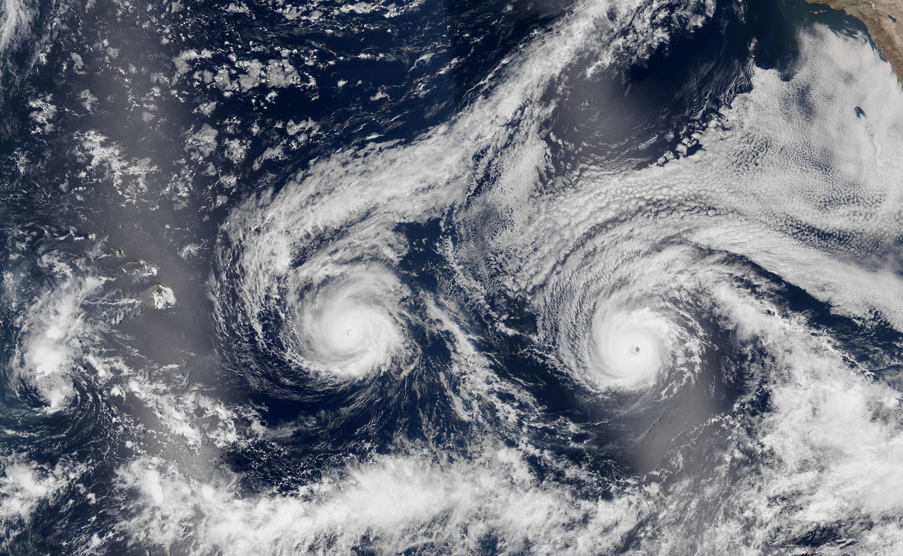
Rare Double Hurricane May Be Good News for Hawaii
The Fujiwhara Effect can lead to unusual weather conditions.
An unusual meteorological event known as a Fujiwhara Effect—a sort of mid-ocean do-si-do movement of two hurricanes—could alter the course of a pair of storms in the Central Pacific Ocean and steer at least one of them away from Hawaii and its 1.4 million residents.
As of midday Wednesday, the center of Hurricane Madeline was about 350 miles east-southeast of Honolulu, Hawaii’s state capital and largest city. Meanwhile, Hurricane Lester’s eye was trailing Madeline and was about 1,275 miles east of Honolulu. Madeline’s strongest winds were blowing at about 80 miles per hour, while Lester’s peak winds had reached 135 miles per hour.
The state of Hawaii is composed of eight major islands and many smaller ones. The state takes its name from the island of Hawaii, the easternmost island in the chain and the largest. Honolulu is on the island of Oahu, about 210 miles west of Hilo, the largest city on the island of Hawaii.
Meteorologists think that as the storms approach the Hawaiian Islands they will get close enough to each other to interact. That interaction, known as a Fujiwhara Effect, could alter the path of both storms.
The phenomenon is named after Sakuhei Fujiwhara, a Japanese meteorologist who identified it in the early 20th century.
Phil Klotzbach, a meteorologist at Colorado State University, said the storms likely will get close enough to each other so that Hurricane Madeline’s circulation could push Hurricane Lester to the north, away from the islands.
The phenomenon is “not super-uncommon,” Klotzbach said, but it is unusual. Hurricanes are very low-pressure weather systems. When they get close enough to each other, their centers can be affected by the other nearby low-pressure system, and the centers can begin orbiting each other.
If the storms get very close to each other and one is larger, they can merge. Klotzbach said this isn’t likely to happen with Lester and Madeline, however.
The five-day forecast for Hurricane Lester predicts that the storm will weaken to a minimal hurricane and turn gradually to the northwest, with its eye staying offshore as it passes to the north of the island of Hawaii.
Meanwhile, Madeline is expected to retain its intensity as a minimal hurricane, and its eye could brush the southern shore of the island of Hawaii sometime Thursday. If Madeline’s eye does touch Hawaii, it will be the first known landfall of a hurricane on that island. Tropical storms with winds lower than minimal hurricane force of 74 mph have made landfall on the island of Hawaii.
Both storms are expected to then move away from the islands and steadily weaken. Although the islands may be spared the worst effects of these hurricanes, heavy rainfall is likely.
The Hawaiian Islands are no stranger to hurricanes, however. In September 1992, powerful Hurricane Iniki made landfall on the island of Kauai, about 115 miles west-northwest of Honolulu. Iniki’s peak winds exceeded 140 mph, making it the most powerful hurricane on record to strike the state of Hawaii. The storm inflicted more than $3 billion in damages and killed six people.
Listen to author Willie Drye discuss his IPPY-Award-winning latest book, For Sale-American Paradise: How Our Nation Was Sold An Impossible Dream in Florida, with Frank Stasio on WUNC’s “The State of Things,” and with Joseph Cooper on WLRN’s “Topical Currents.”