National Geographic Logo - Home
    Partner Content for Mohammed Bin Rashid Space Centre
    • Science

    KhalifaSat: the first Emirati satellite built from ground up

    The launch of the first satellite to be developed on Emirates’ soil is heralding a new era in global space exploration.

    Carrying the UAE’s KhalifaSat, the H-IIA Launch Vehicle blasts off from Japan’s Tanegashima Space Center.
    Photograph courtesy Mitsubishi Heavy Industries Ltd./JAXA
    • 4 min read
    This is Paid Content. The editorial staff of National Geographic was not involved in the preparation or production of this content.

    In October last year the United Arab Emirates took an important step in a journey setting the United Arab Emirates on the path to the planets – and beyond.

    The Emirates launched the KhalifaSat Earth Observation imaging satellite from the Japanese Tanegashima Space Center on an island off the southern tip of Japan aboard a Mitsubishi Heavy Industries H-IIA rocket.

    Developed by a team of young Emirati engineers from the Mohammed Bin Rashid Space Centre (MBRSC), the satellite is a source of inspiration for young Emiratis.
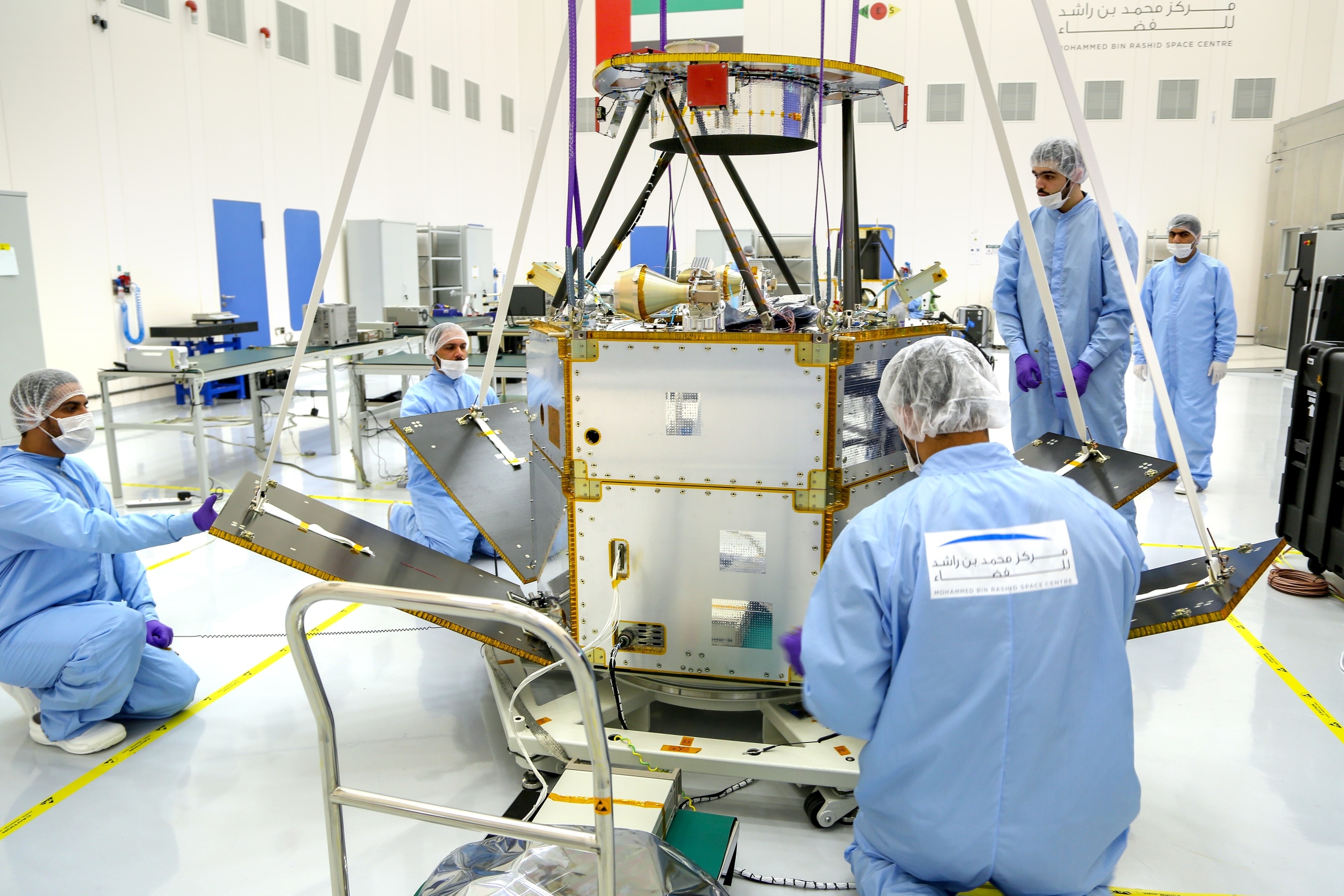
    KhalifaSat was developed by young Emirati engineers from the Mohammed Bin Rashid Space Centre.
    Photograph courtesy Mohammed Bin Rashid Space Centre
    Please be respectful of copyright. Unauthorized use is prohibited.

    KhalifaSat project manager Amer AlGhafri says the sky is the limit for the future of the Emirates’ satellite program.

    KhalifaSat emerged from bold beginnings in South Korea where a small team of Emirati engineers learned the basics, a team that eventually grew to a crew of over 70 working around the clock in a purpose-built “clean room” in Dubai.

    The MBRSC constructed the clean room to develop and build the satellite, a facility which will continue to be transformed as the UAE National Space Programme expands in the coming decades.
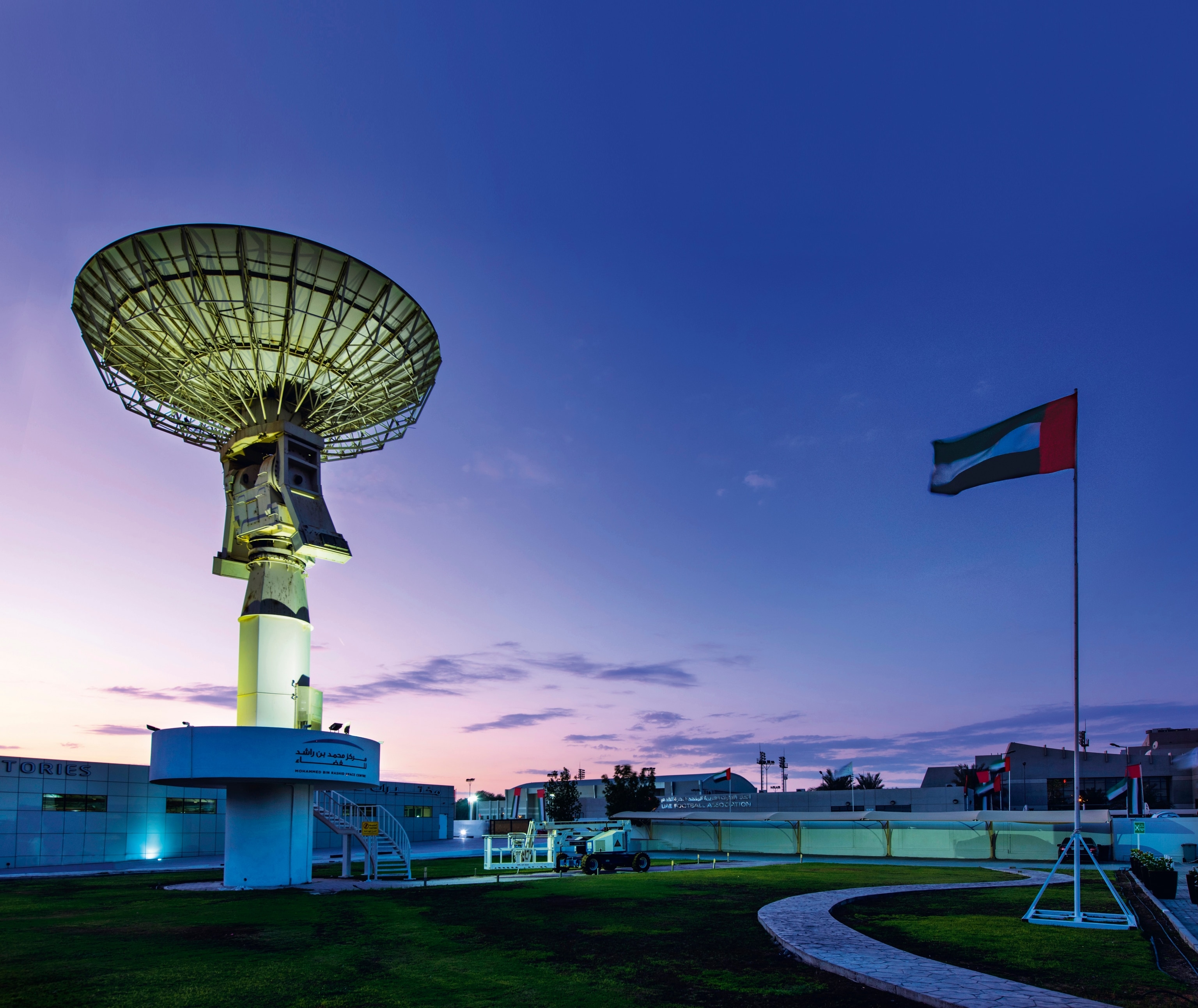
    The Mohammed Bin Rashid Space Centre was established by the Dubai government to advance space science and advanced technology in the United Arab Emirates.
    Photgraph courtesy Mohammed Bin Rashid Space Centre
    Please be respectful of copyright. Unauthorized use is prohibited.

    KhalifaSat’s launch manager Abdullah Saif Harmoul says one of the main purposes of building and launching KhalifaSat was to prove the Emirates’ ability to blast home-grown technology into space.

    “The purpose of KhalifaSat is to show our capability and know-how and bring technology here,” says Harmoul.

    Equipped with the latest in space and imaging technology, KhalifaSat is a powerful imaging tool, more agile than its predecessors: the DubaiSat-1 launched in Kazakhstan in 2009 and DubaiSat-2 launched in Russia in 2013.
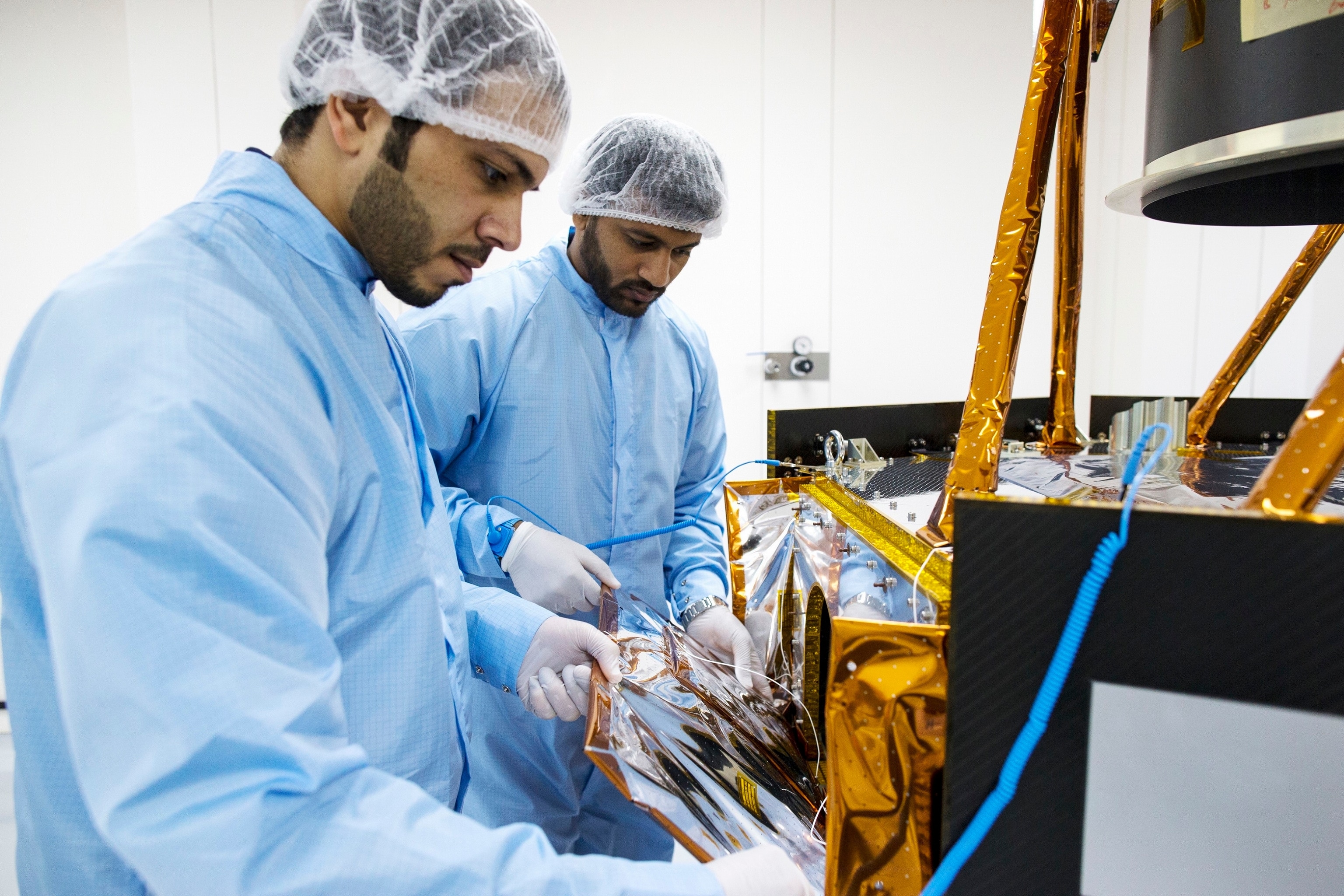
    Numerous space projects are ongoing at the Mohammed Bin Rashid Space Centre. These include an astronaut program, the development of nanosatellites and a Mars probe.
    Photograph courtesy Mohammed Bin Rashid Space Centre
    Please be respectful of copyright. Unauthorized use is prohibited.

    “When we started KhalifaSat we grew as a team and those people whose expertise helped build the DubaiSat-1 and the DubaiSat-2 joined us”.

    “We needed more expertise to build this satellite so the focus was not only on the satellite itself but on the team.”

    The head of the Detail Control Unit, flight software engineer Ibrahim Abdullah Almidfa, says building KhalifaSat required “a big learning curve”.

    “We’re doing this with UAE engineers, giving them knowledge we brought from South Korea so we’ve learned a lot and now we’re teaching others how to build satellites in UAE,” Almidfa says.

    “It’s a great moment for our team, for the nation, for the country.”

    “This proves to the world what we’re capable of.”

    In terms of its practical uses, KhalifaSat will be used in urban planning as well as aid in the design of smarter cities of the future.

    KhalifaSat is designed to capture images with a resolution of just 70cm, meaning each pixel represents less than 1 metre of the ground being captured. It is the most advanced satellite in terms of imaging in the PanGeo Alliance fleet.

    The PanGeo Alliance is an organisation of seven satellite operators, including MBRSC. It supplies daily global imaging capability with its 13 operational satellites.

    Discover more about the UAE’s Mohammed Bin Rashid Space Centre and their planned space missions on our Reach for the Stars content hub.


    Read this next

    • Paid Content for Advertiser

    The planets are next, says UAE space pioneer

    The first Emirati in space, Hazzaa AlMansoori gives a gripping account of his journey and stay onboard the International Space Station.
    • Paid Content for Advertiser

    First Emirati astronaut’s blast into space

    As the final days tick down for the UAE’s first human space flight, astronaut Hazzaa AlMansoori contemplates the mission ahead.
    • Paid Content for Advertiser

    Emirati astronauts count down to ISS scientific mission

    After months of grueling training, the first Emirati astronaut will soon blast-off for a historic mission aboard the International Space Station (ISS).
    • Paid Content for Advertiser

    Emirati astronauts' dream date with the stars

    The United Arab Emirates now has its own veterans to help train the nation’s next generation of space voyagers.

    Legal

    • Terms of Use
    • Privacy Policy
    • Your US State Privacy Rights
    • Children's Online Privacy Policy
    • Interest-Based Ads
    • About Nielsen Measurement
    • Do Not Sell or Share My Personal Information

    Our Sites

    • Nat Geo Home
    • Attend a Live Event
    • Book a Trip
    • Buy Maps
    • Inspire Your Kids
    • Shop Nat Geo
    • Visit the D.C. Museum
    • Watch TV
    • Learn About Our Impact
    • Support our Mission
    • Nat Geo Partners
    • Masthead
    • Press Room
    • Advertise With Us

    Join Us

    • Subscribe
    • Customer Service
    • Renew Subscription
    • Manage Your Subscription
    • Work at NatGeo
    • Signup for Our Newsletters
    • Contribute to Protect the Planet
    • Pitch a Story

    Follow us


    National Geographic Logo - Home

    Copyright © 1996-2015 National Geographic SocietyCopyright © 2015-2023 National Geographic Partners, LLC. All rights reserved