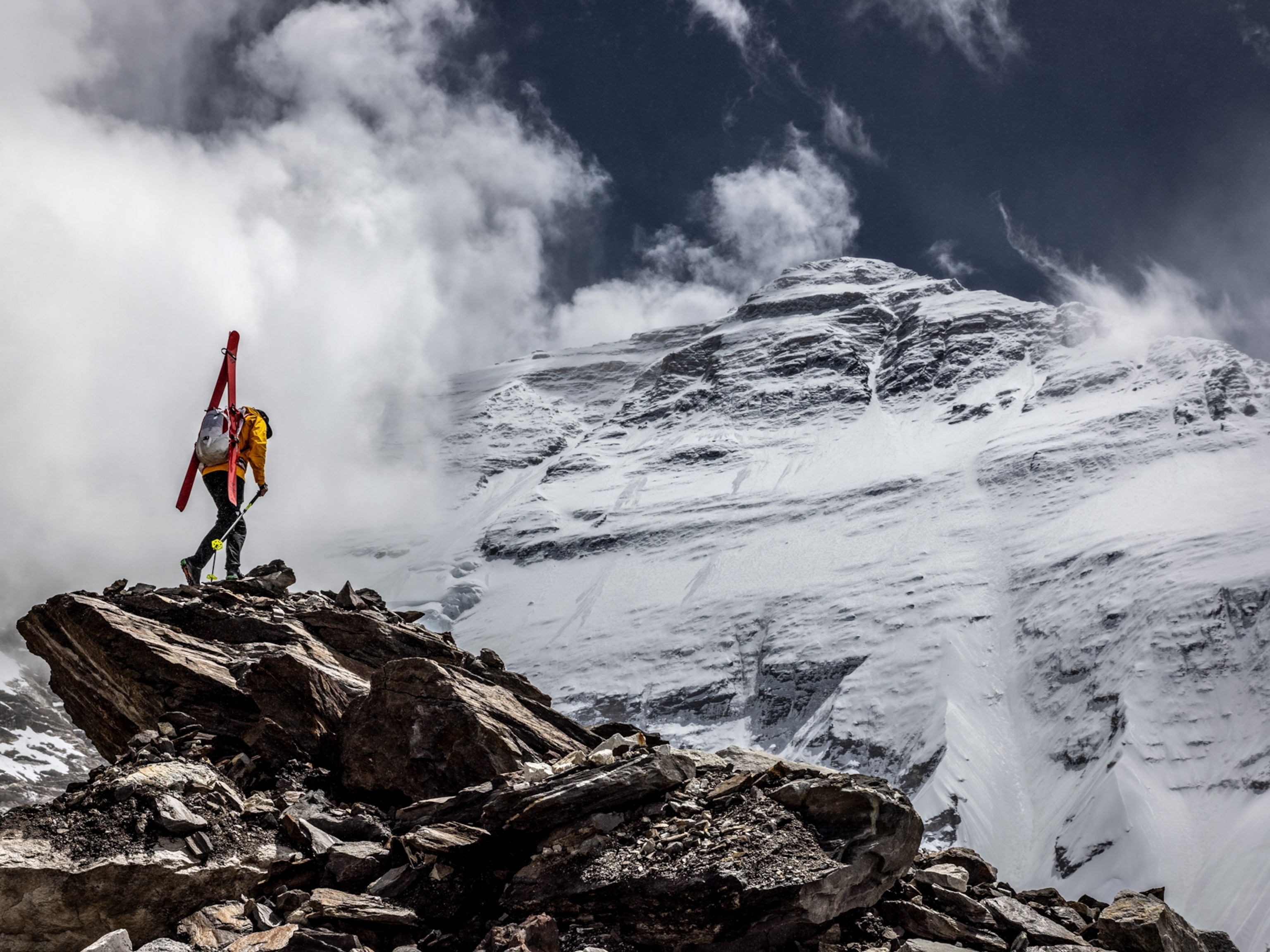
There were no dramatic views taken in or heroic photographs snapped when Khimlal Gautam, a 35-year-old Nepali surveyor and mountaineer, climbed to the top of Mount Everest on May 22, 2019. Gautam and his team had timed their ascent to arrive at around 3 a.m. in the pitch black, when temperatures can plummet to their most lethal, so that they could have the summit to themselves in the midst of one of the busiest climbing seasons in the mountain’s storied history.
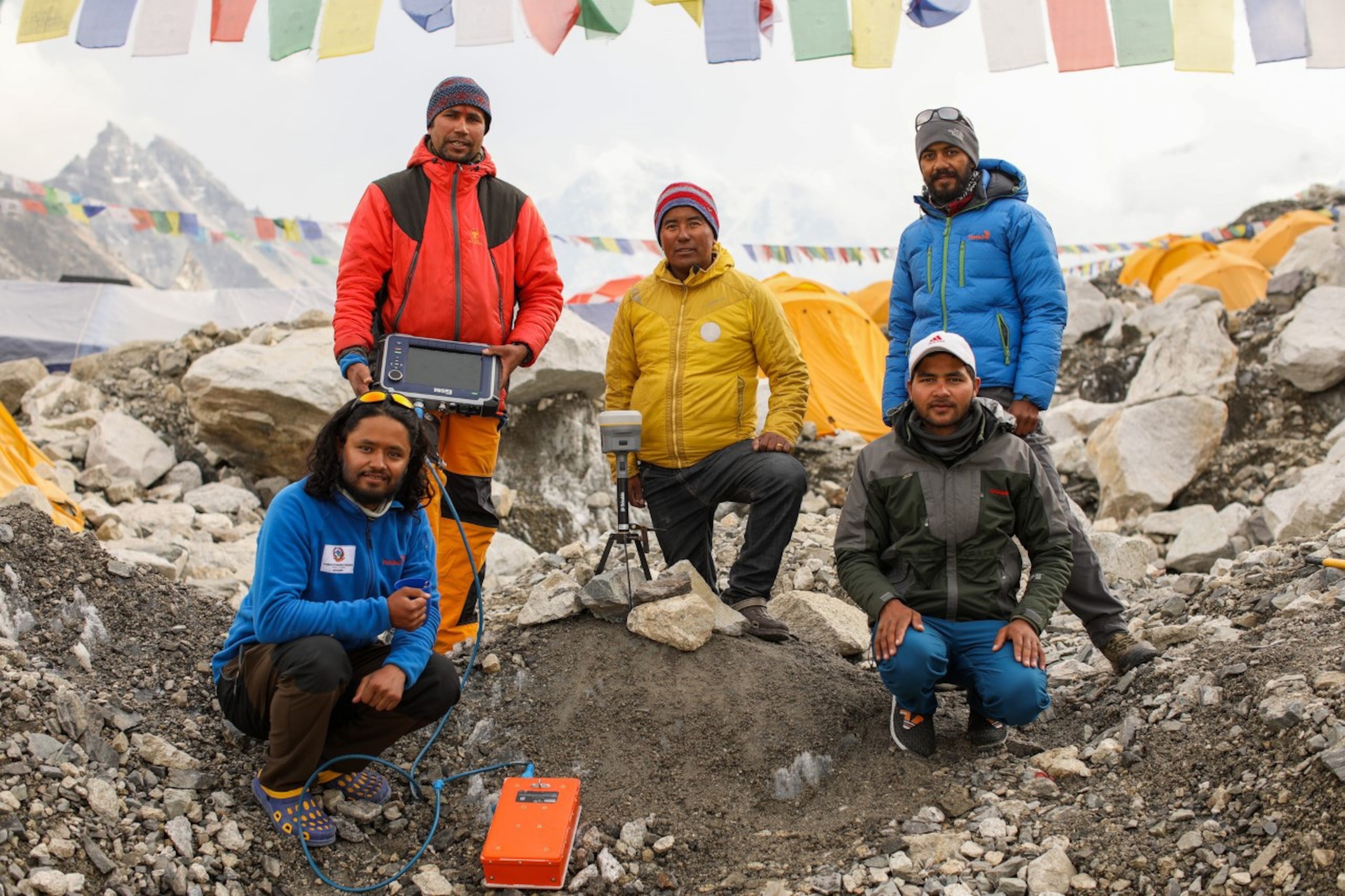
On the peak’s highest crest of snow, Gautam, aided by another Nepali surveyor and three Sherpa guides, set up a GPS antenna, which began recording its precise position from a network of satellites. Next, the men deployed ground-penetrating radar to measure the depth of the snow beneath their crampons. The two dark, frigid hours they worked on the world’s highest mountain were not without personal sacrifice: Gautam would later lose a toe to frostbite.
Now more than 15 months later, the results of their efforts—a new official height for Mount Everest—are eagerly anticipated. The project, spearheaded by Nepal’s Survey Department, was intended to pinpoint the summit elevation as accurately as possible with state-of-the-art instruments and techniques but also to make a statement of national pride.
(The world's tallest mountain? It might not be what you think.)
Most geographers estimate that Everest is growing at an infinitesimal half centimeter per year due to the plate tectonic collision that has been occurring for the last 40 to 50 million years as the Indian plate pushes into the Eurasian plate. But in 2015 a devastating earthquake—7.8 on the moment magnitude scale—struck the region, and ever since then geographers have been intrigued by the possibility that the mountain’s height has changed by several centimeters or more, a notable amount in geologic terms. A slightly more powerful earthquake hit the region in 1934 and is believed to have lowered the mountain by nearly two feet. Additionally, there is the persistent question of whether to include the fluctuating blanket of snow and ice—which can add 10 feet or more to the mountain’s elevation—or just to measure up to the highest point of rock beneath the snow and ice.
But as Gautam sat in a tent, drinking chai and recovering from his climb, he knew that as arduous as it might be to get to the highest point on the planet, the next step would present an equally difficult, if less dangerous, challenge. Measuring the world’s tallest mountain isn’t just about finding the top, but figuring out where the bottom is.
The shape of the planet
For all its soaring peaks and deep abysses, the Earth’s surface is actually less bumpy than you might think. If you were to shrink it down to the size of a billiard ball, the Earth would be smoother than a cue ball. But it’s clearly not smooth, and it’s not a perfect sphere either: it bulges slightly along the equator. This means that if you were to measure the greatest distance from the Earth's center to the point farthest away on its surface, the “tallest” mountain would be Chimborazo, in Ecuador. (Measured from sea level, it’s summit rises a “paltry” 20,702 feet, but measured from the core of Earth, it extends 20,946,288 feet,which is 6,864 feet longer than Everest.)
To measure the world’s mountains and establish their elevations in relation to each other, you need a base line starting point—sea level. But technically speaking, there isn’t just one sea level: The Earth’s oceans are constantly being pulled and shaped by the planet’s gravity.
This is where geodesists come in. They are geographers who specialize in answering this very question: What’s the shape of the Earth? This may sound like a completely esoteric job, but the next time you use navigation to find the closest coffee shop or gas station or to find your way after taking a wrong turn, you can thank geodesists because it’s their work that provides the basis for GPS.
They use two types of models to define the shape of the planet—known as ellipsoids and geoids. Ellipsoid models imagine the Earth as a smooth, curving oval that’s slightly oblong along it’s equatorial axis, sort of like an egg laying on its side. Geographers have defined several versions of this shape mathematically; the most common, known as the WGS84 coordinate reference system, is the basis for most modern GPS systems, providing the 3D reference frame for latitude and longitude coordinates.
Geoid models, meanwhile, try to account for the effect of Earth’s gravity by calculating where sea level would be if the entire planet’s surface were covered with water. This creates a virtual, planet-wide sea level mean. Because the density of the Earth is not uniform, its gravitational field exerts an uneven force across the surface of the planet. Ocean waters are subtly pulled in or away from the center depending on the local dynamics. Rather than a sideways egg, the geoid model suggests the Earth is more like a lumpy potato.
“It’s called an equi-potential surface of gravity,” explains Alex Tait, the geographer of the National Geographic Society. “You have to know where sea level would be under Mount Everest—if sea level could exist under Mount Everest.”
The first survey that measured the mountain, then identified on British maps as “Peak XV,” was undertaken in the 1850s by a British team hired by the former surveyor general of India, Sir George Everest. They calculated sea level by building a network of line-of-sight stations from the Bay of Bengal, the closest swath of ocean, zigzagging north from hilltop to hilltop, all the way until Everest was visible and could be measured using trigonometric calculations. To take the curvature of the Earth into account, surveyors used spheroid models—rough, rounder precursors to the more mathematically complex ellipsoid models. They came up with an altitude of 29,002 feet. Roughly a century later, the 1954 Survey of India using a similar method set Everest’s altitude at 8,848 meters, or 29,028 feet, including the snow cap.


That calculation proved remarkably accurate. In 1999, a survey led by cartographer and explorer Bradford Washburn and sponsored by the National Geographic Society used GPS technology and came up with an altitude only six feet higher than the 1954 measurement. In 2005, a Chinese survey set the rock height of the mountain at 29,017 feet. Currently, all three readings—from 1954, 1999, and 2005—are still in use and/or recognized by different entities. (The National Geographic Society uses the 1999 survey figure of 29,035 feet.)
When I spoke to Khimlal Gautam, whose formal title is chief survey officer of Nepal’s Survey Department, he was under no illusion that his team—even using the most advanced instruments and techniques—would settle the question of Everest’s altitude. “In survey mapping, we can’t find the exact point or altitude,” he said. “We’re trying to find the MPV—the most probable value.”
The team ultimately decided to conduct both a GPS survey and a leveling survey (a 19th-century technique still in use but now done with modern laser equipment). In addition to calculating the height of the highest rock, they also calculated the height including the snow and ice layer.
“We want to have them both and compare them,” Gautam told me, pausing for a beat, “so that we don’t have to listen to any more questions regarding the height of Everest.”
Results on hold
According to Nepal’s Survey Department, the calculations are complete and the new height of Everest is known. But for now the rest of the world will have to wait to learn whether the world’s tallest mountain has grown or shrunk several centimeters or more as the project appears to be mired in international politics. Since Nepal shares Mount Everest with China–the border dividing Nepal from China-controlled Tibet runs through the summit—the matter of determining its new official height is infused with diplomatic considerations.
Four months after Gautam and his colleagues completed their fieldwork, Chinese President Xi Jinping made a state visit to Nepal, arriving in Kathmandu on October 12, 2019. During the visit, China and Nepal announced an agreement to cooperate on the re-measurement of Everest and jointly announce the findings. This spring, while virtually all Everest expeditions were cancelled due to the COVID-19 pandemic, one group reached the summit: a surveying team from China, which conducted their own measurements. A Chinese plane carrying precision gravity survey equipment also flew over the mountain.
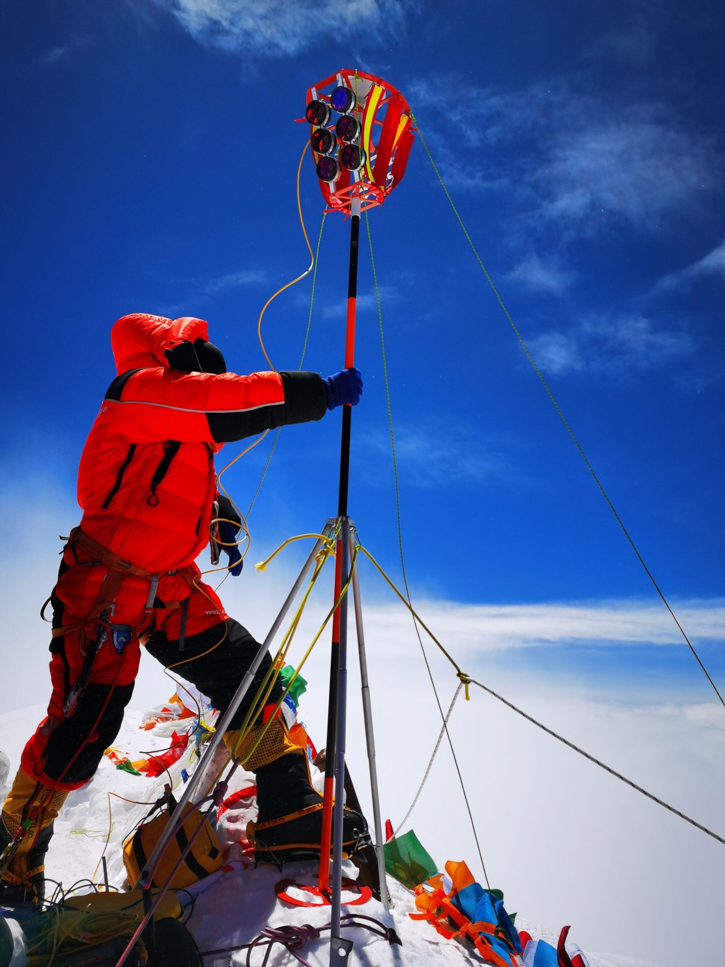
In late May, after the Chinese survey team completed their Everest expedition, Chinese authorities suggested the new elevation would be ready in two to three months, but there have been no further updates.
Last week, Yang Yuanxi, a member of the Chinese Academy of Science, discussed the importance of the Chinese effort to survey the mountain, noting that “a precise measurement of Everest was a demonstration of the country’s technological development.” Furthermore, he said, “It is a symbol of a country’s sovereignty, and it carries huge international impact and societal recognition. The precision of this measuring mission will be better than any other previous mission.”
“There’s a lot of history here,” says Ed Douglas, a respected Everest historian who recently published a history of the Himalaya. Douglas notes that, like Nepal, China has long used Everest as a symbol of national identity. In 1960, Mao Zedong ordered a large state-run expedition of Everest. That team made the first successful ascent from the Tibet side of the mountain. During the 2008 Beijing Olympics, China imposed restrictions on climbers on the Tibet side of the mountain so that an official expedition could carry the Olympic torch to the top without incident.
Nepal, one of the poorest nations in Asia, has numerous reasons to keep its wealthy and powerful neighbor happy. During the last fiscal year, some 90 percent of foreign direct investment in the nation came from China, and during his state visit, Xi pledged $500 million in financial aid. This comes in addition to the millions of dollars China has invested in Nepali infrastructure projects, including new airports, railways, and hydropower plants.
There is precedent for Nepal and China coordinating on the issue of Everest’s height. After the Chinese completed their 2005 survey, Nepal and China announced a joint agreement to recognize both the new Chinese survey of the highest point of rock and the 1954 Survey of India elevation, which included the snowcap.
Regardless of when the new height of Everest is finally announced, Gautam believes Nepal has made its point. “We want to deliver the message that we can do something with our own resources and our technical manpower,” Gautam told me as he sipped a cup of tea in his mess tent as afternoon snow squalls and patches of bright sunlight passed through Everest base camp. “Mount Everest symbolizes something in Nepal, but it’s not only a Nepal asset, it’s a world asset.”


