The Best—and Quirkiest—Maps of the 2017 Solar Eclipse
Want to see if you’re due for clouds—or if your eclipse comes with a side of waffles? These maps are for you.
A solar eclipse is an inherently spatial event: It’s caused by the alignment of the sun, moon and Earth, and it moves across our planet on a predictable path. This makes it an irresistible subject for cartographers.
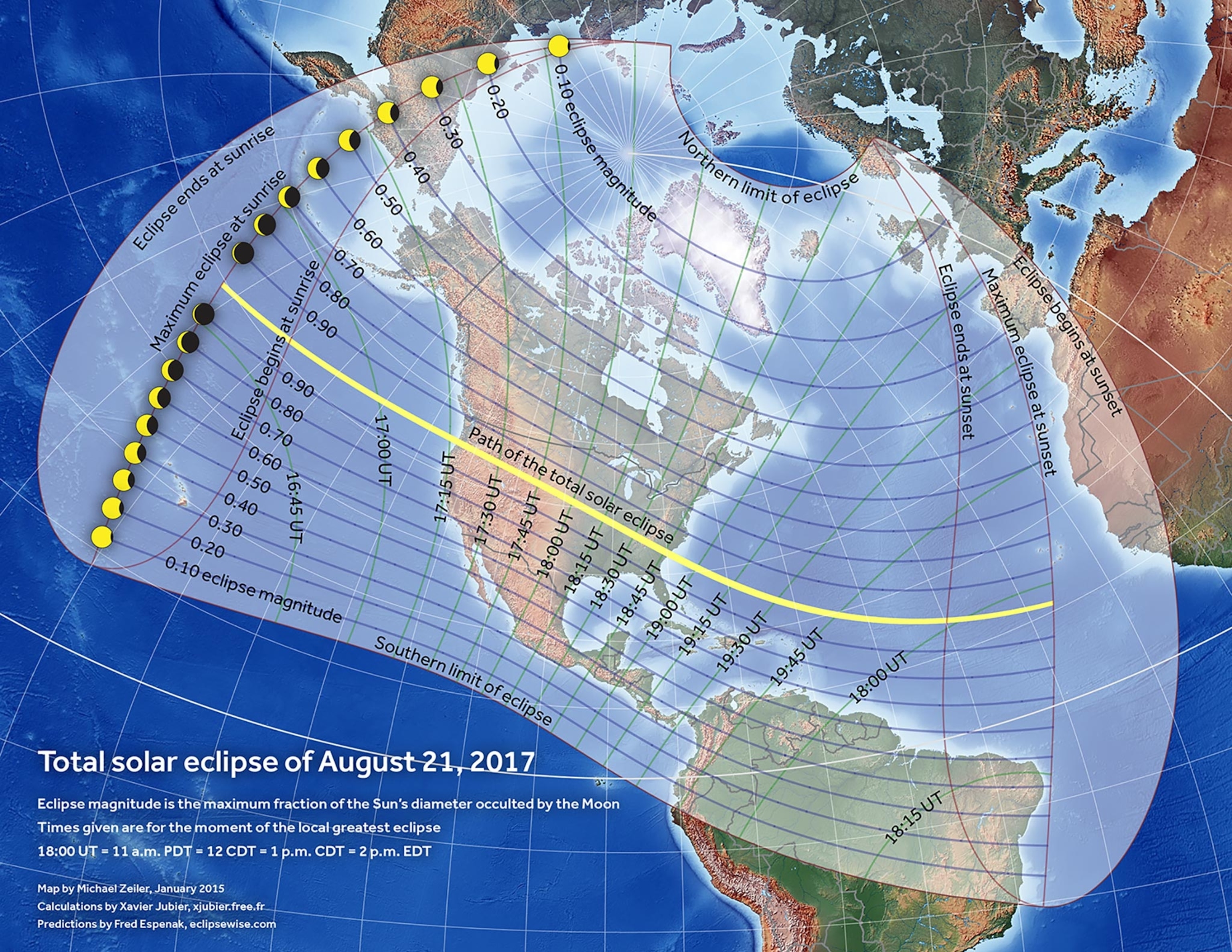
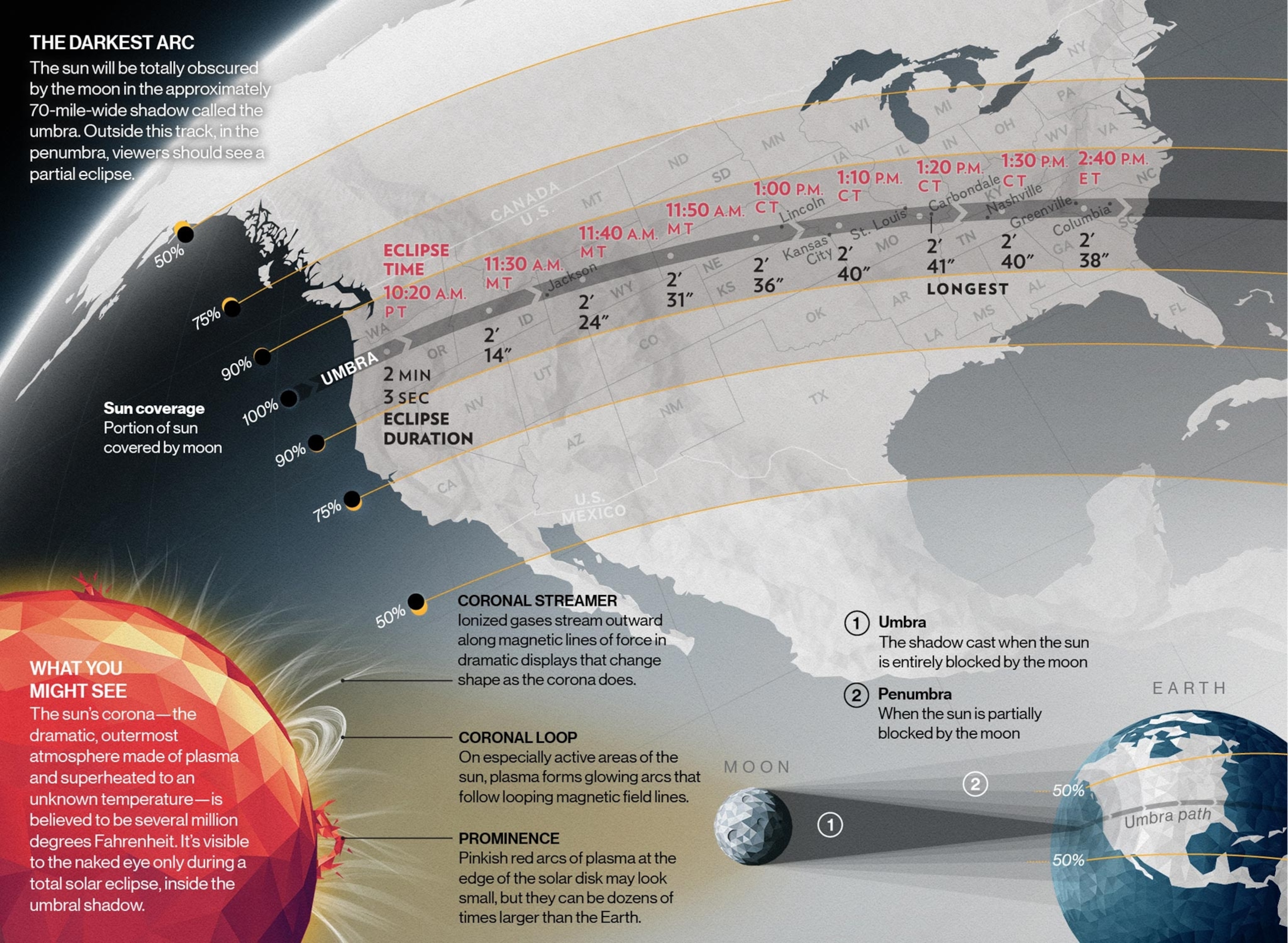
The 2017 total solar eclipse has inspired many American mapmakers to create a wide variety of maps, from practical guides for eclipse chasers to whimsical mashups of the eclipse path with unrelated phenomena. It’s the first major eclipse to cross the continent since digital mapping became as popular, accessible and ubiquitous as it is. We’ve gathered some of the prettiest, most informative, and most fun maps we’ve come across for the August 21 eclipse.
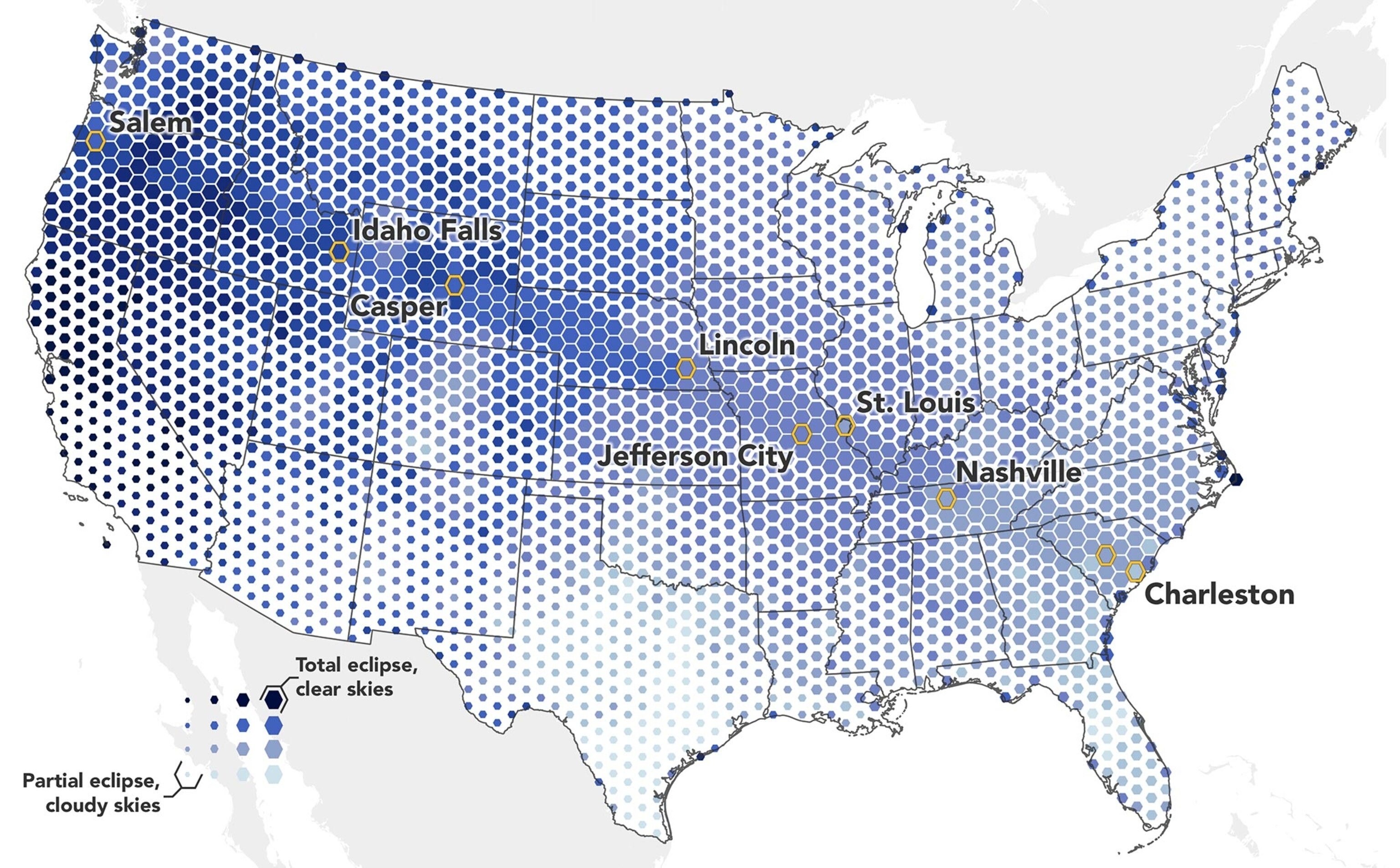
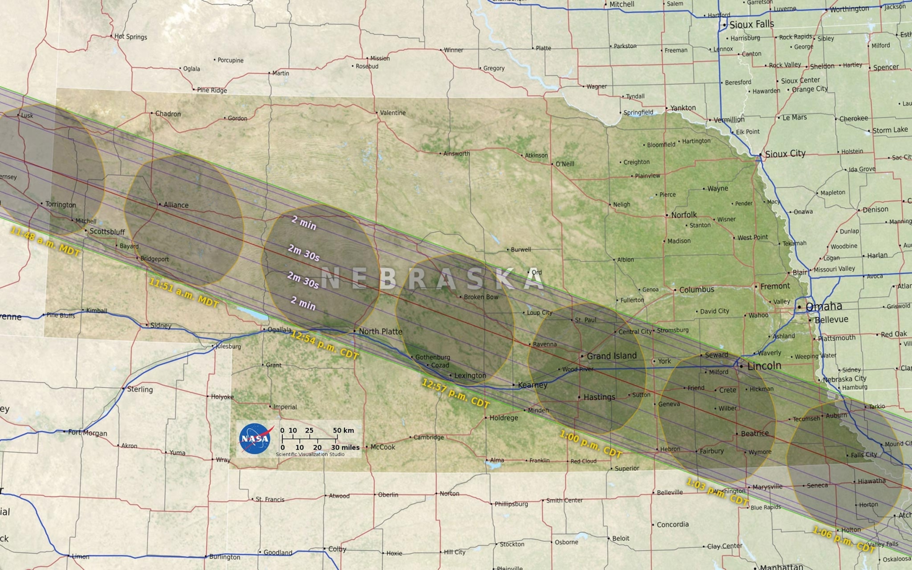
Joshua Stevens of the NASA Earth Observatory made a map (first map above) to show where viewers will likely have the best chance of an unobstructed view of the eclipse. Stevens’ predictive map is based on images from NASA's Aqua and Terra satellites showing how cloudy it was on August 21 for each of the previous 17 years.
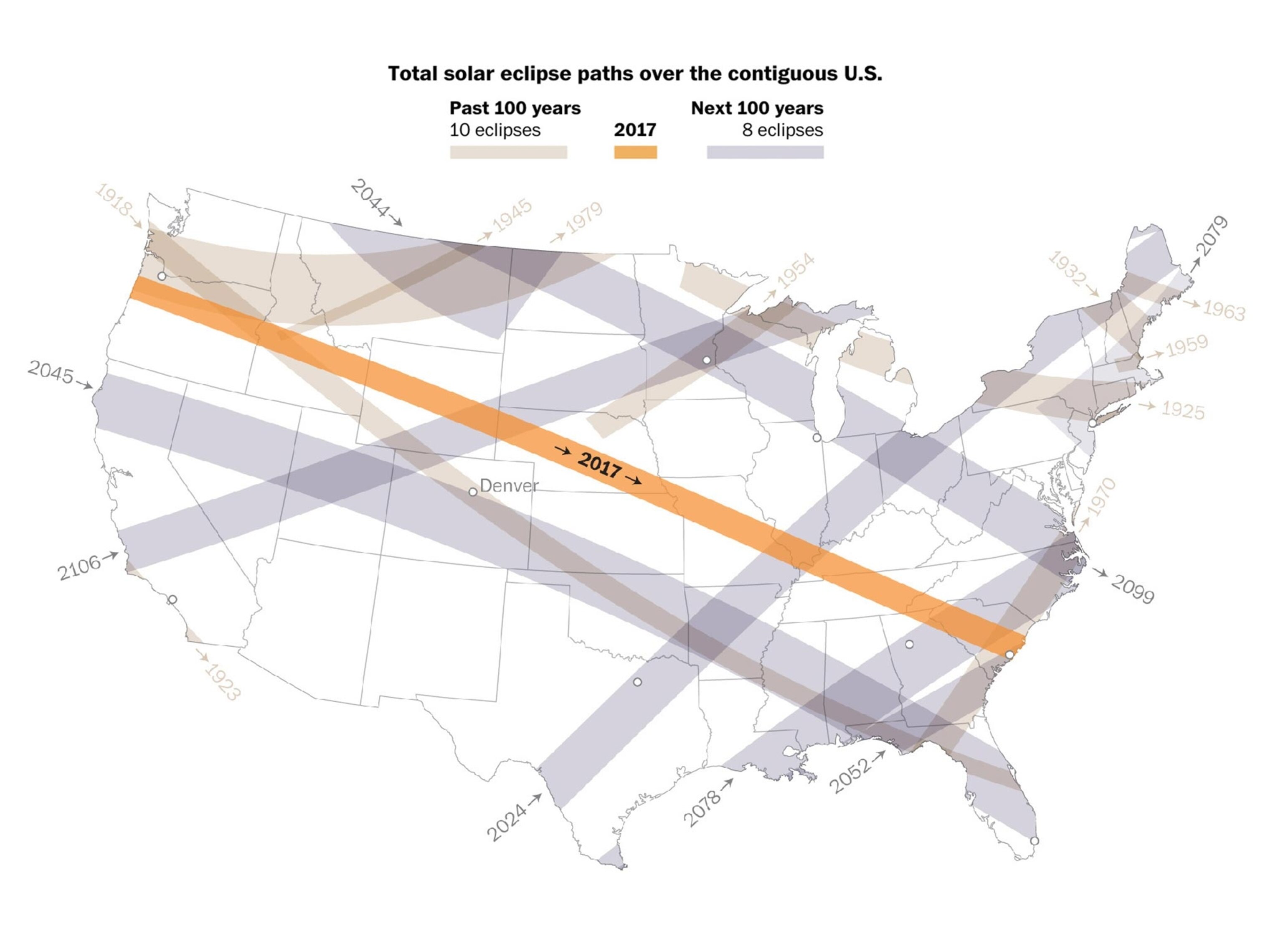
Graphics reporter Denise Lu of the Washington Post put together a beautiful collection of maps, including the one above showing the path of every eclipse that has crossed the contiguous United States in the past 100 years, and every one that will during the next 100 years. You can also check out her interactive version that will show you every eclipse on Earth you’ll have the chance to see for the rest of your life.
We also enjoyed a fun, if obvious, map of where people are searching Google for "solar eclipse 2017" on the newspaper’s Wonkblog.

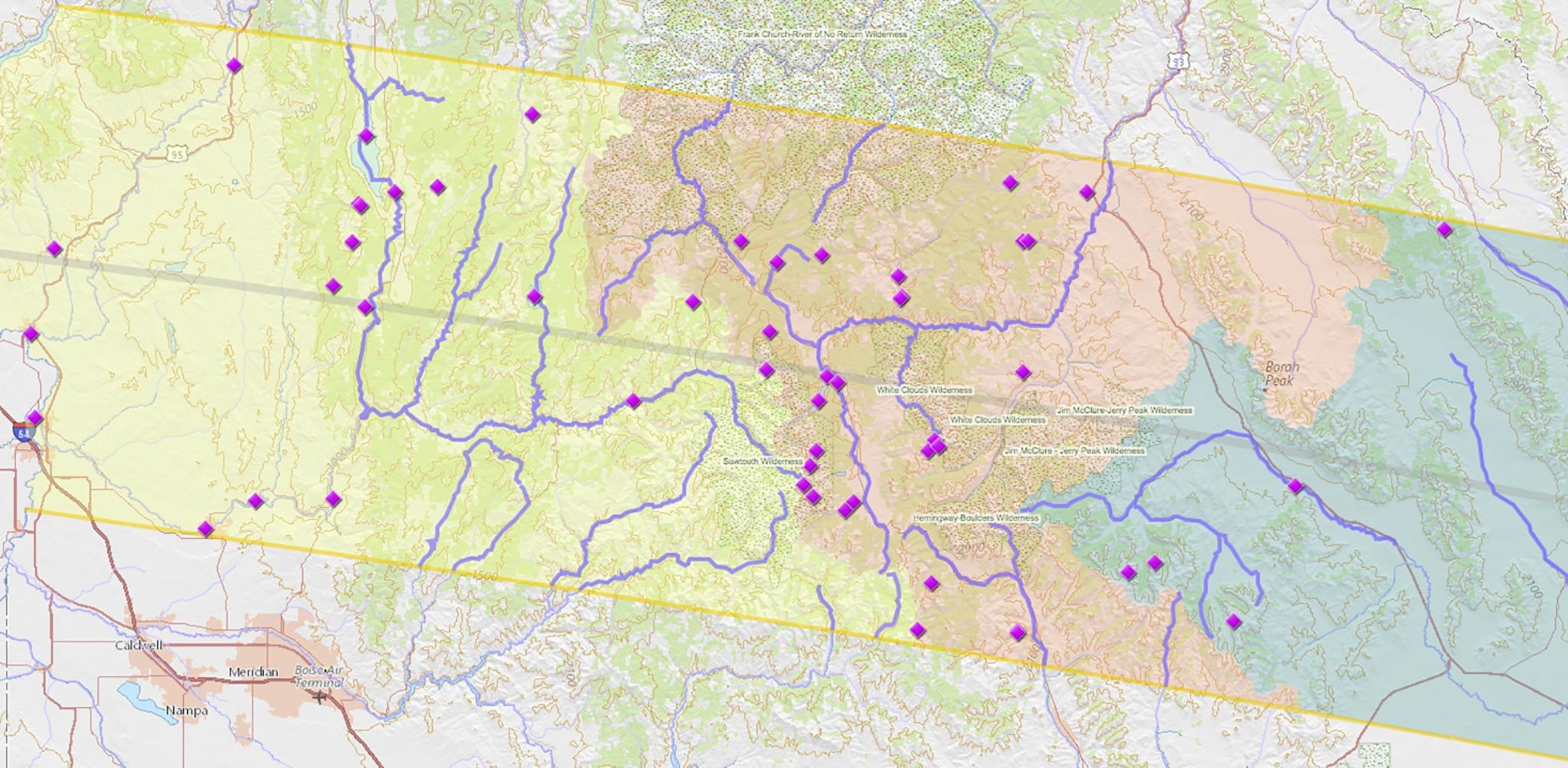
Mapmakers also got creative. Joshua Stevens challenged the idea that the event had been mapped so relentlessly that “there are no more eclipse maps to make” by creating (in his free time) a map he calls “Sunsquatch.” His map shows the best spots to see the eclipse and Sasquatch at the same time (above), by juxtaposing reported Bigfoot sightings with the eclipse’s path.
Sunsquatch inspired a whole slew of clever mashups, as cartographers mapped the best spots to: see the eclipse and UFOs at the same time; watch the eclipse while eating at Waffle House; see confused lightning bugs react to the shadow; and experience the eclipse in places with heart-like names, a nod to Bonnie Tyler’s hit song, “Total Eclipse of the Heart.” You can also see how eerily close the eclipse’s path is to the Oregon Trail, or how many towns can celebrate the eclipse Air-Jordan style.

If you’ve got a car and a last-minute urge to see the totality of the Monday's eclipse, cartographer and eclipse chaser Michael Zeiler has you covered. One of his many eclipse maps (above) will tell you how soon you need to start driving to hit the path of totality in time for the eclipse, but beware, there’s likely to be an unusual amount of traffic—so maybe just leave now.
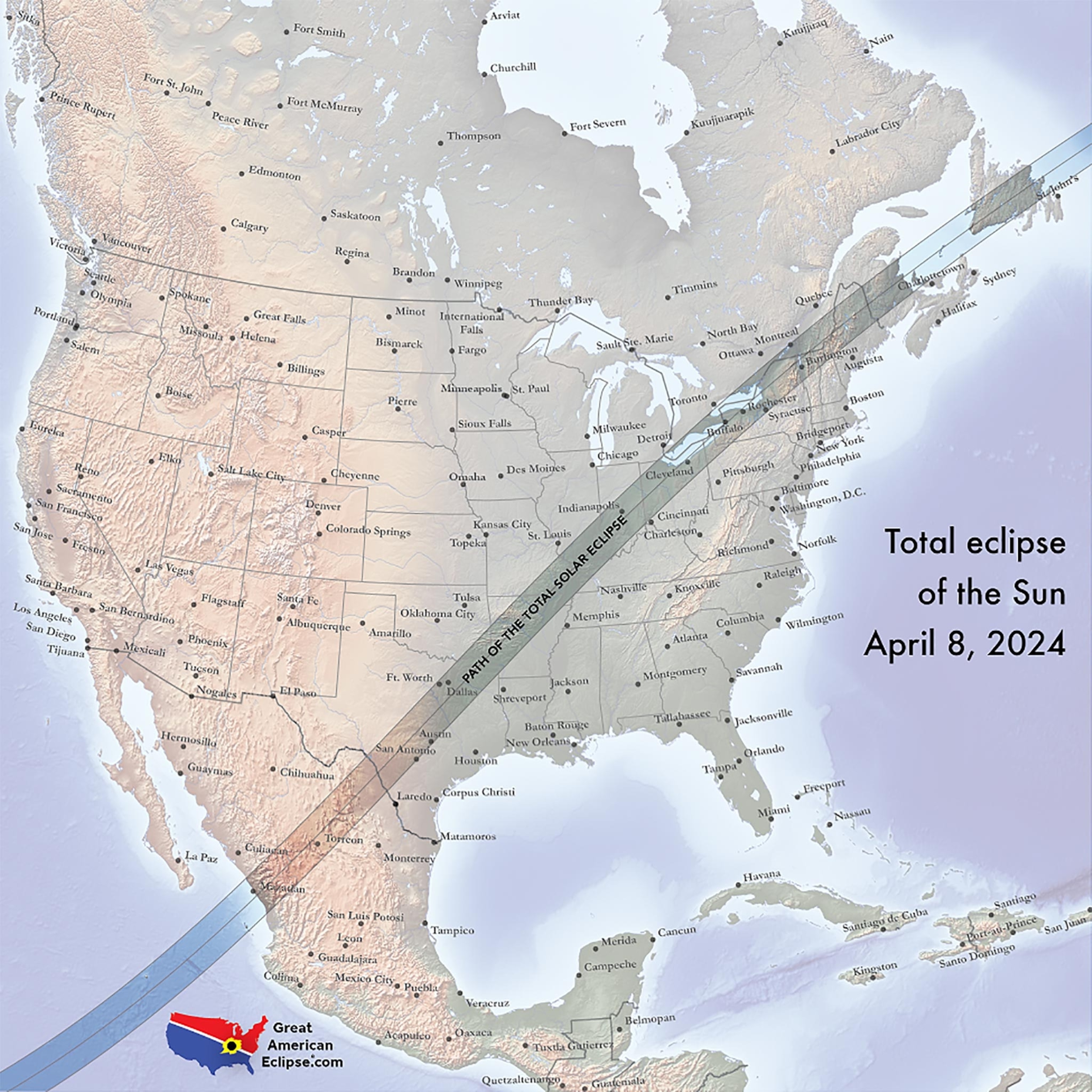
The event will last just over two and a half minutes, but if you miss it and you’re in North America, you’ll only have to wait seven years for the next one. Zeiler’s map below shows the path of the 2024 eclipse.
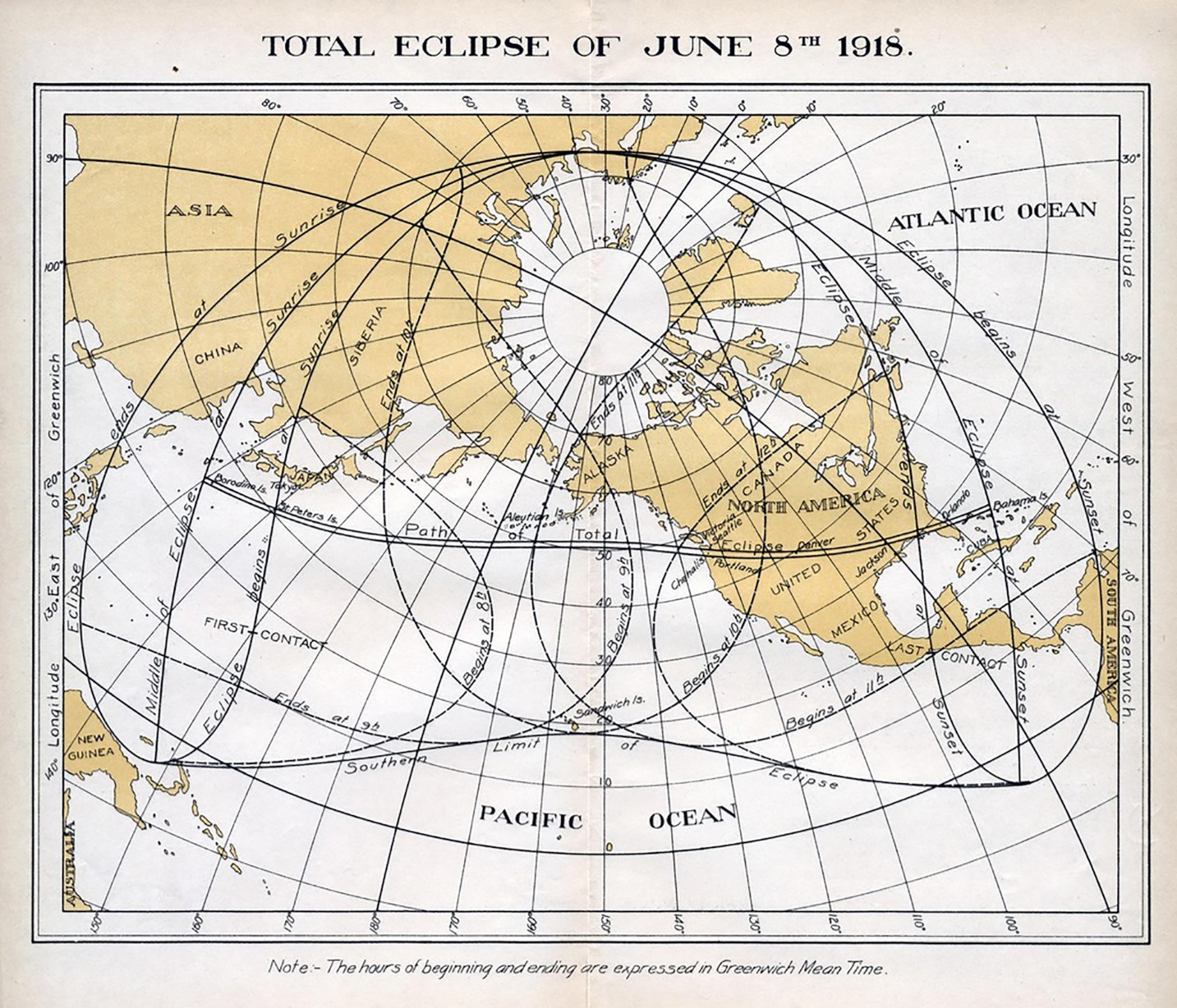
The last time a total solar eclipse traversed the contiguous United States was in 1918, with a path quite similar to this year’s eclipse, stretching from Washington State to Florida.
Eclipse maps first appeared in the 17th century, made possible by Nicolaus Copernicus’ theory that Earth was rotating around the sun (and not the other way around), and Johannes Kepler’s laws of planetary motion. Today’s eclipse maps are far more accurate and detailed, thanks to rapid scientific advancement and precise satellite measurements.
Follow All Over the Map on Twitter and Instagram.

