Hike through 500 million years in U.S. national parks
Fantastic landforms are on display in these five geologically remarkable parks.
The oldest national parks wind us back billions of years. Others? Still crawling into a fully formed existence. Each is a postcard from a different era in Earth’s past—step foot here, and it’s the closest you’ll get to hiking through time.
It’s a journey that starts two billion years ago, when the basement rocks that make up North America were forming—and so were a few of our favorite parks. Here’s how to see them at their best today.
Black Canyon of the Gunnison National Park
500+ million years ago
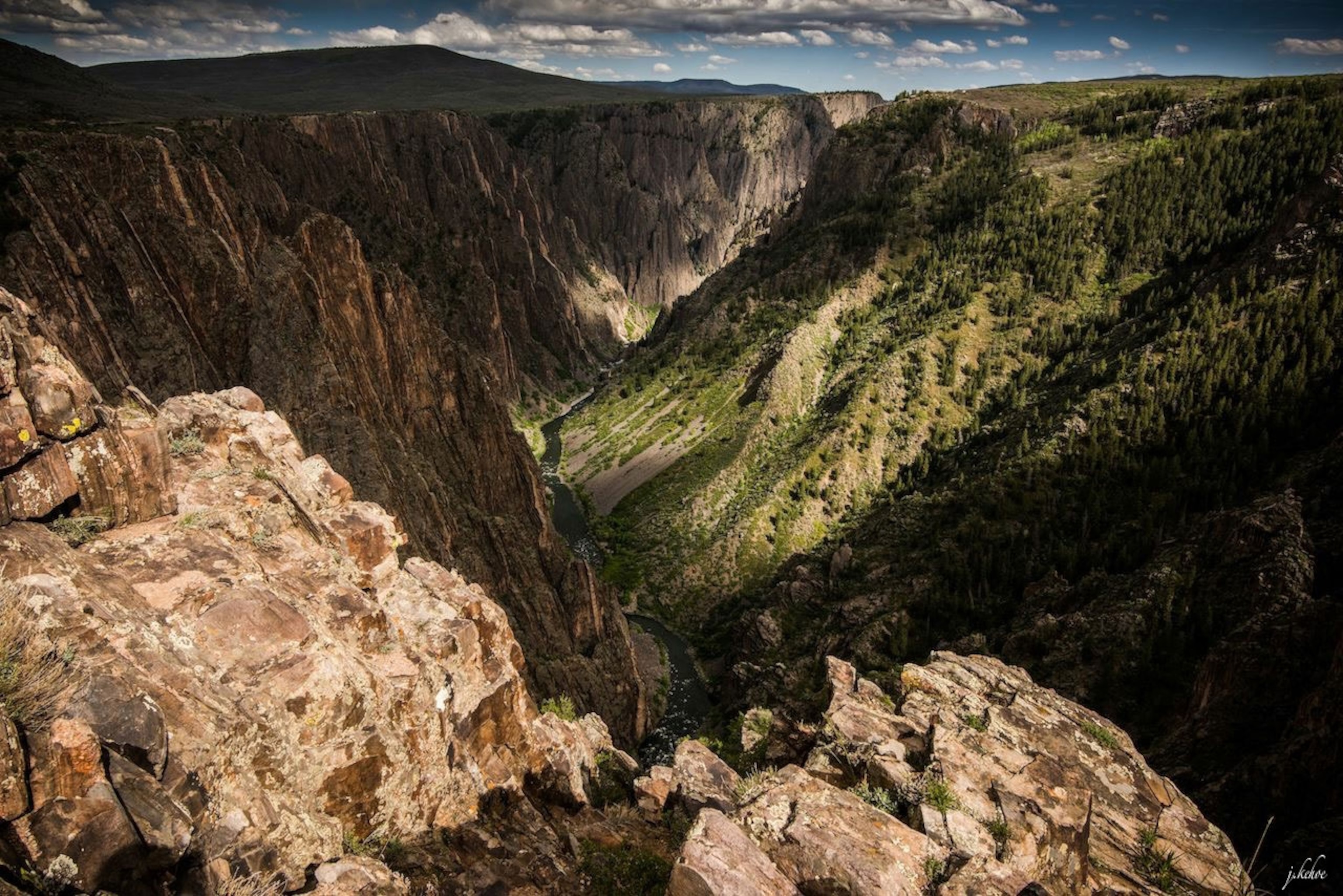
Slice a knife through 2,700 feet of Colorado’s crust (or wait two million years for the Gunnison River to do the work for you), and you’ve got Black Canyon of the Gunnison, a vertical wilderness displaying nearly two billion years of Earth's history.
1.7-billion-year-old gneiss and schist make up the bottom of this dark, unbelievably narrow canyon. The Gunnison River trapped itself between these granitic walls after carving through softer, younger rocks—an impossible path resulting in a river gradient equal to the fifth steepest mountain descent in the world.
Chasm View best illustrates this steep descent from above, but able hikers should nab a permit and trek down into the canyon depths.

Great Smoky Mountains National Park
400 million years ago
Imagine standing on the eastern edge of North America some 400 million years ago. You’re in the sands of a shallow sea, volcanoes at your back, Africa looming in the distance—welcome to Great Smoky Mountains National Park.
The impending continental collision will take the ground you’re on and raise it to Rocky Mountain heights in a line stretching from Newfoundland to, technically, Morocco. The impact, however, is seen across the globe.
“Building high mountains through continent-continent collision changes Earth’s climate,” explains Alexa Sedlacek, Assistant Professor at the University of Northern Iowa. “Parts of the Appalachians weathered so quickly a million-year glacial period ensued” as their erosion removed carbon dioxide from the atmosphere and cooled the climate.
To scope out the park’s watery, glacial past, head to Cades Cove. Fossils there—in limestone, a rock that forms in shallow marine waters—date back 450 million years.
- National Geographic Expeditions
Wind Cave National Park
300 million years ago
Underneath the little footprints of thousands of prairie dogs—and the bigger footprints of bison—lies the densest cave system in the world. It’s also one of the oldest: 350 million years ago, South Dakota was an inland sea that came and went, came and went, came and, finally, went with the uplift of the Black Hills. Throughout that time, calcium carbonate seashells would become limestone, gypsum would crystallize, and the water table would drop, leaving us with the first underground national park, a 142-mile maze cave that’s still growing. The water, dubbed “The Lakes,” is now 500 feet below the surface.
Though all of the NPS-guided tours are worth the (first-come, first-served) ticket, the Natural Entrance tour is the only one that takes you through this 3D cave’s port of discovery.
Petrified Forest National Park
200 million years ago
Arizona’s Petrified Forest National Park was once equatorial, a massive forest-lined riverbed flowing westward to the sea. Today’s jewel-like logs and badlands were born of these bygone waters.
“Persistent flooding buried these trees,” says Ron Blakey, Professor Emeritus at Northern Arizona University. “Altered volcanic ash in the water percolated through the porous wood to turn the trees to colorful agate.” Unrooted, the fallen trees would often get stuck in log jams—now today’s sparkly, petrified forests.
Crystal Forest Trail is an easy three-quarter-mile loop to check out an ancient log jam, but don’t forget: This was the “dawn of the dinosaurs,” and fossils take on the form of fauna as well as flora.
Bryce Canyon National Park
100 million years ago
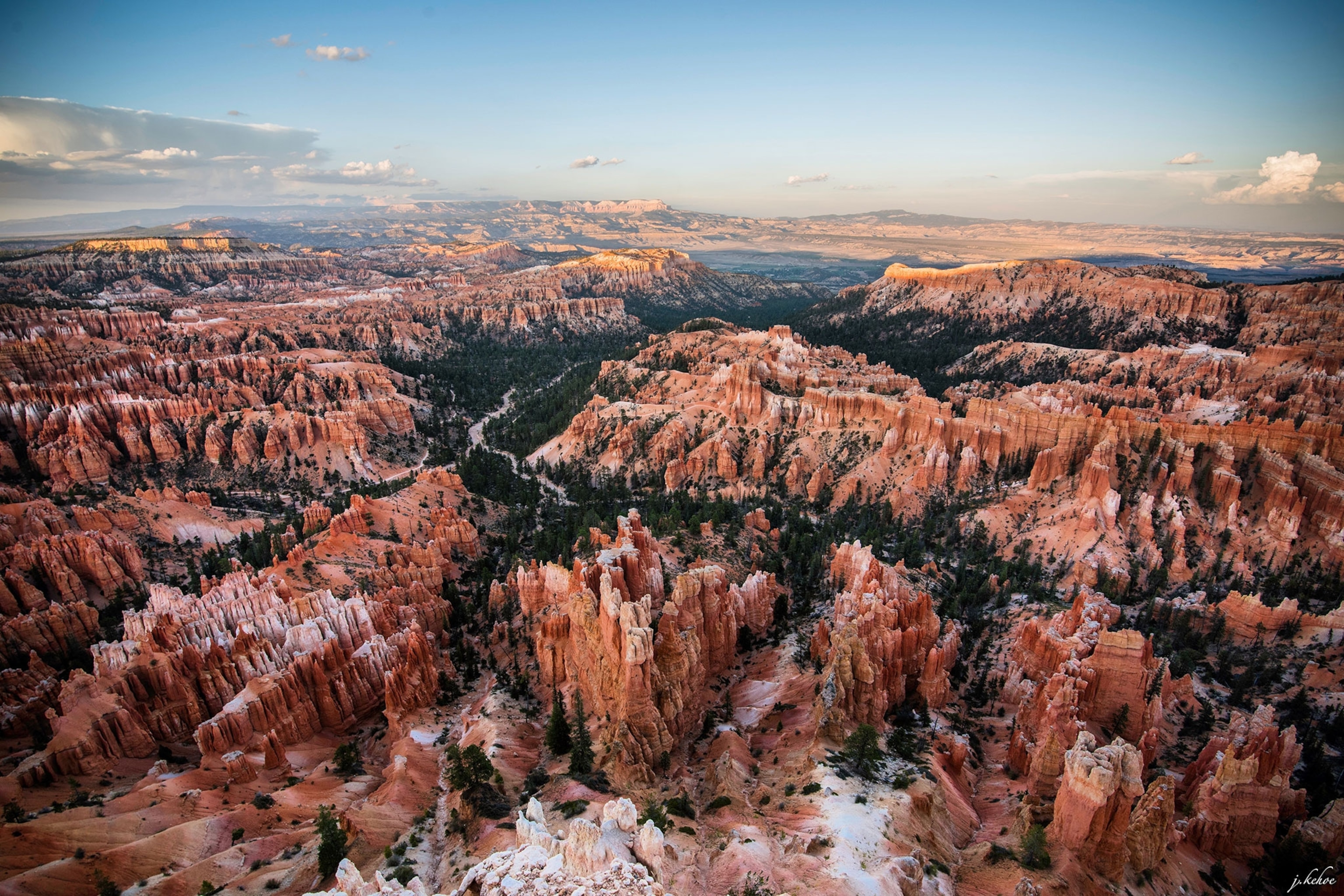
For 60 million years, the Western Interior Seaway covered much of eastern Utah. “Fast production of new ocean crust displaced ocean water onto the continents,” says Sedlacek. When it finally retreated for good, lakes and streams were left to navigate its basin, adding their own sediments to the mix. Uplift of the Colorado Plateau—taking Bryce Canyon to 9,000 feet—would reroute the water and rewrite Bryce’s history.
At this height, a single raindrop is still king. Bryce is at the ideal elevation for hoodoo formation: Reaching freezing temperatures some 200 nights a year, its vistas are still being carved by rain, snow, and ice. Every 50 years, the rim loses a foot.
At the Yovimpa Viewpoint, you can see the “Grand Staircase” clearer than just about anywhere else. Count the distinct, colored layers—each is another postcard in Earth’s history.


