A complete guide to hiking the epic Jordan Trail
The 400-mile Jordan Trail spans the entire length of the country, snaking through incredible sites like Petra, As-Salt and Wadi Rum. Here's how to plan your route.
Sandwiched between Iraq, Syria, Israel and Saudi Arabia, Jordan is home to stunning desert landscapes, world-famous UNESCO World Heritage Sites and a thriving Bedouin culture. Spanning its length is the epic 400-mile Jordan Trail. Established in 2015, it stretches from Umm Qais in the bucolic north to Aqaba in the arid south and takes in some of the country’s most iconic sites, such as the rock-hewn city of Petra and the wide sandy plain of Wadi Rum. In total, the trek is estimated to take 40 days to finish — and, though split into eight sections with wild camping available en route, it's still no walk in the park. There are big distances to cover, the sun can be fierce and the elevation is up to a 3,280ft a day, but the sense of pride that comes with each stamp in your Jordan Trail ‘passport’ is immense.

1. Umm Qais to Ajloun
Distance: 50miles/four days
Difficulty: Moderate
It’s best boot forward on this first leg of the epic trail. It starts on the border with Israel and Syria and bucks hikers’ expectations of a dry, desert-like Jordan by plunging them into a landscape of verdant oak forests and farmland. Travellers share compacted stony paths with long-eared goats and traverse hills scattered with ancient olive groves and villages pioneering community-based tourism. Highlights include the historic remains of the Roman city of Pella, the Byzantine monastery of Tel Mar Elias and neck-craning views of the medieval mountaintop Ajloun Castle, built by the nephew of the famous leader Sultan Saladin.
Did you know? The unassuming ‘Jesus Cave’ in Umm Qais is said to be where Jesus stayed for a few nights before his baptism.
2. Ajloun to As-Salt
Distance: 39 miles/four days
Difficulty: Moderate
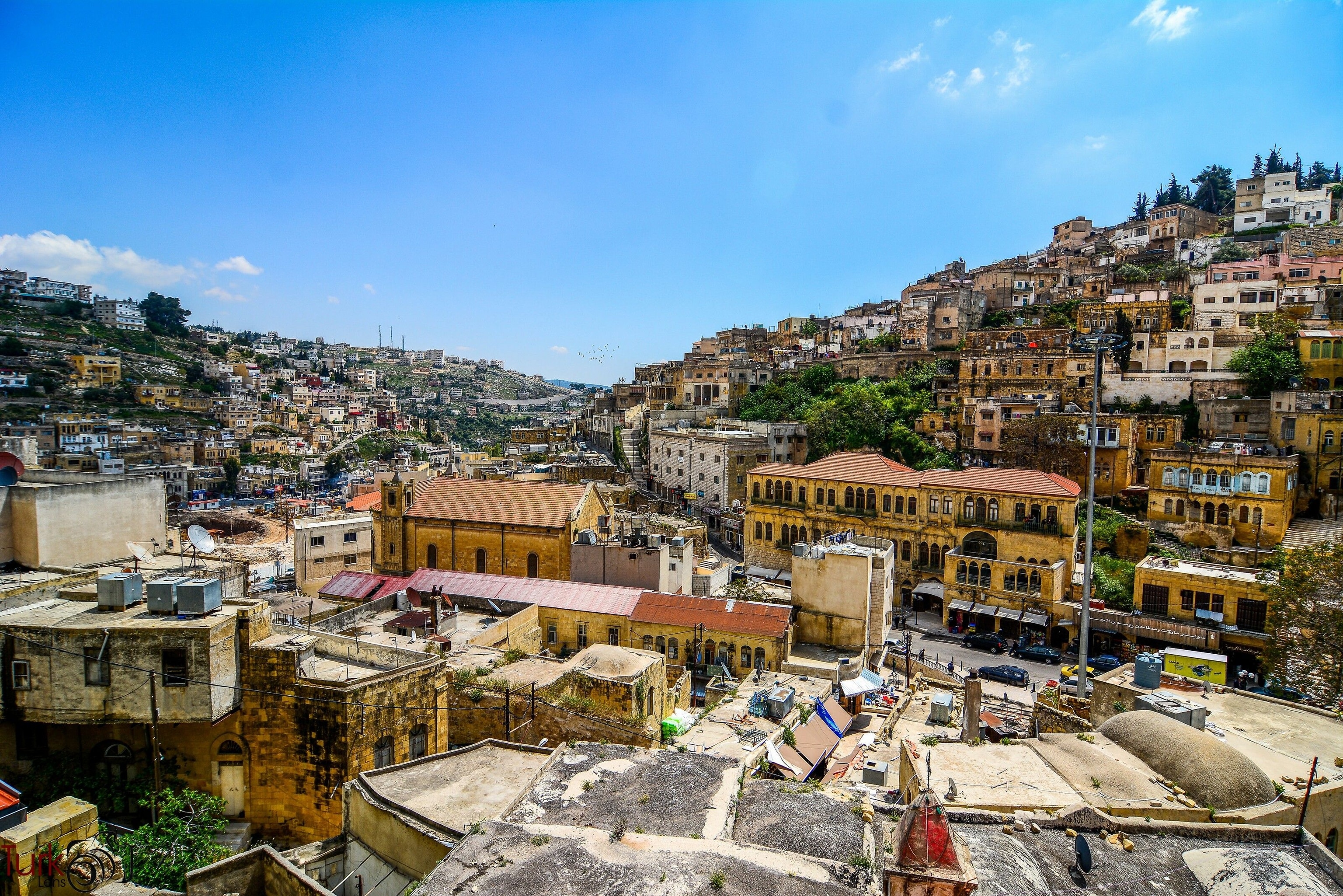
As the stone towers of Ajloun Castle recede, the trail follows a mix of tarmac and stony roads into the pine-scented Al-Safsafa Forest and then onward to farmland that opens to reveal elevated views of the alpine-like King Talal Dam. Then it’s upwards past the cooling spray of Rmemeen waterfall and into the mixed Christian and Muslim village of Rmemeen to stay in the grounds of its beautiful church. Look out for fields splashed with crimson poppies and honeyed buttercups before entering the town of As-Salt, where it's common to see men wearing ghutra (traditional Arabian headdress) playing board games such as backgammon or mancala.
Did you know? Jordan’s only microbrewery, Carakale, is in Fuheis, just south of As-Salt.
3. As-Salt to Wadi Zarqa Ma’in
Distance: 52 miles/four days
Difficulty: Moderate
After As-Salt’s golden tiers of Ottoman-style homes, the moist air begins to dry and arid ambers start to consume the greens. The route passes the colonnaded splendour of Qasr al-Abd palace in Iraq Al-Ameer, built by a noble Jewish family some 2,300 years ago, and descends the zigzag of King Hussein’s Rally Road, built to satisfy the former ruler’s admiration for cars. Hikers pass Bedouin camps and the mercurial shimmer of the Dead Sea appears on the horizon. Then, after following an old Roman road, the trail enters the embrace of Wadi Zarqa Main and Wadi Wala, cut through by refreshing streams.
Did you know? In 2021, As-Salt became the sixth UNESCO World Heritage Site in Jordan.
4. Three Wadis to Al-Karak
Distance: 47 miles/four days
Difficulty: Difficult
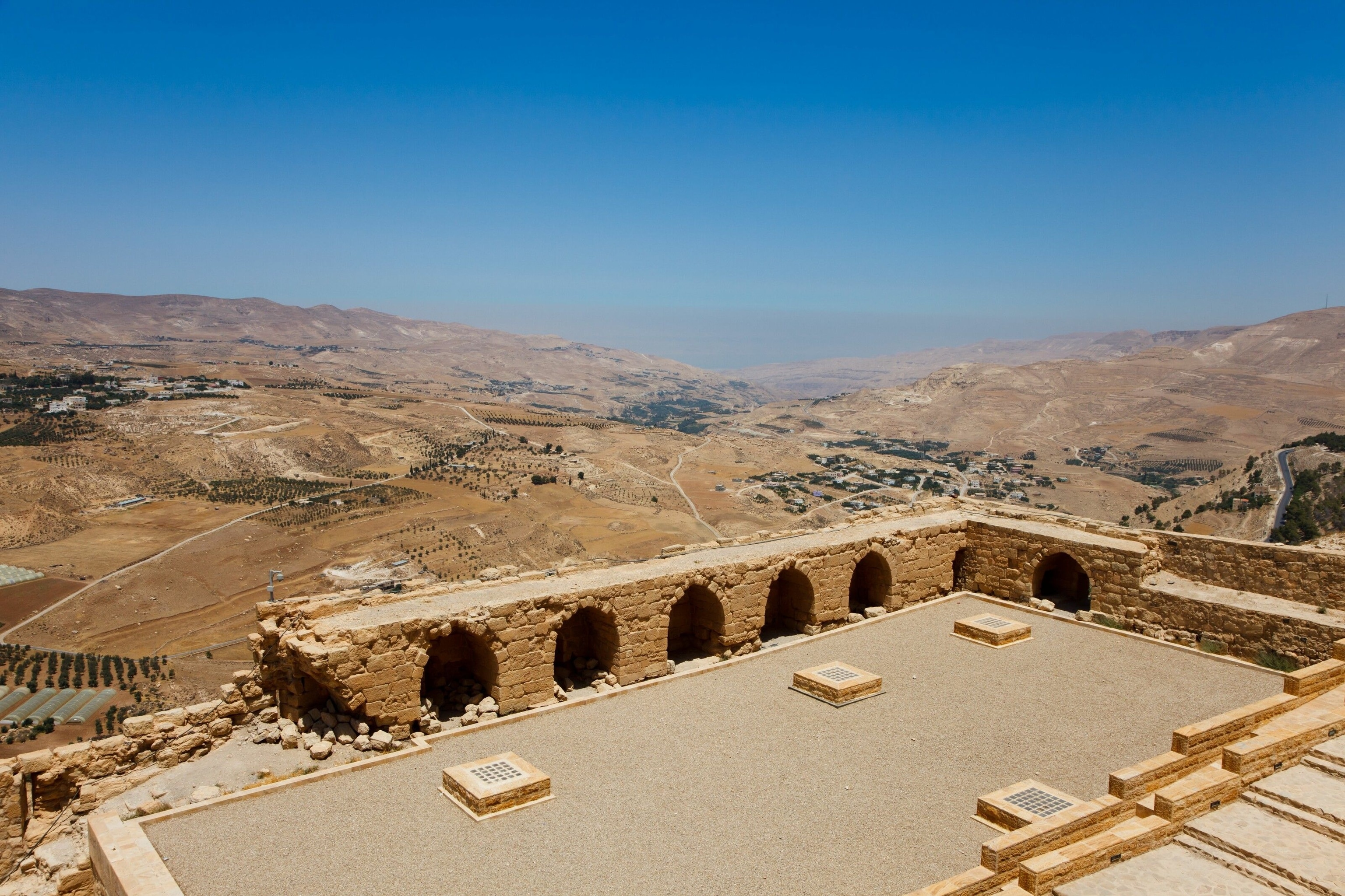
It’s up down, up down in this challenging section that traverses three wadis — Hidan, Mujib and el Tawahin — and a lunar-like terrain peopled by goats, small hardy plants and cacti. Listen to the crunch of gravel under foot, watch the sun and clouds create shifting patterns on the curves and crevices of the canyons, cool off in the fast-flowing stream of the 2,600ft-deep Wadi Mujib and wild camp beneath starry night skies. Archaeological highlights include the elegant stone arches of the Majdaline ruins and the Crusader-built Al-Karak Castle that crowns the hill overlooking Karak and marks the finale of this fourth section.
Did you know? Wadi Mujib is billed as the Grand Canyon of Jordan.
5. Al-Karak to Dana
Distance: 52 miles/four days
Difficulty: Moderate
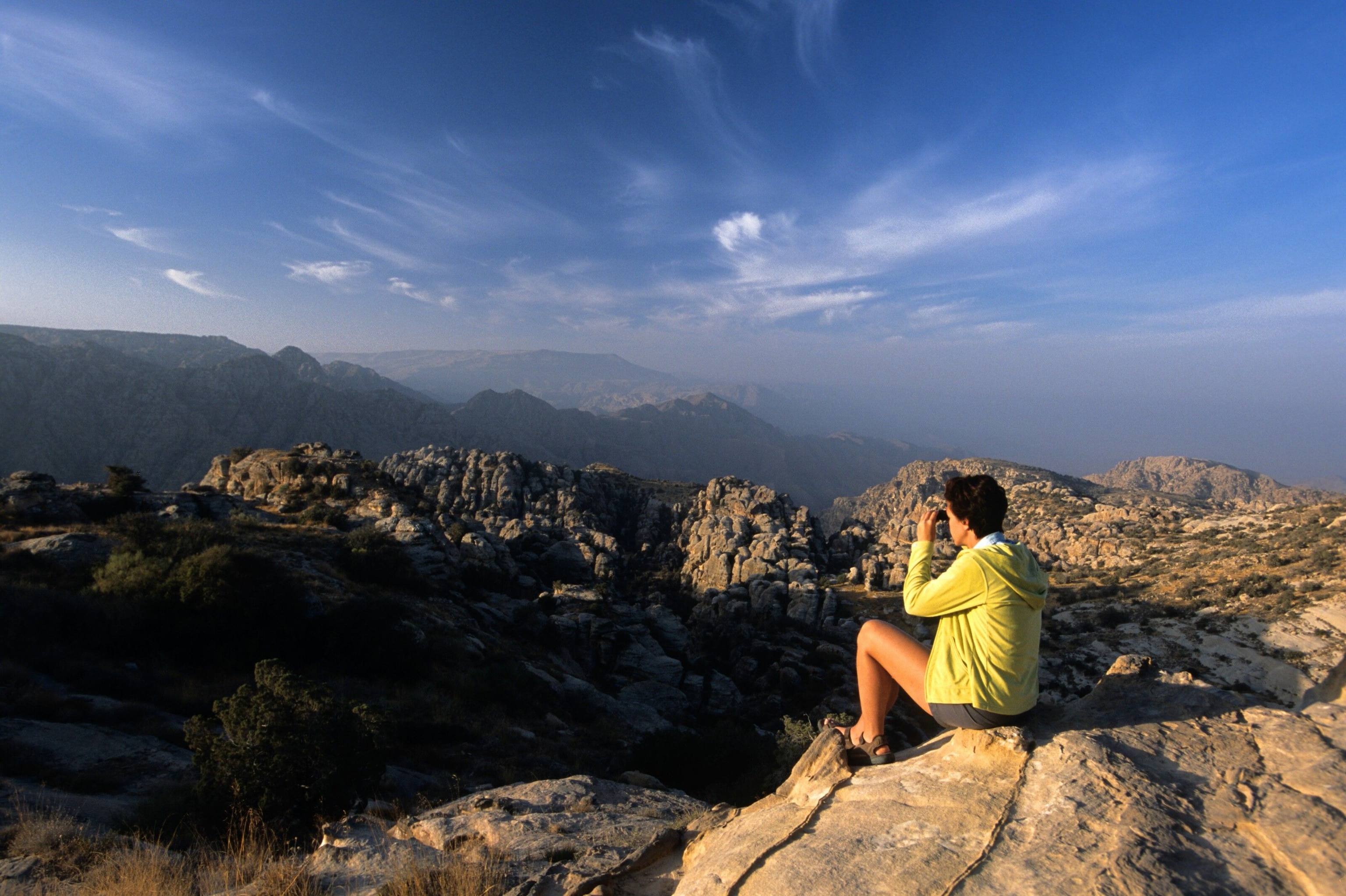
A broad bright-white gravel path leads hikers away from Al-Karak, around hillsides studded with rocks and sun-parched grasses, and past the abandoned village of Khirbet Ainun. Then it’s on to the lush olive groves and orchards on the rim of Wadi Numeira and an ascent of limestone cliffs up to the Tor al-Taboun viewpoint, before descending more than 3,000ft into the reed-dappled base of Wadi Hasa. Once hikers have scrabbled up the other side, there’s the chance to stop at a Bedouin encampment for a reviving sugary tea before heading on to the evocative ruins of Al-Ma’tan, a Bronze Age village. The final stop on this leg is the village of Dana on the outskirts of the must-visit Dana Biosphere Reserve.
Did you know? The Dana Biosphere Reserve is Jordan’s largest nature reserve and home to endangered species such as the Syrian wolf and sand cat.
6. Dana to Petra
Distance: 52.2 miles/four days
Difficulty: Moderate
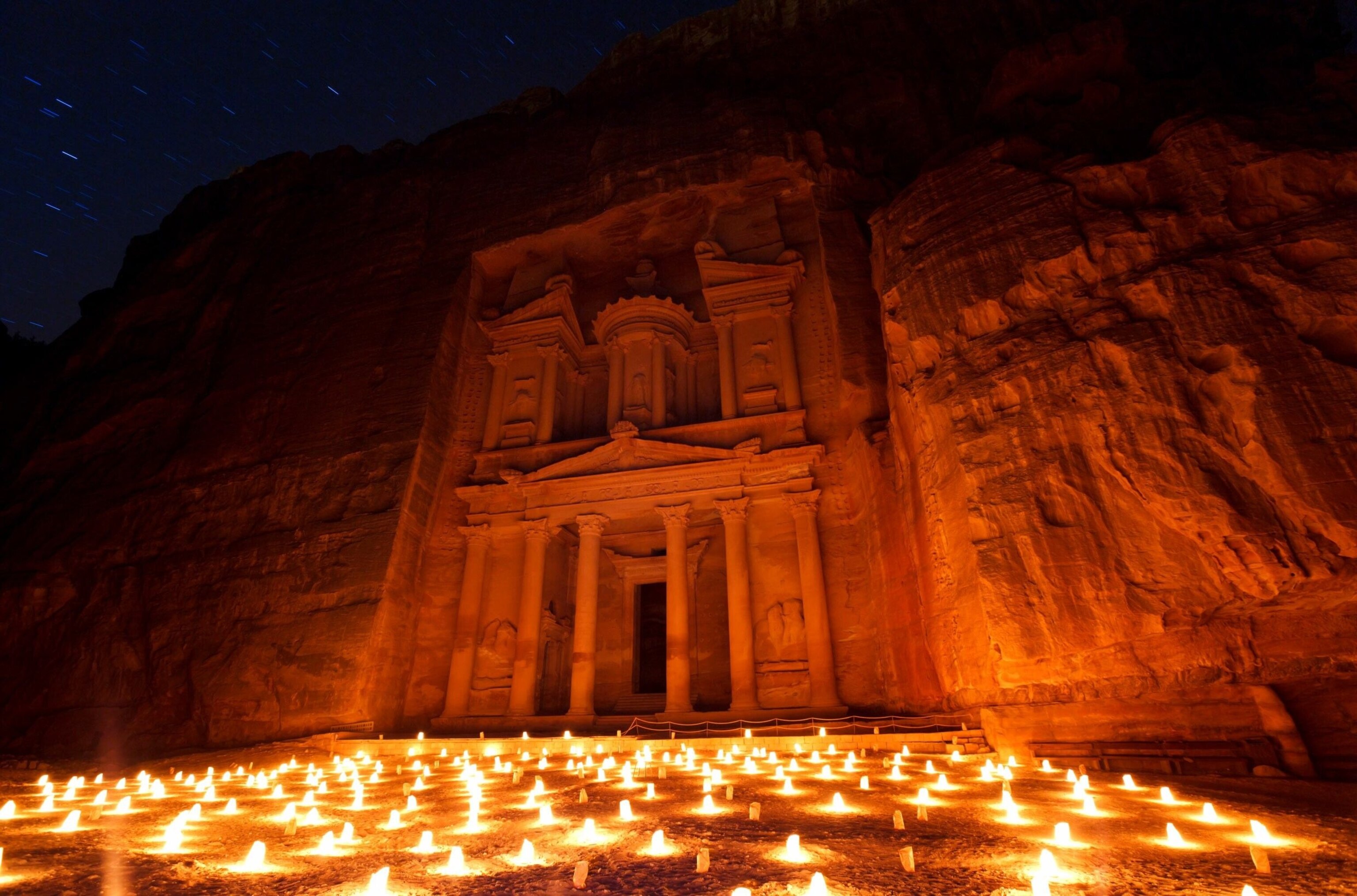
By this stage, hikers’ soles may be getting weary, but their souls will be lifted by one of the most diverse and awe-inspiring sections of the trail. Departing Dana, the landscape changes every few miles from fertile farmland into ochre-hued labyrinthine valleys, passing through wadis Feynan and Araba, and culminating in the UNESCO-listed ‘Rose City’ of Petra, hand-chiselled from the dusky pink sandstone some 2,300 years ago by the Nabateans. Following in the footsteps of ancient spice traders, trekkers enter via the less-used ‘back door’ entrance from Little Petra and pass the famous colonnaded Treasury.
Did you know? National Geographic included this section in its list of the 15 best hikes in the world.
7. Petra to Wadi Rum
Distance: 56.3 miles/five days
Difficulty: Moderate to difficult
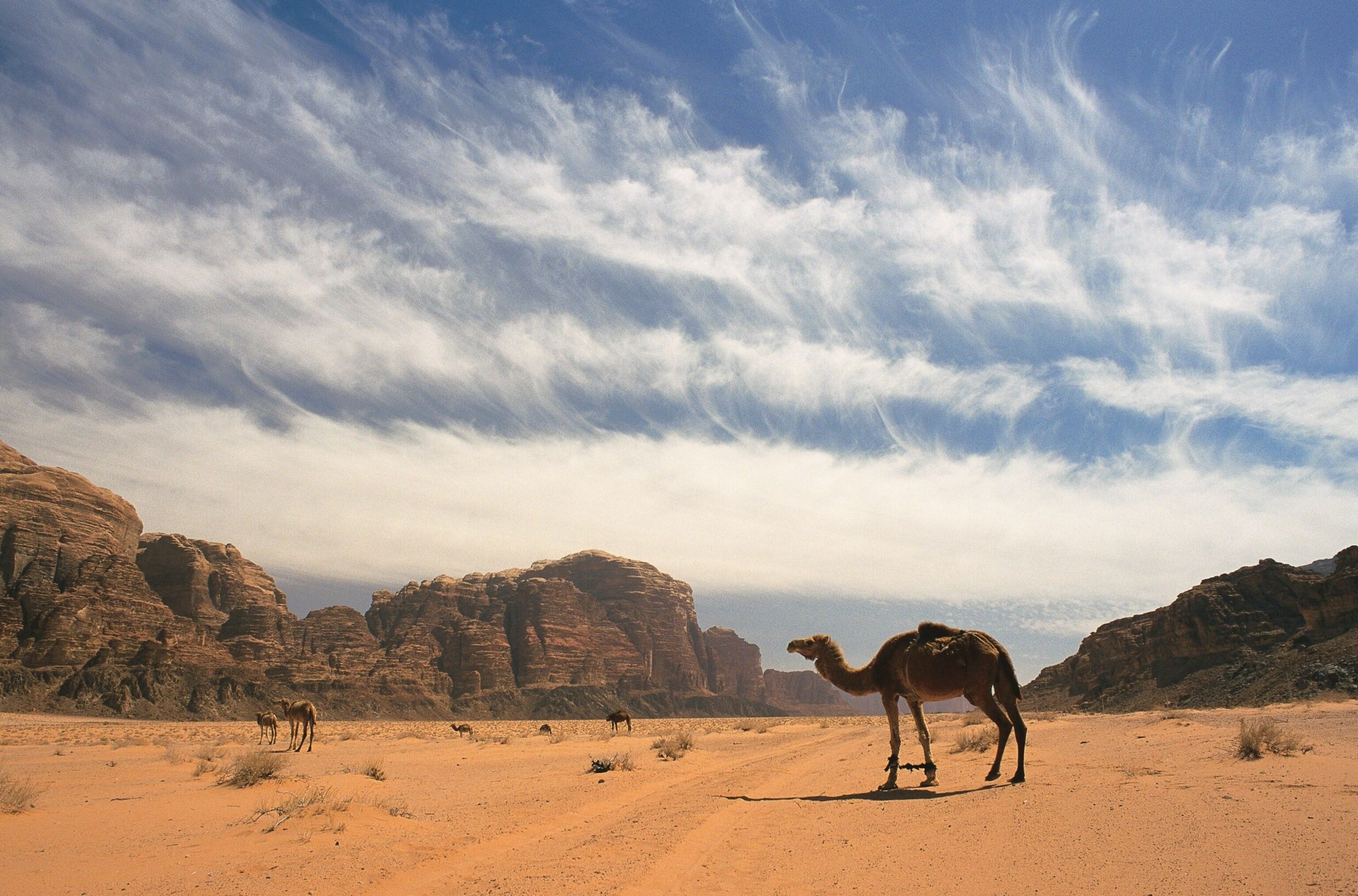
This epic leg between the iconic sites of Petra and Wadi Rum crosses the largest stretch of wilderness on the trail and offers a back-country immersion few other visitors experience. This is a dry Biblical landscape, where hikers trace narrow tracks that cling to rocky hillsides while seeking shade in the overhanging ledges. The route passes the dustbowl of Wadi Sabra and the ‘coloured canyon’, whose rocks are rich in rainbow-hued mineral deposits, between the curvaceous canyon walls of Wadi Aheimar and beneath the stone arches of Nabatean trading post Humeima. Try hiking in silence to notice the small things, from the way the wind has carved the rock into dramatic pinnacles and pillars, how the late afternoon sun casts walkers’ silhouettes on the wadi walls and, come night, the bright twinkle of a panoply of stars.
Did you know? Wadi Rum has been used as a filming location in the likes of Dune (2021), Lawrence of Arabia (1962) and The Martian (2015).
8. Wadi Rum to Aqaba
Distance: 67 miles/six days
Difficulty: Easy to moderate
The last and longest stretch of the trail sees the rocky terrain crumble to sand and the full majesty of Wadi Rum open up into a wide plain. It passes the mammoth wind-hewn rock arch of Jabal Kharazah, the cliffs of Jebel Khazali, which are engraved with ancient rock art, and through the Bedouin hamlets of Shakriya, Titen and Rum. The final night’s camp is reached by old shepherd paths that curl up granite mountains and on the last day it’s down, down toward Aqaba on the north-eastern tip of the Red Sea. Run fully clothed into its salty embrace to celebrate completing the Jordan Trail.
Did you know? The Red Sea marks the divide between Africa and Asia.
Food along the Jordan Trail — what to expect
From friendly homestays to cafes and food providers, there's a wealth of delicious food options for those hiking the Jordan Trail. Find out about dishes and dining opportunities here.
For more information, go to visitjordan.com
Follow National Geographic Traveller (UK) on social media

