Secret Soviet Posters Demystify Map Symbols
These posters, part of a massive military program, illustrated how to map different types of buildings, bridges, and even trees in intricate detail.
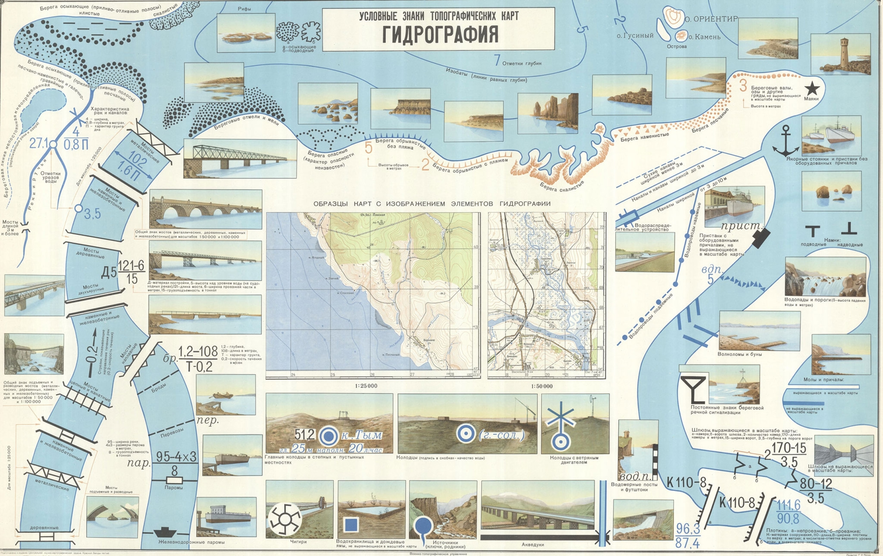
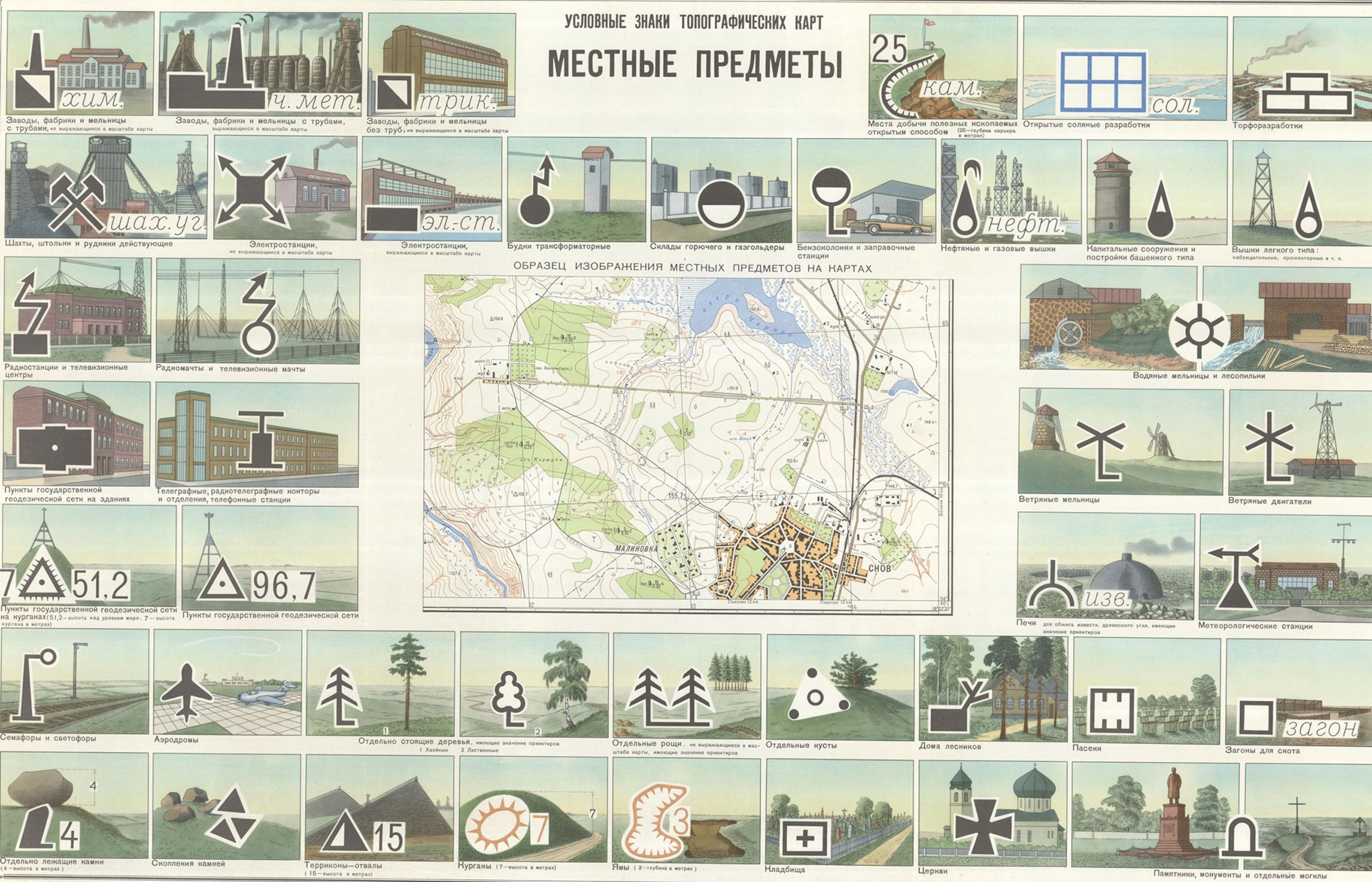
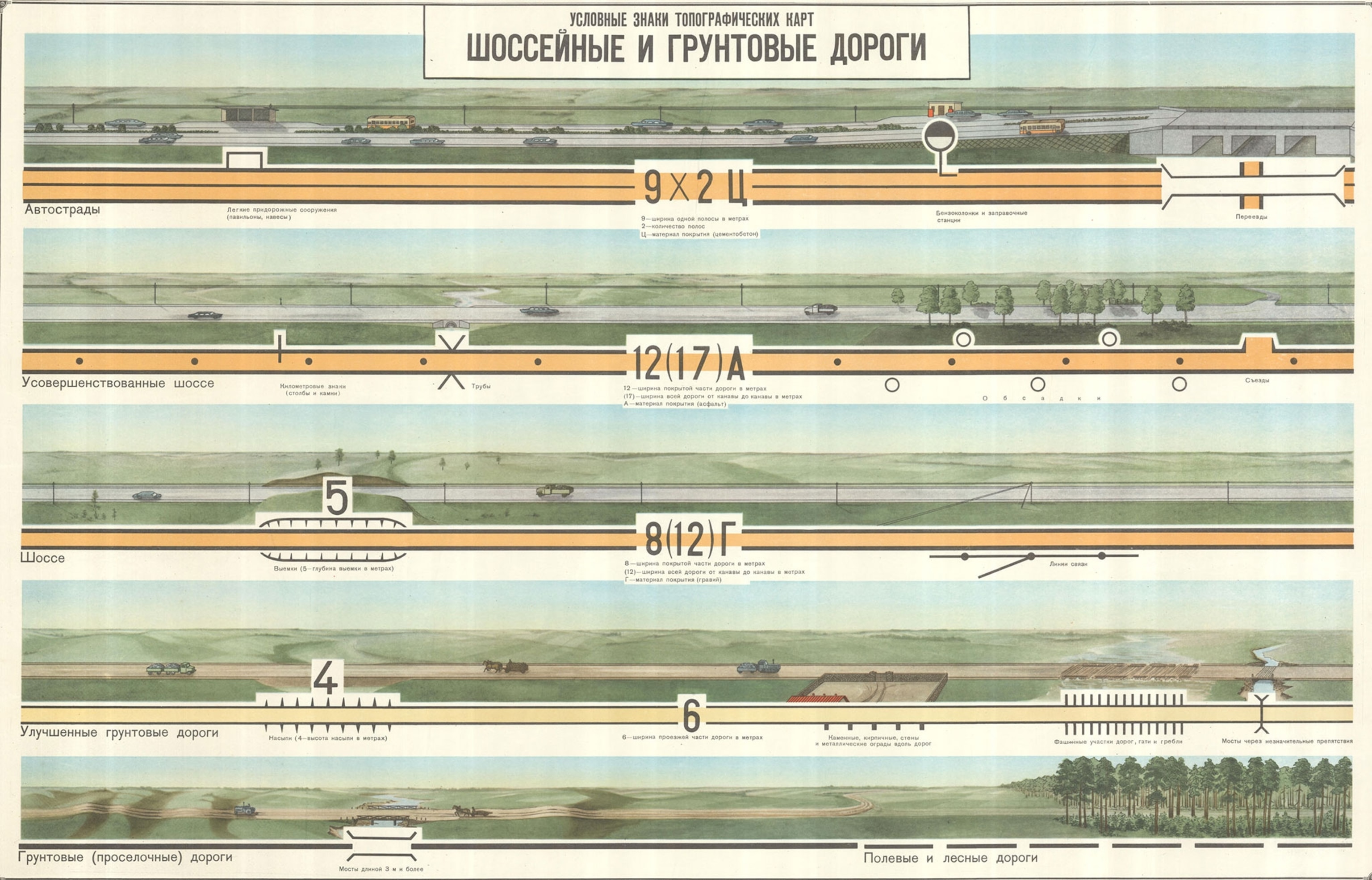
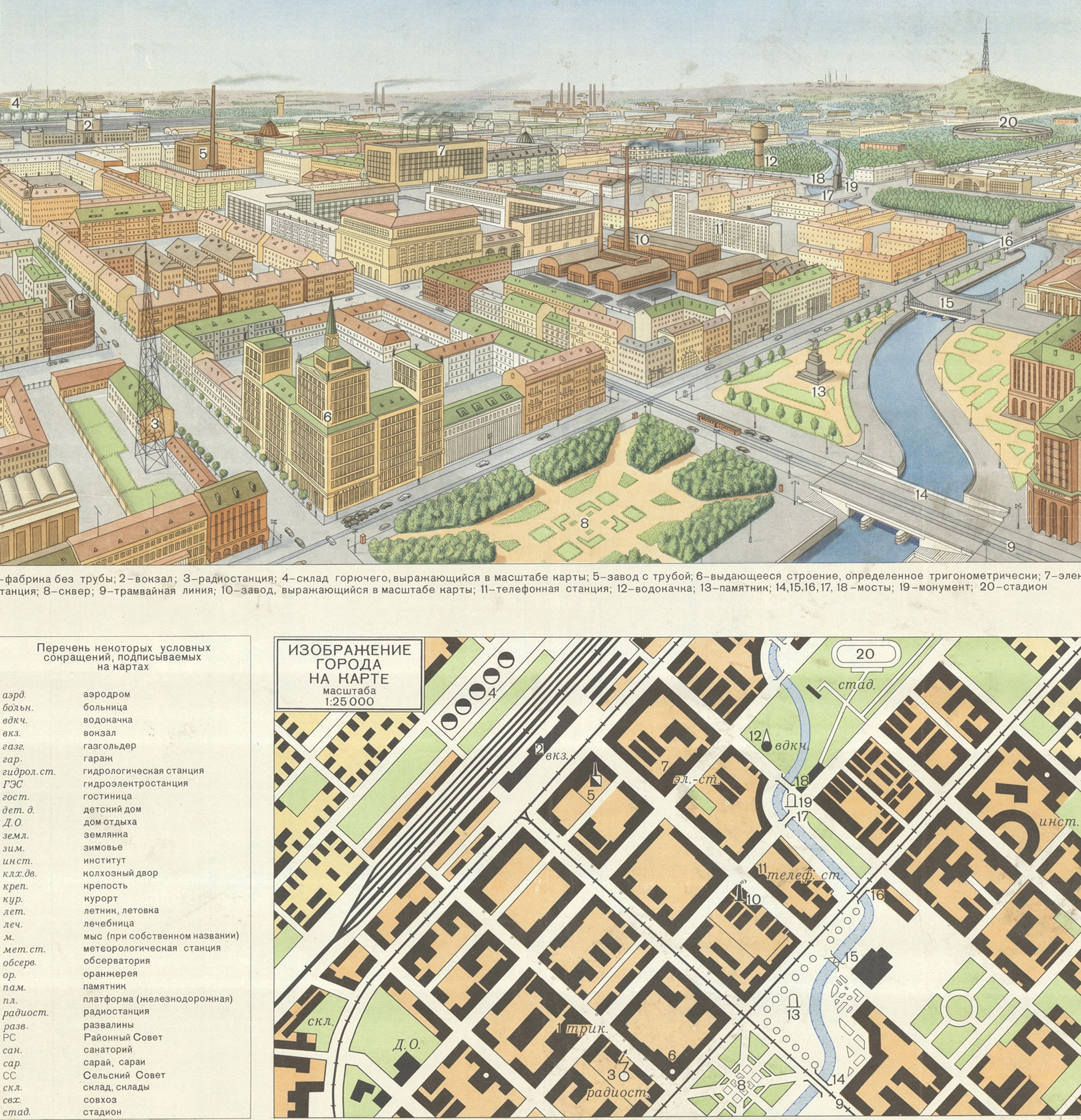
During the Cold War, the Soviet military mapped the entire world. This secret program was one of the most ambitious mapping efforts ever undertaken, and it produced thousands—perhaps even millions—of maps of every part of the planet. It also produced these clever training posters, which show in a very visual way how the symbols used on Soviet military maps corresponded to things in the real world.
The posters offer insight into the remarkable range of symbols the Soviets used to create their maps. There are symbols differentiating types of power plants, factories, and train stations, to name just a few examples.
The posters, each roughly 2 feet by 3 feet, were discovered in a map shop in Riga, Latvia by John Davies, a British map enthusiast who’s been studying the Soviet military maps for more than a decade. The owner of the map shop had acquired the posters along with an enormous cache of military maps after the fall of the Soviet Union in the early 90s. The posters appear in a new book, The Red Atlas, by Davies and Alexander Kent, a geographer at Canterbury Christ Church University.
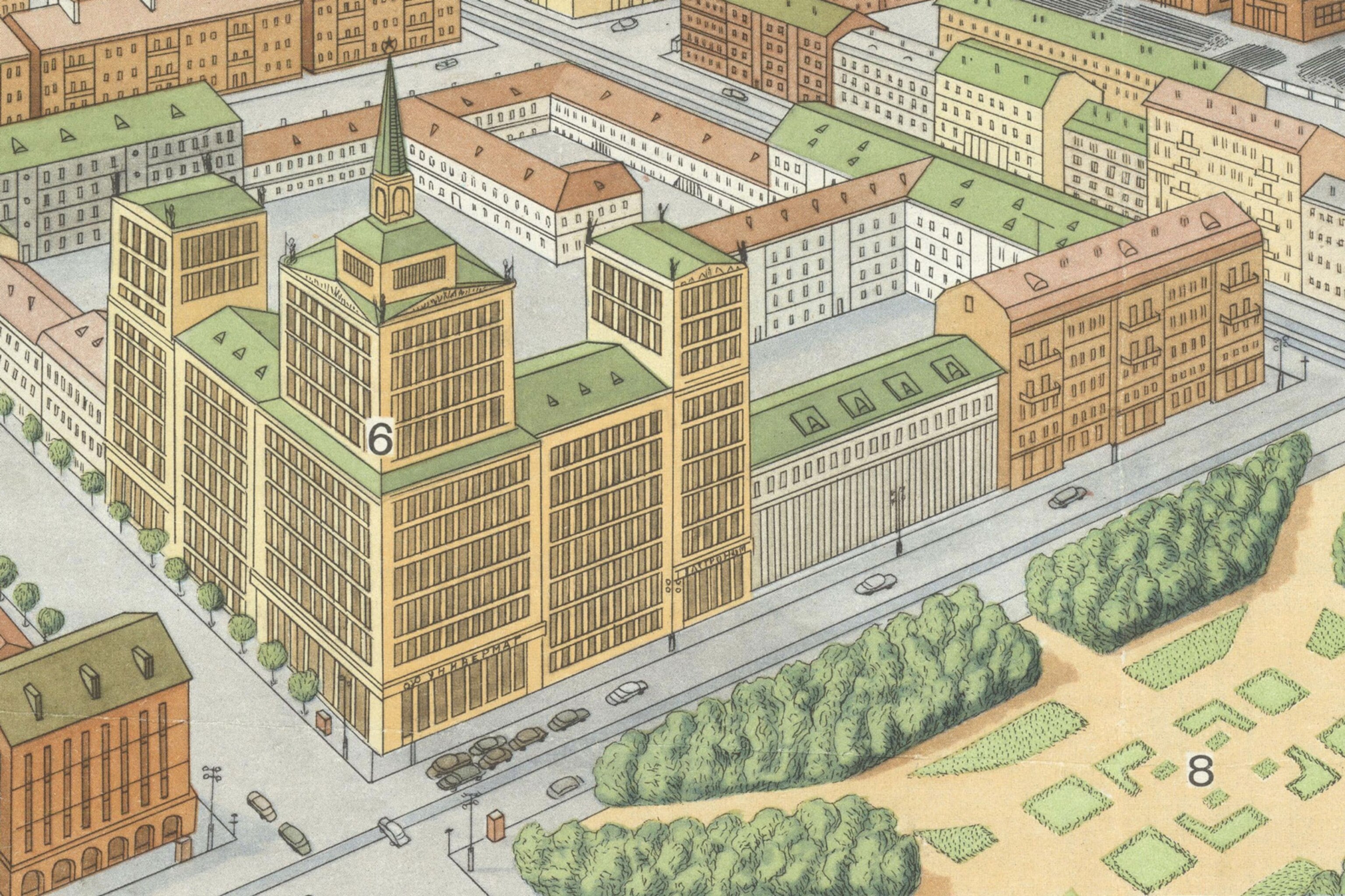
Kent thinks the posters were likely used to train cartographers. “They mapped the world using these symbols,” he says. “They created a vocabulary of symbols that would work anywhere.” The posters are a visual guide to that vocabulary, showing each symbol superimposed on a drawing of the real-world thing it represents.
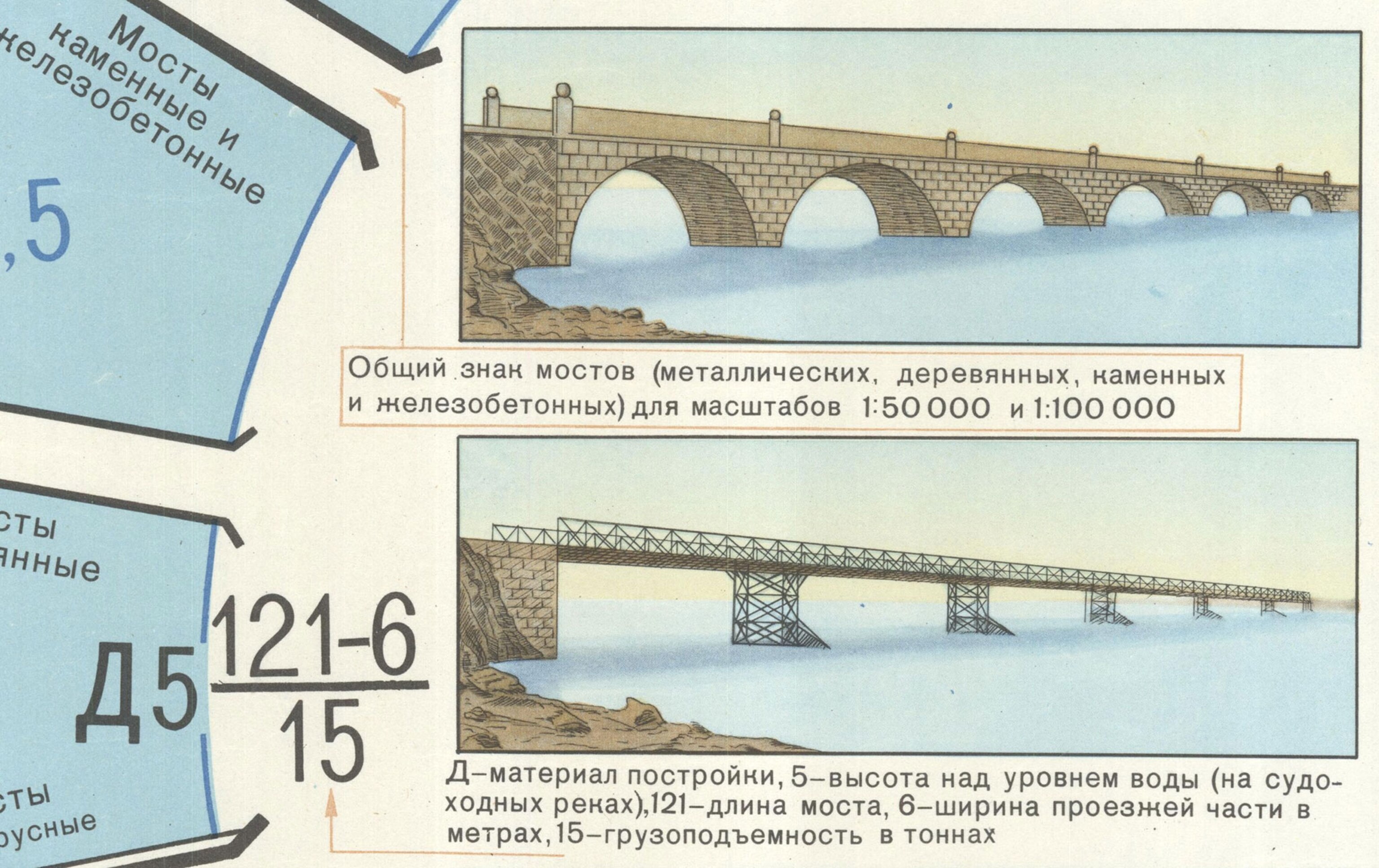
The drawings are remarkably artistic. On the poster at the top of this post, for example, you can see shadows cast by rocks in the water and nearly every stone in the bridges (it’s even more apparent in the close-up below). There are also details that would be of military strategic value. In the detail below, numbers indicate that the bottom bridge is 121 meters long, 6 meters wide, has a clearance of 5 meters above the water, and can carry a load of 15 tons. The beautifully drawn, idealized bridges with details that could be exploited in a military attack makes for a strange juxtaposition, Kent says.
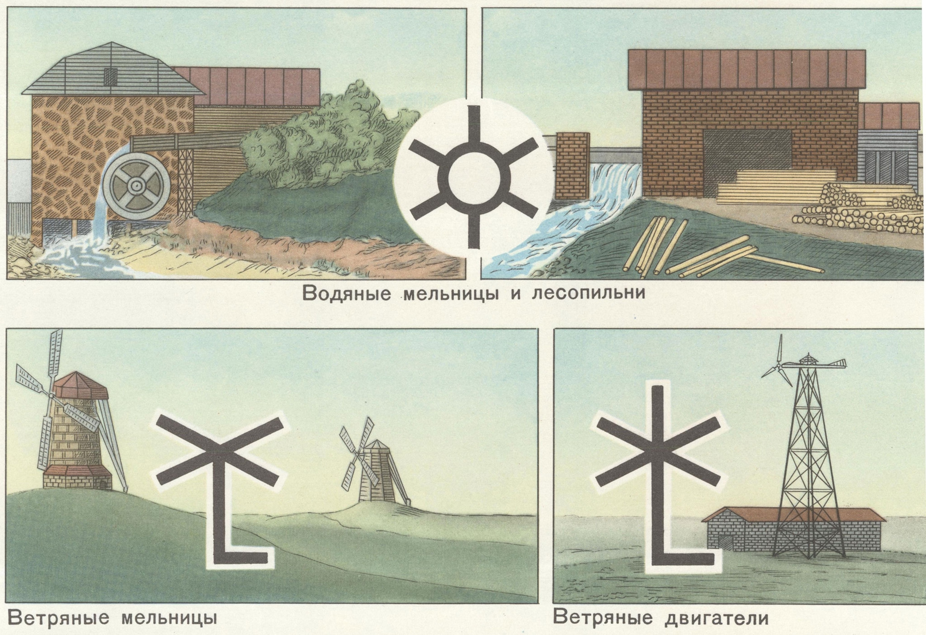
Kent and Davies think the Soviet mapping program served more than just military objectives, acting as a pre-digital database of everything the Soviets knew about the world. The maps show that the Soviets were especially interested in infrastructure like power grids, manufacturing centers, and transportation networks—and the posters reflect this, too. Specific symbols indicate different types of factories and power plants. The symbols even distinguish between windmills and wind turbines, for example, and differentiate telegraph and telephone exchange buildings from radio and television stations.
Although the Soviets created a vocabulary of symbols that could be used describe the entire world, many of these symbols don’t seem to appear on any actual Soviet maps, Kent says. “Their ambition was to map everything,” he says. But in reality, they were limited by the information available, especially for places outside their own borders.
Many thanks to Canterbury Christ Church University graduate student Martin Davis for translating some of the Russian text on the posters.
If you’re interested in secret military maps, check out our previous posts on Japanese military maps and maps declassified by the CIA.
Follow All Over the Map on Twitter and Instagram.
