Map Shows Every River That Flows to the Mighty Mississippi
A new look at the Mississippi’s enormous watershed reveals the true size and strength of the world’s fourth longest river.
The Mississippi River is impressive on its own, but when you consider all the other rivers that feed it on its way to the Gulf of Mexico, it seems all the mightier. The Mississippi’s massive watershed stretches from the Rocky Mountains in the west to the Appalachian Mountains in the east. It covers all or part of 31 states and reaches into two Canadian provinces. It drains nearly 40 percent of the contiguous United States—1.2 million square miles in total.
The animated map above, made by NASA’s Scientific Visualization Studio, highlights the river’s huge watershed and every river in it, conveying a magnitude that can be hard to fathom. The map is based on a U.S. Geological Survey database of the direction water is flowing at every point on Earth. Using the streamflow data, NASA’s Horace Mitchell traced the path of all the water that runs into the Gulf via the Mississippi. The animation starts at the points farthest away from the Mississippi’s outlet and then moves down hundreds of streams and rivers to the delta.
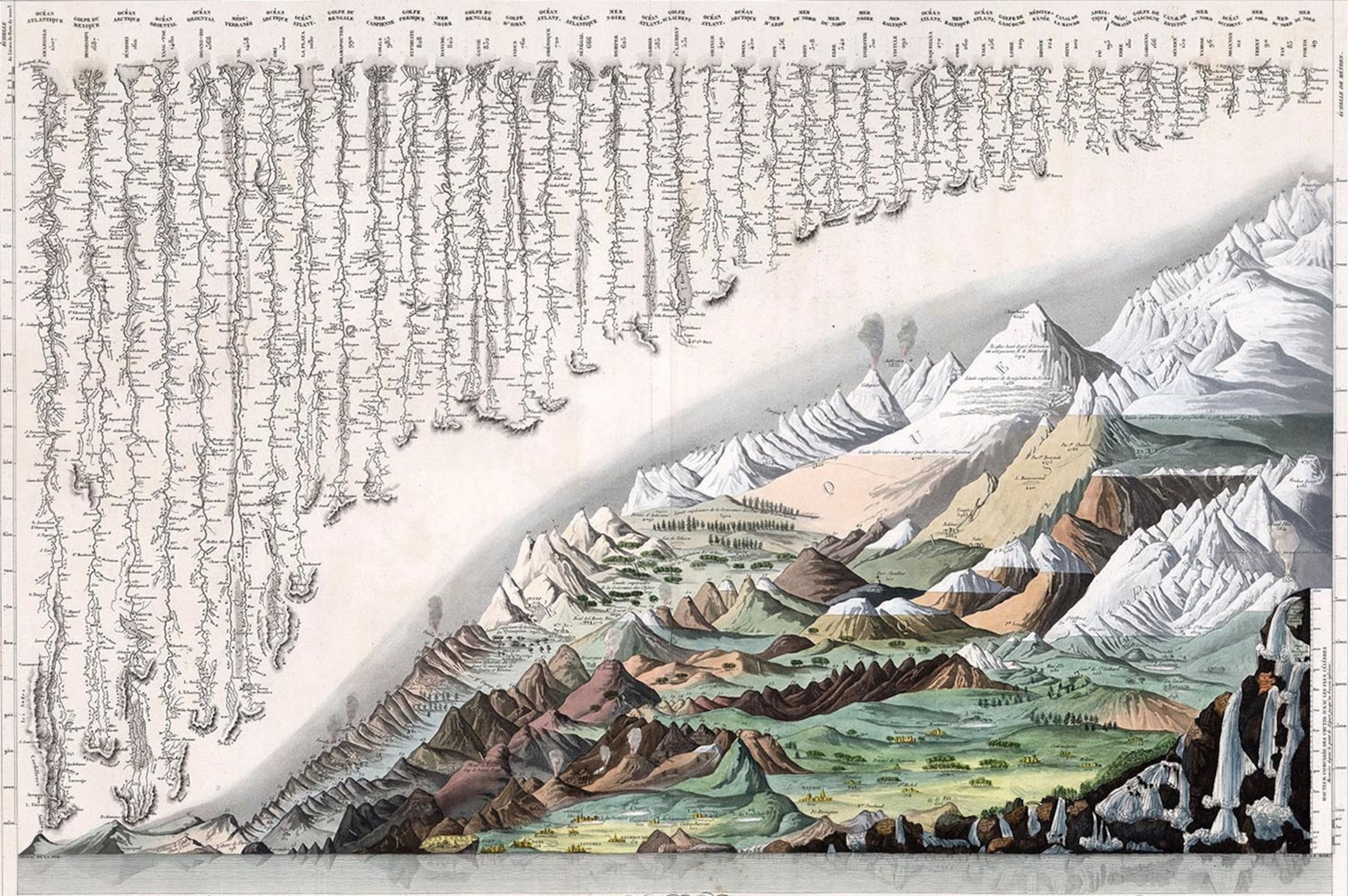
But the Mississippi isn’t just big by United States standards; it ranks among the world’s major rivers. At more than 2,300 miles, it’s the fourth longest river in the world, behind the Amazon, Nile, and Yangtze Rivers. The chart below, which shows the world’s principal rivers and mountains, makes it easy to compare these features. The Mississippi is the second river from the left, with the Missouri River shown flowing into it as well.

The chart is from 1829, and it's a beautiful example of the comparative charts that became popular in the 19th century. Though the geographical data on this one is a bit outdated and lists the Mississippi as the second longest, it still gives a nice sense of how it fits with the rest of the world’s giant rivers. Labeled “Tableau comparatif et figuré de la hauteur des principales montagnes et du cours des principaux fleuves du monde” (Comparative table and figure of the height of principal mounts and course of principal rivers of the world”), this work by J. Andriveau-Goujon was part of an atlas published in France and is part of an extensive collection of similar charts in David Rumsey’s collection.
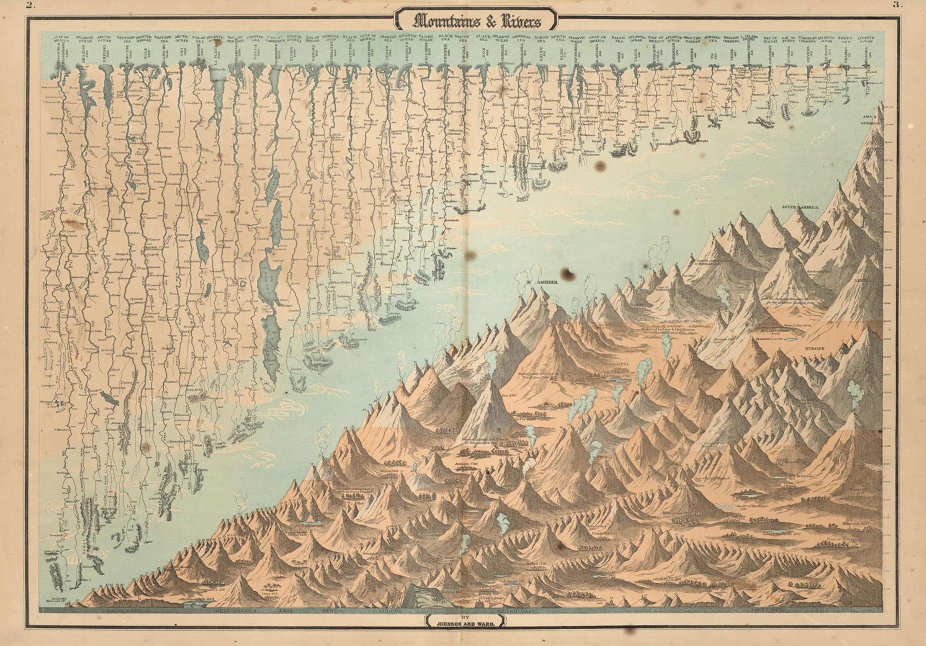
The collection also has several examples of these comparative tables that were published in the U.S. Interestingly, many of them, including the one below from an 1864 Johnson and Ward atlas, choose to combine the Mississippi with the Missouri River, which is in the Mississippi's watershed, effectively doubling the length listed on the chart. This has the dubious benefit of making the U.S. system the longest, allowing cartographers to put it in the prime spot at the far left of the rivers. In reality, the Amazon River is more than 400 miles longer than the Mississippi River alone.
