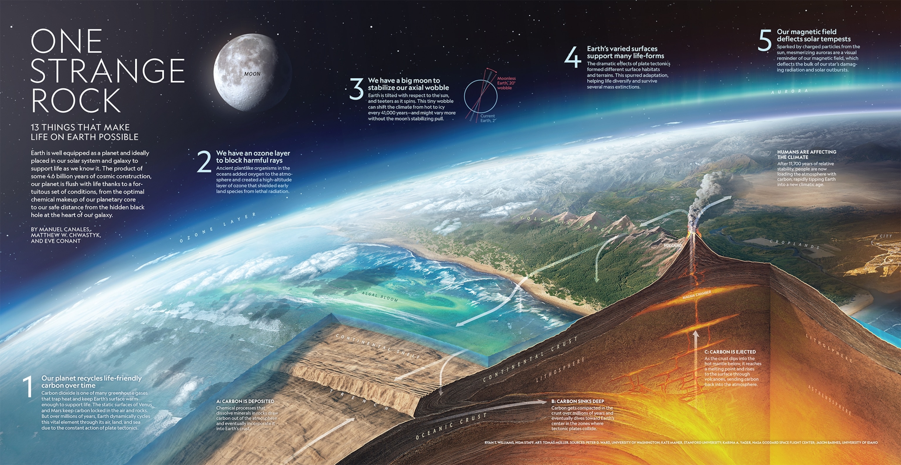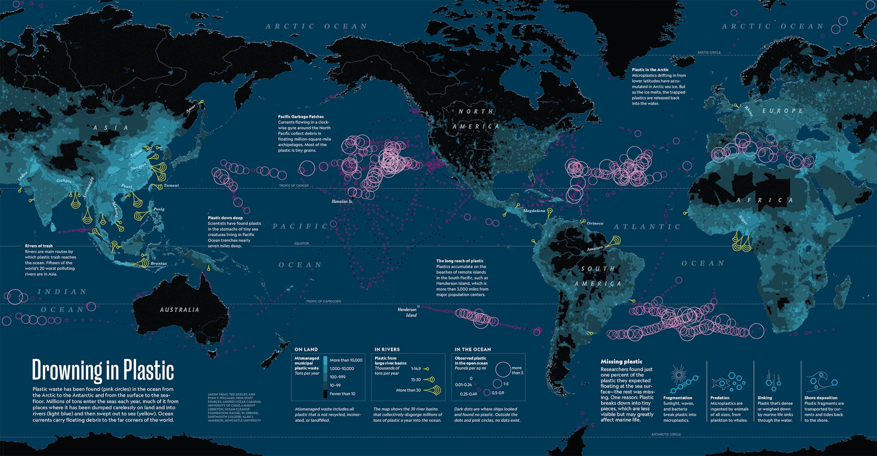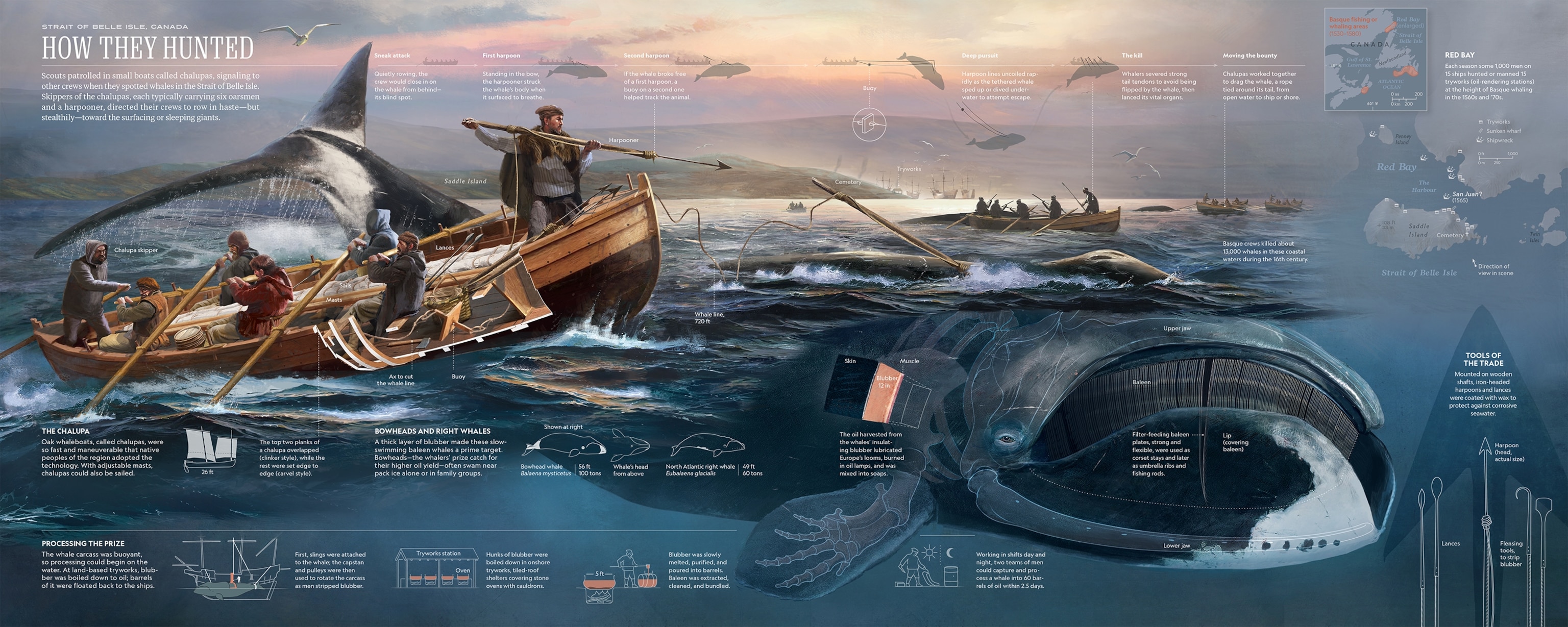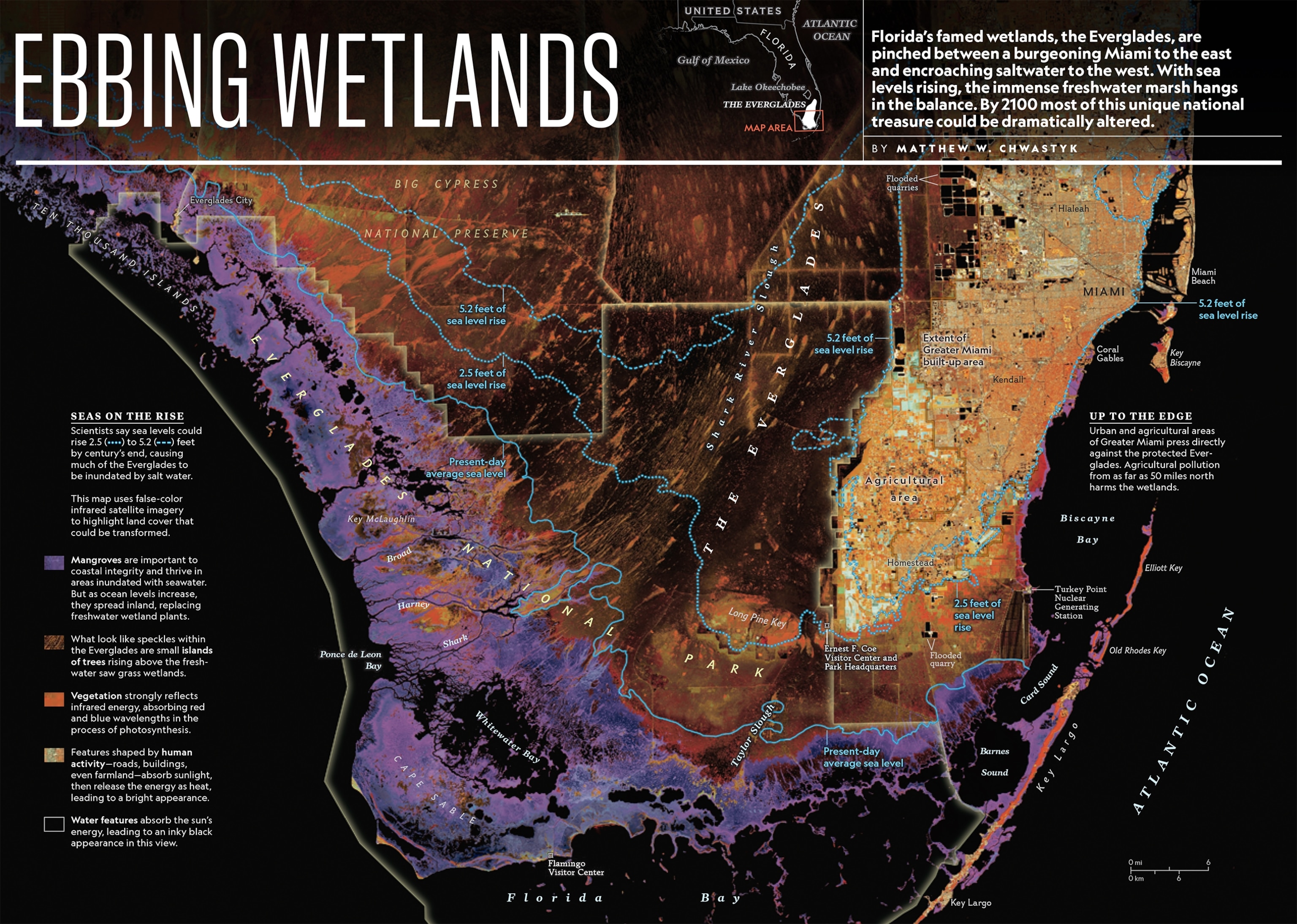
Our most memorable maps and graphics from 2018
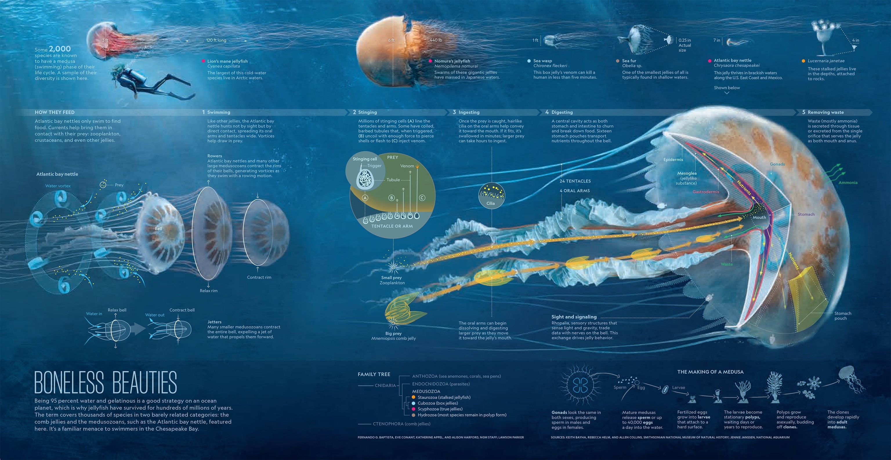
Illuminating our world: from the diversity of U.S. cities to the inner workings of jellyfish
National Geographic’s cartographers and graphic editors created more than 70 maps and graphics for the magazine this year. Already on deadline for 2019’s stories, they took a moment to choose 10 works from 2018 that stand out for their originality, deep research, and range.
Before they’re translated to print and pixels, the renderings are often first sketched by hand and in some cases even sculpted from clay or wood.
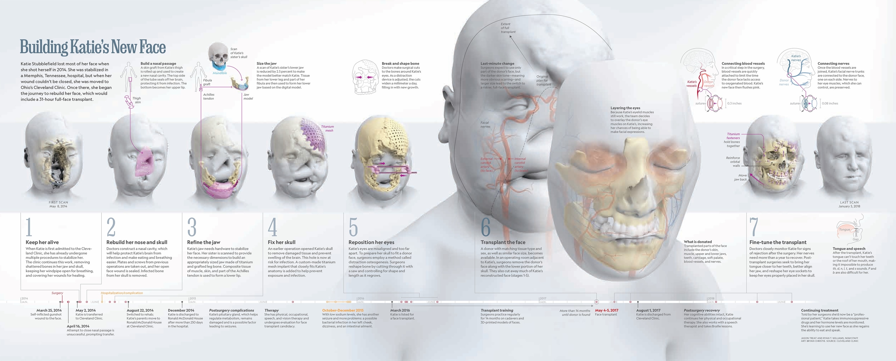
The selections this year venture beneath surfaces: Into the inner workings of Pablo Picasso’s mind, the Florida landscape slowly drowning in salt water, or the scaffolding that surgeons used to transplant a face and rebuild a woman’s shattered life.
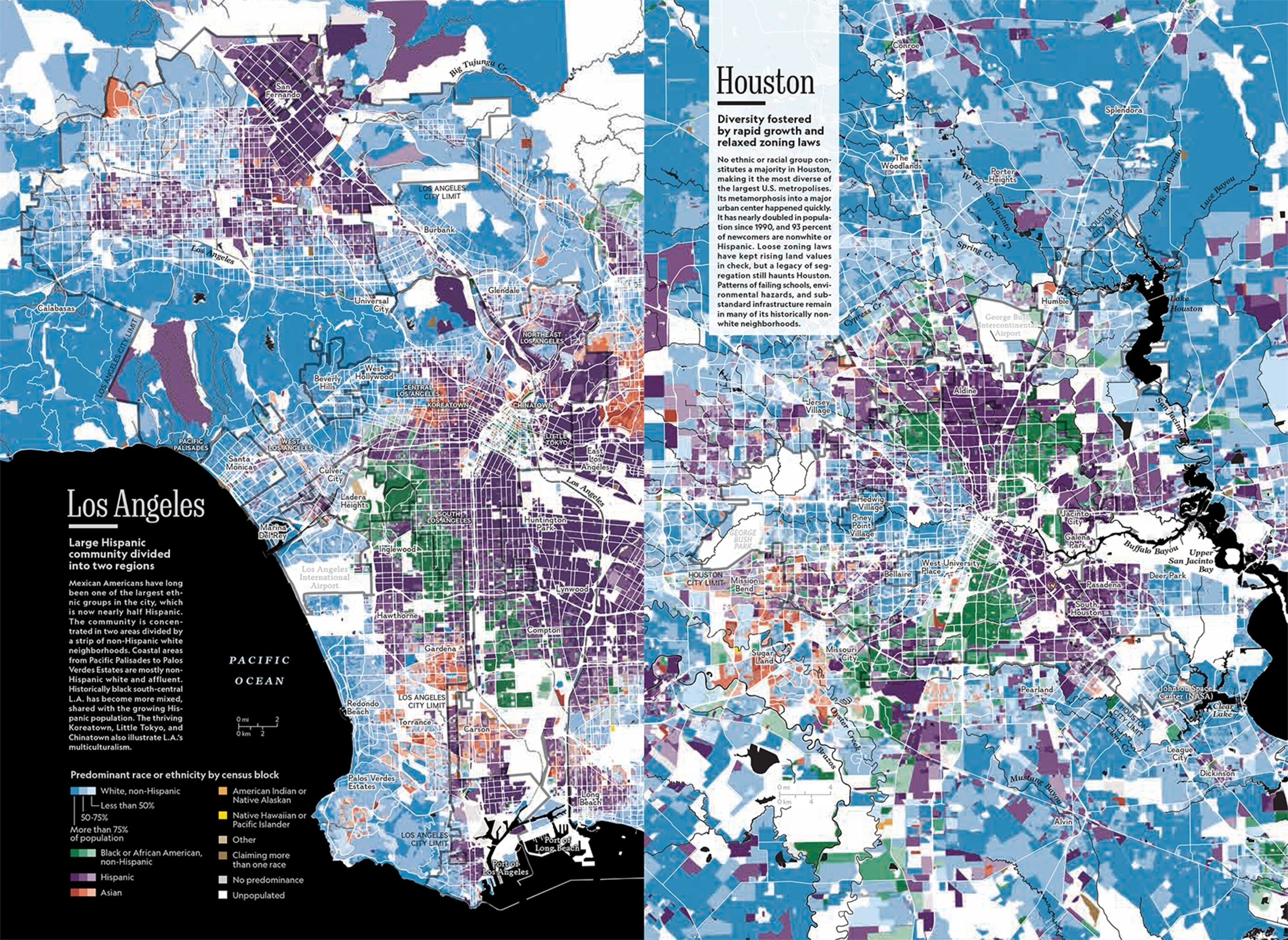
The maps and graphics also aim high, such as in the secret sky routes known to migrating birds. And they travel through time, mapping the effect of centuries of migration, conflict, and prosperity on the diversity of today’s cities or glimpsing a troubled future in the toxic, growing gyres of plastic-filled oceans.
Print version shown in most cases; click an image to view the web version.

