Moon photos from the 1960s were developed in space—here's how
To find safe places for Apollo astronauts to land, NASA designed five survey satellites carrying classified defense technology.
Before Neil Armstrong could take his historic first step on the moon, NASA needed to know exactly where the Apollo 11 spacecraft could safely set down. In the early 1960s, humankind’s maps of the lunar surface were based on photographs taken from Earth and a few early U.S. and Soviet satellites, none of which could capture the breadth and detail needed to find landing sites clear of hazardous boulders and craters.
That’s why the space agency launched its Lunar Orbiter program, a fleet of five nearly identical, van-size satellites sent out in 1966 and 1967 to map the moon. Lunar Orbiter 3, which took pictures from February 15 to 23 in 1967, confirmed safe landing sites for the Apollo program, returning some of the last pictures taken of the moon before humans put boots on lunar soil.


In the pre-digital era, sending photographs from space back to Earth was no casual task. But with precise engineering—and some top-secret reconnaissance technology—the Lunar Orbiters provided NASA engineers and scientists the imagery they needed to make the Apollo landings possible.
Cameras in space
The Lunar Orbiters weren’t the first photo-focused spacecraft aimed at the moon, but they were unique because of the equipment they were carrying.
“They basically borrowed spy cameras from the Defense Department, from their satellite program,” says David Williams, the acting head of the NASA Space Science Data Coordinated Archive. At the time, the U.S. Department of Defense was using similar cameras in the CORONA program, known to the public as Discoverer, to take satellite photos of the Soviet Union.
Each Lunar Orbiter had two cameras, one with a high-resolution lens and one with medium resolution. Rather than standard 35-millimeter film, the satellites used 70-millimeter, the same size that’s used today to make IMAX movies.
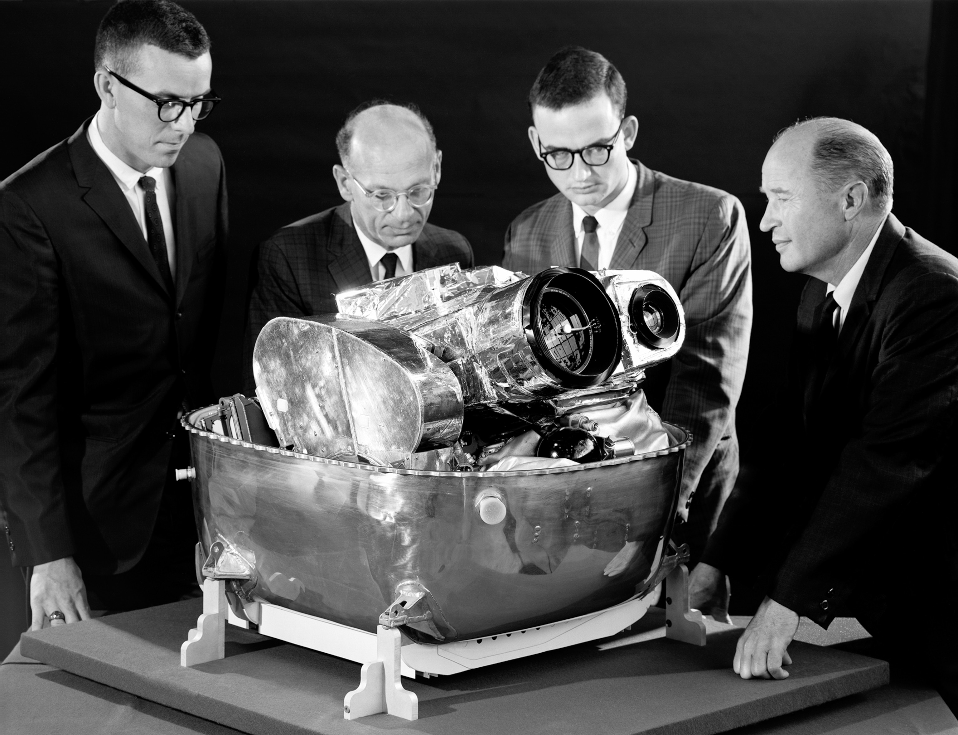
From as close as a few hundred miles above the moon’s surface, the Lunar Orbiters captured features down to about three feet wide. But using film in space came with a major hurdle.
“Once you’re at the moon, you could take all the pictures all you want, but you have no way of getting the film back to Earth to develop it,” Williams says. “So, they had to devise a system where you develop the film on board the spacecraft.”
The floating photo lab
Developing film usually requires rinsing the negatives in a series of liquid chemicals, which would wreak havoc inside of a satellite in microgravity. Instead, the Lunar Orbiters used the Kodak BIMAT transfer processing system, which was classified by the Central Intelligence Agency until 2001 because it was primarily created for reconnaissance.
The film had to be moved precisely first from the storage spool to the lens, then to a holding area as the remaining photographs were taken, and finally to the development stage, where a layer of chemical-infused gelatin was pressed up against the film. The tasks were completed in aluminum tubs about the size of watermelons. The burnout of a single film-moving motor, as happened on Lunar Orbiter 3 after it had captured a couple hundred frames, was enough to threaten a mission’s success.

When you look inside of a Lunar Orbiter satellite, “it’s an interesting kind of peek at the relationships during the Cold War,” says Matt Shindell, a curator at the Smithsonian National Air and Space Museum. “You see all of the Eastman Kodak hardware that’s in there ... and you see the camera that is designed by our intelligence agencies, and then you have all of the NASA hardware around it.”
To send their photos back to Earth, the CORONA program dropped film from space in capsules equipped with heat shields for protection during re-entry, thrusters for steering and stabilization, and parachutes to slow their fall. The recovery plane was built to hook a capsule mid-air by its parachute, but when that failed, a helicopter team would recover it from the water. However, NASA instead developed a system to send the photographs home by radio.
On the Lunar Orbiters, the film was moved in front of a scanner that shone through it and recorded the brightness levels of each miniscule section it measured. Those numbers were then sent by radio signal to NASA’s deep space communication centers in Spain, Australia, and the U.S., where the measurements were received on magnetic tape. Image processers could then use the numbers to re-create the film exposures on Earth and paste the strips together to develop the highly detailed photographs.
“You can take a magnifying glass and look at them really closely and just see all this detail; it’s really unbelievable,” Williams says. “Considering this was the mid- to late ‘60s, it was really an amazing accomplishment.”
For the good of science
Some of the resulting images, like Lunar Orbiter 1’s famous photograph of Earth behind the moon’s horizon, show the vertical lines of the reconstruction process. Despite theories to the contrary, it is unlikely that NASA meddled with the image quality before releasing their photos to the public.

“They weren’t shy about releasing what they thought were good representative images, so that people could see that the U.S. space program was capable of doing these great things,” Shindell says. Throughout the mission, Lunar Orbiter images appeared in newspapers and magazines worldwide.
“Even though this was the space race and it’s highly competitive,” Shindell says, “there was still a kind of atmosphere of this was being done for the good of not just the countries that are doing it, but the good of science around the world.”
