National Parks Road Trip: Pacific Northwest
North Cascades > Mount Rainier > Olympic
Gateway Airport: Seattle-Tacoma International Airport, Washington
In western Washington, it’s all about the mountains. Spanning the stony teeth of the North Cascades to the verdant slopes of the Olympics, this road trip starts at sea level but ranges as high as you’re willing to go, up to and including the 14,410-foot peak of Mount Rainier. Climbers and backcountry explorers will be in heaven, while those with more modest ambitions can still choose from countless lakes, viewpoints, and streamside rambles. Complete the loop by taking the car ferry between Port Townsend and Coupeville.
North Cascades National Park
America’s version of the Alps is as rugged as it is remote, which explains why the park gets so few visitors even though it’s just two hours from Seattle. This is the wild domain of mountaineers and backpackers, bald eagles and grizzlies, home to almost 400 miles of trails and a third of all glaciers in the country outside of Alaska. Still, there’s plenty to do even on mild day trips, including boat trips on azure lakes and easy jaunts through flower-studded meadows.
The Route: Seattle > I-5N > WA 530E > WA 20E (107 miles)
On the Way: Seattle’s Museum of Flight occupies an old red building where the Boeing Corporation had its launch (so to speak) in 1916. Today, the museum—one of the largest aviation museums in the U.S.—houses everything from a one-person, open-air gyrocopter to a 747.
Stay: Nestled in the Methow Valley, the park’s eastern gateway, the Rolling Huts ($135) are a herd of sleek modern cabins with fireplaces, Wi-Fi, and two-person sleeping platforms.
Eat: It’s hard to miss the red train car along Washington Route 20 in Marblemount that houses Que Car BBQ. You’ll have to sit outside, but given the scenery, that’s the perfect place to chow down on a smoked brisket or pulled pork sandwich.
Don’t Miss: Hike to one of the region’s many historic fire lookouts, which unsurprisingly boast some of the best views around. One of the easiest to reach is the one on Evergreen Mountain (only a 1.5-mile trail), which you can rent for the night through Recreation.gov.
Jaw-Dropping Viewpoint: Just east of the park boundary, Washington Pass Overlook (5,477 feet) is the highest point on Route 20. Take a short, paved trail through subalpine forest to a panorama of Liberty Bell Mountain and Early Winters Spires, both popular with experienced rock climbers.
Tour: In Newhalem, reserve a spot on a boat tour of glacier-fed Diablo Lake organized by Seattle City Light, which operates the lake’s three hydroelectric dams. You’ll get stories about early explorers and settlers while visiting parts of the lake inaccessible by road, including islands and waterfalls.
Walks:
- Easy: Starting about 18 miles east of Newhalem, the 2.2-mile Ruby Creek Trail leads along a rushing creek with ice-clear pools and interpretive signs about the area’s gold mining history. (One early prospector found a large ruby here, hence the name.)
- Moderate: The Cascade River Road leaves Route 20 at Marblemount and extends 23 miles to the trailhead—about an hour's drive. The road is paved for the first third and then becomes gravel, with some narrow and steep sections near the end. The road typically opens to the Cascade Pass parking lot by the end of June, except in heavy snow years when it may not open until early July.
- Strenuous: The 4.5-mile, 3,300-foot climb to historic Hidden Lake Lookout (at 6,890 feet) ends amid naked granite with views of Cascades giants like Eldorado Peak, Mount Baker, and Mount Shuksan. In the fall, keep an eye out for wild blueberries in the wildflower meadows along the start of the trail.
Oddity: North Cascades National Park has more glaciers—over 300—than any other place in the United States outside of Alaska. By some estimates, about 40 percent of the park’s ice cover has vanished in the past 150 years.
Before You Come: Read Poets on the Peaks: Gary Snyder, Philip Whalen, and Jack Kerouac in the Cascades to learn how the craggy landscape inspired beat writers.
Park Website: www.nps.gov/noca
Seasonal Notes: Summer at high elevations is magnificent and short, lasting roughly from June to August, depending on snowfall. August is peak wildflower season. Winter often closes Route 20 between November and April.

Mount Rainier National Park
At 14,410 feet, Seattle’s looming neighbor is unmissable, at least when it’s not buried in clouds. When “the mountain is out,” as they say, it’s an alpine wonderland of dense forests, roaring waterfalls, flower-carpeted meadows, and icy vistas. The park it anchors is large enough that it’s easy to forget some two million visitors come every year. Escape the crowds at the less used Carbon River and White River entrances.
The Route: North Cascades National Park > WA 20W > WA 530W > I-5S > WA 512E > WA 161S > WA 706E (190 miles)
On the Way: In tiny Elbe, Washington, hop aboard an antique steam train at the Mount Rainier Railroad and Logging Museum. The ride chuffs south along the Upper Nisqually River to even tinier Mineral, Washington, home to a shed that was once the smallest post office in the country.
Stay: Stormking Spa and Cabins ($205-230 per night) is a romantic escape in the woods just outside the park’s Nisqually entrance. The cabins are as cozy as a bear’s den, with gas fireplaces, outdoor hot tubs, and bathrooms floored with river stones. Book a couples massage for the full experience.
Eat: Fuel up for a stiff hike at the Wildberry Restaurant in Ashford, run by a legendary Everest Sherpa. The menu includes Nepalese dishes like steamed dumplings and a hearty Sherpa stew. It’s worth a stop just for the huckleberry pie.
Don’t Miss: Between midsummer and the first snows, Rainier’s high meadows erupt in color in one of the world’s most exquisite wildflower displays. Among the hundreds of species in residence, look for fiery red Indian paintbrush and white-starred avalanche lilies in the sun and delicate lavender fairy slippers in the shade.
Jaw-Dropping Viewpoint: From the park gateway at Paradise Valley, the 2.7-mile one-way hike to the 1930s-era Mount Fremont fire lookout rewards with an up-close view of some of the mountain’s 35 square miles of snowfields and glaciers. On clear days you can see the Olympic Range on the far side of Puget Sound.
Tour: Rangers offer free nature hikes, cultural talks, and star-viewing programs at Paradise in the summer. In winter, reserve a spot on a guided snowshoe ramble starting at the Jackson Visitor Center.
Walks:
- Easy: The flat, 1.5-mile loop trail to the Grove of the Patriarchs ends at an awe-inspiring forest of thousand-year-old red cedars and Douglas firs on a small island in the Ohanapecosh River.
- Moderate: Make like a mountain goat on the Summerland Trail from White River Road, which climbs 3.5 miles to the Fryingpan Valley, home to a glacier of the same name. Another half mile brings you to the flower-filled Summerland Meadows.
- Strenuous: Starting at Paradise, the 5.5-mile Skyline Trail is a justifiably popular loop that climbs along the Nisqually Glacier to Panorama Point at 6,800 feet, with views of Rainier, Mount St. Helens, Mount Adams, and even Mount Hood (on clear days).
Oddity: Paradise is possibly the snowiest place on Earth where snowfall is measured on a regular basis. During the record-setting winter of 1971-72, the valley was buried in 93.5 feet of the white stuff.
Before You Come: Read Dee Molenaar’s The Challenge of Rainier to understand why some 10,000 people try to climb the peak every year—and only half are successful.
Park Website: www.nps.gov/mora
Seasonal Notes: Summer is most often warm and dry—and peak wildflower season—while spring and fall bring cooler temperatures and more rain. Many access roads are closed during the winter, although that means you’ll pretty much have the snow-buried park to yourself.

Olympic National Park
The natural riches that fill the fat peninsula between Puget Sound, Vancouver Island, and the Pacific could easily qualify as three or four separate parks. Blinding white glaciers, rain forests dripping with moss, old-growth woodlands fit for a Sasquatch—it’s all here, plus more than 70 miles of coastline, hot springs, and more trails than you could hike in a lifetime. Highway 101 circles the whole thing, but the roadless interior is still virtually untouched, the realm of bears, elk, eagles, and intrepid backpackers.
The Route: WA 706W >WA 7N > WA 702W > WA 507S > WA 510W > I-5S > U.S. 101N > WA 119N (116 miles)
- National Geographic Expeditions
On the Way: If you hit Olympia hungry, seek out the Arepa Venezuelan food cart downtown at East 4th Avenue and Plum Street. Their eponymous dish, a stuffed corn flour bun, comes filled with cheese, veggies, beans, or meat. They also offer other kinds of Latin American street food, such as patacones (deep-fried plantain chips) and classic Cuban ropa vieja (shredded beef, beans, and rice).
Stay: Kalaloch Lodge ($130-300) perches on a bluff overlooking a tide pool-dotted beach in the coastal town of Forks. Lodging choices include comfy, shingled cabins and more modern hotel rooms in the main building. Whichever you choose, you’ll have no choice but to trade checking email and surfing the Internet for beachcombing and storm-watching—there’s no Wi-Fi here.
Eat: It’s hard to decide which is the bigger draw at Toga’s Soup House in Port Angeles: the sandwiches or the homemade soups (butternut squash, filet mignon chili). Enjoy either or both on the open-air patio of this Victorian café.
Don’t Miss: Unwind after a stiff hike in one of the natural geothermal pools at Sol Duc Hot Springs in the park’s northwest corner. Three steaming sulfur-tinged pools range from 99°F to 104°F. If you’re too relaxed to leave, there are cabins for rent.
Jaw-Dropping Viewpoint: Even if you don’t have the urge to venture into the mountainous heart of the park, you can see a good chunk of it from Hurricane Ridge, a 17-mile drive south of Port Angeles. Snowy peaks jut skyward to the south, and dozens of trails wander off in almost every direction.
Tour: Taste the Elwha River’s newly freed white water on a rafting trip with Olympic Raft and Kayak out of Port Angeles. Half-day excursions between two recently decommissioned dams hit several Class III rapids.
Walks:
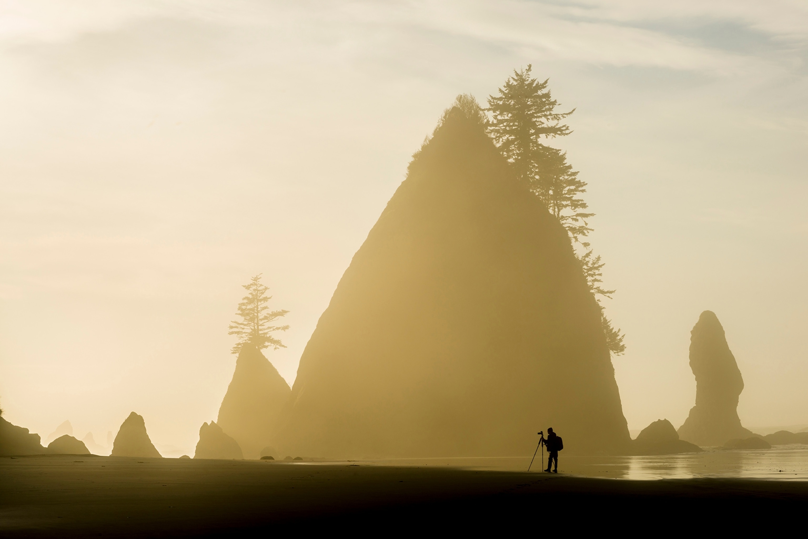
- Easy: The park’s Pacific shoreline is known for sculpted sea stacks, mountains of driftwood, and hammering winter storms. Many beach hikes are easy and open-ended; try starting at Sand Point or Rialto Beach near the Ozette Ranger Station. Keep an eye out for memorials to the many ships that have wrecked here over the centuries.
- Moderate: Avoid the crowds on the ultra-popular Hoh River Trail by taking its equally lush cousin, the Bogachiel Trail. The route starts in the state park of the same name but soon enters the national park, an enveloping world of giant cedars, maples, and spruces. Eight miles in is the world’s largest silver fir tree.
- Strenuous: Among the highest trail section in the Olympics, Grand Ridge connects Obstruction Point with Deer Park. You can do the 7.4-mile route in either direction, following the roller-coaster ridgeline up and over Elk Mountain and soaking in views as far as Victoria, British Columbia.
Oddity: On the north side of the peninsula, the Elwha River recently underwent the largest dam-removal project in U.S. history. The deconstruction of the 108-foot Elwha Dam in 2012 and the 210-foot Glines Canyon Dam in 2014 restored more than 70 miles of white water and salmon-spawning streams.
Before You Come: Read A Field Guide to the Cascades and Olympics for a detailed look at the park’s plants, animals, insects, and geology.
Park Website: nps.gov/olym
Seasonal Notes: Summer is prime time weather-wise, but late spring and early fall can be equally clear and almost as warm. The rest of the year is precipitation time: frequent downpours at lower elevations and snow on the high peaks.


